Not only Europe /see our homepage/ or Philadelphia /https://mkweather.com/100-year-floods-in-philadelphia-10-inches-250-mm-in-only-3-4-hours//, but too Upper Midwest and Northern Plains were in last days drenched by severe storms.
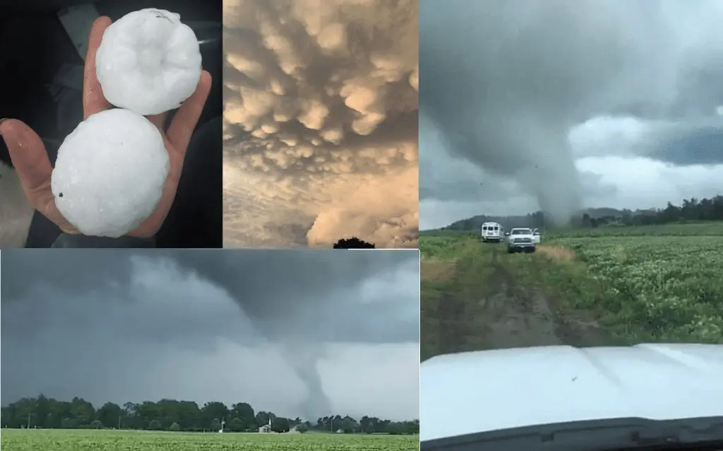
Hailstorms with 4.25 / 11 cm diameter of hail appeared (the largest in Nebraska) and tornadoes EF1 – EF2 (the strongest in Missouri, then in Iowa or Illinois) have appeared since the weekend and from Wednesday to Thursday, 14.-15. July, a region with 20 million people northwestward from Chicago was hit by severe storms, with gusting winds up to 80 mph / 130 km/h and heavy rain, too.
Before severe storms, mammatus clouds have appeared.
More detailed reports from important events we have collected in Tweets are below.
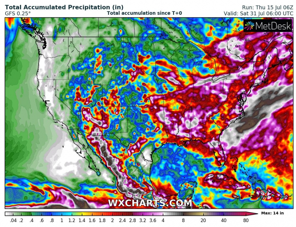
In the next period, severe storms will shift mainly along the East Coast, Southeast, and eastern parts of the Midwest, with the next possible heavy downpours and regional floods.
Monsoon will be ongoing in Arizona or New Mexico, too.
Near Newfoundland, a possible tropical storm from depression 99L Invest should form in the next few days, but land very probably won´t be hit or will be hit only marginally.