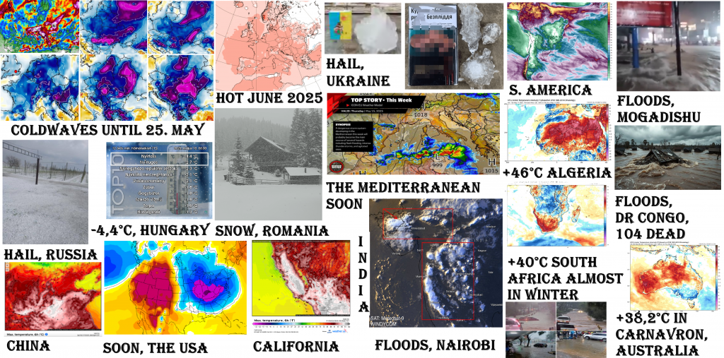
Weather report for 10.-11. May 2025: Almost all May 2025 in Europe cold! Heatwaves are shifting to June…Snow in Romania, hail in Ukraine, Russia, -4,4°C in Hungary, Cyprus +37,3°C, dangerous Mediterranean storm in outlook / Tornadic situation in the US soon + heatwave from Mexico to Canada / +46°C in Algeria and +40°C in South Africa almost in the winter (!), floods in Nairobi, Mogadishu and 104 dead in DR Congo / +38,2°C in Carnavron, Australia / The Arctic sea ice extent above 2010´s average
Europe
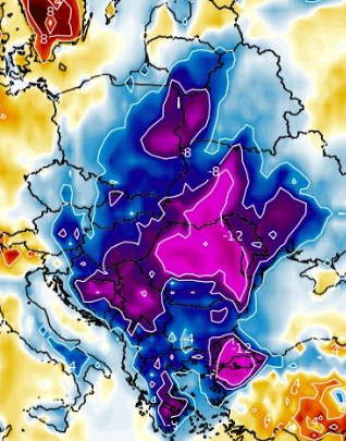
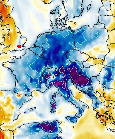
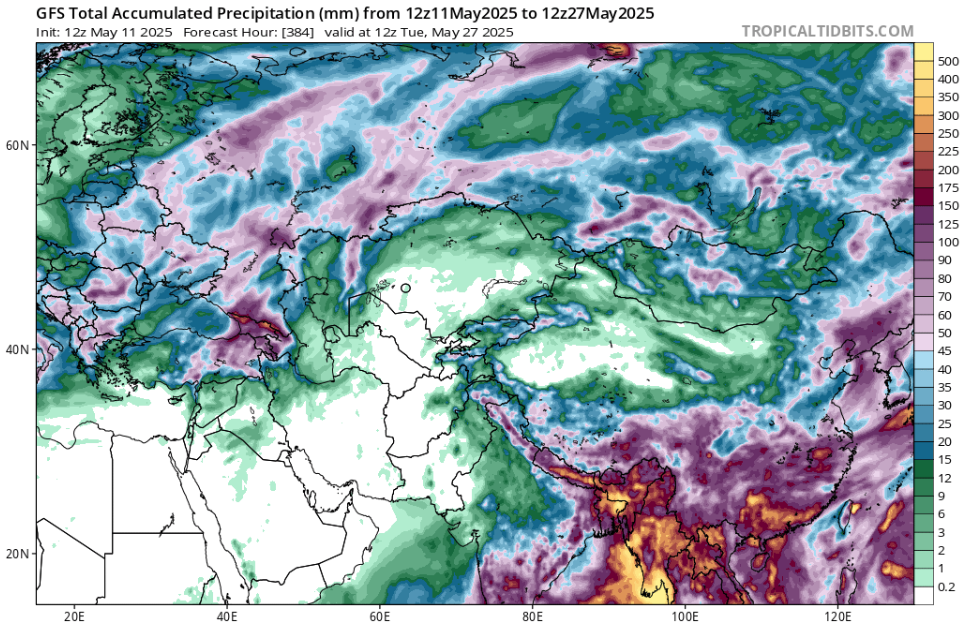
A coldwave in Europe is ongoing from 3. May 2025 and it will be very long, in some parts of the continent possibly until 26. May 2025, it means almost all month!
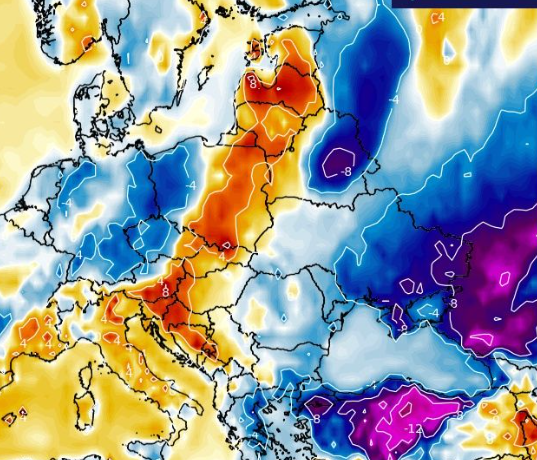
Heatwaves are therefore shifting to the end of the month and June 2025 and they will come from the West mainly to Western and Central Europe, such as the Mediterranean and Balkan except for eastern parts and Eastern Europe.
In the last 48 hours, snowfall surprised Romanian Carpathians below 1000 MASL and in Hungary, extremely low May temperature, only -4,4°C in Nyírtass, was measured, only 2°C above all-time national May records for the whole territory of the country from 2.-3. May 2007.
Meanwhile in SE sector of Europe, mainly E Mediterranean and Caucasian region, extreme heatwaves are bringing temperatures up to +37,3°C in Lefkoniko, Cyprus. Greece still reported up to +36,1°C in the last days. A record night with a Tmin of +26,9°C in Eleftherna was measured.
From interestingly high or low temperatures from Europe measured on 10. and 11. May 2025 we are choosing:
10. May 2025:
Tmaxes: Hatay Havaliman, Turkey, +37,3°C, Lefkoniko, Cyprus, +37,3°C, Nicosia, Cyprus, +36,5°C, Adana, Turkey, +34,4°C, Kasteli, Greece, +32,0°C, Zakatala, Azerbaijan, +30,2°C, Megri, Armenia, +30,0°C, Tbilisi, Georgia, +30,0°C.
Tmins (below 1000 MASL): Kuusiku, Estonia, -3,6°C, Zwettl, Austria, -2,9°C, La Brevine, Switzerland -2,3°C, Lyntupy, Belarus, -2,3°C, Utena, Lithuania, -2,2°C, Tallin, Estonia, -2,2°C, Liesek, Slovakia, -2,1°C, Doksany, Czechia, -1,8°C, Karlovy Vary, Czechia, -1,7°C, Milhostov, Slovakia, -1,4°C, Straubing, Germany, -1,2°C, Redesdale, the UK, -1,1°C, Kosice, Slovakia, -0,9°C, Shepetivka, Ukraine, -0,9°C, Uzhorod, Ukraine, -0,9°C, Bamberg, Germany, -0,8°C, Ivano-Frankivsk, Ukraine, -0,8°C, Vilnius, Lithiania, -0,8°C, Elseborn, Belgium, -0,7°C, Wien, Austria, -0,7°C, Zahony, Hungary, -0,6°C, Ceske Budejovice, Czechia, -0,6°C, Munich, Germany, -0,3°C, Zakopane, Poland, -0,3°C, Plzen, Czechia, -0,2°C.
Low Tmaxes (below 1000 MASL): Lublin, Poland, +9,2°C, Zakopane, Poland, +9,5°C, Pakri, Estonia, +7,3°C, Ventspils, Latvia, +8,3°C, Vente, Lithuania, +9,9°C, Shepetivka, Ukraine, +6,9°C.
11. May 2025:
Tmaxes: Lefkoniko, Cyprus, +35,7°C, Nicosia, Cyprus, +35,4°C, Hatay Havaliman, Turky, +34,6°C, Larnaca, Cyprus, +34,6°C, Urfa, Turkey, +34,6°C, Geokchay, Azerbaijan, +31,2°C.
Tmins (below 1000 MASL): Alytus, Lithuania, -3,3°C, Lyntupy, Belarus, -2,4°C, Sarny, Ukraine, -2,3°C, Lodz, Poland, -2,2°C, Rucava, Latvia, -2,0°C, Narva, Estonia, -1,9°C, Miercurea Ciuc, Romania -1,1°C, Sjenica, Serbia, -1,0°C, Altnaharra, the UK, -0,9°C, Puchberg, Austria, -0,4°C, Munich, Germany, -0,3°C.
Low Tmaxes (below 1000 MASL): Ustka, Poland, +9,4°C, Zakopane, Poland, +9,6°C, Gdansk, Poland, +9,9°C, Telgart, Slovakia, +8,8°C, Ocna Sugatag, Romania, +9,9°C, Kornesty, Moldova, +9,0°C, Kunda, Estonia, +7,1°C, Ventspils, Latvia, +9,0°C, Gorki, Belarus, +8,9°C.
According to the newest outputs of CFS /https://www.cpc.ncep.noaa.gov/products/CFSv2/htmls/euPrece3Mon.html/, still very stormy western and central parts of Europe are predicted for Summer 2025, as in our Summer 2025 forecast /https://mkweather.com/summer-2025-forecast-for-europe//. It appears like strong later Central European Monsoon, in some features.
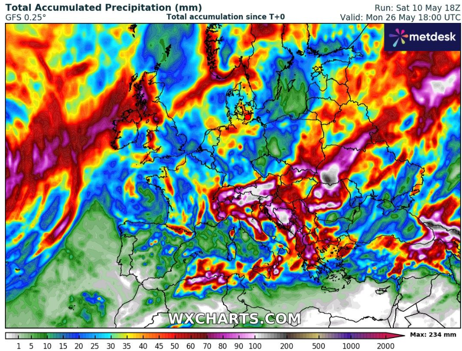
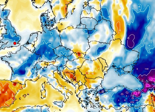
PRECIPITATION TOTALS IN EUROPE UNTIL 26. MAY 2025
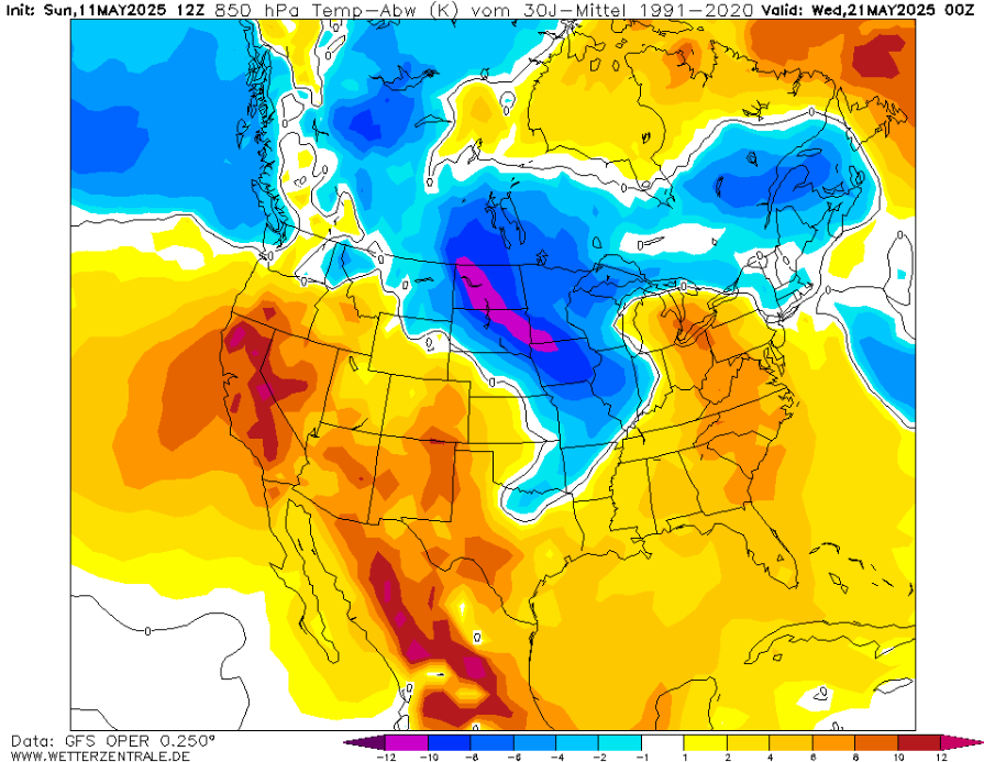
COLDWAVE IN EASTERN HALF OF EUROPE – NEXT DAYS
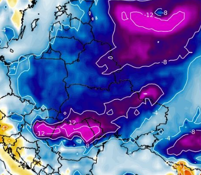
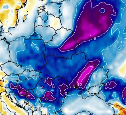
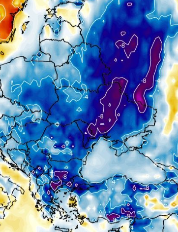
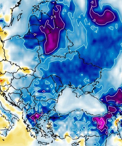
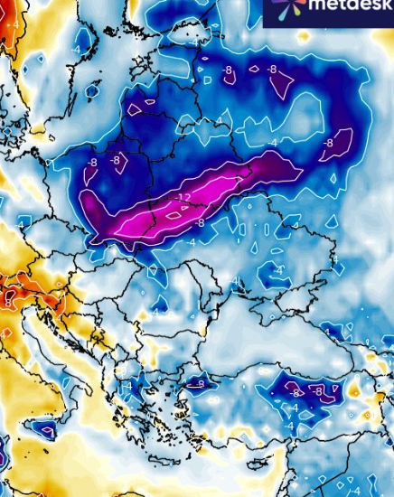
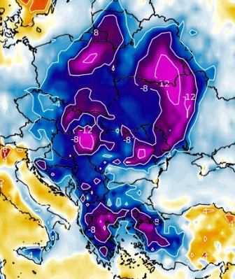

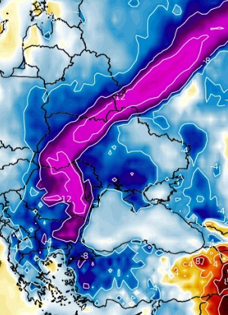
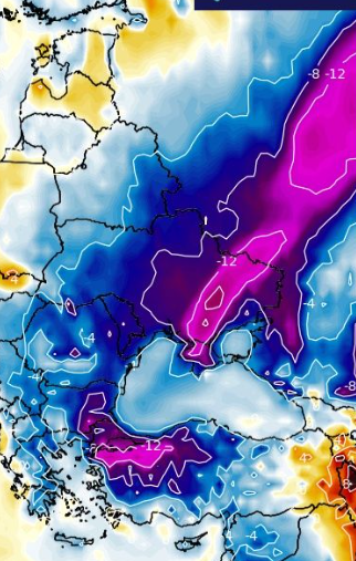
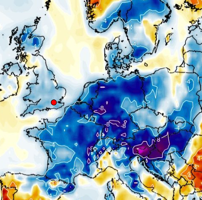
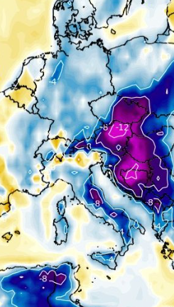
Cold temperature anomalies in Europe from 11. to 26. May 2025. Source: https://www.wxcharts.com/
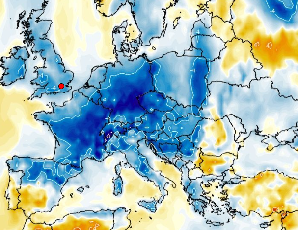
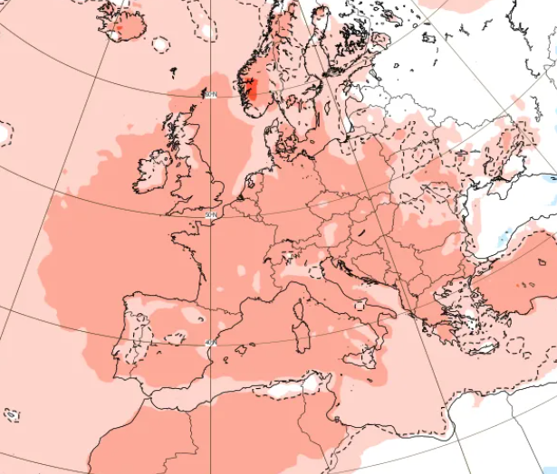
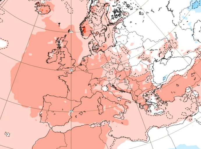
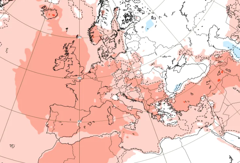
EXPECTED WARMING FROM EUROPE FROM 2. TO 23. JUNE 2025:
EXTREME PRECIPITATION IN EUROPE ON 10. AND 11. MAY 2025
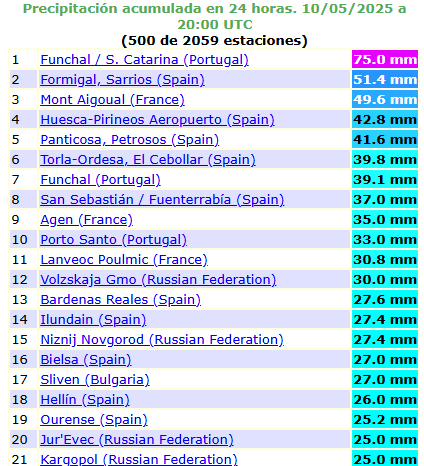
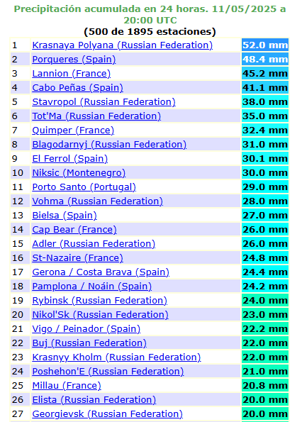
Source: https://ogimet.com/ranking.phtml
SNOWING IN SUCEAVA, ROMANIA, 1000 MASL
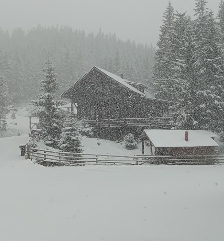
Source: https://www.idokep.hu/hirek/suru-havazas-erkezett-a-keleti-karpatokba
HUNGARY WITH -4,4°C
SEVERE HAILSTORM IN RUSSIA
7-CM HAIL IN UKRAINE
GREECE +36,1°C, CYPRUS CLOSE TO +40°C
5 CM HAIL IN ZAPORIZHZHIA, UKRAINE

SEVERE STORMS EXPECTED IN THE CENTRAL MEDITERRANEAN
HAILSTORM IN TURKEY
North America
A lot of rainfall is still forecast for eastern half of the USA and inhabited parts of southern Canada in outlook.
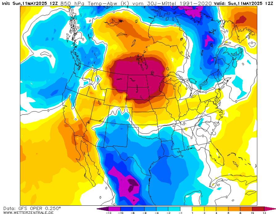
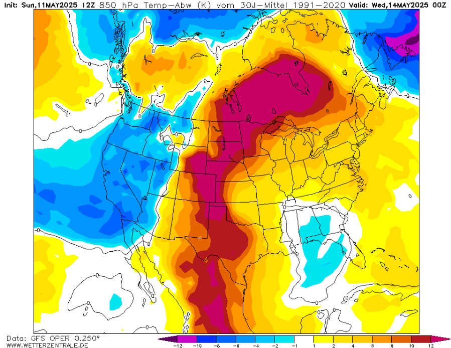
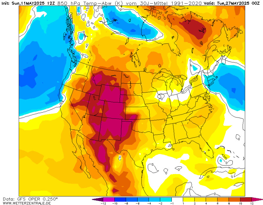
However, a severe heatwaves is prepared for region from Mexico to Canada, in the following days.
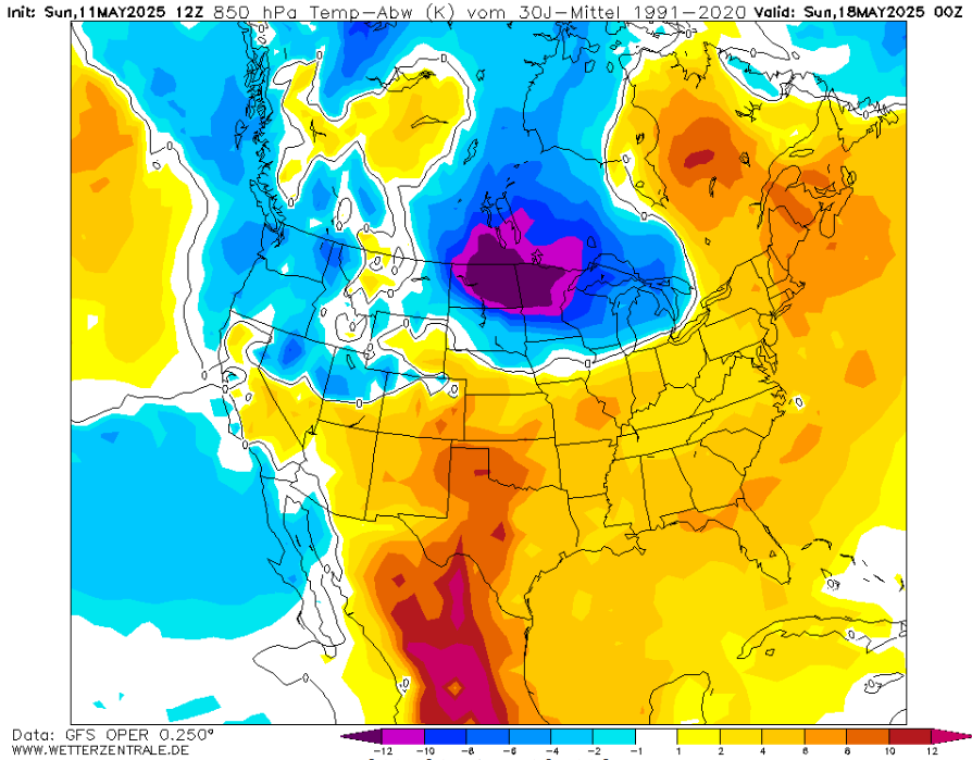
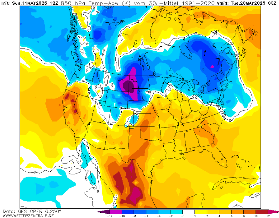
Around 23. May 2025, a typical tornadic situation, with hot West and cold East of the USA will create.
In the last days, many temperature records was observed in the long line from California to Montana.
In Death Valley, +44,4°C / 112°F was measured. Exceptional hot night in SW USA with Tmin +87°F in the Death Valley was measured, too – it’s one of the hottest nights ever recorded in US history that early (below 10.5. 2020).
Tmins in the 80s in SW USA and NW Mexico brought exceptional and totally unprecedented heat for mid-May (in late May they happened few times, mostly 1984 and 2003).
Widespread >+45°C in the northwestern Mexico between Sonora, Sinaloa and Chihuahua, unprecedented for this time of the year is reported, in Hermosillo with +109°F/+42,8°C.
Historic heat hit in the next hours Dakotas, Minnesota and Canadian Manitoba //https://www.accuweather.com/en/weather-forecasts/heat-wave-to-bake-dakotas-to-minnesota-into-midweek/1773659/. /.
The Canadian hottest Spring night in history is at stake, too! (more here: https://x.com/extremetemps)
Stories about severe storms and floods across eastern half of the USA are bringing Wunderground and Accuweather: About severe weather to escalate in central, eastern US during mid-May /https://www.accuweather.com/en/severe-weather/rounds-of-severe-weather-to-escalate-in-central-eastern-us-during-mid-may/1773601/, about Southeast risk for flooding and damaging thunderstorms /https://www.accuweather.com/en/severe-weather/storm-crawling-through-southeast-will-raise-the-risk-for-flooding-damaging-thunderstorms/1773485/, again about severe storms /https://weather.com/storms/severe/news/2025-05-07-may-tornado-break-pattern-change-ahead-plains/, hailstorms /https://weather.com/storms/severe/video/hailstorm-covers-roads-in-culleoka-tennessee/ and rain in Northeast /https://www.accuweather.com/en/weather-forecasts/when-will-wet-weather-return-to-northeast-us/1773574/.
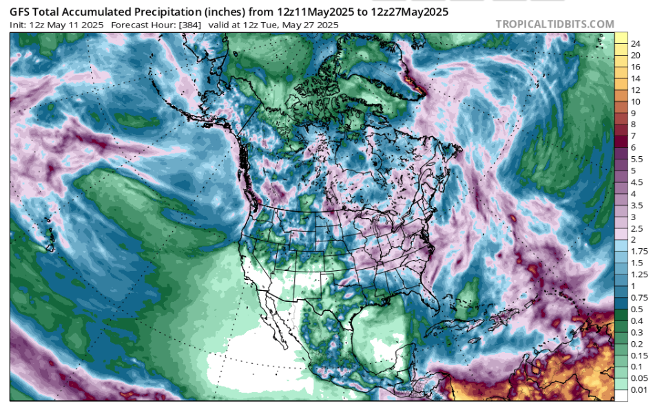
PRECIPITATION TOTALS IN NORTH AMERICA UNTIL 27. MAY 2025:
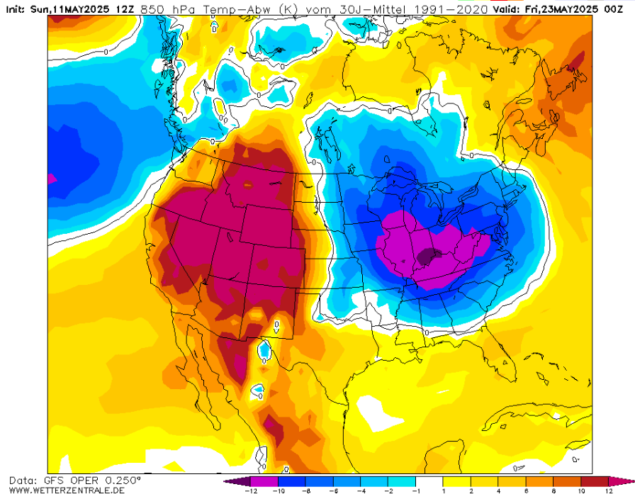
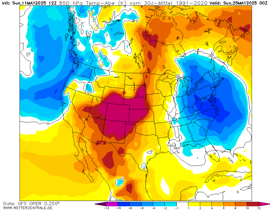
T80 HPA ANOMALY ABOVE NORTHERN AMERICA IN THE NEXT PERIOD IN 48-HOUR INTERVAL

STORMS AND FLOODS IN EASTERN HALF OF THE USA
EXTREME HEATWAVE FROM MEXICO TO CANADA!
Asia
The most severe storms and floods in hot environment are reported from SE Asia – Bangkok, Singapore, Ho Chi Minh City, parts of Cambodia or Malaysia were heavily flooded in the last 48 hours, near heat indexes locally up to +55°C, mainly in Thailand. In Indonesia, +37,1°C was measured in Tanjung Karang, as a highest May temperature ever.
China and Indian region are reporting severe heatwaves and floods both. In Henan, China, +44°C temperatures are possible around 16.-21. May 2025 with May records. In Malda, India, extremely warm +30,3°C Tmin was measured, and in Ragamati, Bangladesh a minimum temperature dropped only at +27,8°C. Kashmir region hit severe hailstorms and landslides and severe storms are bothering many parts of India.
The Middle East and Central Asia are for the next extreme heatwaves only preparing…
PRECIPITATION TOTALS IN ASIA UNTIL 27. MAY 2025
HEATWAVES IN CENTRAL CHINA
EXTREMELY HOT NIGHTS IN INDIA AND BALGLADESH
STORMS IN INDIA
HAILSTORM IN ISLAMABAD, PAKISTAN
HEATWAVES IN INDONESIA
SEVERE FLOODS IN CAMBODIA
HO CHI MINH CITY FLOODED
STORMS IN BANGKOK, THAILAND
STORMS IN SINGAPORE AND MALAYSIA
South America
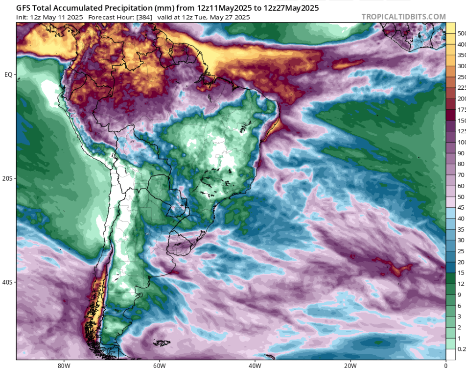
Very stormy North and very dry South of South America – the same pattern as we forecast in Winter 2025 forecast for South America: https://mkweather.com/winter-2025-forecast-for-south-america-la-nina-aao-pdo-psa-dakar-nina-ao-nao-iod-amo-qbo-to-hot-and-dry-southern-brazil-bolivia-paraguay-stormy-rainforest-colombia-venezuela-gu/.
We are still watching heatwaves in Bolivia, Paraguay, N Argentina and S Brazil.
In northern regions, floods are on daily basis.
PRECIPITATION TOTALS IN SOUTH AMERICA UNTIL 27. MAY 2025
Africa
Extreme heatwaves, between floods and again extreme heatwaves!
Africa is in May 2025 divided to 3 different words.
In northern Africa, up to +46°C was measured in Algeria and Mali, with Tmins +35°C, Libya reported +44°C and the next days will bring +48°C over Sahara.
Heatwave in Africa and Asia is long-scale, from Algeria to China, which is a historic moment, when every country in this line is reporting temperature records.
Meanwhile +39,5°C in Komatidraai, South Afirca was measured only 20 days before winter! Port Edward reported +35,1°C and the next week will be reached +35/+40°C in South Africa every day!
Extreme temperatures are reported from the Gulf of Guinea, too. Tmin of +26,0°C in Dimbokro, Ivory Coast (May record). Extremely hot nigths up to +33°C Tmins are reported from Ghana and Togo, too.
Disquieting is an extent of damages caused by floods in Africa only in 48-hour interval in 10.-11. May 2025. Extreme floods swept Nairobi, Kenya, Mogadishu, Somalia; in DR Congo, 104 died and problems are reported from Nigeria region, too. Overall, many equatorial and subequatorial countries are currently fighting with floods.
PRECIPITATION TOTALS FOR AFRICA UNTIL 27. MAY 2025
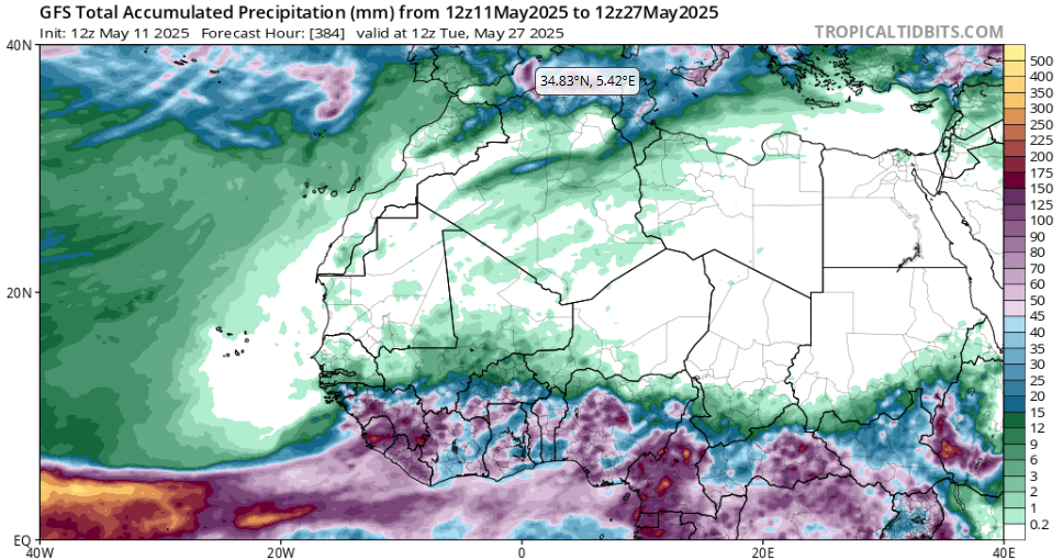
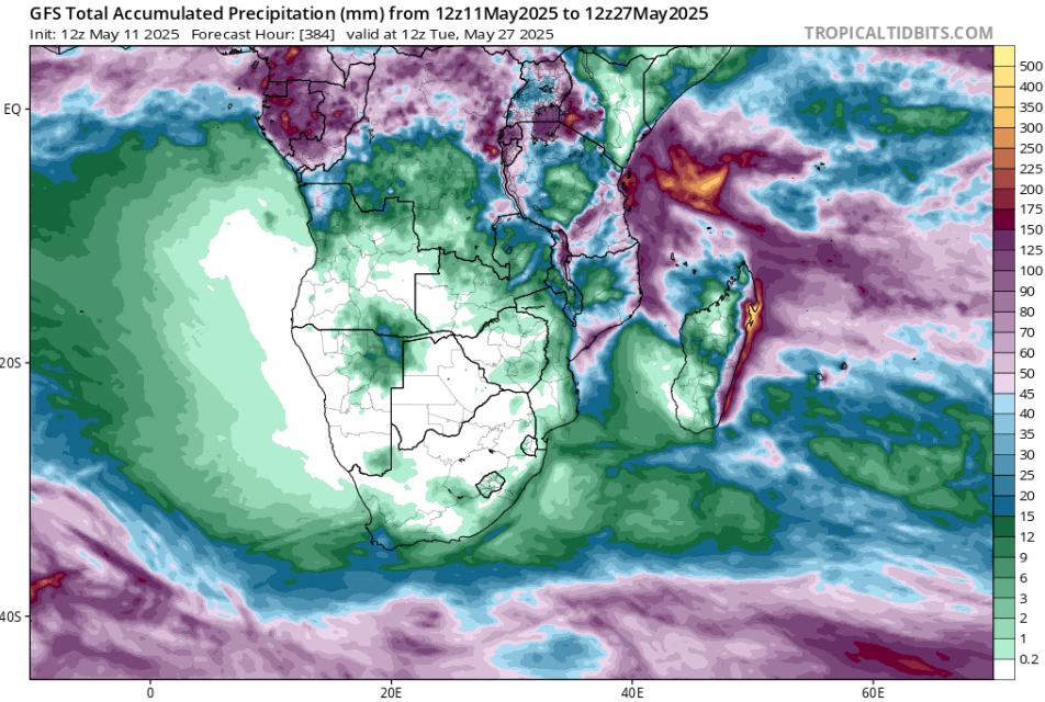
Sources: https://www.tropicaltidbits.com/analysis/models/?model=gfs®ion=nafr&pkg=apcpn&runtime=2025051112&fh=384, https://www.tropicaltidbits.com/analysis/models/?model=gfs®ion=safr&pkg=apcpn&runtime=2025051112&fh=384
EXTREME HEATWAVE FROM ALGERIA TO CHINA, ALGERIA AND MALI +46°C
ABNORMAL ALMOST +40°C IN SOUTH AFRICA SHORTLY BEFORE WINTER!
THE GULF OG GUINEA WITH EXTREMELY WAMR NIGHTS
FLOODS IN NAIROBI, KENYA
STORMS AND FLOODS IN MAGADISHU, SOMALIA
FLOODS IN D.R. CONGO
HEAVY RAINFALL IN LAGOS, NIGERIA
Australia
Heatwaves in Western and continental Australia are continuing, with a record Tmax in Carnavron, Western Australia, +38,2°C only 20 days before winter.
In Perth in the last days, +34,4°C was measured.
A record high minimum at Windy Harbour with a Tmin of +19,0°C occurred. Summer conditions in Western Australia will continue for any foreseeable future.
Meanwhile, in Oceania, and northward from Australia, a powerful cyclone season is continuing. Tropical Storm Thirtytwo is bringing winds and rainfall in Papua, Indonesia, Timor Leste and northern Australian coast.
Tropical depression 94P Invest is shifting near Solomon Islands.
Finally, Tropical depression 95 Invest is moving near Fiji.
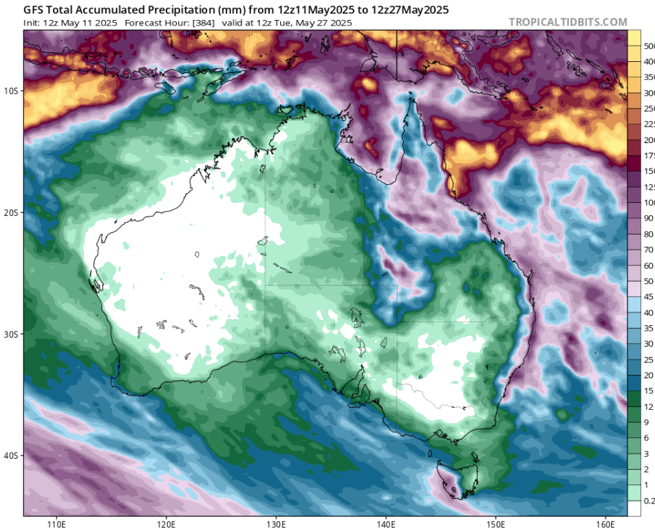
PRECIPITATION TOTALS FOR AUSTRALIA UNTIL 27. MAY 2025
EXTREME HEATWAVES IN WESTERN AND CENTRAL AUSTRALIA
TROPICAL CYCLONE THIRTYTWO
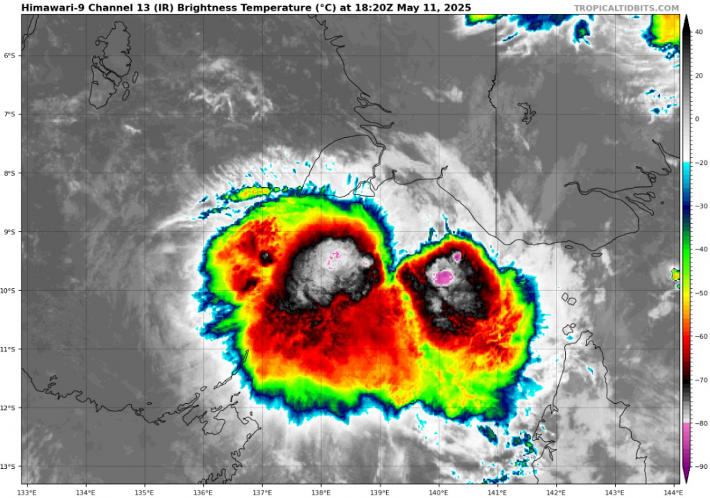
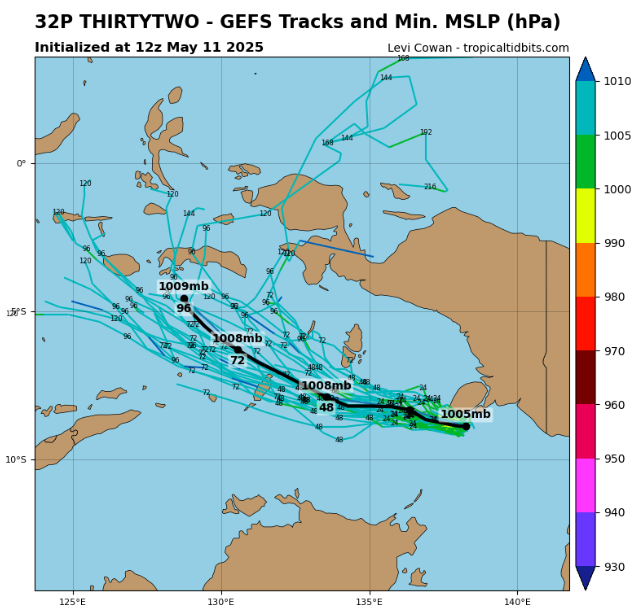
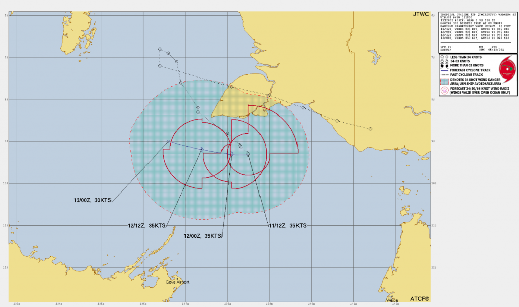
Source: https://www.tropicaltidbits.com/storminfo/#32P
TROPICAL DEPRESSION 94P INVEST NEAR SOLOMON ISLANDS
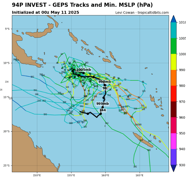
Source: https://www.tropicaltidbits.com/storminfo/#94P
TROPICAL DEPRESSION 95P INVEST NEAR FIJI
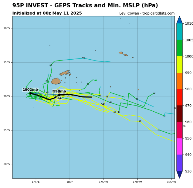
Source: https://www.tropicaltidbits.com/storminfo/#95P
The Arctic / Antarctica
The Arctic Sea Ice is still surprisingly above 2010´s average. We know why: https://mkweather.com/the-collapse-of-the-polar-vortex-in-2025-and-late-season-cold-in-europe/.
Every day we will try to bring some news / Tweet from Antarctica, too.
THE ARCTIC SEA ICE ABOVE 2010´S AVERAGE!
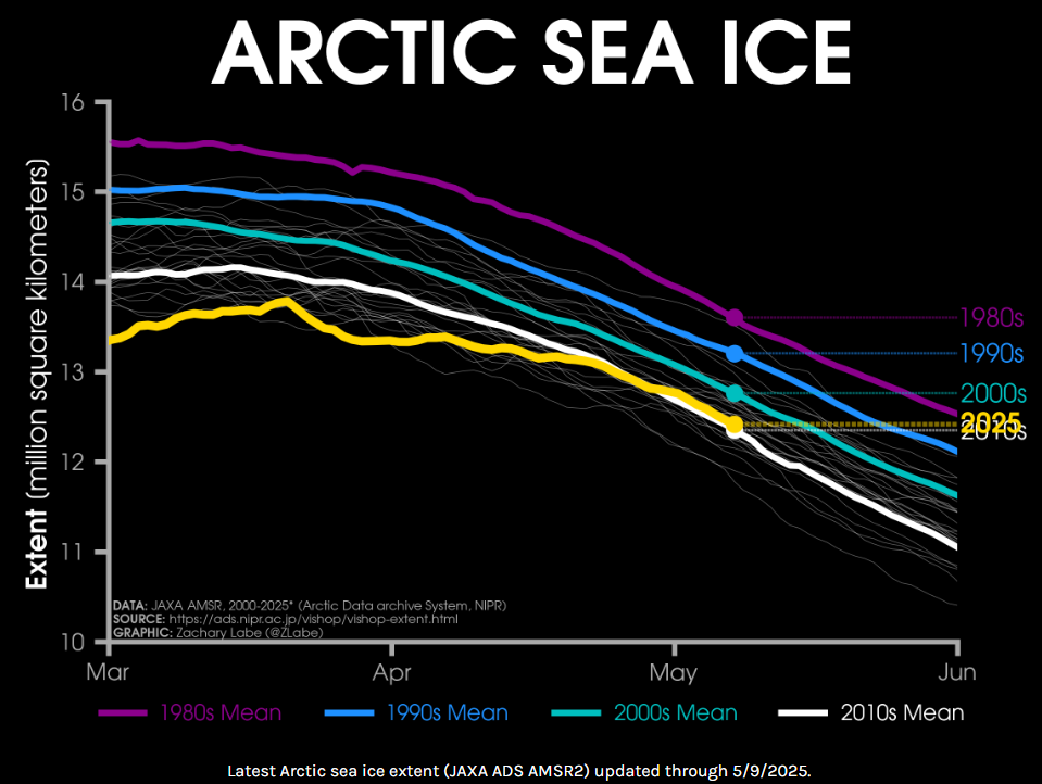
Source: https://zacklabe.com/arctic-sea-ice-extentconcentration/


13 thoughts on “Weather report for 10.-11. May 2025: Almost all May 2025 in Europe cold! Heatwaves are shifting to June…Snow in Romania, hail in Ukraine, Russia, -4,4°C in Hungary, Cyprus +37,3°C, dangerous Mediterranean storm in outlook / Tornadic situation in the US soon + heatwave from Mexico to Canada / +46°C in Algeria and +40°C in South Africa almost in the winter (!), floods in Nairobi, Mogadishu and 104 dead in DR Congo / +38,2°C in Carnavron, Australia / The Arctic sea ice extent above 2010´s average”
Comments are closed.