Frosts and ground frosts in Europe next 7 days, protect your flowers and harvest!
Arctic air comes after wind pressure system over NW Europe
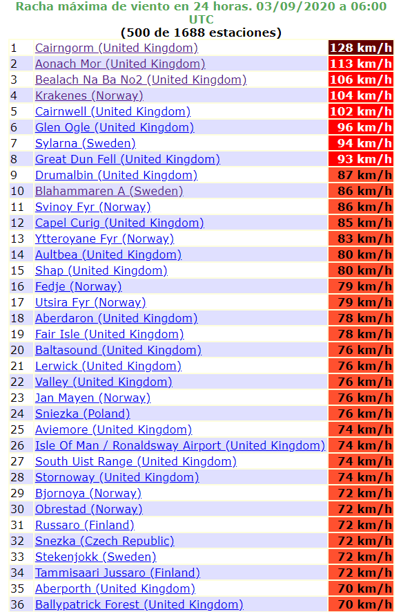
While windstorm Ellen and Francis in August 2020 brought wind gusts 143 km/h (89 mph) and 163 km/h (100 mph) above lands of Europe, current wind pressure low system is weaker, with winds up to 128 km/h in mountains (Cairngorm, UK, 1245 MASL) and 104 km/h in low areas (Krakenes, Norway, 4 MASL).
In addition, Met Office says, that “Strongest storm is determined by lowest pressure and maximum recorded non-mountainous wind gust is also included for reference.”, therefore, it is still missing 6 km/h to reach status of windstorm in lower situated areas.
Despite of various terminology (it is not clear, if somewhere in Norway was reached more than 110 km/h last 48 hours and if for UK classification of windstorm territory of Norway is valid, too), wind pressure low associated with remnants of hurricane Laura will bring a week of cold mornings across large parts of Europe.
Temperatures +5/0°C in low elevated basins and valleys, rarely minus temperatures with frosts and ground frosts
Cold morning is reported from Europe already on Thursday, 3. September: in Le Puy (832 MASL) in France was measured only +3,4°C, in Stockholm +3,4°C, in Burgos, Spain (894 MASL) +3,5°C, in Vitoria, Spain (532 MASL) +3,8°C, in Horsens, Denmark +3,9°C, in Oberstdorf, Germany (810 MASL) +4,0°C, in Karlove Vary, Czech republic (503 MASL) +4,3°C and on Thursday +2,7°C, in Elseborn in Belgium (564 MASL) +4,5°C, in Hannover, Germany +5,0°C, Liesek, Slovakia (614 MASL) +5,0°C.
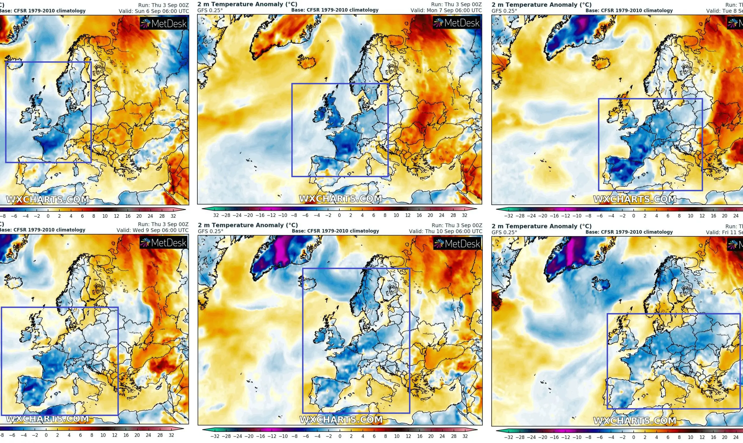
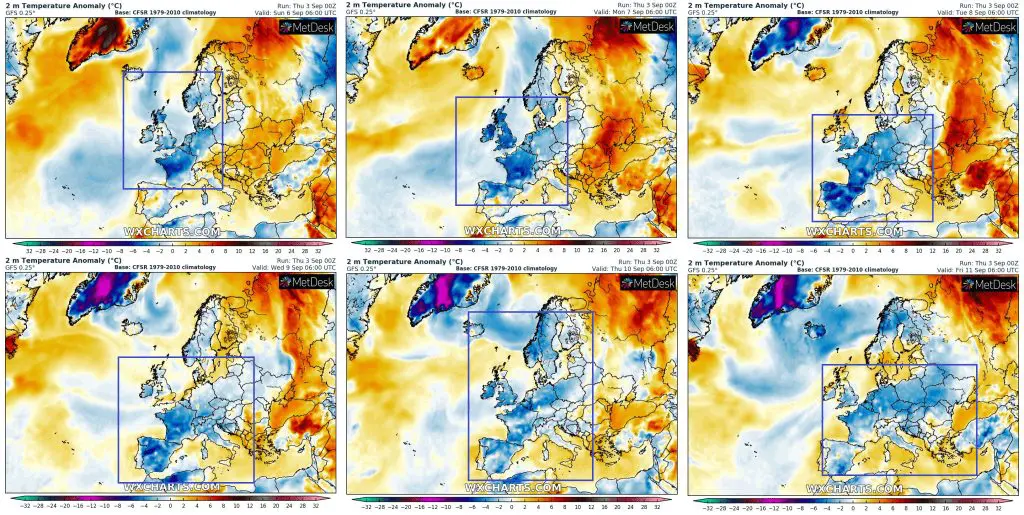
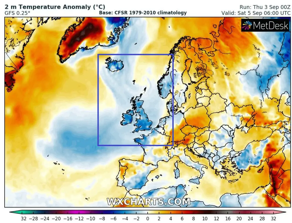
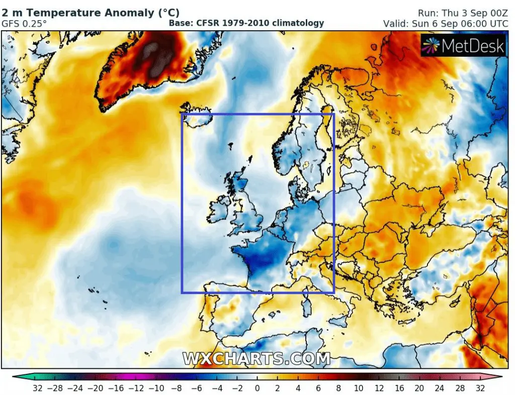
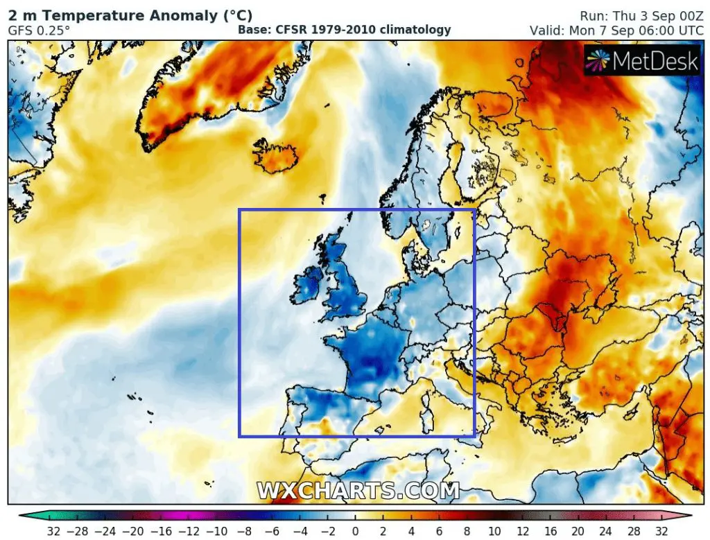
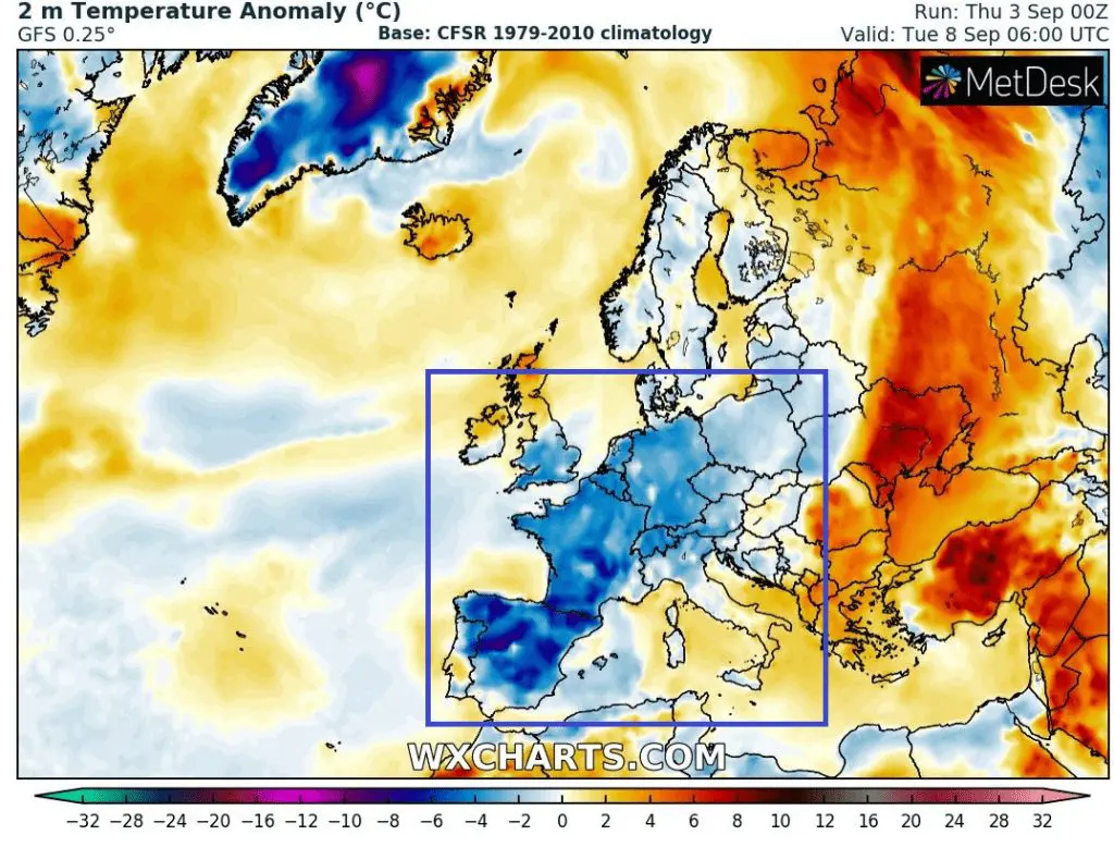
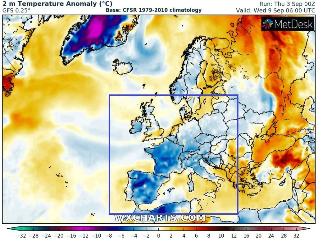
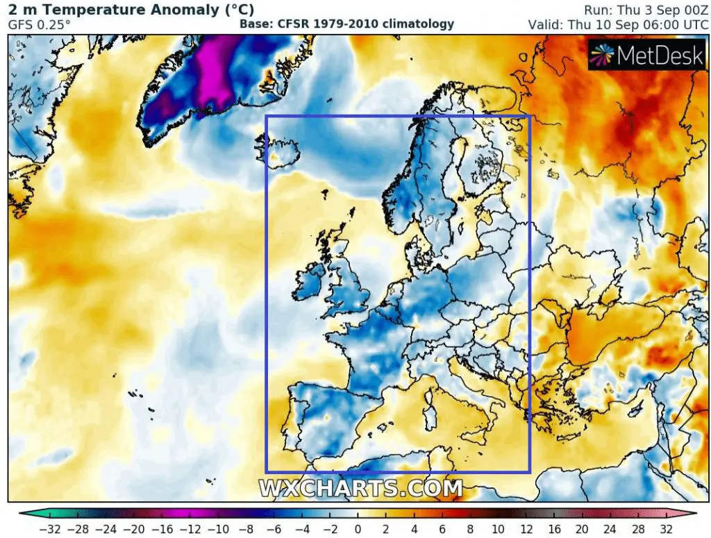
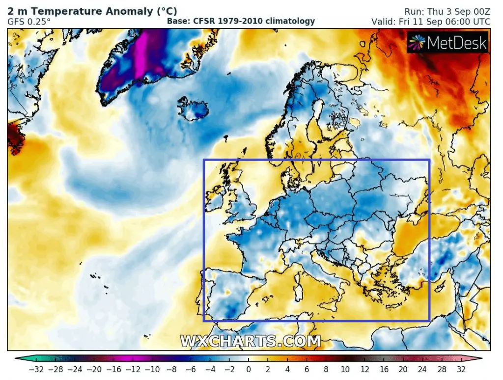
Friday will be warmer yet, before arrival of cold front linked with robust pressure system over NW Europe, in southern France up to +35°C. Ground frost period will begin in British Isles from Saturday and in European continent form Sunday 5.-6. September 2020 and will be persisting till Friday 11. September 2020.
It´s possible, that in many countries will be these minimum temperatures in valleys and low elevated basins bewteen Saturday 5. and Friday 11. September even lower, with possible ground frosts, or rarely frosts.
Therefore, watch current weather news and forecast models and protect your flowers and harvest before early 5 cm or 2m frosts during next week, mainly in “blue” areas on maps below.
6-day panel + 7-days of detailed maps of minimum temperature anomalies form long term average above Europe between Saturday 5.9 – Friday 11.9 2020 /wxcharts.com
Measured TOP wind gusts in Europe /ogimet.com and net 7 mornings
Arrival of powerful cold front over Europe in next 3 days /chmi.cz:


