On Friday, before an arrival of cold front, linked with robust cyclonic low pressure area over NW Europe, comes over France hot tropical air from Spain, yet, with maximum temperatures up to +35/+36°C in southwestern parts.
Next week, after shifting of cold front across Europe, a period with cold mornings will start from the weekend /https://mkweather.com/2020/09/03/frosts-and-ground-frosts-in-europe-next-7-days-protect-your-flowers-and-harvest//. Mornings during these 7 days will be associated with ground frosts and temperatures only +5/0°C in European low situated basins and valleys.
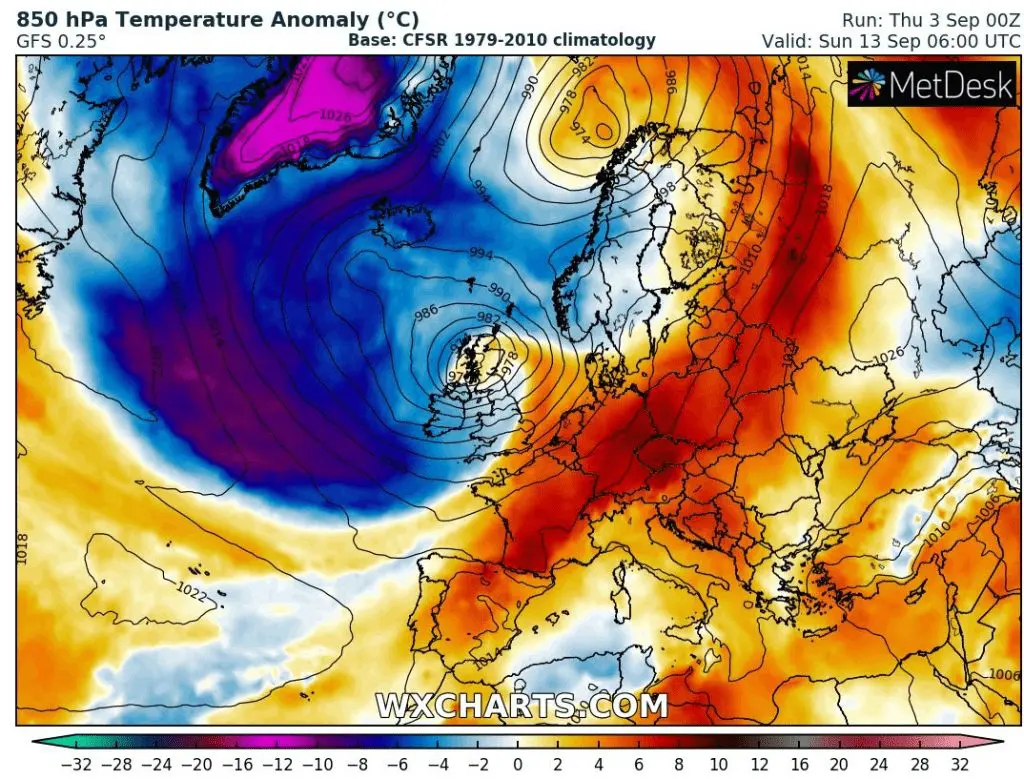
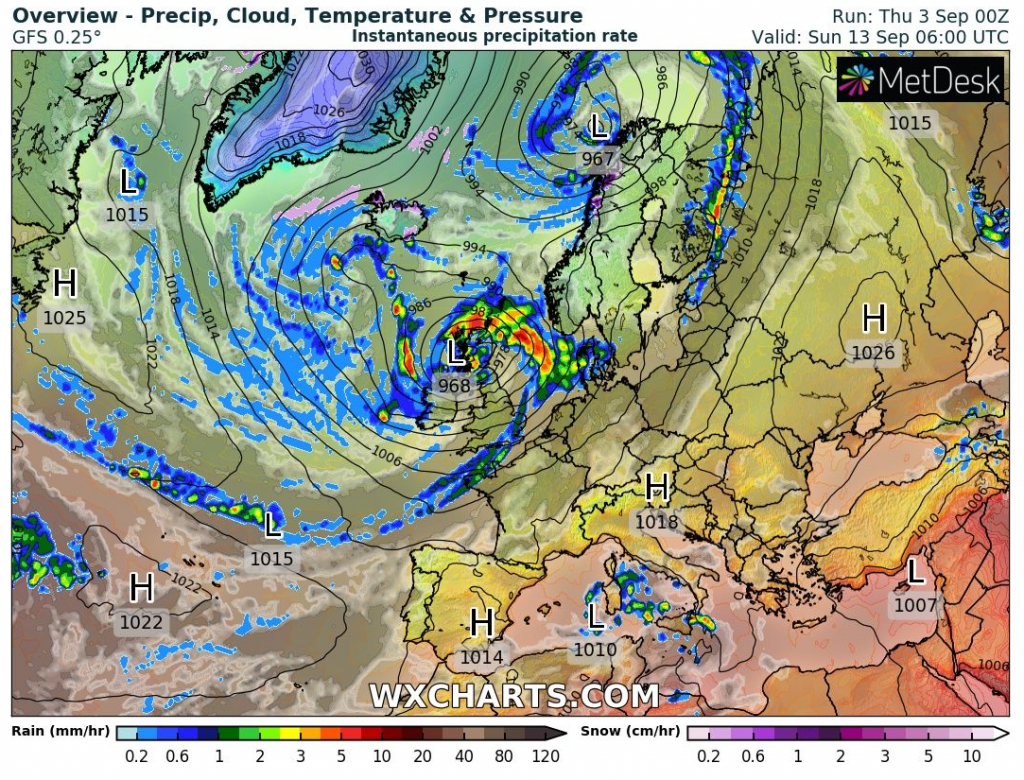
After this period, in mid-September 2020 very interesting situation is expected – from the next weekend, 2 deep pressure depressions of tropical origin will be shifting towards Europe and they will start advection of extreme hot tropical air over continental Europe, with last possible temperatures slightly over +30°C in northern France, Germany, Benelux, Poland, Czechia and Slovakia in 2020.
Ex-tropical or surprising tropical storms will cause over western parts of Europe and British Isles powerful storms, winds, heavy rain and flood risk. After these deep-pressure systems with anomalously southern stormtracks, will arrive over Europe even more colder Arctic air, as at the end of August and start of September 2020 and after last chance for tropical days in continental Europe, we can expect a farewell with summer 2020 in a big style!
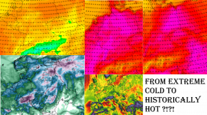
Attention-worthy predicted conditions to mid-September 2020 with possible tropical activity over Europe and last heatwave with +30°C in continental Europe /wxcharts.com:
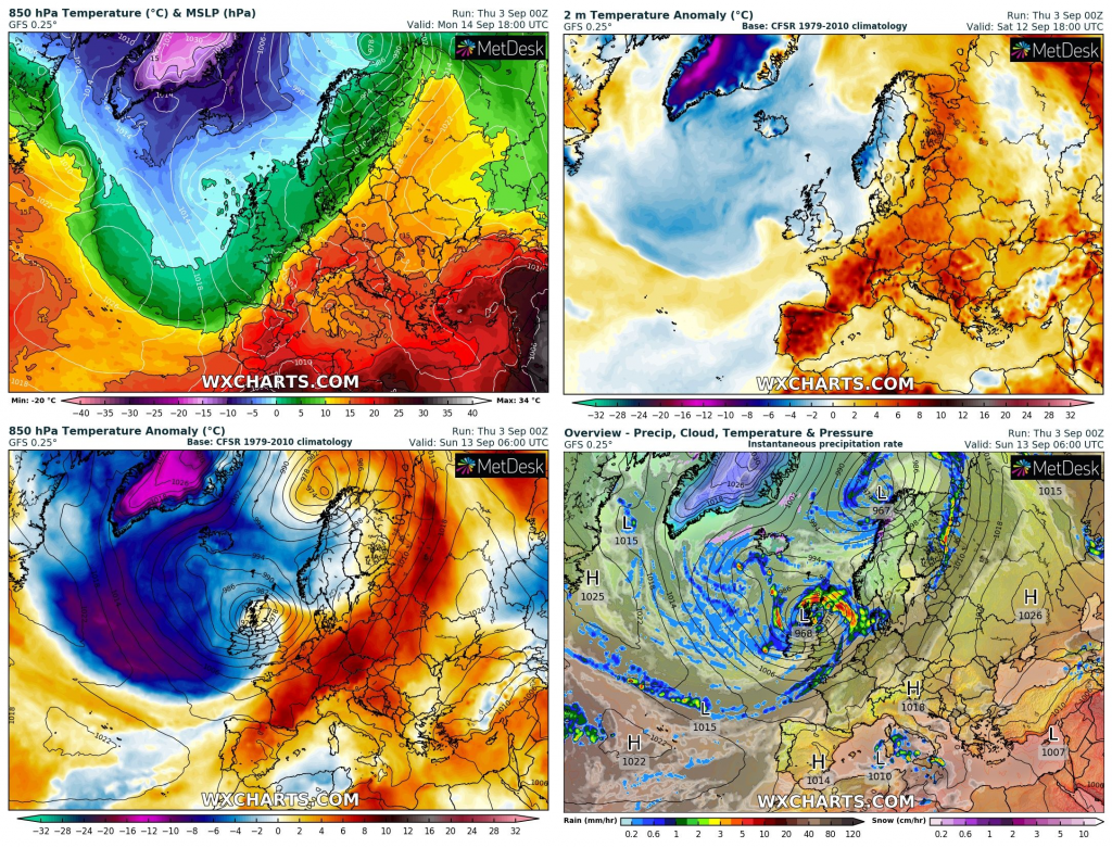
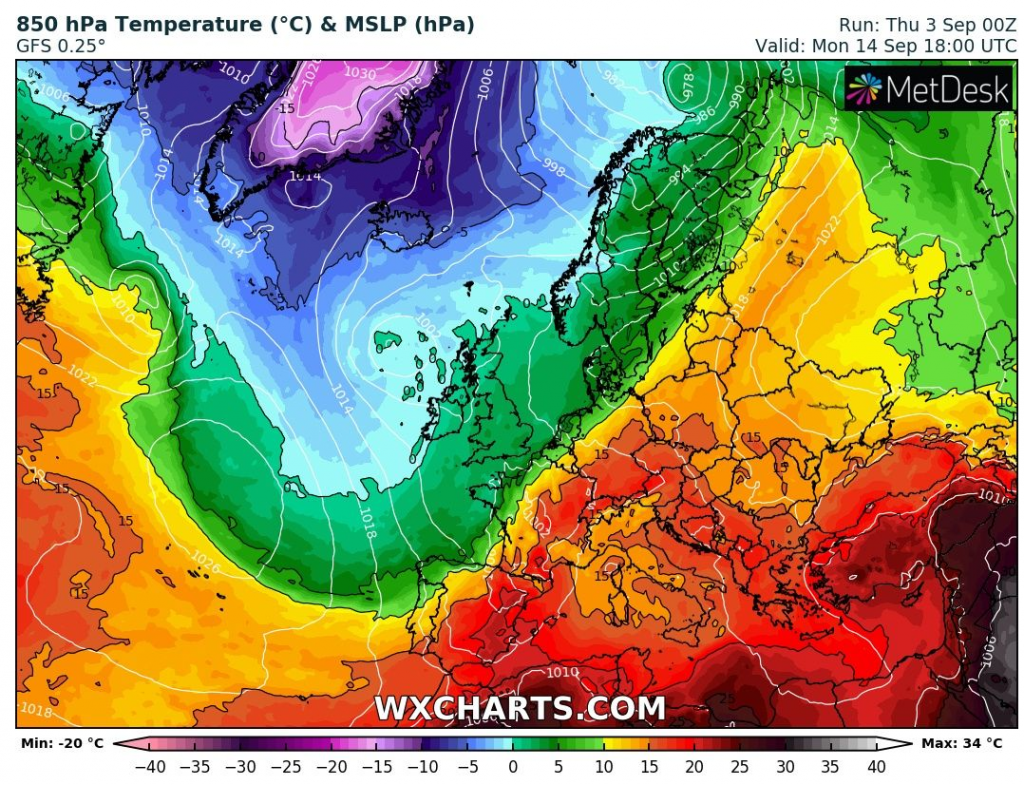
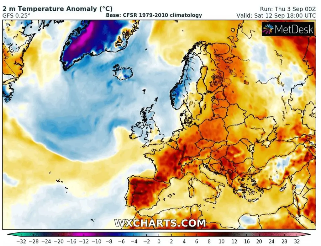
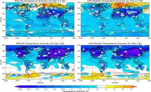
2 hottest days in continental Europe within 16-day outlook: Friday 4.9. in France and mid-September in Central Europe /wetterzentrale.de:
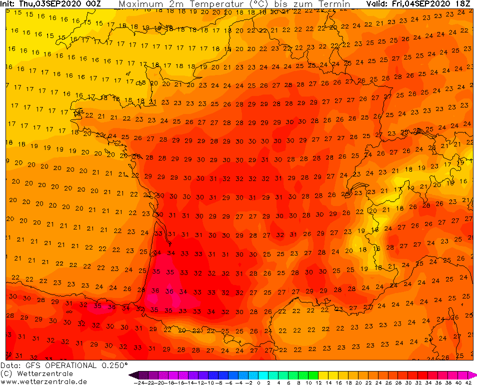
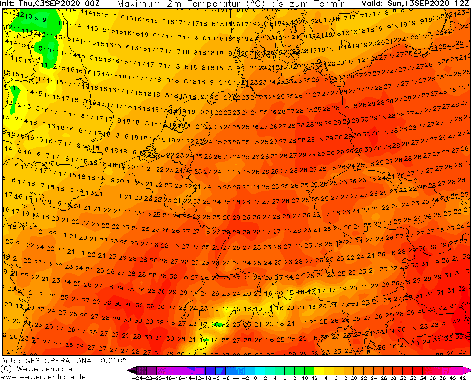
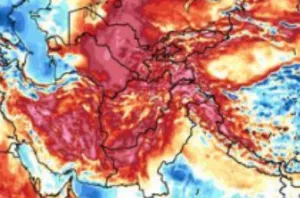
Illustration photo: https://www.centralamericalink.com