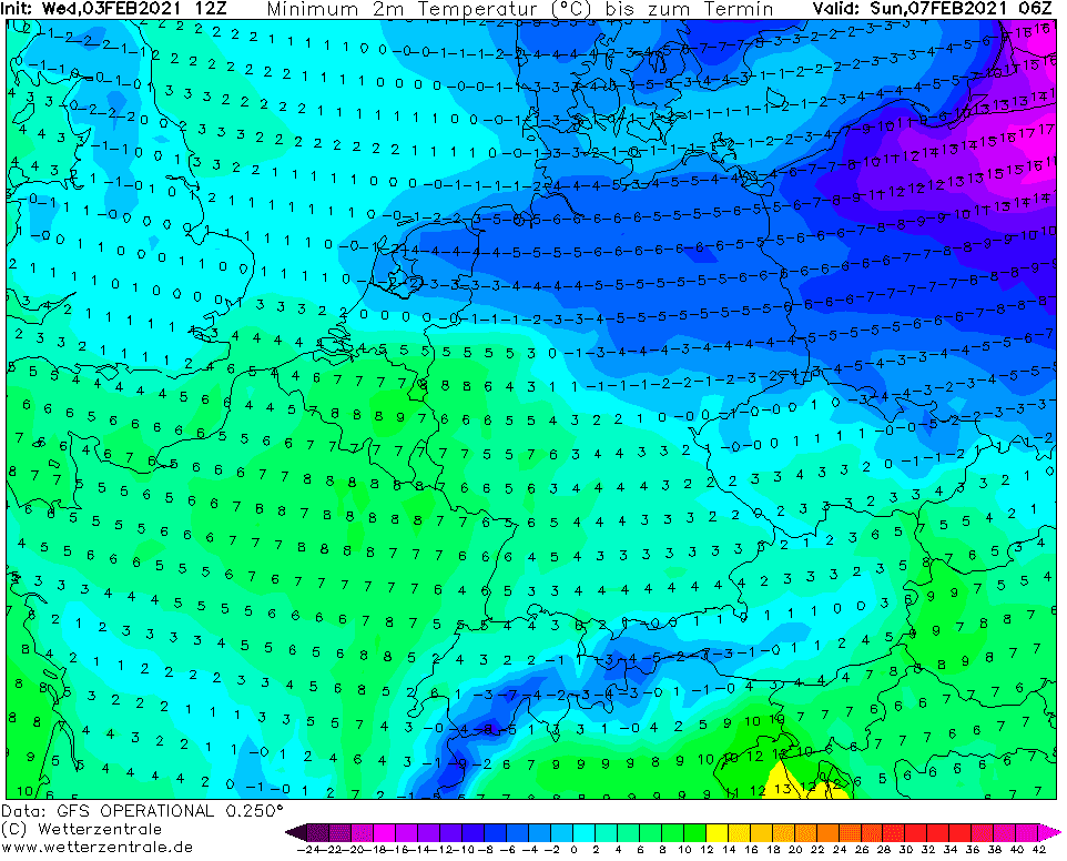
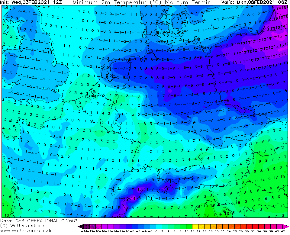
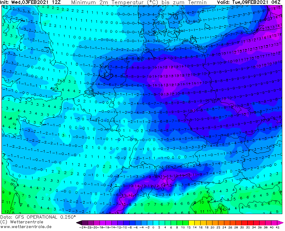
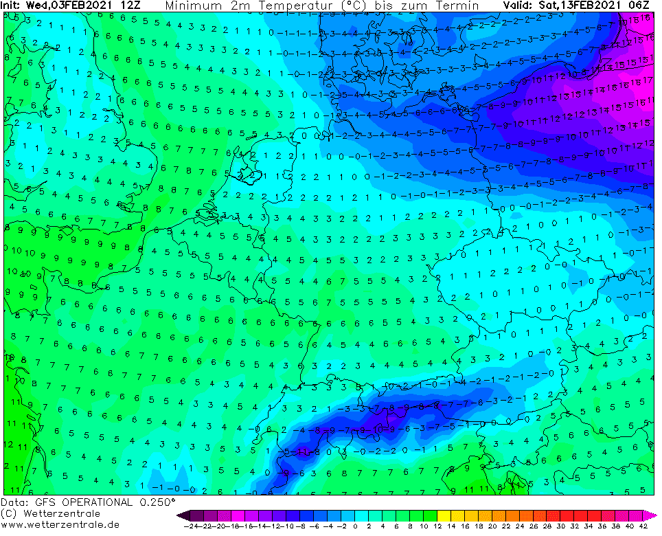
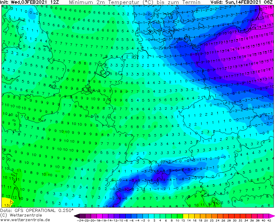
The highest chances for temperatures in interval -25/-30°C are for Czechian frost basins and valleys and for lowlands in northeastern Poland.
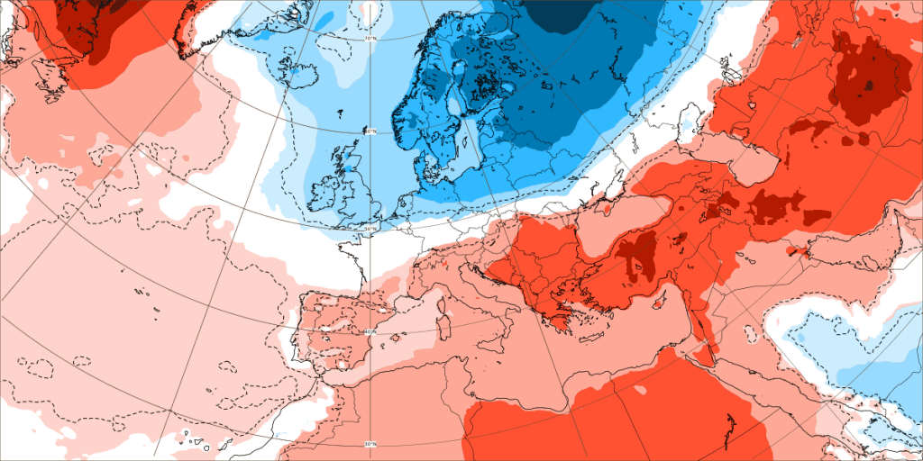
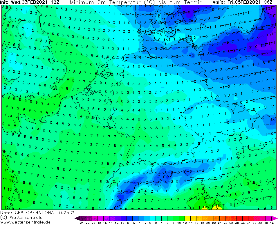
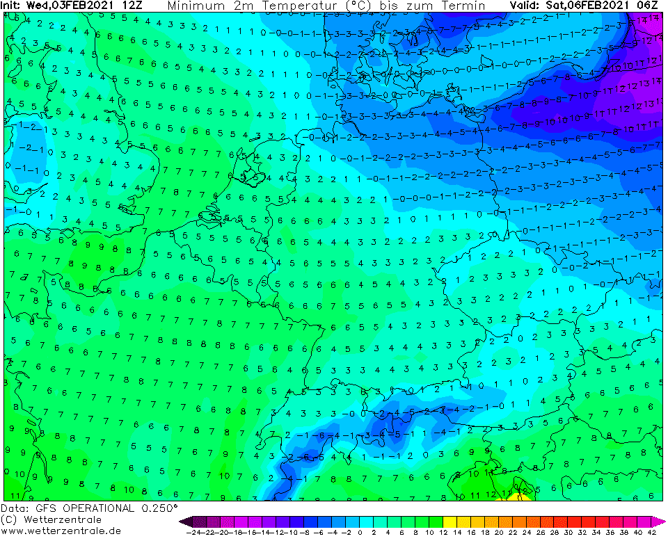
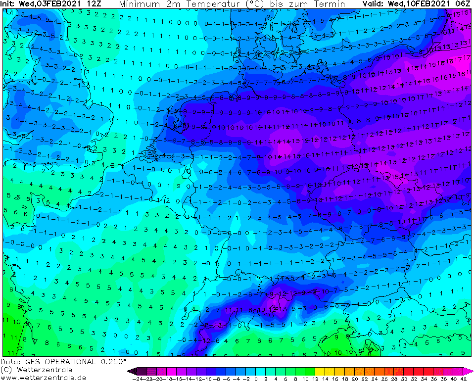
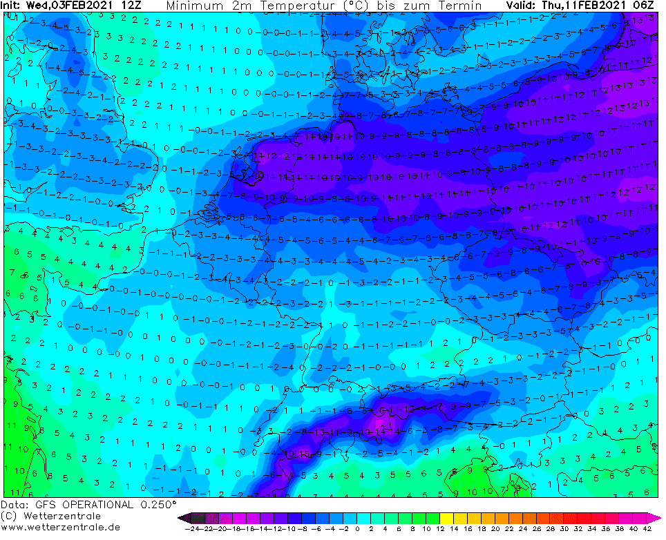
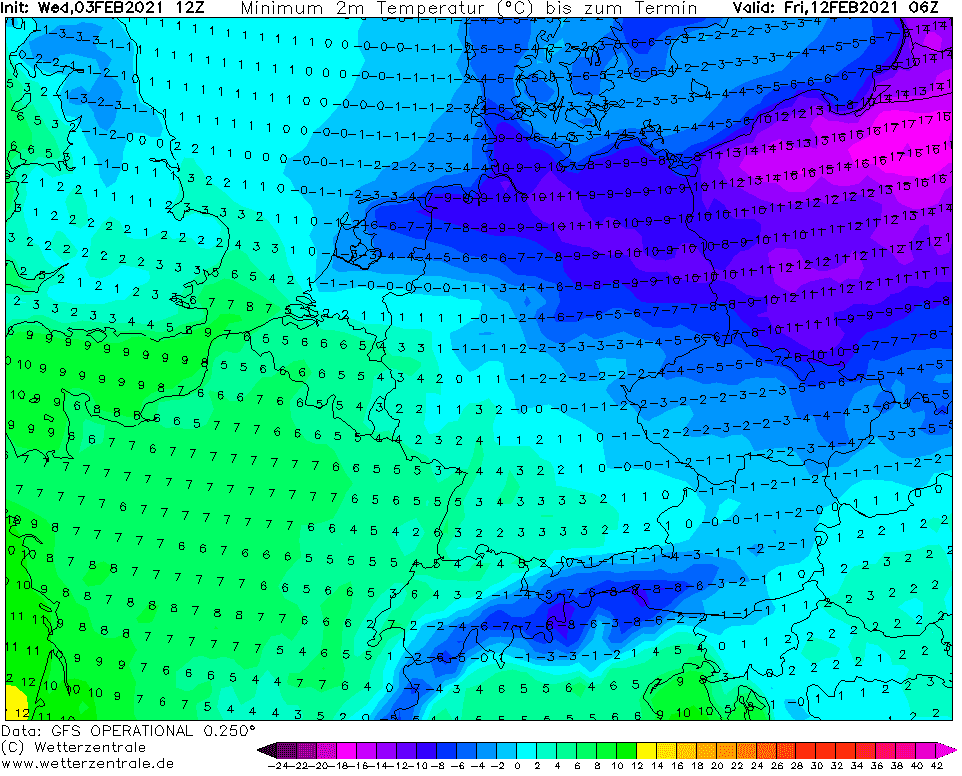
Siberian winter this time hit mainly Poland, Germany, Czechia and the Netehrlands, with shorter duration in Denmark, Austria, Belgium, England or Slovakia.
Absolute national top temperatures should be up to 10°C lower than in outputs (maps) below.
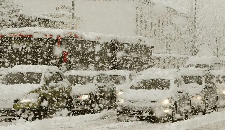
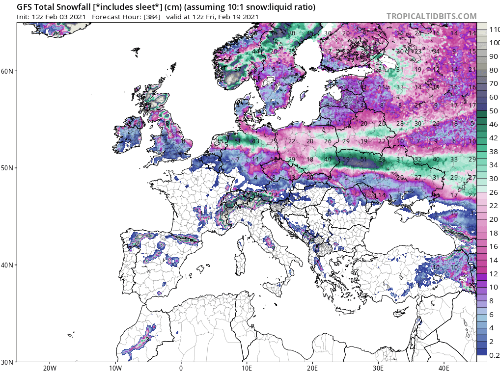
Parts of Poland, Germany, Czechia and the Netherlands (and too many parts of Eastern Europe, Scandinavia and Baltic states) should experience with snow calamity, with 20-50 cm snow already next week.
Coldwave is starting already on Friday, 5. February in Poland and gradually, extremely cold Siberian air will spread up to Benelux and England.
The Alps won´t be hit strongly and extreme frosts should appear only in northern parts of the Carpathians.
However, lowlands in northern Central Europe will experience with really hard winter conditions, with snow calamity and extreme frosts – even in Netherlands are possible frosts below -20°C rarely.
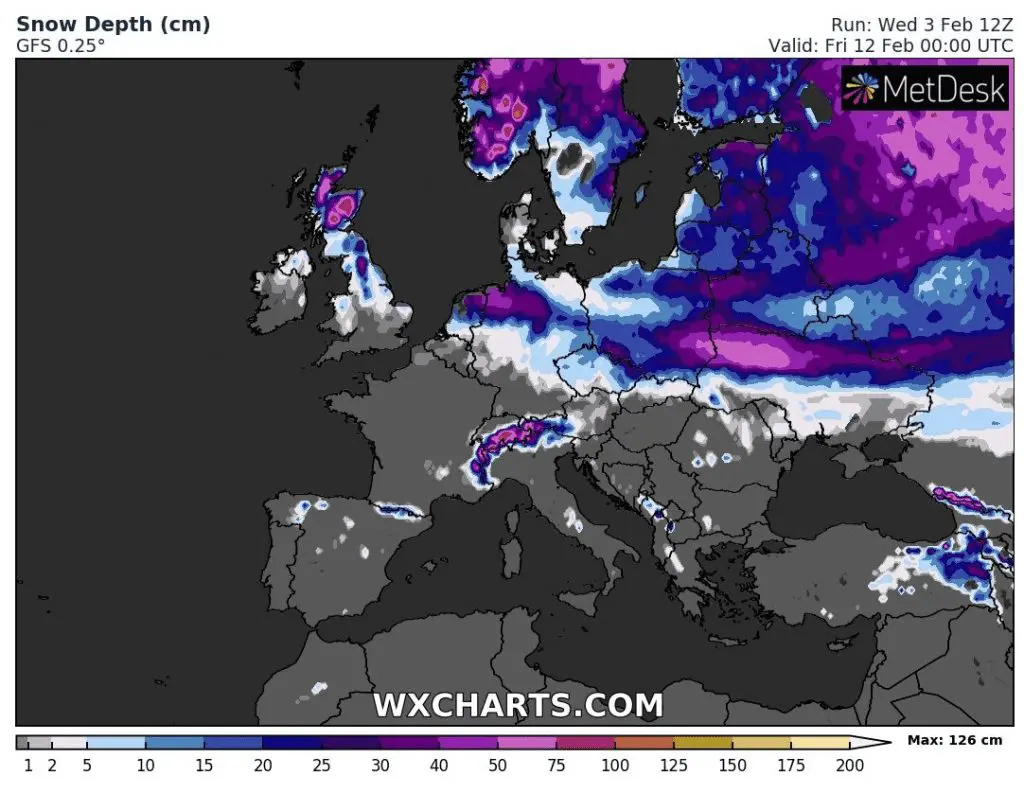
Big problems with snow should report Ukraine, Belarus, european Russia, Lithuania, Latvia, Estonia, Finland, Sweden, Norway and Scotland, e.g. in Lviv region, Ukraine, around 75 cm of snow is forecasted.
0,5 meters of snow should surprise Hamburg region, Germany and northeastern Netherlands.
Almost all Poland ends under the snow, too, 3/4 of territory of the coutnry should report 15 – 30, in eastern regions up to 50 cm of snow.