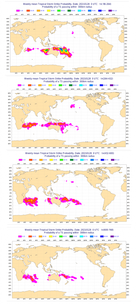
4 tropical systems as a potential threats for Australia, New Zealand and Oceania
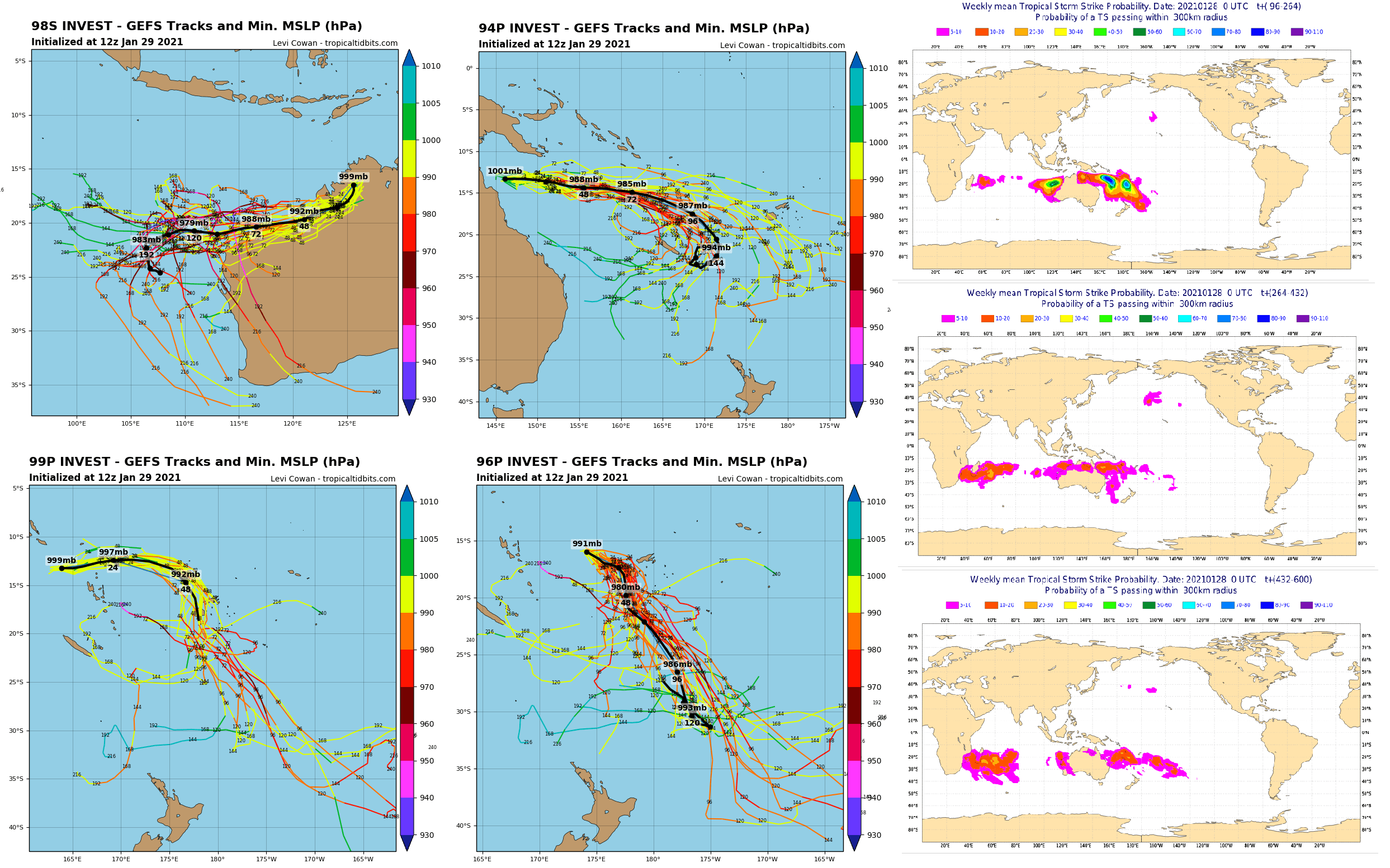
As was previously expected /https://mkweather.com/2021/01/24/tropical-activity-forecast-for-next-month-and-half-year-videos-ts-eloise-kimi-chalane-imogen-danilo//, Australian and Oceanian region hit increased tropical activity at the end of January and at the beginning of February 2021.
4 tropical systems have developed (and 1 additional system near SE Africa):
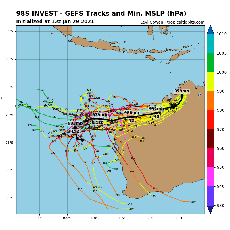
- 98S Invest, which hit northwestern Australia and should continue across western coast
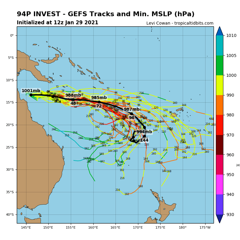
- 94P Invest, which is shifting from Queensland coast towards New Caledonia
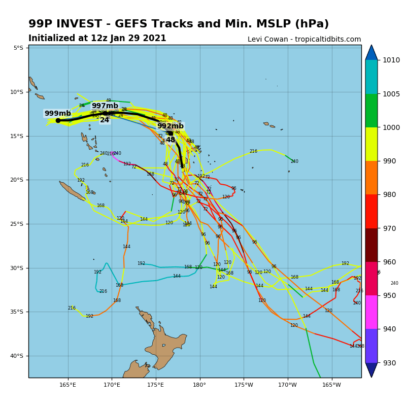
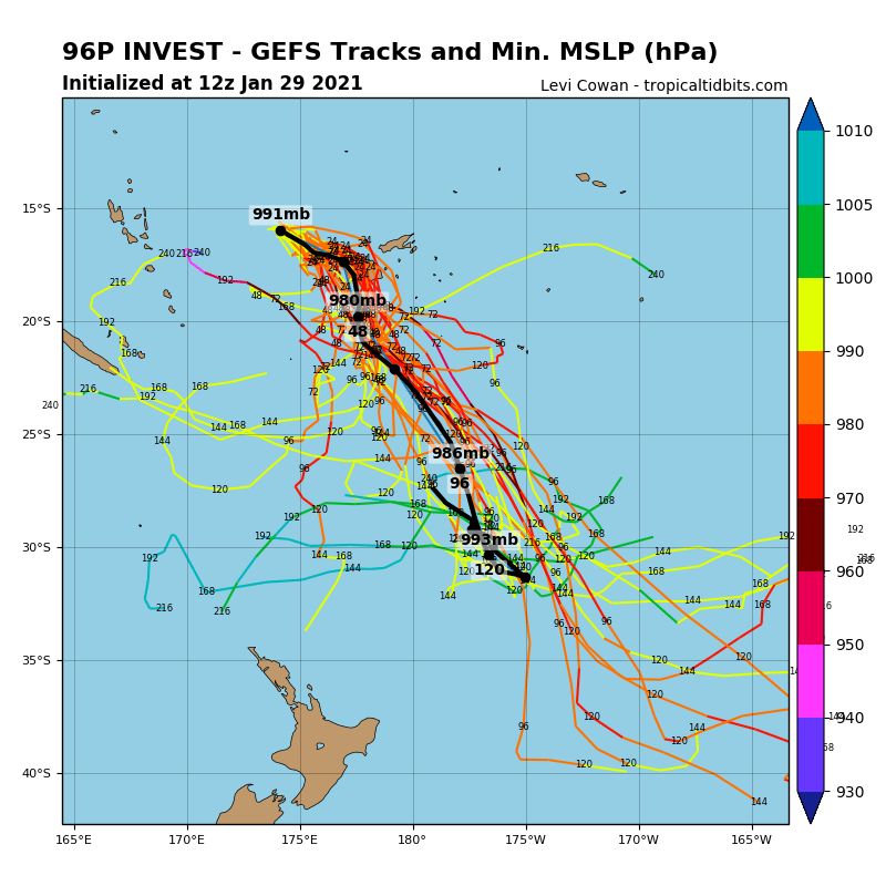
- 99P and 96P Invest, which are shifting from Fiji region very close to New Zealand
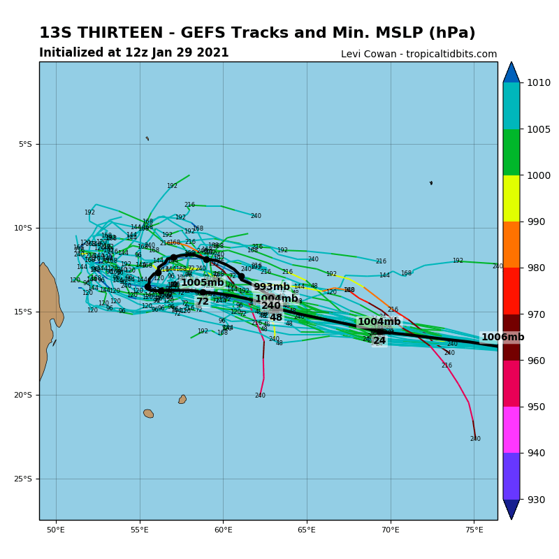
- Tropical storm Thirteen is shifting towards Madagascar, yet
During next month (February 2021), tropical activity in Australian and Oceanian sector will be weakening, while South-West Indian cyclones will be strengthening.
Systems should bring bad conditions above seas and local floods and winds above lands, although, extreme impacts are excluded (there are only tropical depressions, not tropical storms or cyclones).
After strong heatwave /https://mkweather.com/2021/01/25/australia-with-extreme-heatwave-and-wildfires-port-augusta-near-adelaide-453celsius//, heavy rains are reported from parts of Victoria and New South Wales, too.
Southern Hemisphere was in January 2021 very cold thanks to tropical cyclones and ongoing La-nina /https://mkweather.com/2021/01/24/antarctica-set-to-coldest-january-since-1978-southern-hemisphere-hasnt-been-so-cold-almost-10-years//, Antarctica maybe the coldest since satellite measurements (1978).
Infographics: tropicaltidbits.com, ECMWF