Vietnam hits next 3 tropical systems – tropical storm Linfa and depressions 93W and 94W, it makes significant landfall in Philippines, Laos, Cambodia, Thailand and Myanmar too
Already during last week we have informed about extreme circulation, which is expanding in Southeastern Asia and parts of India /VIETNAM 1500 MM; INDIA; SE AND S ASIA; PHILIPPINES/.
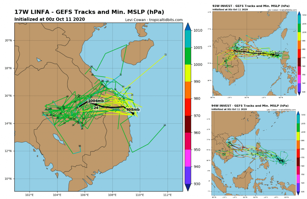
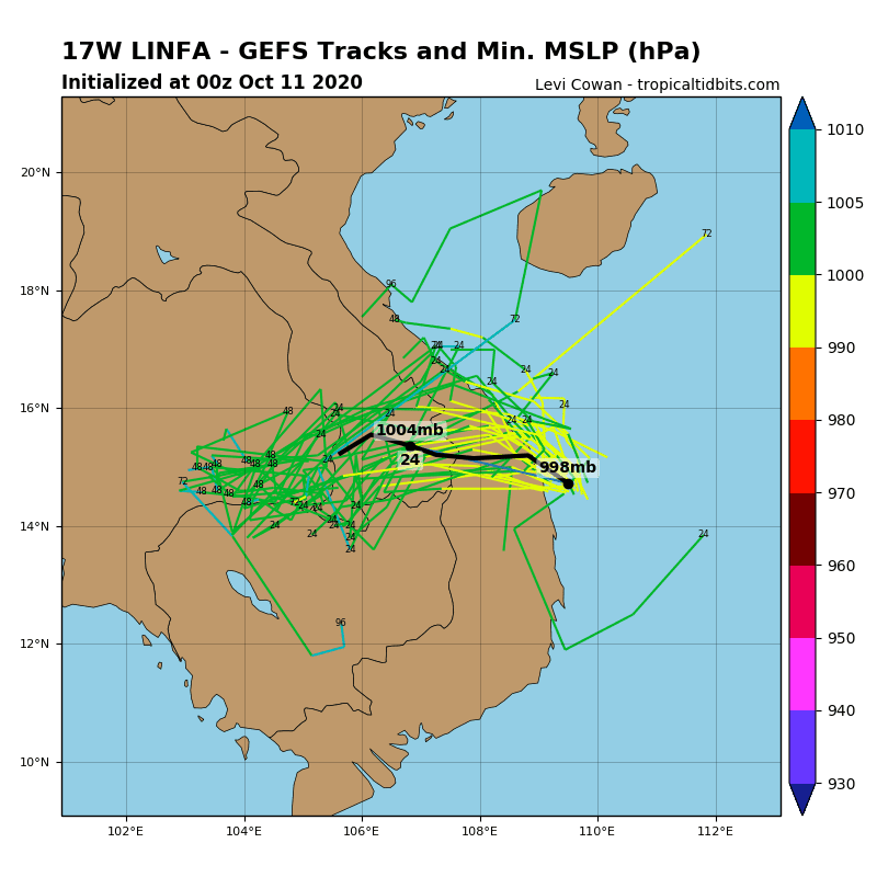
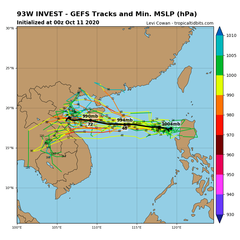
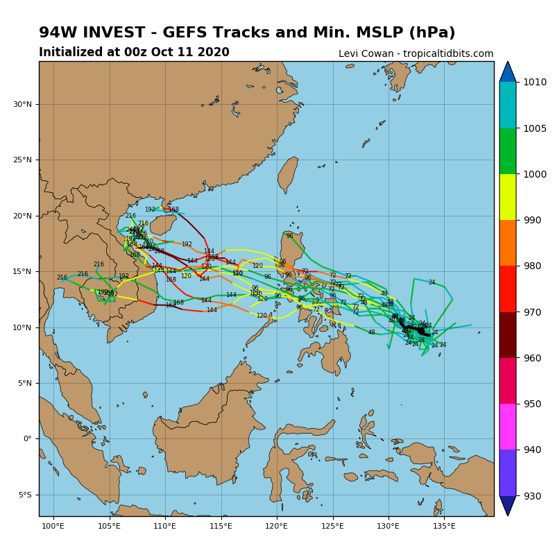
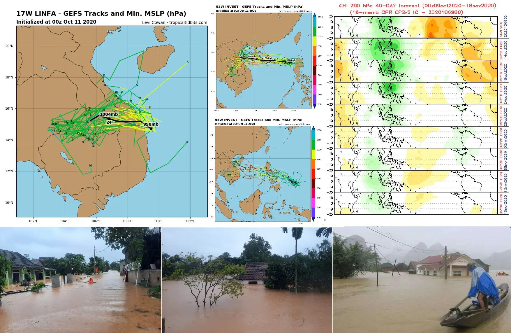
Meteorologists have a lot of work now with the monitoring of the situation in Southeastern Asia, because after tropical depression 91W Invest, a tropical storm Linfa and tropical depressions 93W Invest and 94W Invest immediately appear above the region.
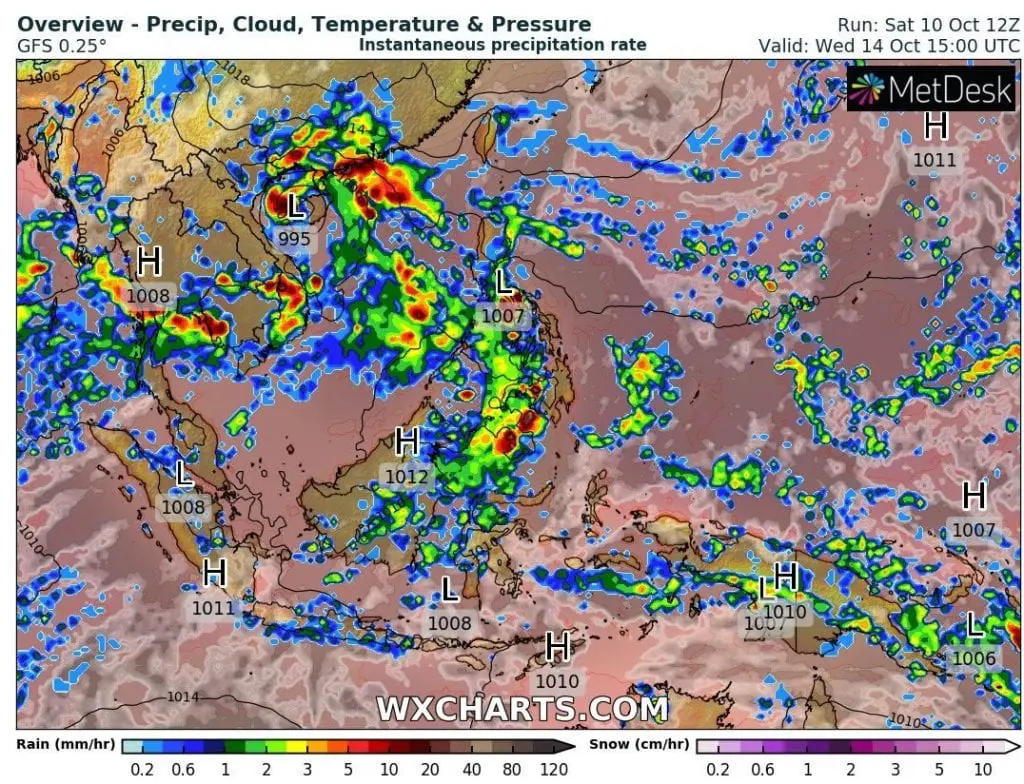
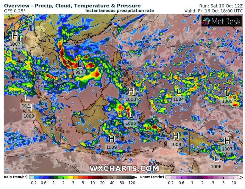
A tropical wave created from TS Linfa, 93W Invest and 94 W Invest hits Vientam during the next period and cause even worse floods than floods from last days (with 5 dead and 6 missing in Vietnam and 2 dead in Cambodia).
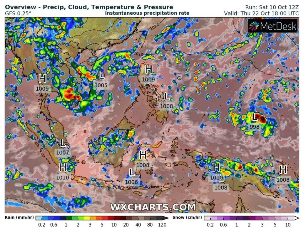
According to forecast models, the worst flooding days should arrive around Wednesday 14. October and Friday, 16. October to Vietnam, but whole next period will be critical, with next 1500 mm of rain possible until 27. October 2020, mainly in Central Vietnam, but with extreme rainfalls in Cambodia, southern Laos, southern Thailand and southern Myanmar (Laos and Cambodia over 500 mm, S Thailand and S Myanmar over 1000 mm).
It is possible, that tropical waves will regenerate above Bengal Bay and hits India very soon (after tropical depression 91B Invest, which has arised from flooding Vietnamese cyclone last days and hit India during next days).
Tropical storm Linfa hit Vientam already during next 48 hours on Sunday and Monday 11.-12. October 2020, 93 W Invest arrives on Wednesday and 94W Invest from Friday to Sunday 16.-18. October 2020.
It should be historic floods in Vietnam, with few meters of flooding water regionally and extreme life-threating potential, with next possible killed during next week, or rest of October, respectively.
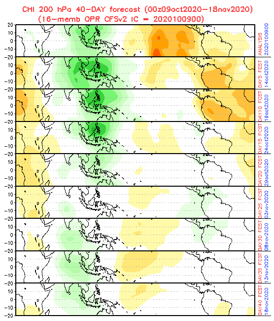
Extremely strong Asian monsoon is strengthened mainly thanks wet MJO phase, La-niňa and shift ITCZ to southern latitudes in October 2020.
End of extreme floods in region is forecasted around end of the October, when MJO wet phase will be weakening and during November 2020, and neutral or dry MJO arrives, respectively.
Mkweather will monitor the situation and will be bringing fresh news from the region during the rest of the October 2020.
Infographics: tropicaltidbits.com (stromtracks), NOAA (MJO 40-day forecast), wxcharts.com (weather maps):