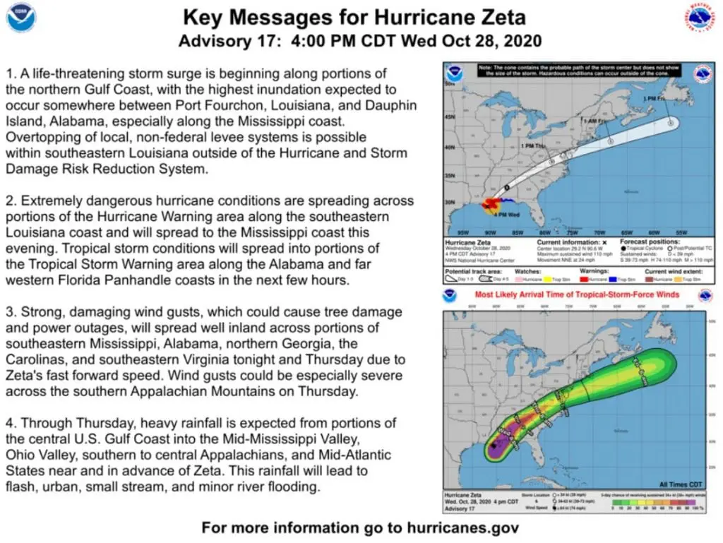
Hurricane Zeta hit Louisiana with winds 177 km/h (110 mph – Category 2), it aims to Europe!

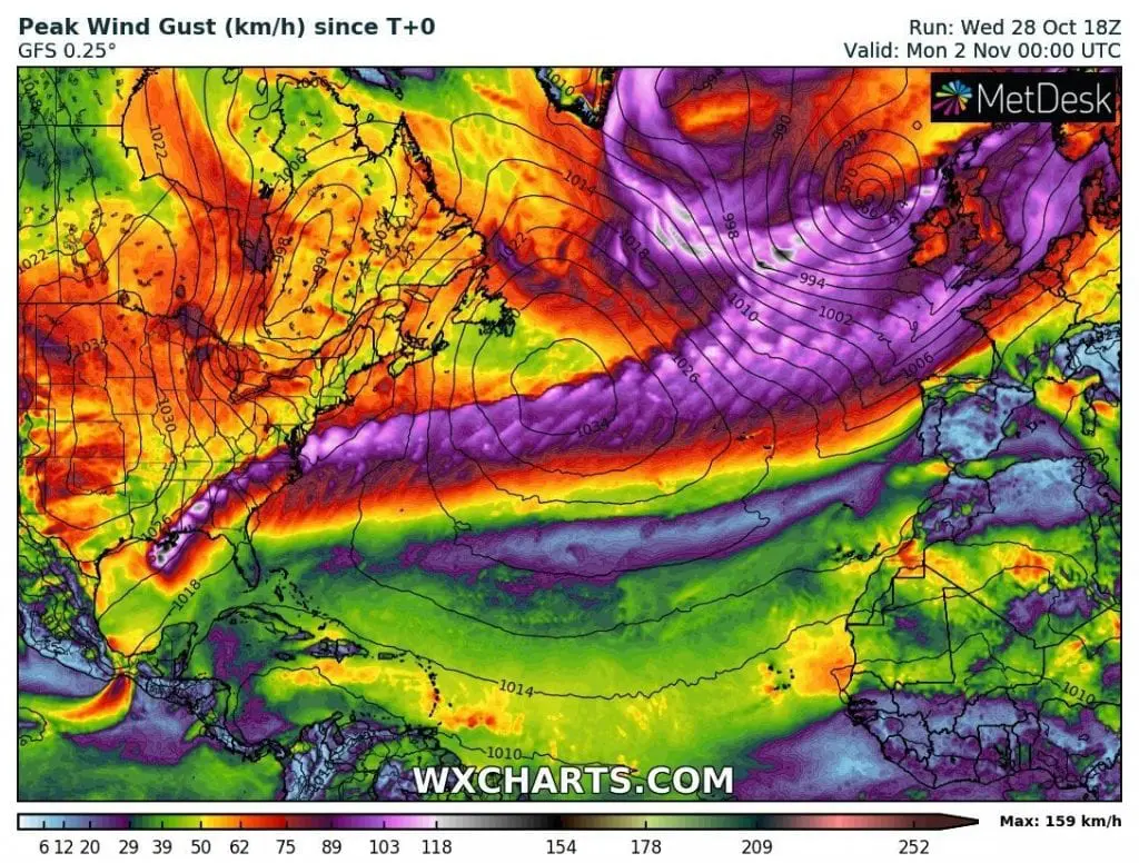
The second of mentioned windstorm in the last article, which hits Europe already on Sunday, 1. November 2020 /https://mkweather.com/2020/10/29/if-you-are-dissapointed-with-ex-hurricane-epsilon-2-windstorms-hit-british-isles-on-thursday-and-sunday// will be ex-hurricane Zeta, maybe still with power of tropical storm or tropical depression.
For now, 96 hours before arrival to Europe, forecasted track is so southward – towards France and England, but it should little change, yet.
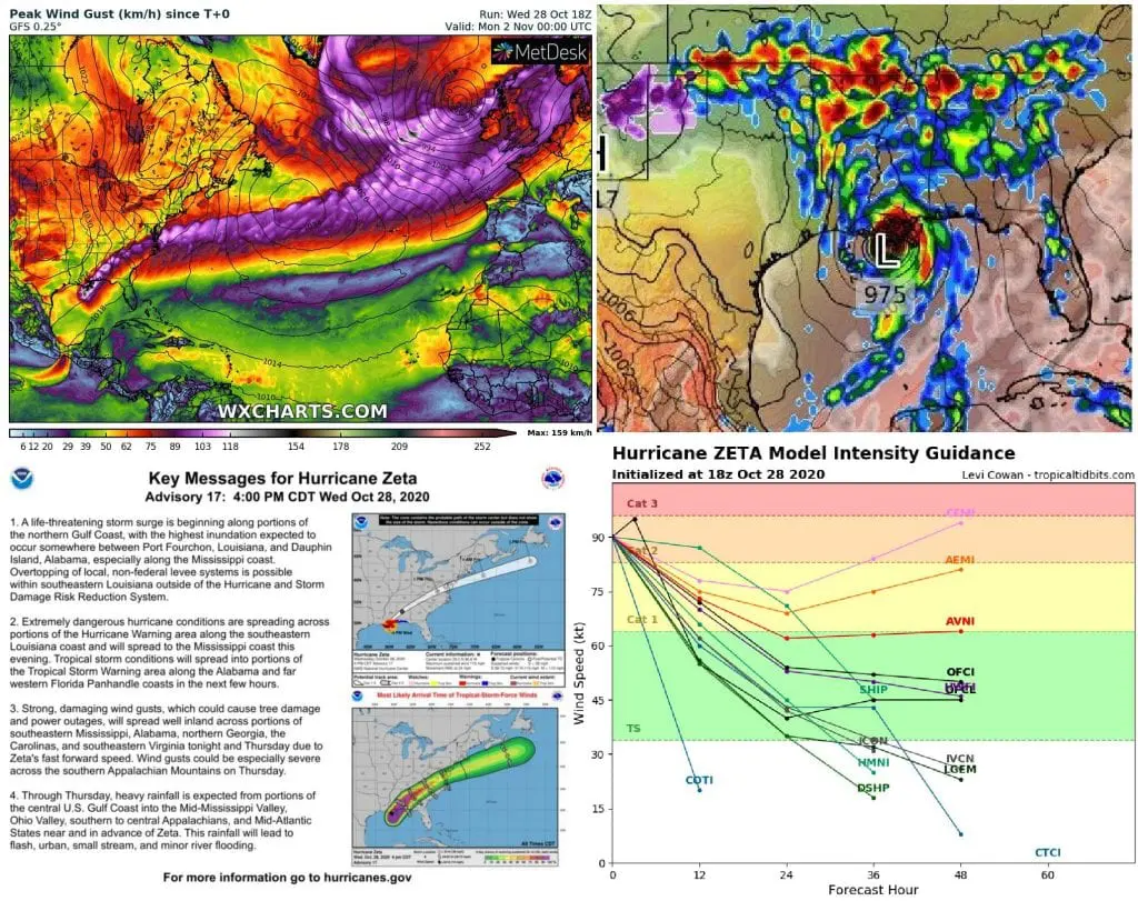
Now, Zeta such as hurricane Category 2 hit Louisiana, with wind gusts in Golden Meadow 110 mph / 177 km/h.
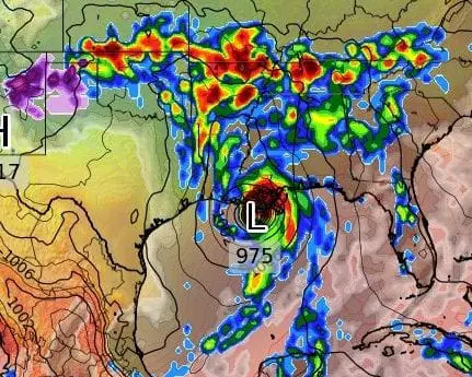
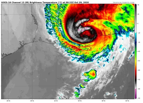
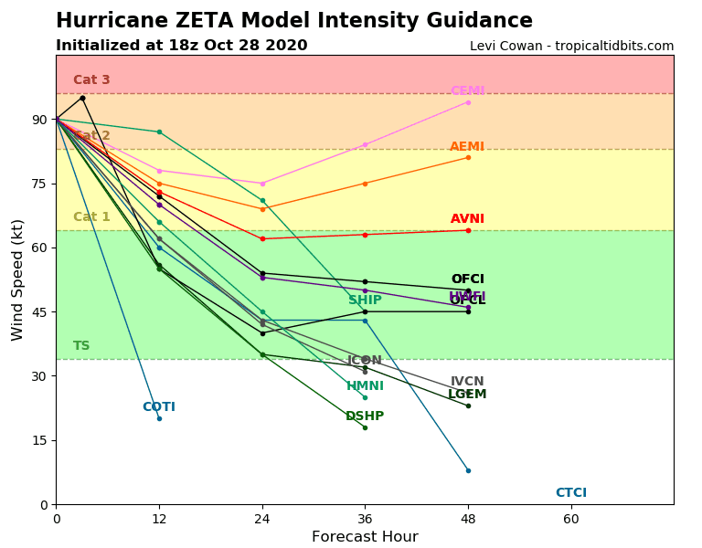
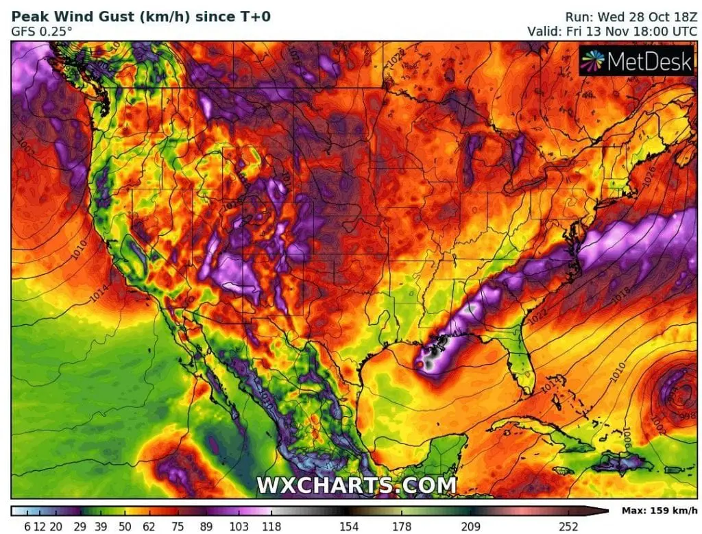
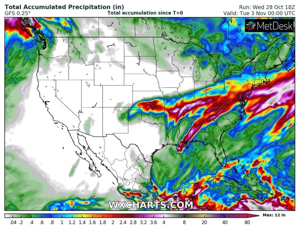
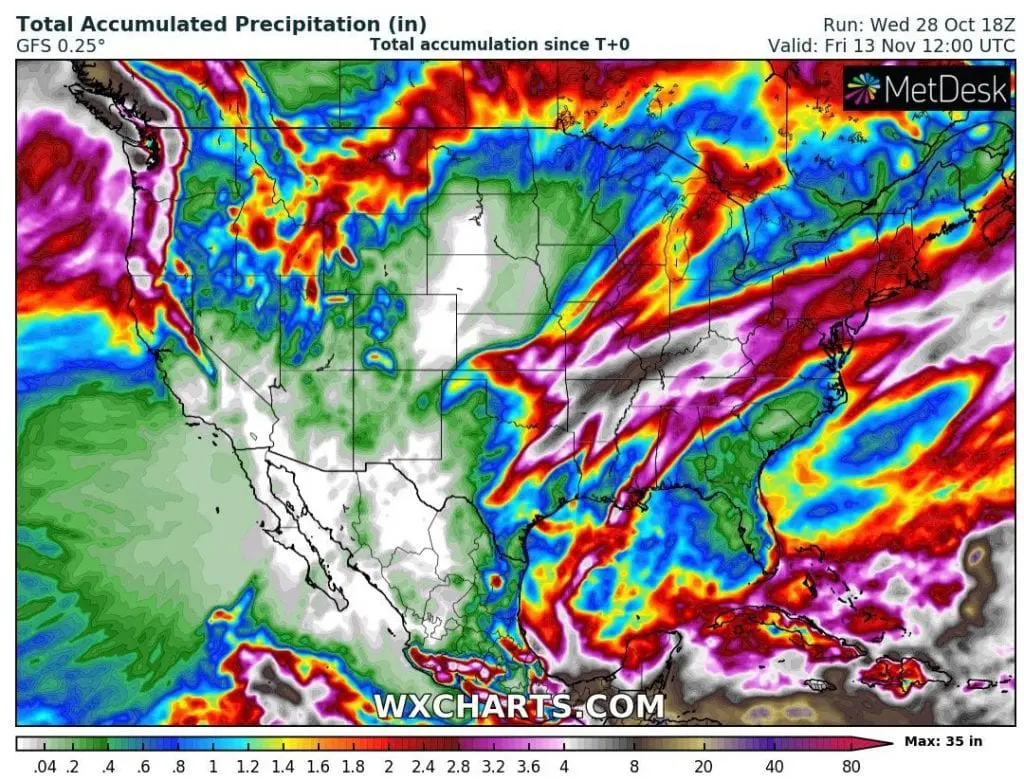
Zeta has reached almost strength of a hurricane Category 3 (major hurricane) on Wednesday, 28. October 2020, before its arrival above the land and system has been connected with extreme coldwave above Southern and Central USA /https://mkweather.com/2020/10/26/in-october-never-been-so-cold-in-the-usa-220-years-all-time-records-overcame-in-november-indian-summer-in-outlook/; https://mkweather.com/2020/10/23/arctic-days-will-come-in-october-usa-under-record-early-snowfall-with-200-year-october-frosts/; https://mkweather.com/2020/10/27/after-historic-october-coldwaves-long-period-of-indian-summer-in-northern-usa-and-southern-canada-between-2-10-november-temperatures-regionally-more-than-20c-above-long-term-averages// – both precipitation systems are now creating a big storm threat for Southeastern US, with possible flood risk during next days, mainly in areas on maps below, with the most inches of rain.
Zeta is already 5th hurricane which hit Louisiana in 2020 and it is bringing significant worsening weather to New Orleans region from Wednesday to Thursday, 28.-29. October 2020.
Its shift above Southeastern USA and Mid-Atlantic, however will be very quick and above Atlantic, system should stay relative powerful until its arrival to Europe.
Forecasts until 13. November are favorable, with any bigger hurricane threats in the USA and any bigger threats isn´t forecasted for Mexico or Caribbean for now. However, it should quickly change and some tropical depression, tropical storm, or even hurricane Category 1 or 2 should appear over the region until 20. November 2020, thanks to expected slightly wet phase of MJO (Madden Julian Oscillation) over the Atlantic.
Infographics: wxcharts.com, tropicaltidbits.com, NOAA: