Only at the weekend we have informed about first serious frosts in northern Greece /https://mkweather.com/2020/11/08/greece-already-with-serious-frosts-florina-35c-25-7f//. On Monday and Tuesday, 9.-10. November 2020, frosts in Florina, northern Greece were even more stronger – it was measured -4,4°C on Monday and -4,1°C on Tuesday.
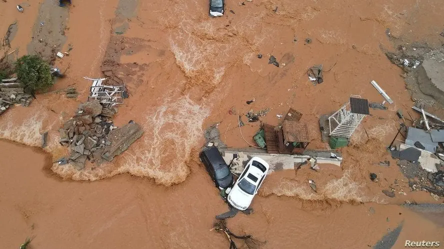
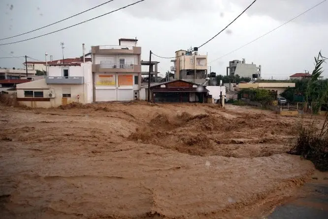
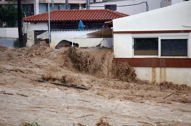
Exactly these air masses have shifted southward, over Greek islands in Mediterranean, where they met with warm tropical air masses, with result of severe floods in Crete.
Kastelorizo, one of Greek islands near Turkey on Tuesday still has reported summer day (+25,0°C), but e.g. in Larissa, maximum temperature has reached only to +15,6°C.
Weather data from Heraklion are not after flooding Tuesday available, however, we should see lot of video and photo-materials from next disastrous flooding in Greece.
Last time, extreme floods hit Greece in September 2020, when country hit Medicane Lanos /https://mkweather.com/2020/09/20/medicane-lanos-with-strength-of-cat-1-hurricane-hit-greece-500-mm-rain-20-inches-326-km-h-estimated-winds-2-dead//.
These materials document, that flash floods water took everything what stayed in its way, it shifted cars, flooded houses and streets and made panic.
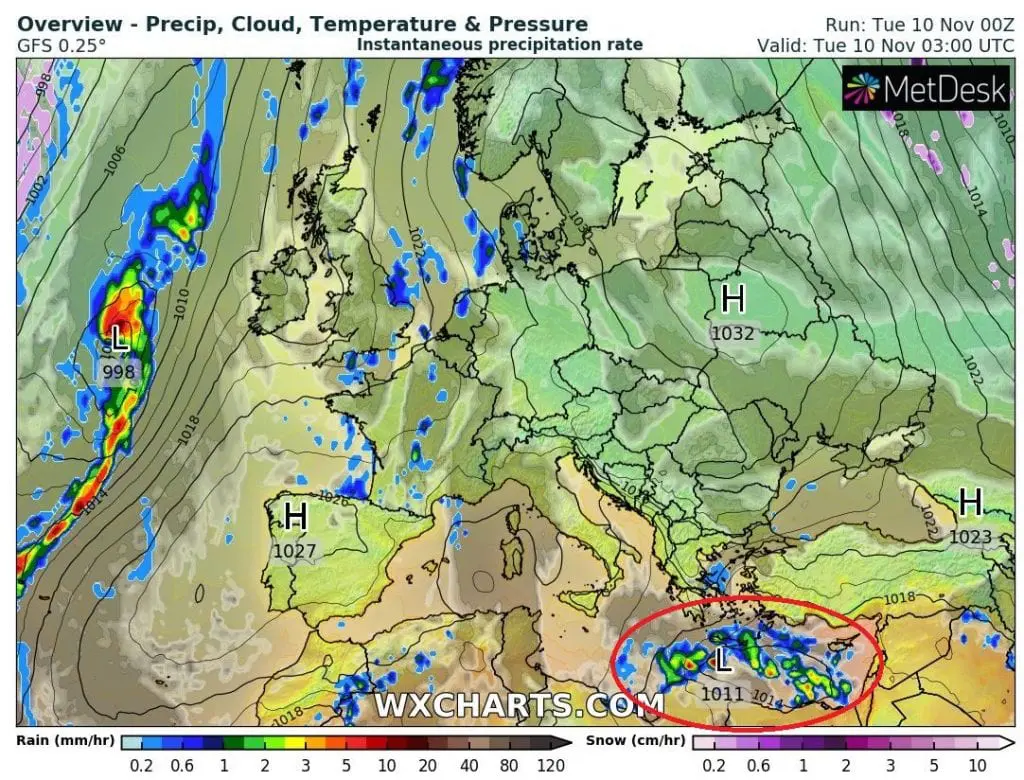
Storm system, which hit Greece and southwestern Turkey from Monday to Tuesday, 9.-10. November 2020 is shifting to Libya and Egypt where it should cause problems during Wednesday and Thursday, 11.-12. November 2020. From eastern Libya, floods has been reported already, what will be topic of one of next articles.