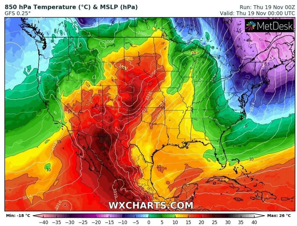
Early this week Mkweather has informed about severe winds, which hit Northeast, Great Lake region and partly Midwest and Mid-Atlantic in the USA /https://mkweather.com/2020/11/15/northeast-with-120-km-h-winds-next-24-hours/; https://mkweather.com/2020/11/17/windstorm-in-northeast-cleveland-115-km-h-detroit-98-km-h-buffalo-94-km-h-big-problems-in-new-york-and-toronto//.
After powerful cold front, which brought these winds, anomalously cold air has shifted above Northeast and Mid-Atlantic last 48 hours, with temperature anomalies below -12°C /-21°F from long-term average.
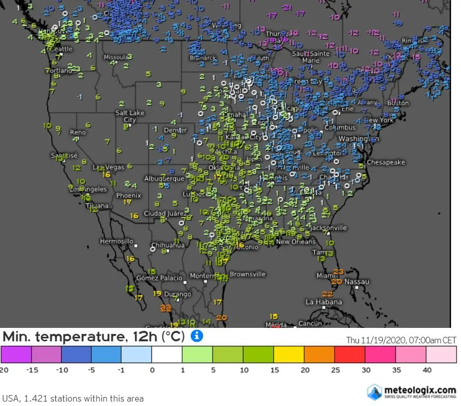
From bigger cities, the most interesting were minimum temperatures from Boston (-5,6°C / 21.9°F) and New York (-3,3°C / 26.1°F) on Thursday, 19. November 2020.
Measured temperatures in chosen cities on Wednesday were: Duluth, -11,7°C, International Falls, -10,6°C, Minneapolis, -6,7°C, Sioux Falls, -6,6°C, North Platte, -6,1°C, Syracuse, -5,6°C, Detroit, -4,4°C, Buffalo, -2,8°C, Providence, -2,2°C, Atlantic City, -1,7°C, Indianapolis, -1,1°C, Erie, -0,6°C, Pittsburgh, -0,6°C and New York, 0,0°C.
On Thursday we chose cities: International Falls, -8,2°C, Atlantic City, -6,7°C, Providence, -6,7°C, BOSTON, Duluth, -4,9°C, North Platte, -4,9°C, Baltimore, -3,9°C, Detroit, -3,8°C, NEW YORK, Buffalo, -2,7°C, Cleveland, -2,1°C, Philadelphia, -1,1°C, Pittsburgh, -1,1°C, Rapid City, -1,1°C, Indianapolis, -1,0°C, Minneapolis, -1,0°C, Erie, -0,5°C and Washington D.C. 0,0°C.
In Midwest, despite of strong morning frosts, days were in very dry air very sunny, with maximum temperatures above +20°C / 68°F.
Last higher temperatures in 2020 in Midwest will be topic of the next article.

Infographics: meteologix.com, coolwx.com, wxcharts.com: