Europe: The strongest heatwaves of summer 2020: England with +35°C (95°F) on Friday, Spain exceeds +45°C (113°F)…Tuesday in Austria +38°C/100°F, Slovakia, Czechia, Hungary and Bavaria +36°C/97°F, between heatwaves powerful cold fronts with severe storms, wind and cooling effect

Next two weeks in Europe will have similar circulation scheme – heatwaves in southern, central and eastern parts, cold fronts in west, northwest and north and their disintegrating above hot continent, with T-storms, which will damp high temperatures over Europe between the individual peaks of heatwaves.
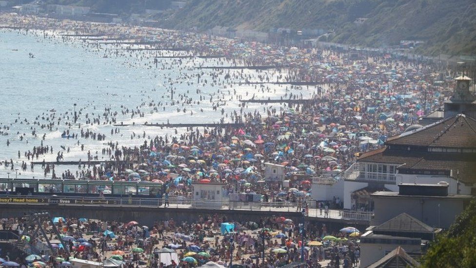
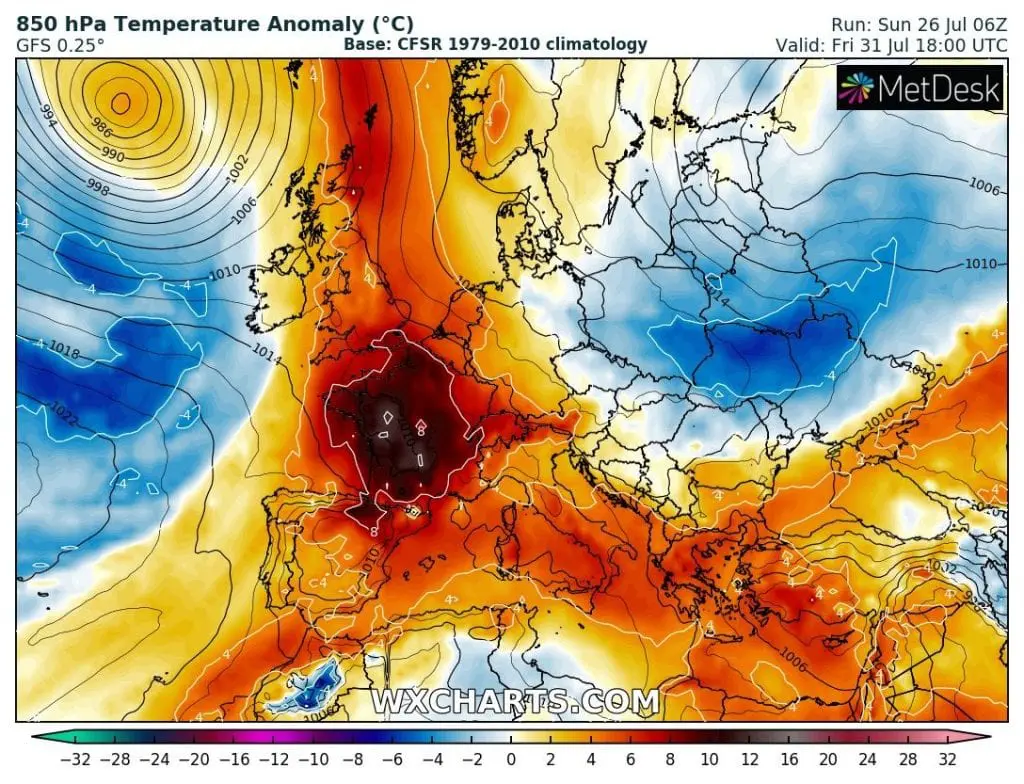
Altough British Isles will stay most of the time in cold sector, with severe T-storms, wind and coldwaves, nevertheless hot air gets here for a while – mainly around Friday, 31. July, when forecast models are expecting in southern England air with temperature up to +18/+19°C in 850 hPa and rarely maximum temperatures up to +35°C in southeastern England! Lastly, when tropical air hit the UK, people despite the limitations around COVID-19 /https://www.bbc.com/news/uk-53165918/ filled the beaches in the southern England near temperatures up to +32,6°C.
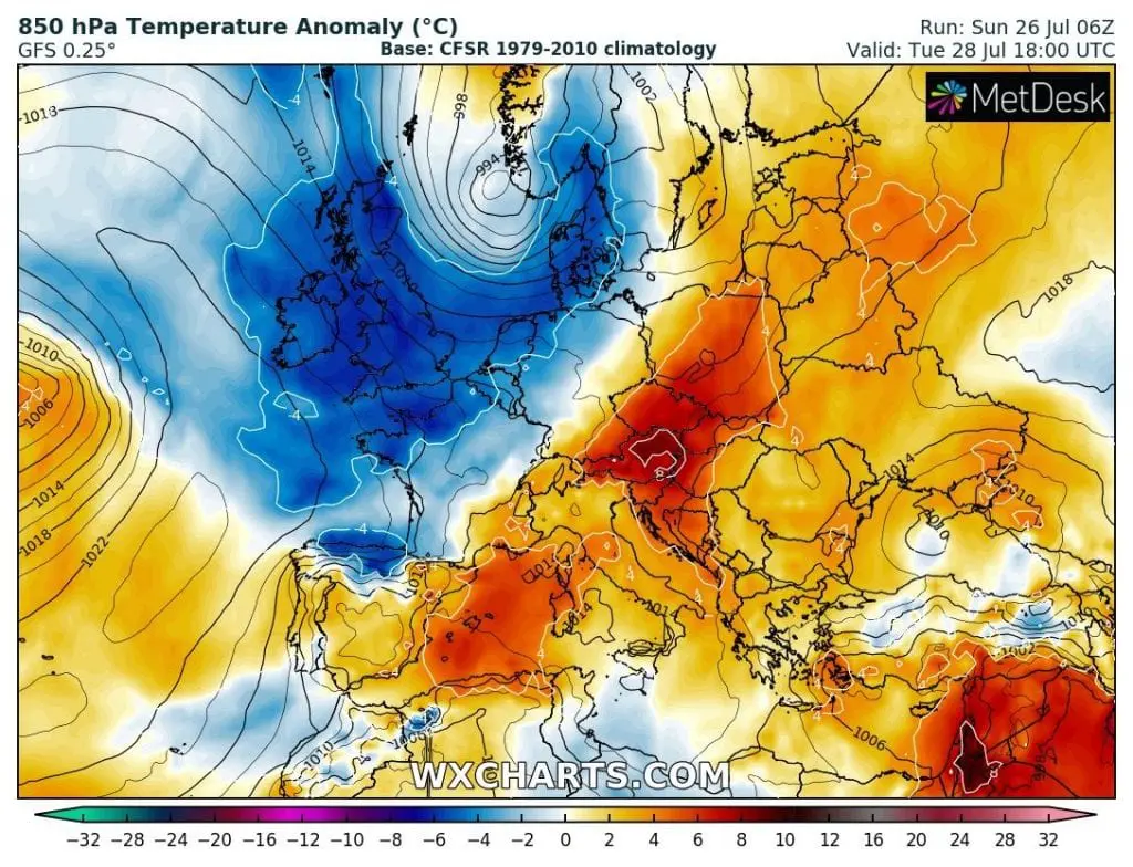
Before this, second, heatwave, arrive another one yet, already during the next 48 hours, but with the most extremely anomalies above Central Europe. In Tuesday, Austria will be flooded by temperatures up to +26°C in 850 hPa (thanks to föhn winds) and maximum temperatures in the lowlands of country will reach scorching +38°C (100°F). Very hot will be in Czechia, Slovakia, Hungary and Bavaria too, up to +36°C (97°F). In lowlands will appear tropical nights with minimum temperatures more than +20°C (68°F).
Between hot spells, powerful cold front events, in W, NW, N Europe with severe storms, wind and coldwaves
As you can see in the 16-day animations below, powerful cold fronts will hit during the next period mainly W, NW and N Europe with regional flash-flooding, gusty or damaging T-storms. How you can see on our warning maps for Europe for SUN-MON-TUE 26.-28. July 2020, the worst situation during next 72 hours in UK, Norway, Denmark, Sweden, Netherlands, Germany and Ireland is expected. On the maps it´s possible to see the shifting of first heatwave above Europe during next hours from southwest to the central parts.
Cold front will decline temperatures in Central Europe from Wednesday, but in Thursday-Friday, in SW/W Europe will start next, the second heatwave. Temperatures won´t be anomalous only in England (according to GFS), but too in France (locally 12°C temperature anomaly from long-term average!) and Spain. In Spain, breaking the 45°C threeshold is possible during this wave, therefore, it´s possible, that it will be the strongest heatwave in Europe in summer 2020.
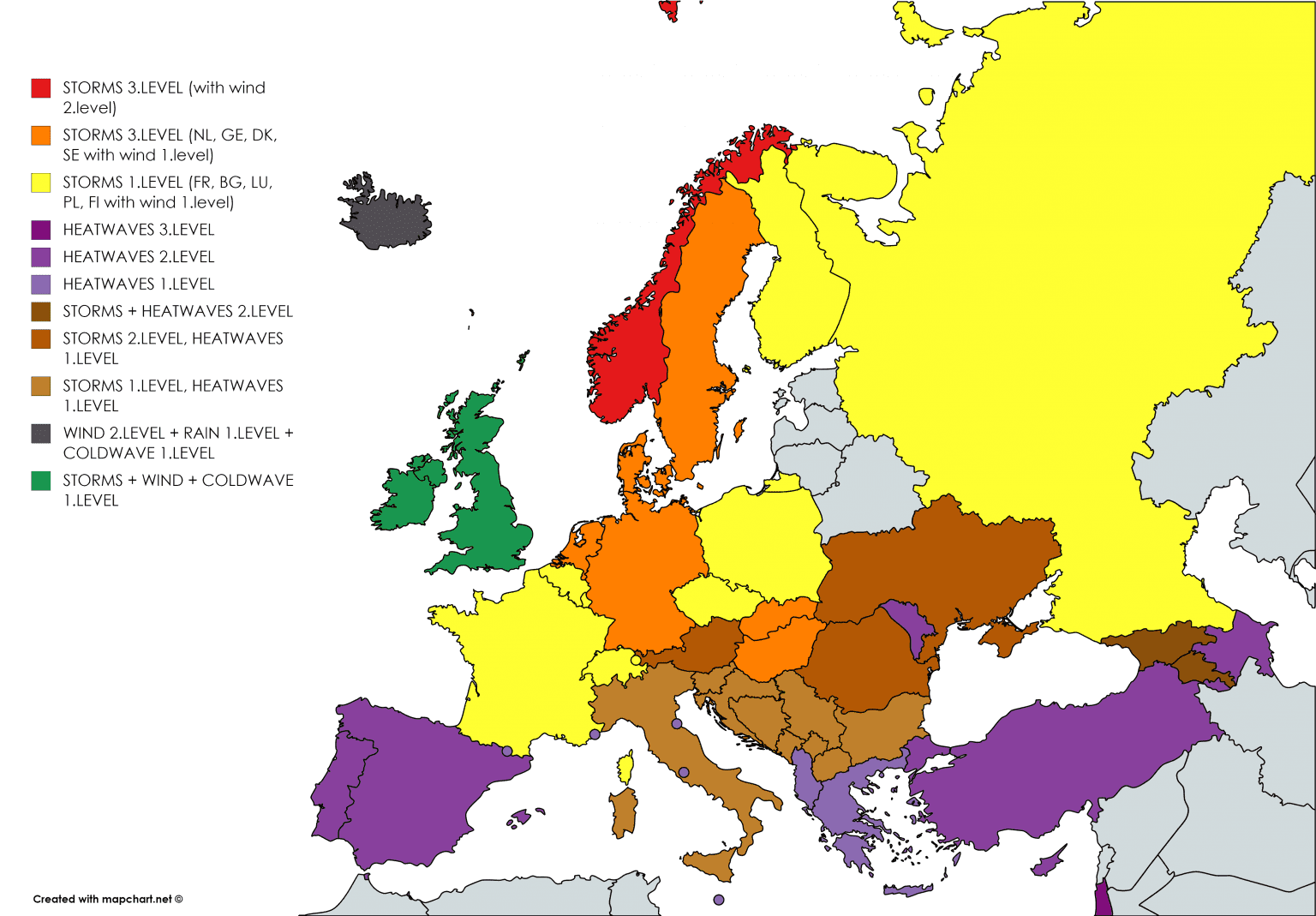
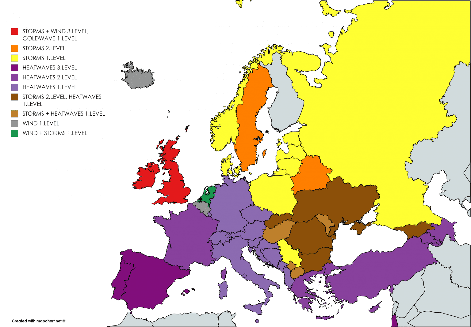
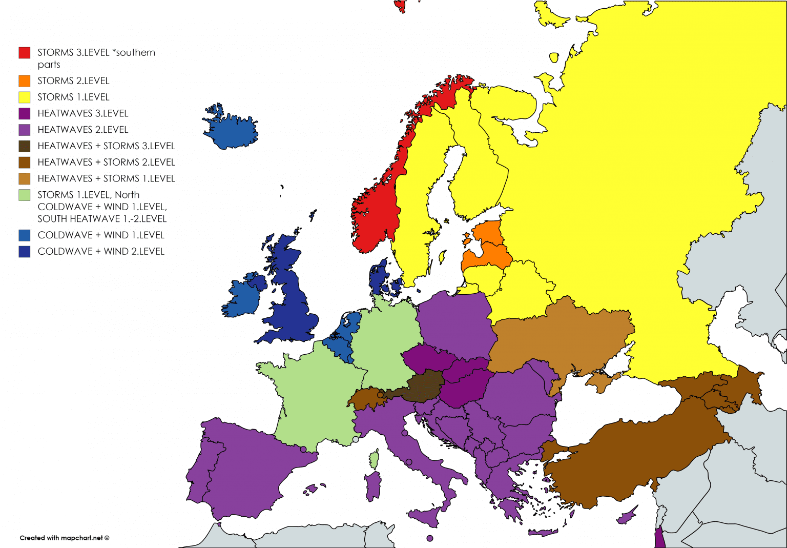
Our warnings for SUN-MON-TUE, 26., 27. and 28. July 2020 /https://mkweather.com/warnings/https://mkweather.com/warnings/
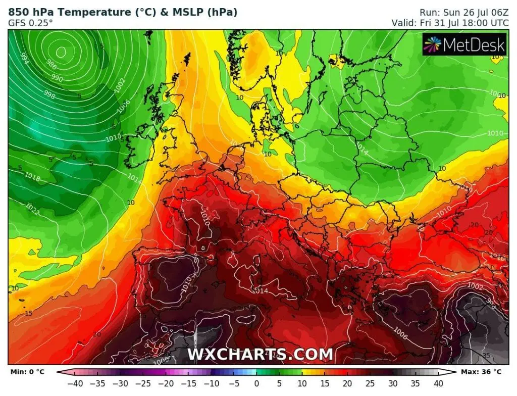
Expected peak of heatwave in UK on Friday 31. July 2020 /wxcharts.com/ and illustration from Brighton beach from June 2020 /
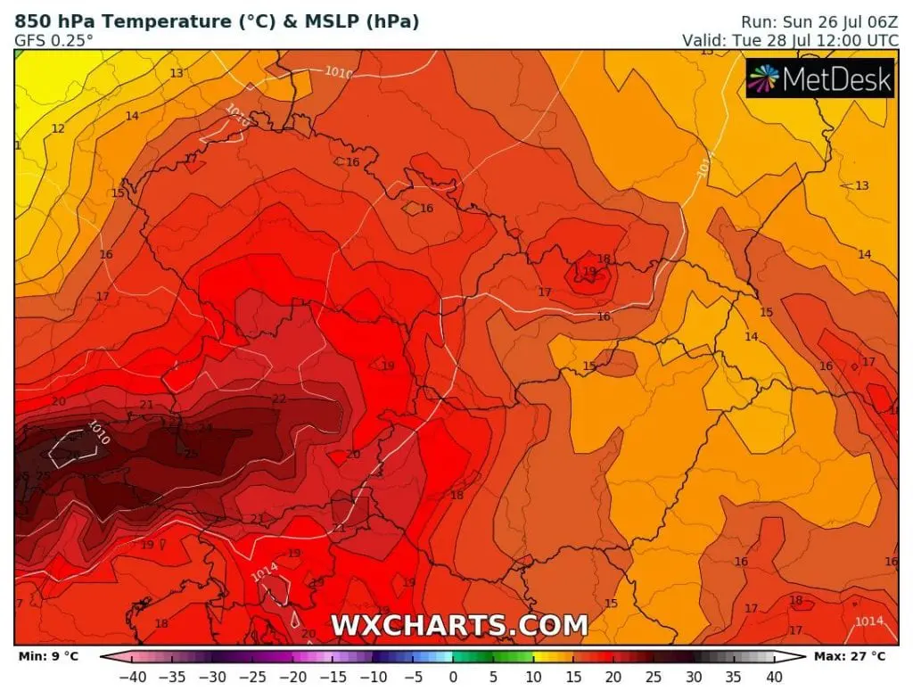
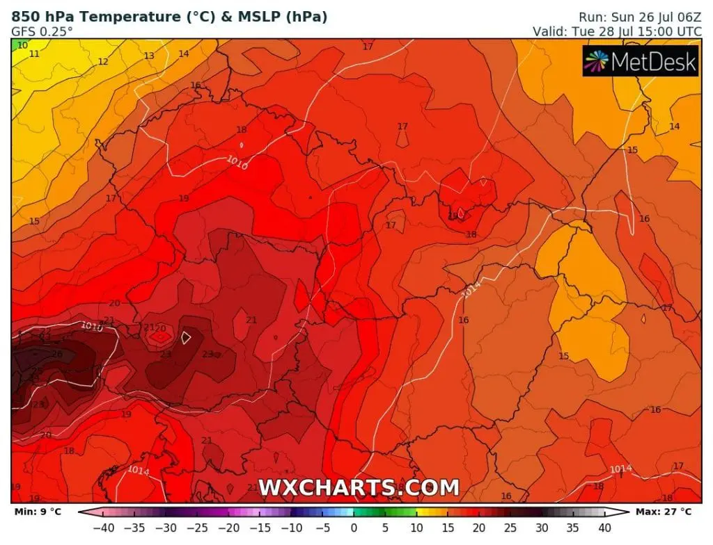
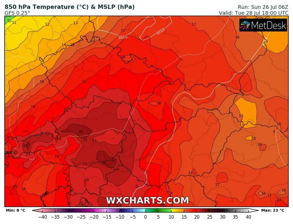
Expected T850 hPa over Central Europe in Tuesday 28. July 2020 /wxcharts.com/


Illustrate photos: https://www.kidsnews.com.au; https://unsplash.com; https://www.pikist.com


