Northwest and Minneapolis region with widespread snow cover 7 days before Christmas

At the weekend, 12.-13. December 2020, some snowfall is expected in Upper Midwest, but it probably won´t create more than 1-3 inches of snow cover (up to 2 – 8 cm), therefore it won´t be any big blizzard, although, travelling of outdoor activities should be affected.
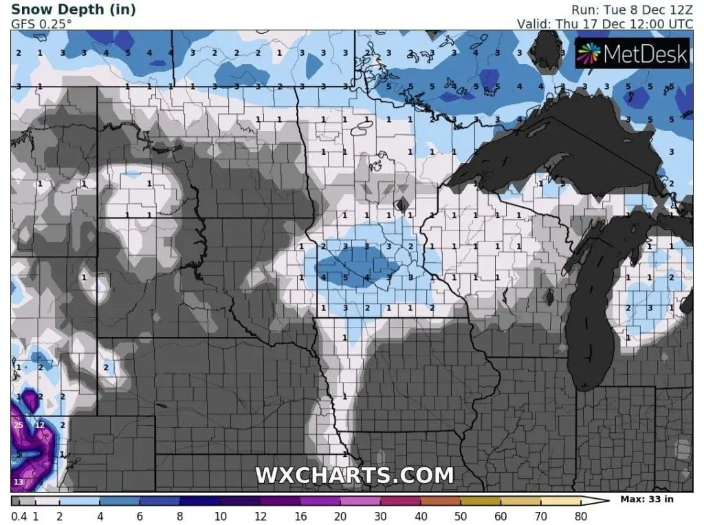
Little more interesting situation is possible from Monday to Friday, 14.-18. December 2020, when relative heavy snowfall hit Minneapolis and region westward from Minneapolis, with possible 5 – 6 inches (up to 20 cm) of snow cover around Thursday – Friday, 17.-18. December, only a week before a Christmas Day.
Probability of a White Christmas is in this region very high /https://mkweather.com/2020/12/08/chances-of-a-white-christmas-from-noaa//, but still isn´t known, if snow cover will stay in the region until 24. December, because since next weekend should be warming up across large parts of the USA.
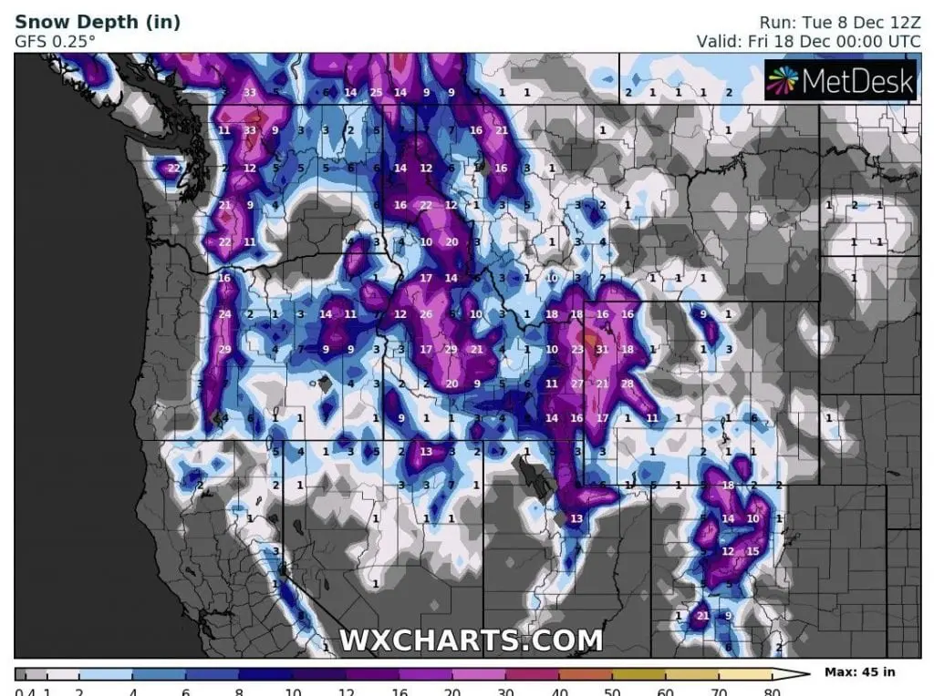
Around the same dates, snow cover should reach maximum across Northwest and Rocky Mountains and until Christmas, snow will slowly melting.
Between 20.-24. December hit USA and southern Canada powerful warm spell according to GFS, but since 25.-26. December, next coldwave least in Northwest and after Christmas in other parts of the USA is possible.
Christmas 2020 and New Year 2021 forecast for the USA, Canada and Europe is on Mkweather updated every Friday / Saturday.
Infographics: wxcharts.com