After latest Christmas 2020 and New Year 2021 Mkweather forecast for the USA and Canada /https://mkweather.com/2020/12/11/first-gfs-christmas-2020-forecast-and-ecmwf-new-year-2021-outlook-for-the-usa-and-canada// we should look into, already 4th Christmas 2020 and 1st New Year 2021 forecast for Europe.
After development of weather in Europe before Christmas /https://mkweather.com/2020/12/11/heavy-rains-storms-floods-and-snowfall-in-mediterranean-and-then-western-europe-central-europe-dry-until-the-christmas-2020/; https://mkweather.com/2020/12/08/historic-snowfall-in-alps-a-big-photogallery//, with next 4 Mediterranean lows, exactly around a Christmas Day, we will transit from negative to positive NAO phase, with shift of stormtracks from Mediterranean above Western Europe.
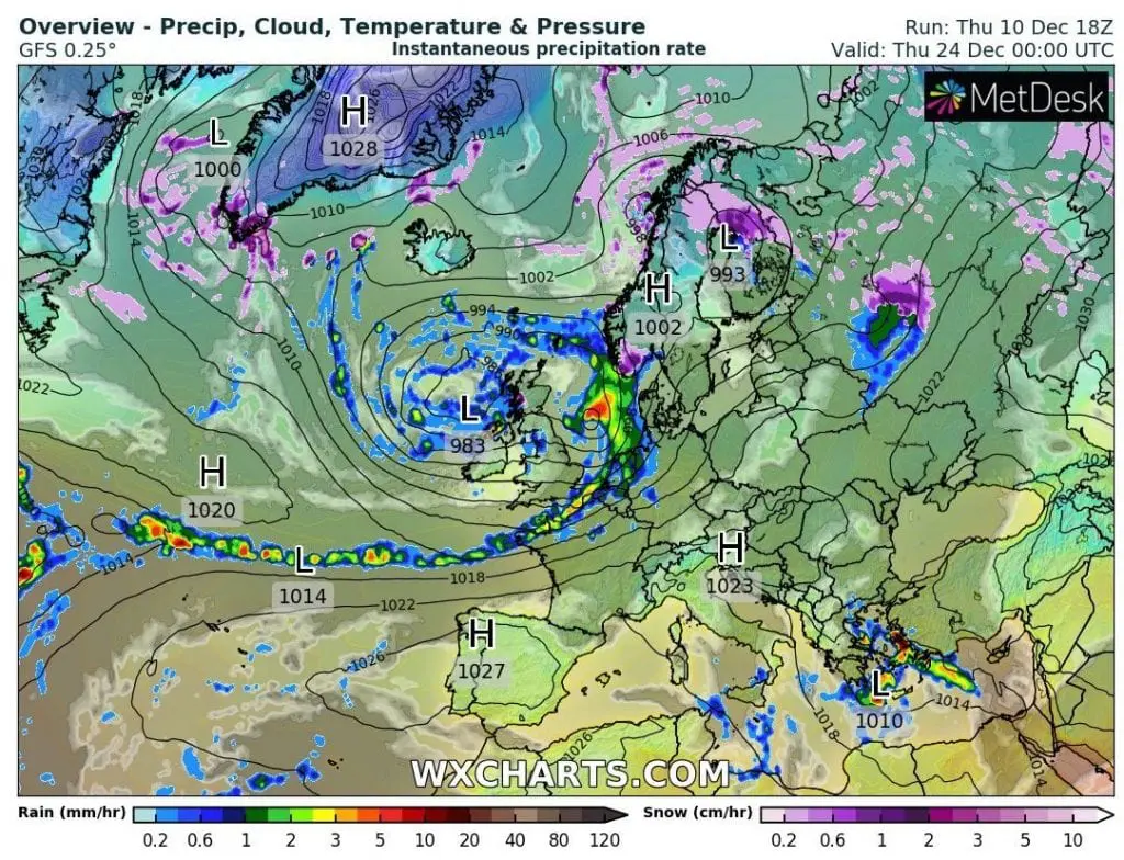
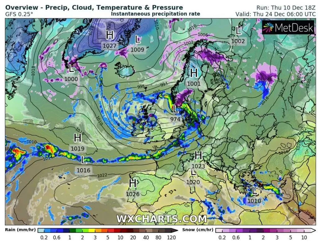
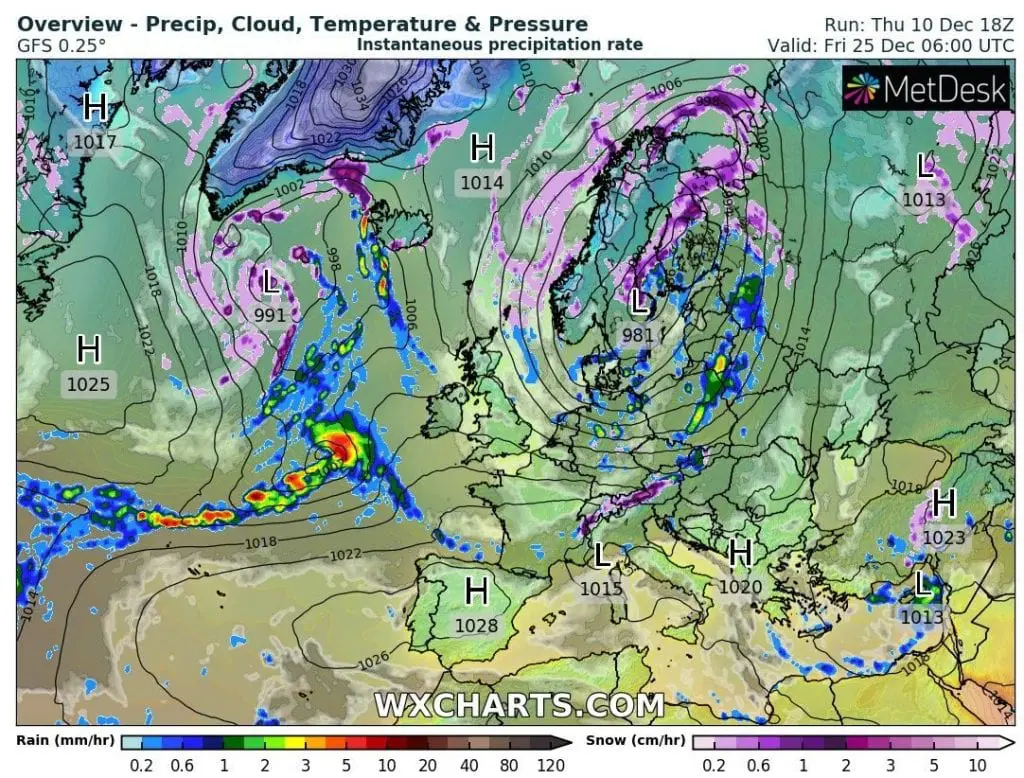
On 24. December, many Europeans will wake up into sunny or foggy anticyclonic day – only in British Islands, and southern Balkan and Greece are forecasted rains or storms and in Scandinavia snowing.
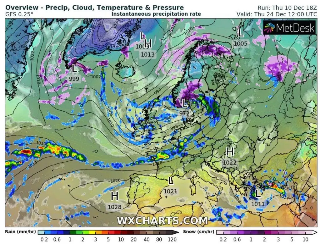
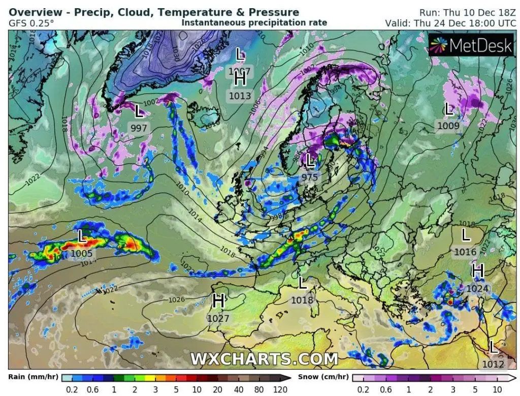
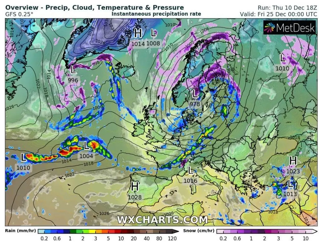
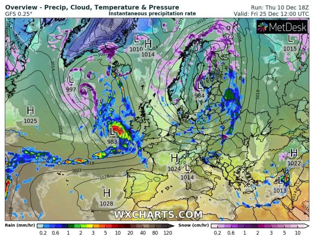
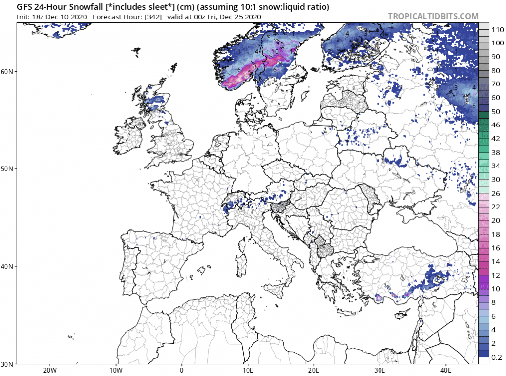
During 24.-25. December, cyclonic system with powerful cold front is forecasted above western and northern half of Europe, with gradual rain in western Europe, snowing in Scandinavia, and later too in Alps and Carpathians.
In other regions western and central Europe, such as Ireland, the UK, France, Benelux, Germany, Czechia or Poland, cold front should be accompanied with rain, level of snow should moving between 300 (East-Central) and 800 (Western Europe) meters.
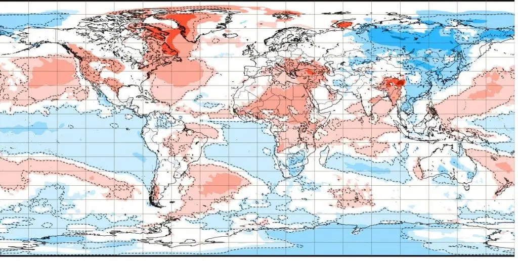
A New Year according to ECMWF weekly forecast for a week 29. December – 4. January 2020 should be warmer in southern and eastern Europe, mainly Italy, Balkan and Ukraine, and colder in western and northern Europe, mainly British Islands, France, Benelux, Iberia and Scandinavia.
It is possible, that approximately in Iberian region should be around 1. January 2021 situated deep pressure system with heavy rain and snowfall in the mountains, and northward from this system, above Iceland, Scotland or Norway should very quickly appear cold and dry Arctic air, with severe frosts.
On the other hand, warmer southern and eastern parts of Europe around 1. January 2020 should mean weaker frosts and more sunny and foggy weather on the back side of anticyclone.
Between 24.12. 2020 and 1.1.2021 should appear snowing near moving of cold fronts and cyclones eastward across Europe, but Mediterranean lows aren´t expected (besides Eastern Mediterranean around 24.-26. December).
Forecasts of GFS to 24.-25. December 2020 /wxhcarts.com, tropicaltidbits.com:
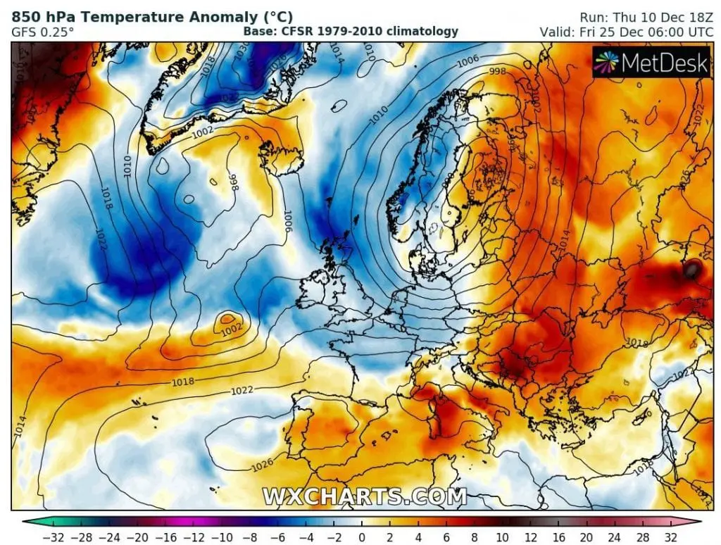
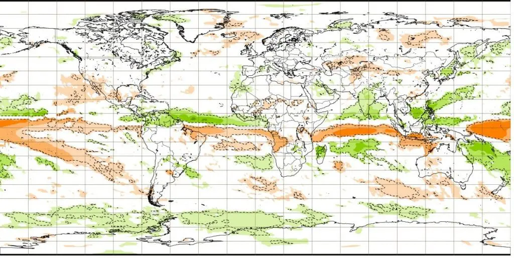
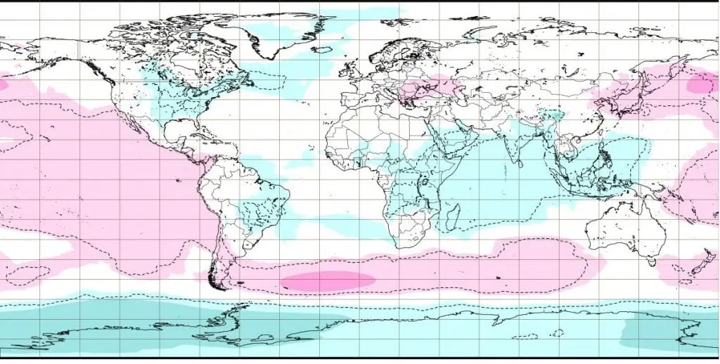
Week 29. December – 4. January 2020 – temperature, precipitation and air pressure anomalies /ECMWF: