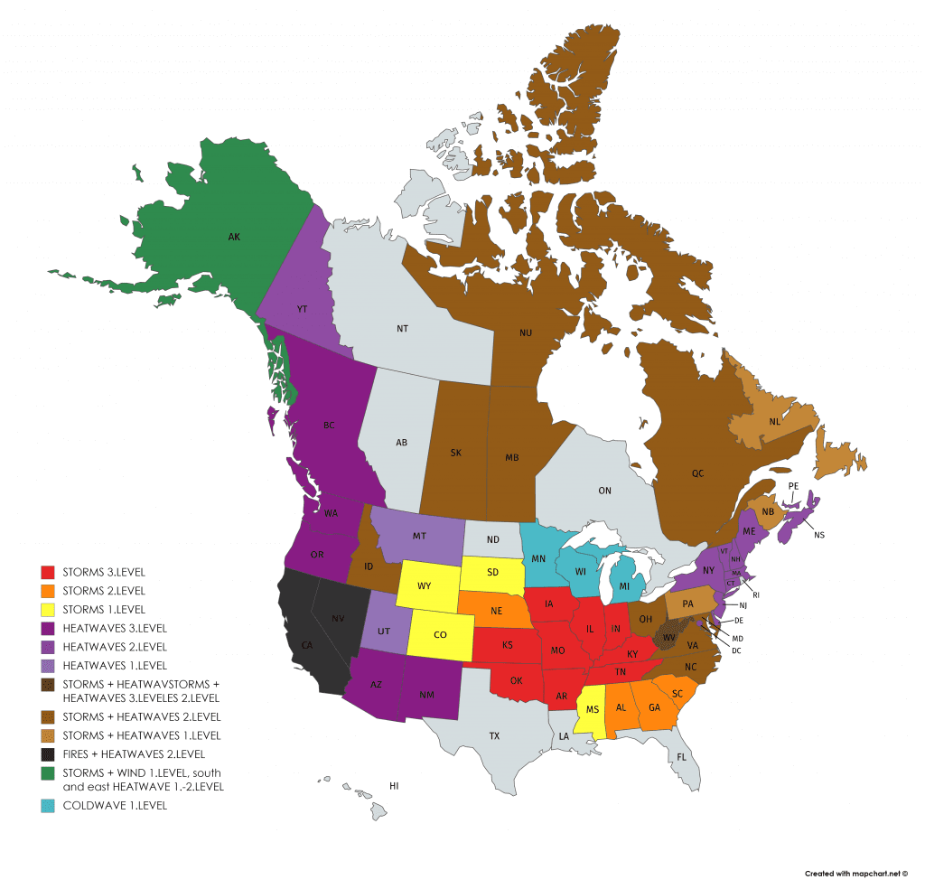
3 main topics of extreme events in US/Canada: 1.Hurricane Isaiash (estimates) hits E Coast / Northeast with floods; 2. Midwest with extreme storms; 3. West with excessive heatwave
Let´s to look to 3 main topics of extreme events in US and Canada expected during the next days.
- (Estimated) hurricane Isaiash hit East Coast and Northeast
- Extreme storms in Midwest
- Excessive heatwave in West
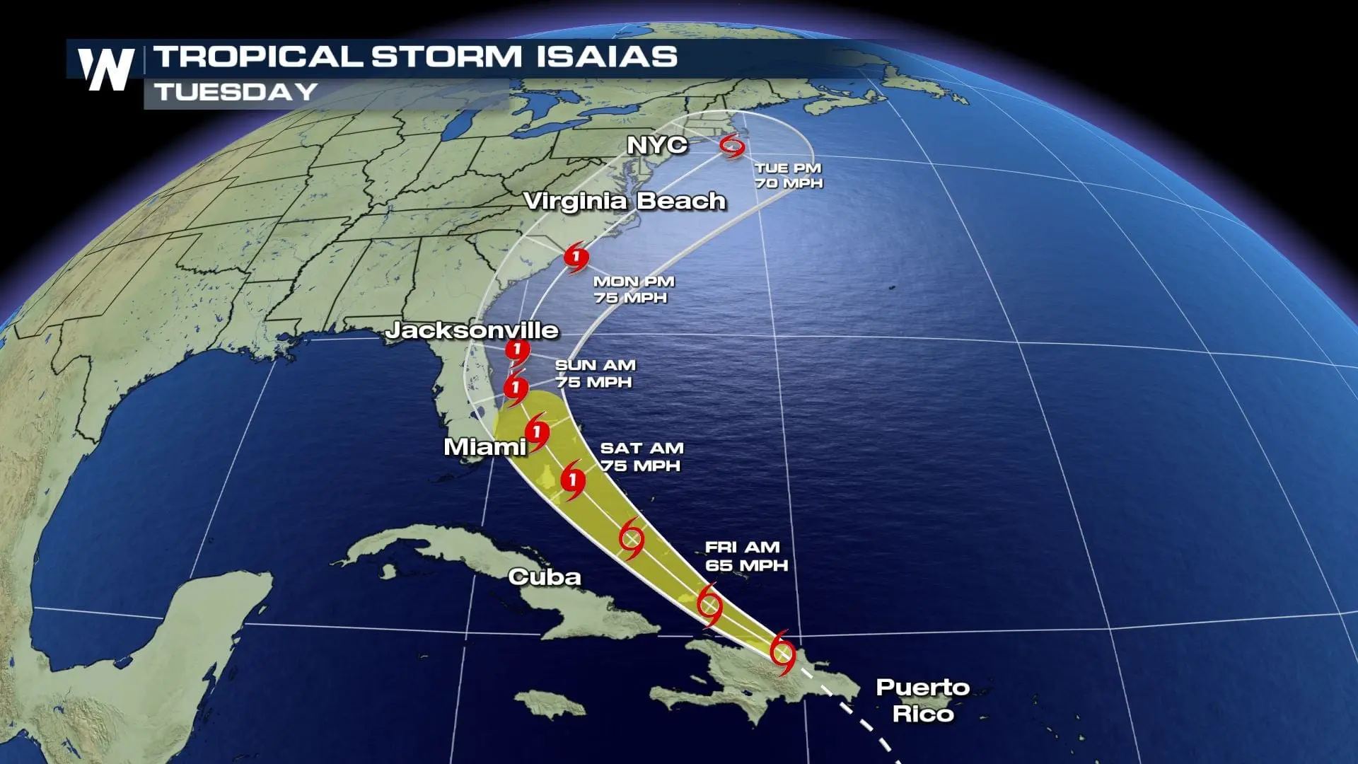
1. Tropical storm Isaiash hit Portorico, near Bahamas it intensifies to hurricane and hits in East Coast and Midwest with flooding risk
Isaiash on Thursday hit Portorico, where caused heavy rain and wind gusts up to 60 mph / 100 km/h. From Portorico are available a videos with car flying in river and stormgust watching.
Isaiash on Friday hit Dominican republic and according to fresh estimates, strengthens above Bahamas to hurricane of 1. category during Saturday and then hit Florida with 75 mph/ 130 km/h winds and flood risk on the east coast of Florida with more than 4 inches (100 mm rain) above eastern half of peninsula.
As a hurricane of 1st category it could hit Virginia beach on Monday and then as weakened tropical storm hit New York on Tuesday. Northeast will be affected around Wednesday, 5. august 2020. Possible flooding effect is forecasted by American weather services such as Accuweather or Weather Nation on East Coast and in Northeast.
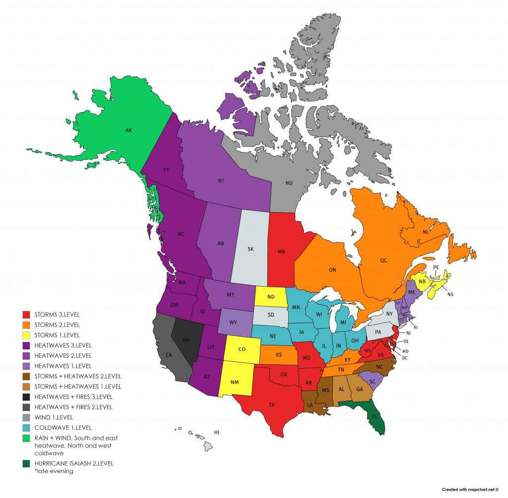
2. Extreme storms in Midwest
From Thursday to Friday, but too at the weekend, powerful storms in Midwest and southern US are expected. During last days, we replied to high potential risk by warnings of 3. (red) level and later, American weather services confirmed our expectations.
Storms can be accompanied with large hails, severe wind gusts, heavy rain and strong lighting activity, therefore, will be during rest of the week careful. Our warnings for the next 3 days will be every day updated on our main page or /https://mkweather.com/warnings/; https://mkweather.com/warnings-2-day/; https://mkweather.com/warnings-3-day//.
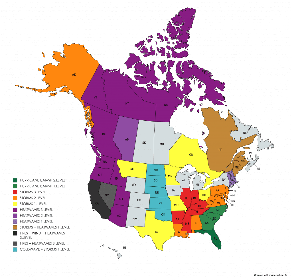
3. Excessive deadly heatwaves in West US and Canada
On Wednesday, we pointed to extreme deep Arctic low – in record (968 hPa), which is linked with advection of extremely hot air over western parts of North-American continent /https://mkweather.com/2020/07/29/the-2nd-deepest-summer-cyclone-in-history-over-arctic-heatwave-starts-on-the-west-near-seattle-109f-43c-is-expected//.
Hot air will be moving during rest of the week slowly to the east and states from California and Arizona to Washington state and Montana, British Columbia, Central Canada, Northern Territories, Nunavut and later, to the central US.
Excessively heat hit mainly parts of California, Arizona, Oregon and Washington in US during next days, in southern regions are heatwaves signed as “deadly”. Temperatures will reach during Friday in the south 121°F and near Seatlle 109°F. Tropical air will be moved far away to the northern parts of Canada.
Heatwave, storms in Midwest and potential hurricane Isaiash will be monitored and during next days we will bring fresh news about extreme weather across North America.


Excessive rain outlook for Midwest storms / https://www.weathernationtv.com/news/drenching-downpours-soak-central-us


Deadly heatwave documentation from Accuweather and Weather Nation
Our warnings for THU-FRI-SAY 30.7. – 1.8. 2020


