Isaias did not say the last word: The cold front associated with it is bringing floods over Mid-Atlantic
Isaias is already only extratropical storm, located between New Fouland and southern Greenladn over Atlantic, but threat of flood is still alive in parts of East Coast and North East.
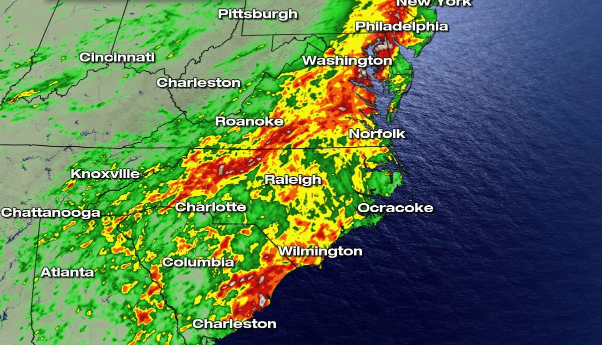
The worst conditions are expected up to Saturday over Mid-Atlantic, mainly in New York, Wilmington, and Raleigh region, where cold front, linked with ex-hurricane Isaias could cause local floods or severe storms.
Locally, can fall 3-6 inches of rain (75-150 mm) in regions, where accumulations from Sunday reached up to 8 inches (more than 200 mm).
Gradually, heatwaves will return above area during the weekend, with possbility of next T-storms. Up to 12.-14. August, in East Coast and Northeast will be warming up with possible peak of next heatwave before 15. August 2020.
Strong hurricane season is during late summer and autumn 2020 expected, therefore, after time, next similar situations as during last days can occur in region, but in Southern US, too.
Documentation of flood risk over Mid-Atlantic from Weather Nation:


Hurricane season 2020 forecast from Accuweather:


