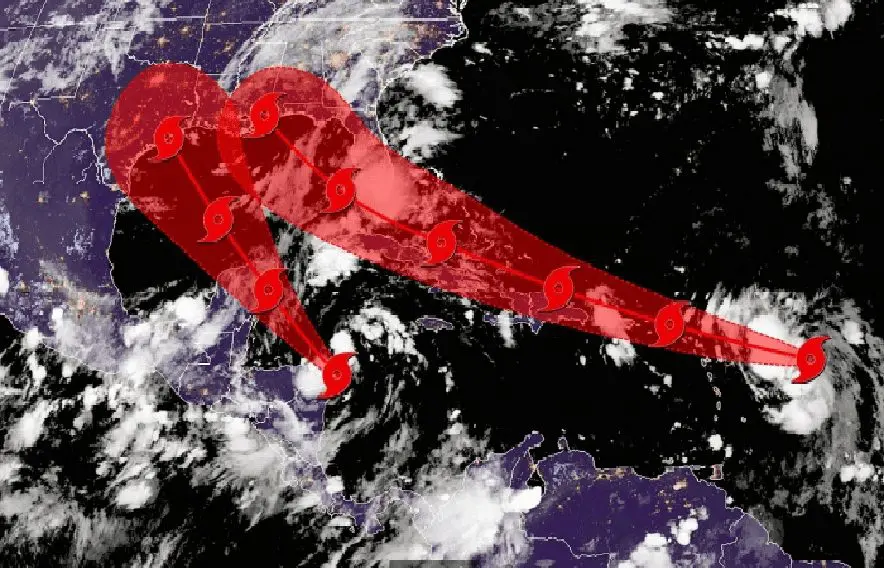
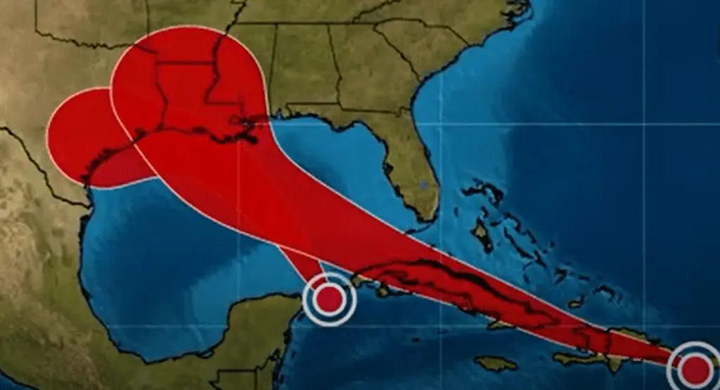
Hurricanes Laura and Marco will collide over Gulf Coast and will create a superstorm
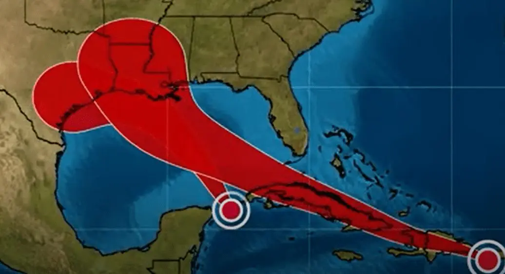
Hurricanes, or hurricane Laura and potential hurricane Marco, respectively, hit Gulf Coast at the same time and could be first duo of hurricanes, which will collide in Gulf of Mexico to one, in history.
2 hurricanes has potential to create a wide-area superstorm, which hit region of New Orleans, but Florida, other parts Luisiana, Texas, Mississippi and Alabama, too.
According to Severe Weather Europe and NOAA, this rarely event of collision 2 tropical storms / hurricanes is called Fujiwara effect:
““When two hurricanes spinning in the same direction pass close enough to each other, they begin an intense dance around their common center. If one hurricane is a lot stronger than the other, the smaller one will orbit it and eventually come crashing into its vortex to be absorbed.”
“The storms closer in strength can gravitate towards each other until they reach a common point and merge, or merely spin each other around for a while before shooting off on their own paths.”
“But often, the effect is additive when hurricanes come together, and we usually end up with one massive storm instead of two smaller ones.”
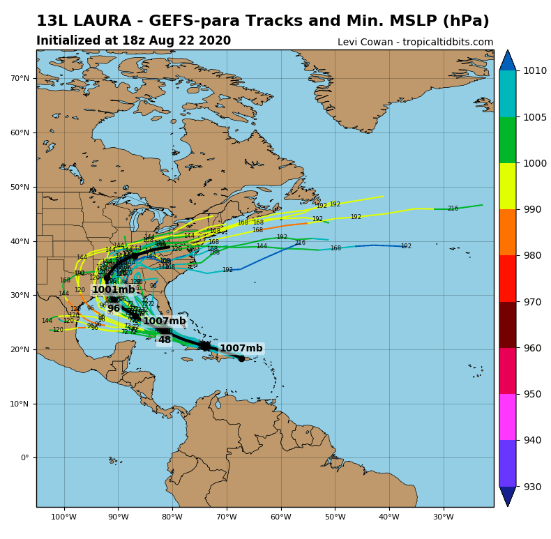
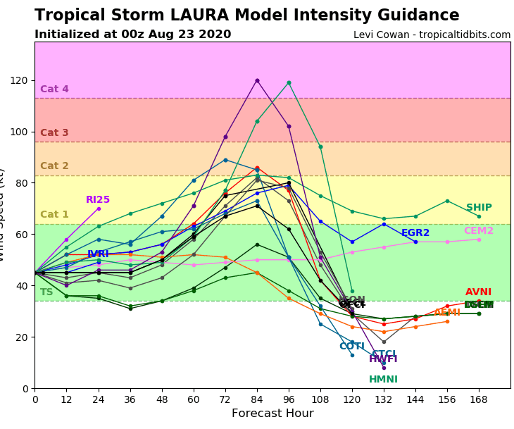
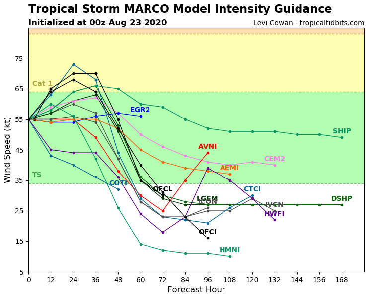
While Laura could strenghtens up to Category 4 till Tuesday, Marco will be weaker, only tropical storm and hurricane Category 1.
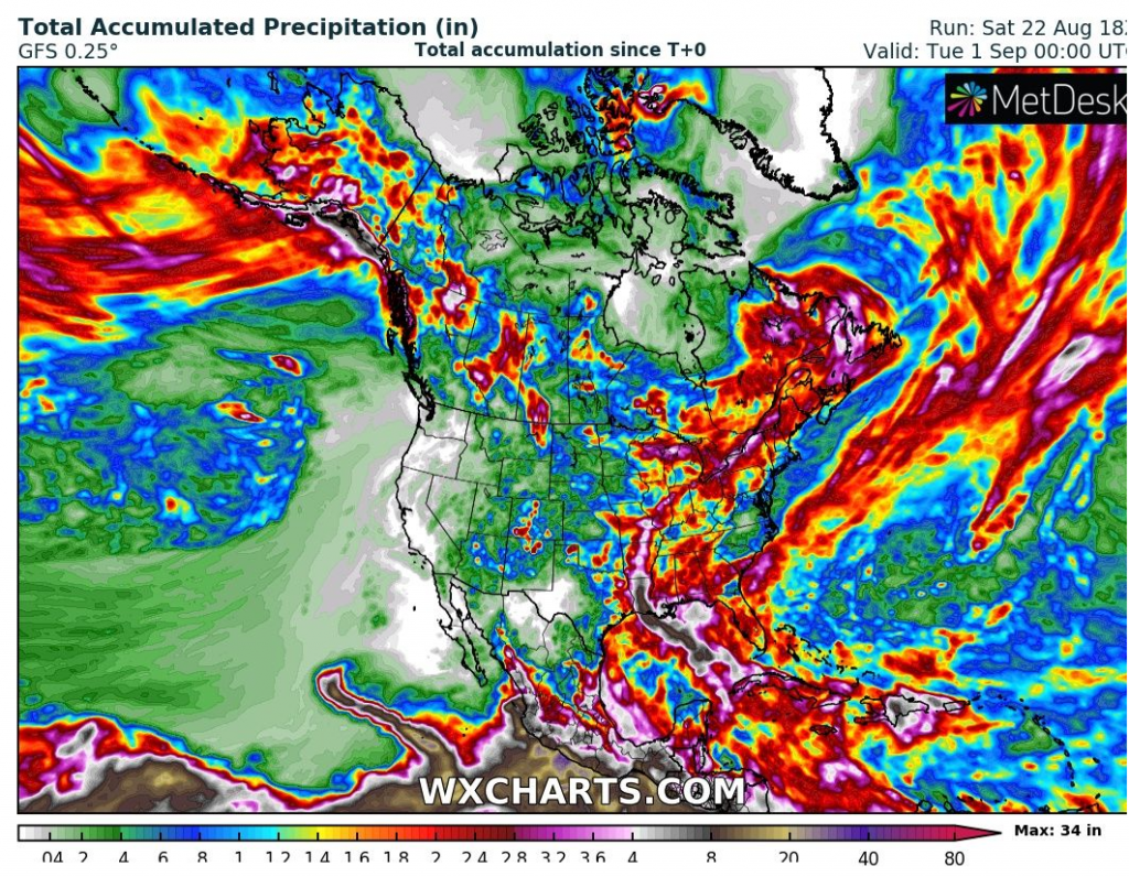
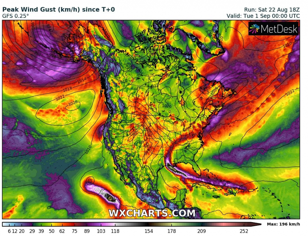
Big mass of moisture and cloudiness linking together will create really powerful system, which will be moving during rest of the week across United Stated firstly northward, then eastward, over Atlantic and bringing severe winds and heavy rain above the territory, mainly near the center of superstorm (what is seen on accumulated precipitation and maximum wind gust outputs from Wxcharts below).
And its not all – in our fresh Autumn forecast for Europe /https://mkweather.com/2020/08/22/europe-autumn-2020-forecast-mkweather-accuweather-maps-and-analysis// we have mentioned, that MJO with Kelvin waves will be very favorable for next hurricane development over Atlantic and North American sector of tropical latitudes during next weeks.
Near west Africa, next tropical depression is in development right now and next potential hurricanes are developing in Pacific North-American sector too.
Extremely hurricane season 2020 can during the next weeks continue with a lot of big surprises.
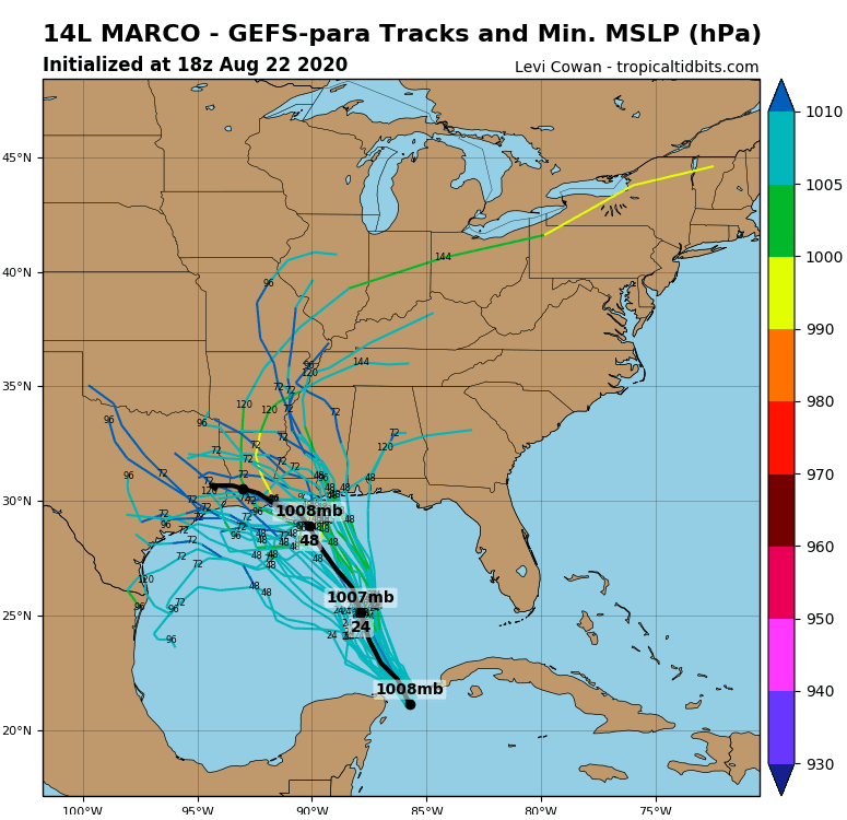
Documentation of expected collision of Laura and Marco over Gulf Coast /Wunderground, Severe Weather Europe, Tropicaltidbits, Wxcharts/: