Forecast for US, Canada and Mexico till 10. September: Without hurricanes, cold will coming from Canada

After outlook for Europe till 10. September /https://mkweather.com/2020/08/25/forecast-for-europe-till-10-september-2020// we looked at the development of weather across North America.
There are 5 main remarks linked with upcoming weather patterns over US, Canada and Mexico during next 16 days:
1.) After hurricane Laura, any other big or major superstorm come over territory of US, but over land of Mexico too, till 10. September. The next tropical storm or hurricane will arrive over Caribbean according to GFS only at the end of first September decade.
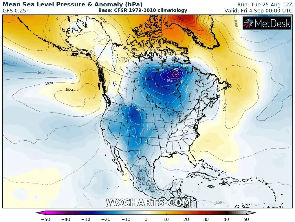
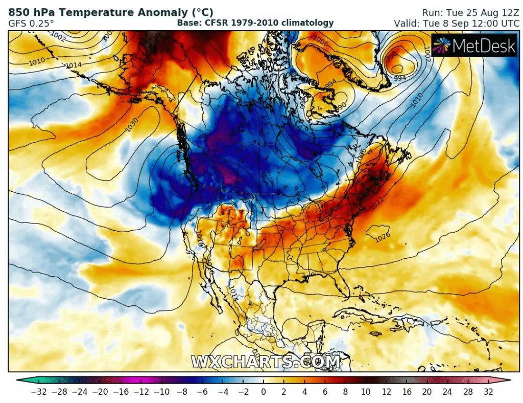
2.) Coldwaves will be coming from Canada to Midwest and other regions of US. 2 powerful Aleutian lows will shift over Canada and NW US during first September decade with expected coldwave across Canada and parts of United States. Hot weather will remain in the South and the most lately coldwaves will arrive to East/Northeast coast.
3.) Hot and dry with fire risk in Southwest. While Washington state and Oregon will be affected by coldwaves and rainy pattern, Southwest remains still in hot and dry air.
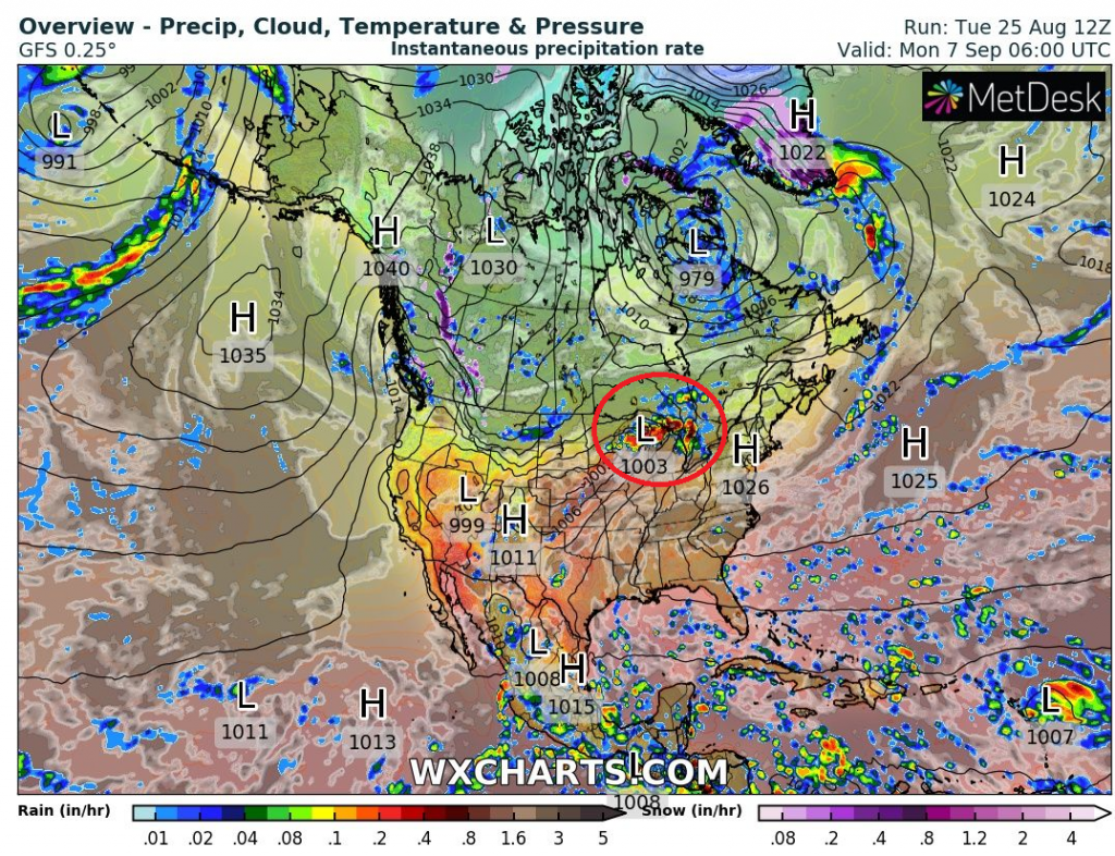
4.) Lot of precipitation over east-half of US – with possible storm activity.
5.) Possible powerful storms in Great Lakes area and powerful cold front between coldwaves in the North and Hot air in the South.
It appears, that for northern parts of the US is prepared autumn already and that Americans wont be in stress from possible hurricanes for a time (but next threats already around 10.-15. September !). Fires on Southwest could continue during the start of Autumn and in parts of Canada could be seen first snow or frost in many regions. Mexico will be hot, with slight threats from Pacific, only.
Welcome Autumn 2020!
Animation of expected temperature anomalies and precipitation/pressure over North America till 10. September 2020:
The most powerful moments from the outlook and peak wind gust and accumulated precipitation:
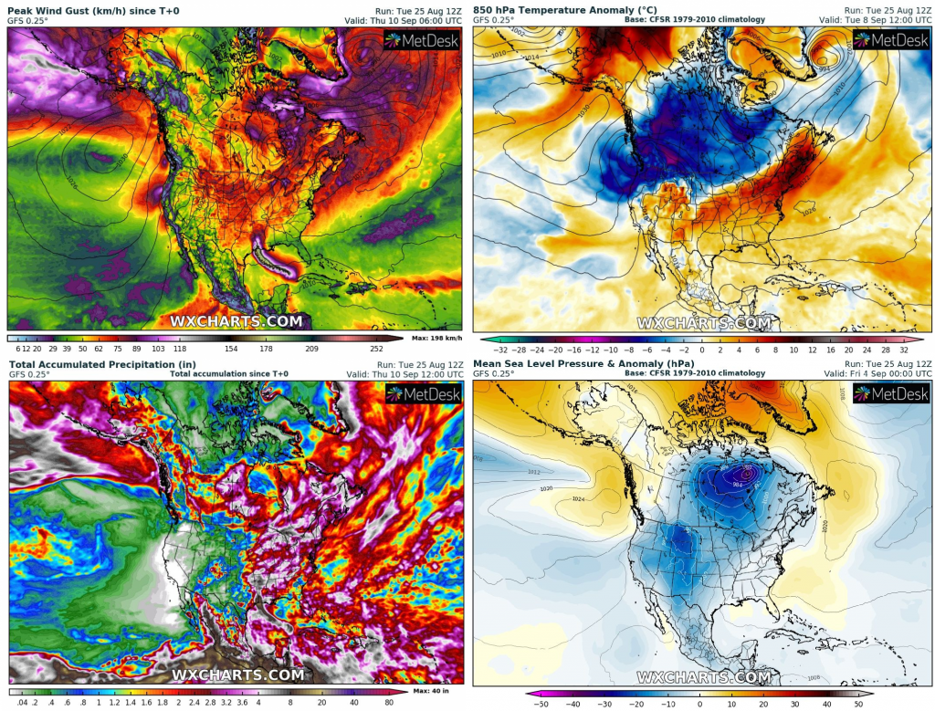
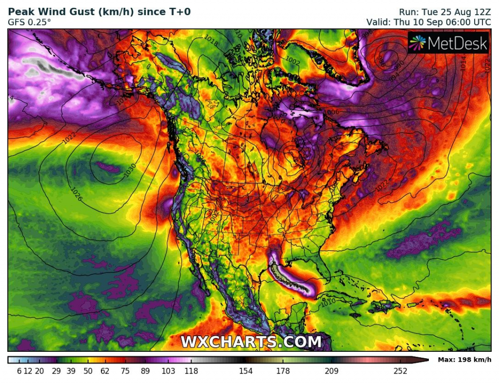
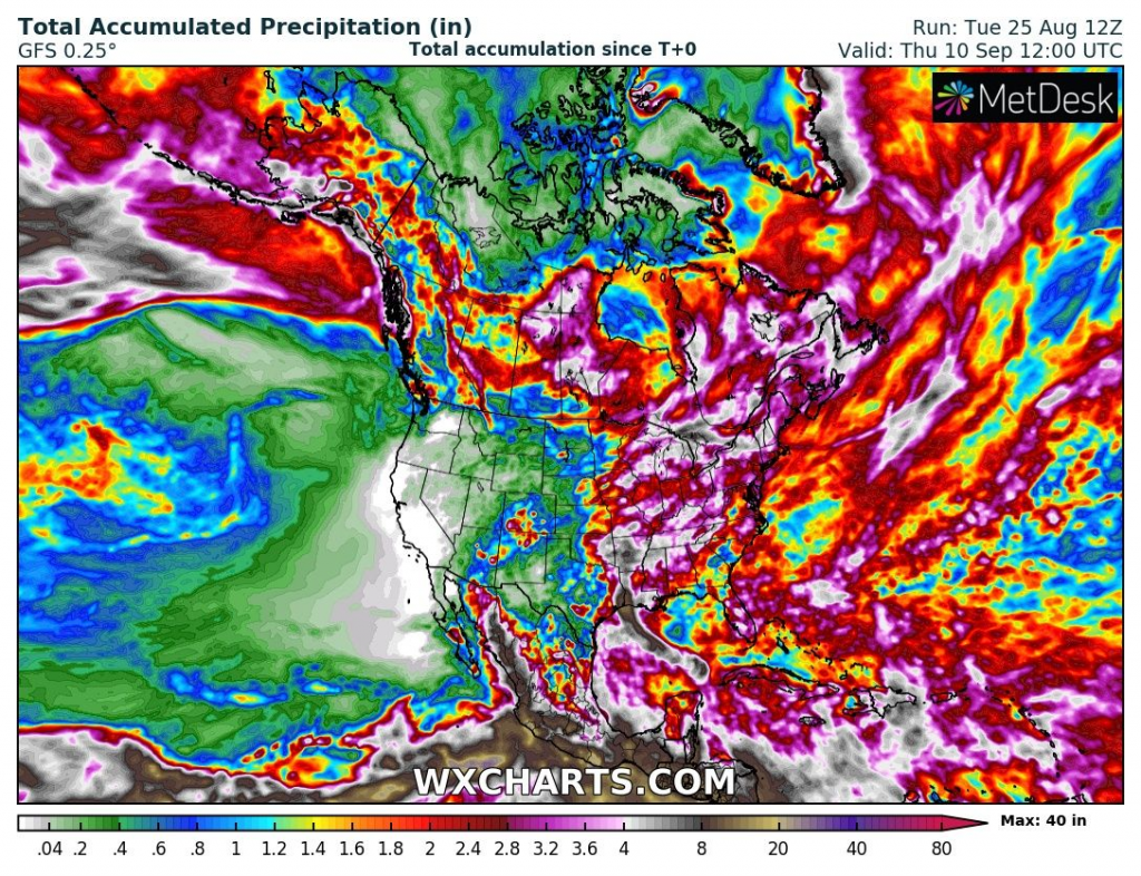
Infographics: wxcharts.com


