Better conditions for hurricanes between 25. July – 15. August, the worst should come in September/October 2021
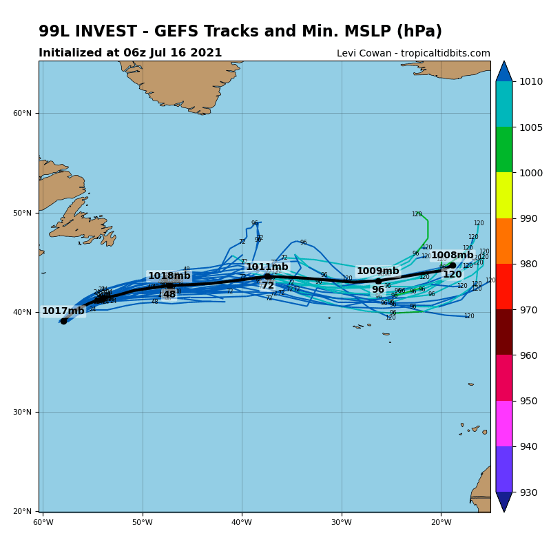
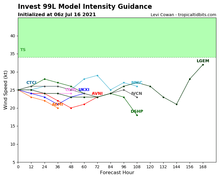
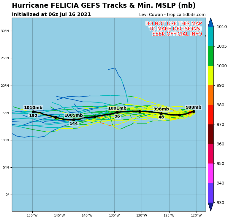
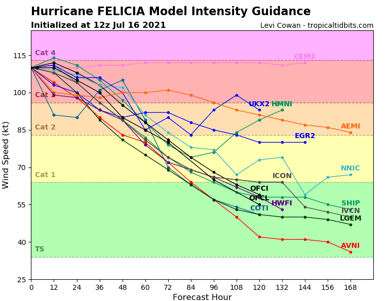
In mid-July 2021, tropical depression 98 L Invest is shifting near Newfoundland towards Europe, a hurricane of Category 3-4 Felicia is making problems in eastern Pacific and the next tropical wave is increasing near Mexican coast (97 E Invest).
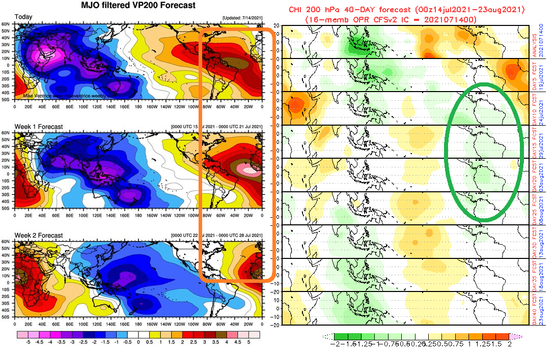
For a possible hurricane in the Atlantic, we however will be waiting minimally 10 days – only in the period between 25. July and 15. August 2021, the wet MJO phase is forecasted gradually for the Caribbean, where increased tropical activity should bring the next systems.
Then, in the second half of August 2021, again dry MJO should appear and for very good conditions for tropical development above the northern Atlantic, we will wait probably until September/October 2021, when major hurricanes should appear from northern South America to eastern Canada and such as ex-hurricanes should cause significant coldwaves above European continent, with heavy rains, end of summer days and possible floods.
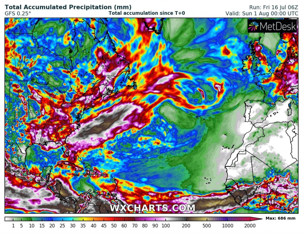
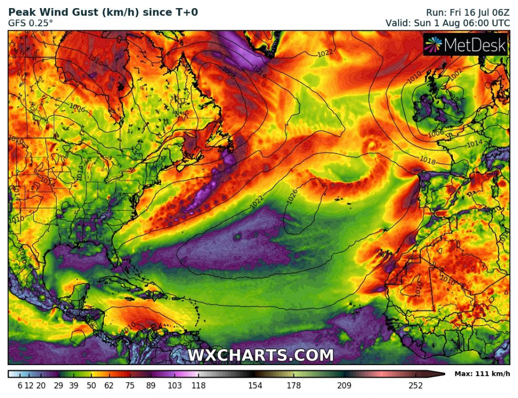
Some tropical depressions or storms should appear until the end of July 2021 near East Coast, USA and Canada and hit Newfoundland, but in Gulf Coast, very clam weather is forecasted, for now (until the end of July).
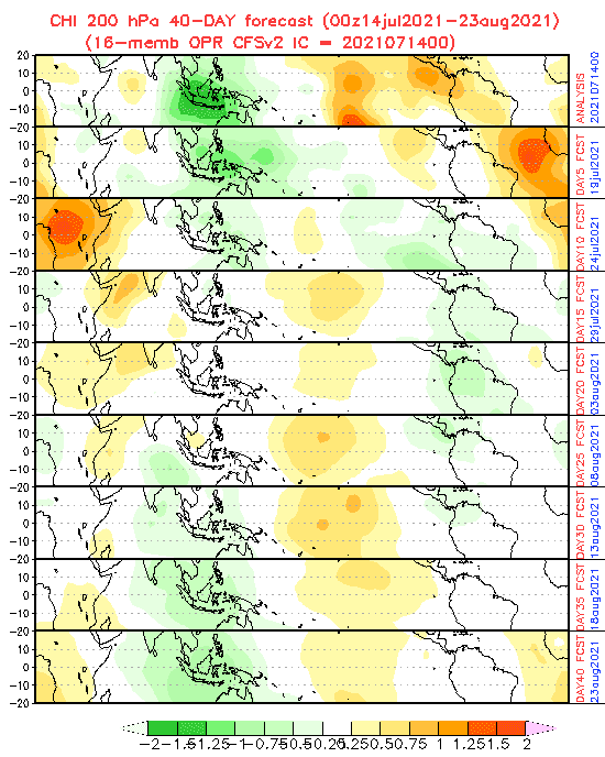
The convectively suppressed phase of the Madden Julian Oscillation is now moving across the Atlantic-African sector, what will be an intraseasonal, not very conducive phase for developing Atlantic tropical cyclones.
Moreover, plume of African dust is currently moving through the Atlantic. This will suppress activity.
If you plan holidays in Gulf Coast, the next 2 weeks should be ideal, with any significant tropical threats according to forecast models, but the first half of August 2021 should bring worsening the situation.

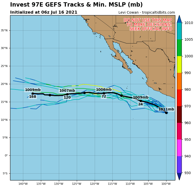
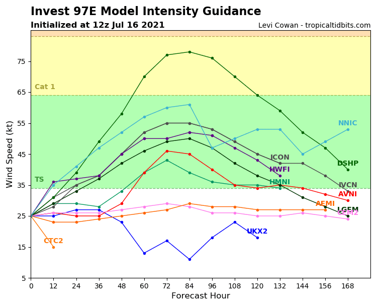
Source: tropicaltidbits.com