The first 2 December 2021 decades in the USA brought/bring unseasonably warm, in southern regions even summer or tropical weather /https://mkweather.com/winter-tropical-heatwave-hits-the-usa-unseasonably-hot-from-the-south-to-the-north//, even, with deadly supercell storms with historic winter tornado outbreaks (50 people killed in Kentucky: https://mkweather.com/breaking-ef4-tornado-in-kentucky-killed-50-people-it-was-historic-winter-supercell/.
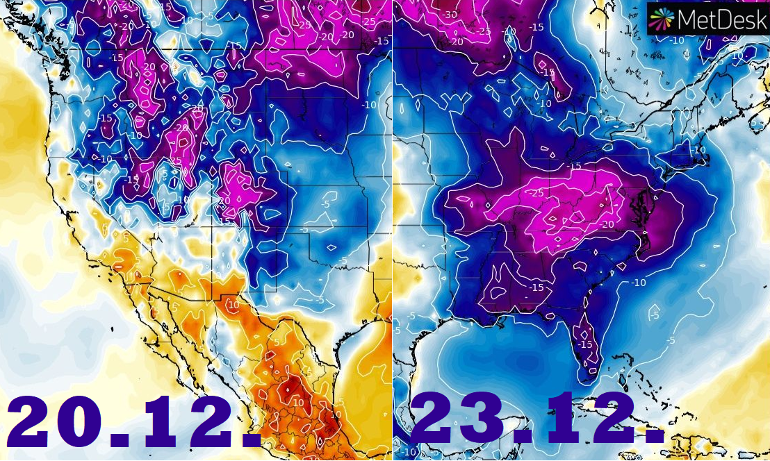
A peak of extremely warm weather is forecasted around 14.-17. December 2021, with the next possible severe cold front, with storms, or tornadoes, and only around 20. December 2021, cold Arctic air will begin to flood all the territory of the USA, until Christmas 2021.
Firstly, around and shortly after 20. December, the western half of the USA will be hit by this Arctic blast.
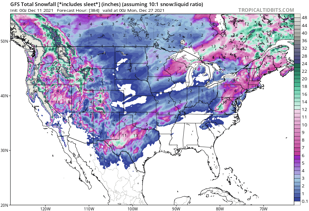
Snowfall should gradually appear even in large parts of Texas, where regional snow calamity is in preliminary outlook.
Shortly before Christmas and during Christmas, very cold air will shift above the eastern half of the USA.
Many central and north-central parts of the country however should stay without a significant snowfall until 27. December 2021 and snow is forecasted mainly in the western half, Northeast, and partially Great Lakes region.
6-week ECMWF outlook for North America we will describe already in one of the next Mkweather articles, including Christmas and New Year 2021-2022 forecast.
Information about Winter 2021/2022 forecast for continents of Northern Hemisphere you will find here: https://mkweather.com/winter-2021-2022-forecast-for-northern-hemisphere/.