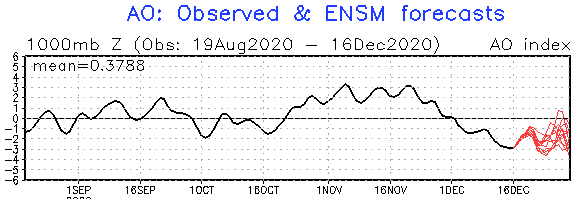
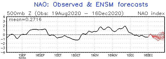
A big surprise! Between the Christmas and the New Year next coldwave in Europe! The second peak of NAO-/AO- around Christmas, cold weather will return!
Long-term forecasts during the first decade of December 2020 was promising transition from NAO-/AO- to NAO+/AO+ phase after Christmas 2020 and warm end of the year 2020 and warm January 2020, but everything has changed!
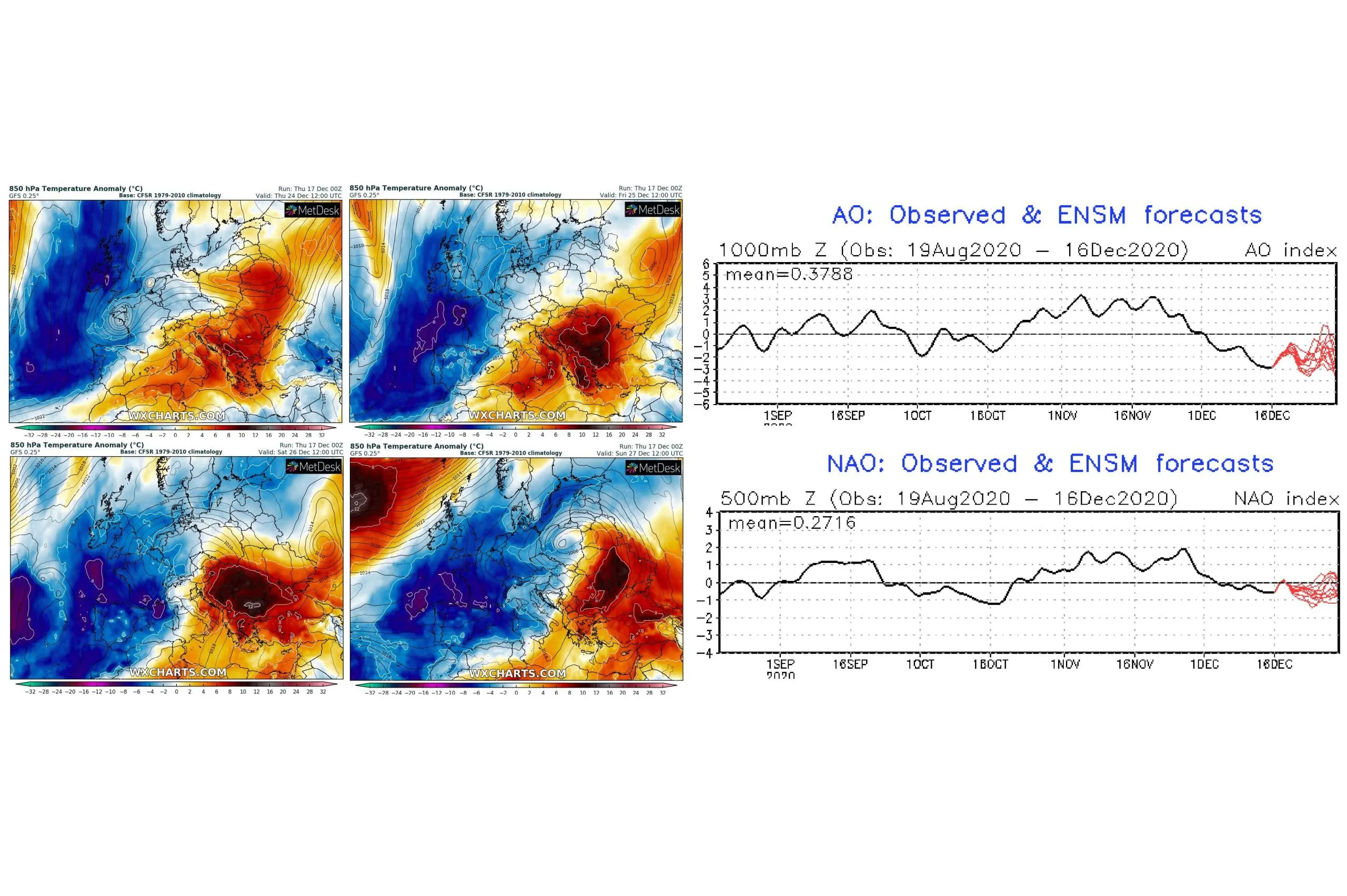
Although currently is above almost all Europe very warm air and and warmer weather stays in parts of Europe until the Christmas, already around 24.12. is expected next decline of NAO and AO index, with effect of soon coldwave after this peak in Europe, between the Christmas 2020 and the New Year 2021!
Coldwave in last days of the year 2020 should bring minimum temperatures -8/-18°C to basins and valleys and 0/-8°C to lowlands and maximum temperatures -8/-2°C to basins and valleys and -4/+4°C in lowlands during the peak of cold spell in continental Europe.
While Christmas should be in many parts of Europe warm, Silvester and New Year we will be already in cold air masses and celebrations of the New Year 2021 will be in cold air.
Since AO and NAO indices decline into their peaks, last few days, while cold air will flood mid-latitudes, peak of cold weather is in continental Europe often around 5 – 10 days after a peak of this decline.
Long-term seasonal Mkweather forecasts, which expected early winter cold blasts, forecasted directly this type of weather – more NAO- / AO- than NAO+/AO+ from October to December. Forecast was successful for October and December, while November surprised with NAO+/ AO+.
Last forecasts for January and February 2021 were NAO+/AO+, but it should change, yet.
Incoming negative NAO/AO should make next SSW (Sudden Stratospheric Warming) less possible, because for SSW needs strong NAO+/AO+ initial phase, mainly during the first half of the winter, after which is observed sharp decline of indices.
About expected temperatures we will inform during next days and Mkweather Christmas 2020 and New Year forecast will be updated already on Friday, 18. December 2020 – for Europe, but too for the USA and Canada.

Infographics: NOAA, wxcharts.com