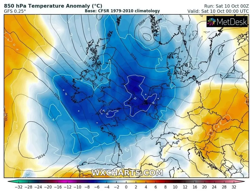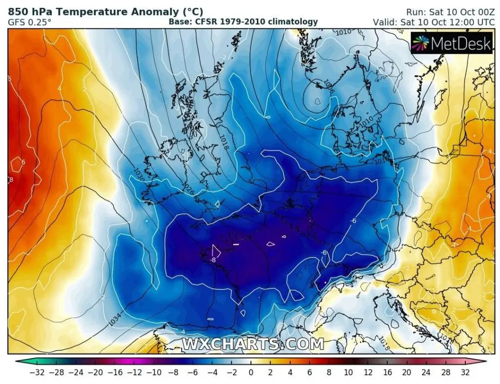
10-day European mid-October 2020 coldwave /https://mkweather.com/2020/10/09/coldwave-in-europe-will-be-longer-and-stronger-10-days-of-cold-weather-between-9-18-october// has started on Friday and Saturday in British Isles and Northwestern Europe with powerful cooldown.
Cold Arctic air has started to flow over Europe after transition of cold front associated with a low pressure system over Northern Sea. In the southern edge of this cold front, next Mediterranean storm is arising above Ligurian sea on Sunday, 11. October 2020, with next flooding effect in parts of Italy and Balkan on Monday, 12. October 2020 /https://mkweather.com/2020/10/08/red-warnings-before-possible-medicane-for-italy-greece-tunisia-and-balkan-on-monday-11-october-2020//.
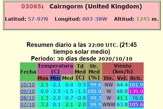
Interesting are windchill temperatures estimated for mountainous areas in the UK on Friday and Saturday 9.-10. October 2020. In Cairngorm, 1245 MASL, temperature on Friday oscillating between -2,5°C and 0,0°C with wind gusts up to 139 km/h, with result of -12 to -15°C wind chill temperature!
In London, minimum temperature on Saturday has dropped only to +4,8°C, what is the lowest value since 15. May 2020. It is possible, that temperatures will even closely to zero during next days in case of clear night in cold Arctic air.
As we have forecasted on Friday, Europe is waiting coldwave minimally until 18. October 2020 (maps of temperature anomalies in Europe are available here: https://mkweather.com/2020/10/09/coldwave-in-europe-will-be-longer-and-stronger-10-days-of-cold-weather-between-9-18-october/) and new possible regional temperature records are expected. Too, COVID-19 outbreak is very possible during the long-term cold persisting weather, therefore stay safe and watch current forecast, warnings and weather news.
Infographics: