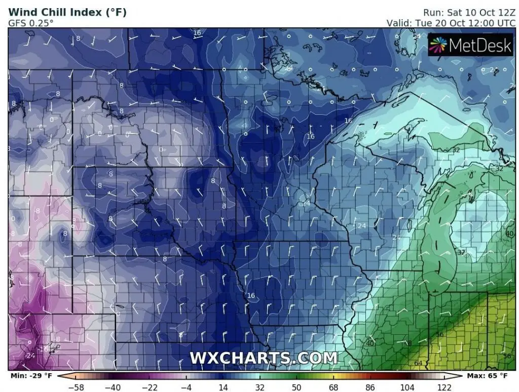
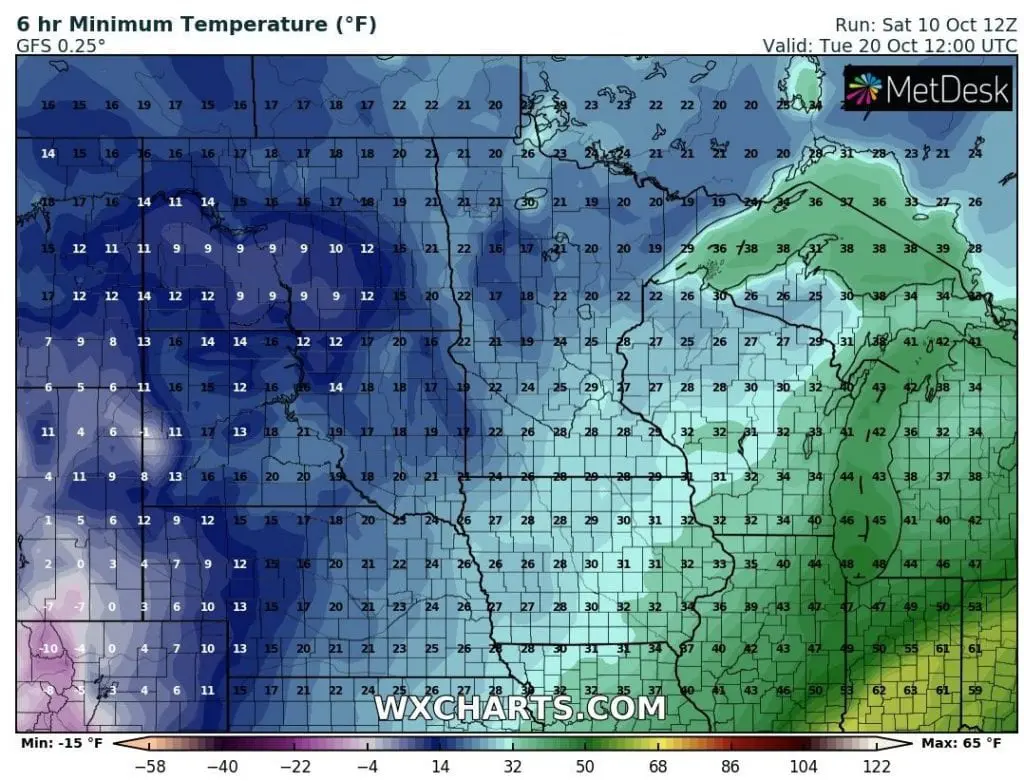
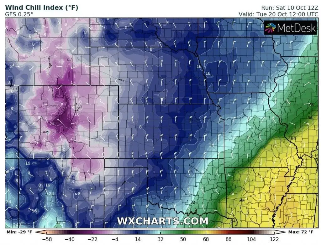
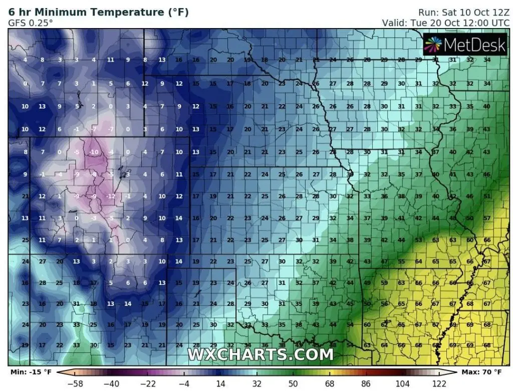
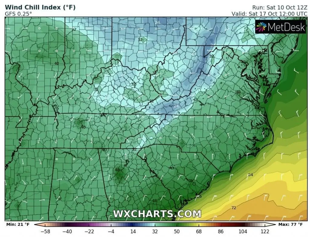
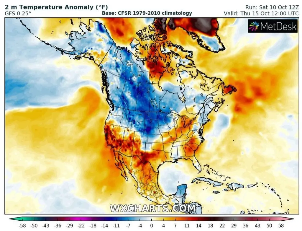
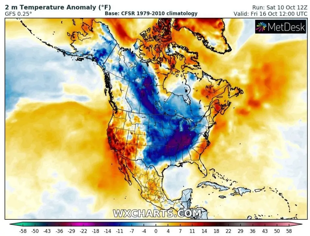
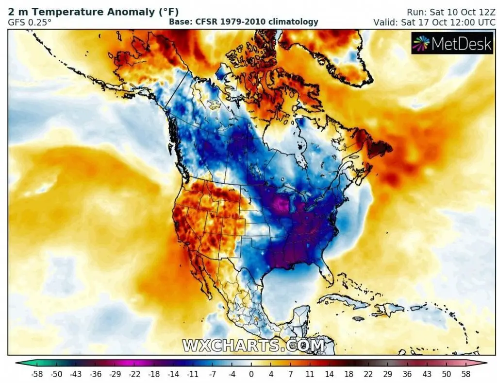
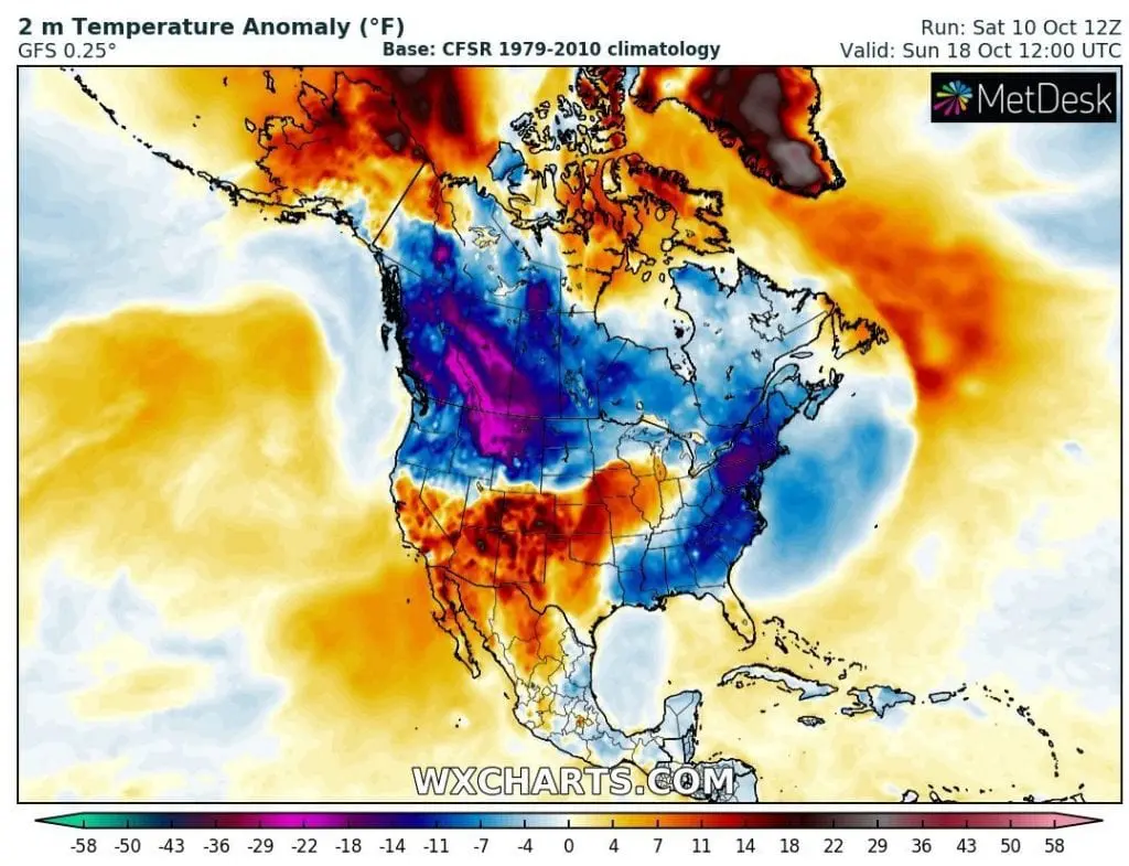
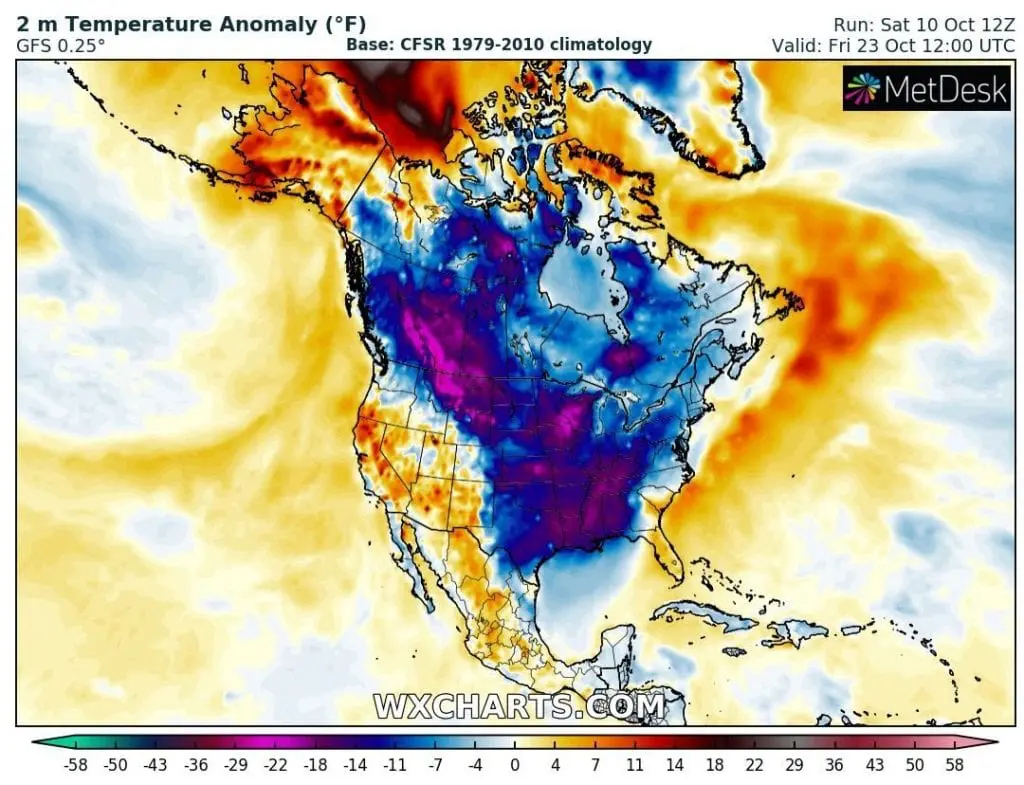
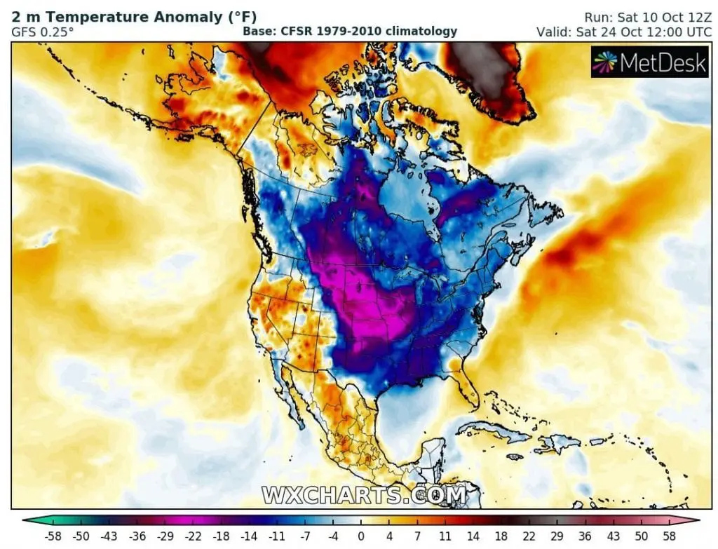
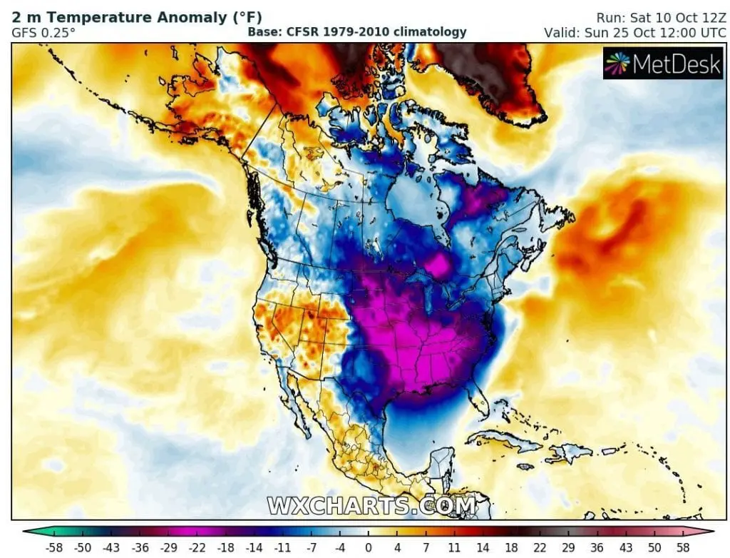
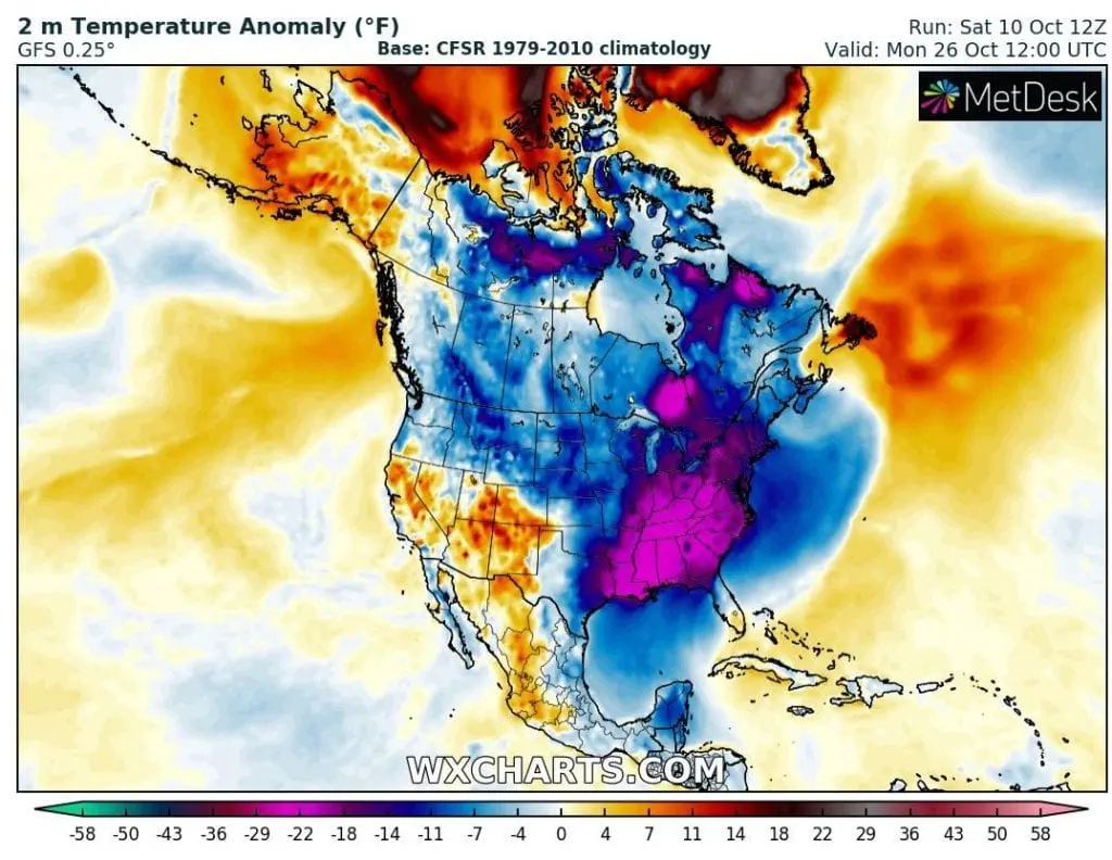
Deadly coldwave in the USA between 15.-25. October! Temperatures up to -15°F (-24°C) and windchill -24°F (-31°C) expected!

Extremely low Arctic Oscillation Index won´t be associated only with extremely and strong 10-day coldwave in Europe /https://mkweather.com/2020/10/09/coldwave-in-europe-will-be-longer-and-stronger-10-days-of-cold-weather-between-9-18-october//, but too with more than 10-days persistiong and DEADLY wave of cold weather in Canada and the USA.
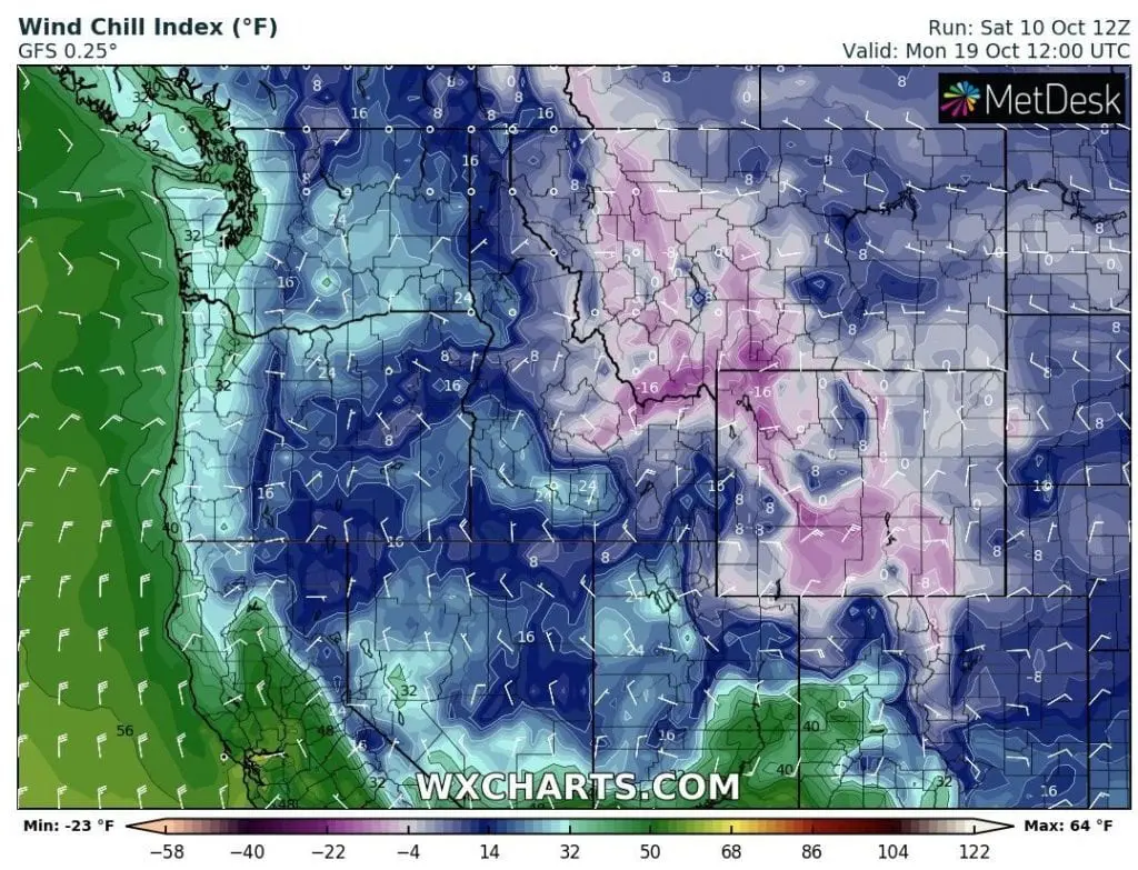
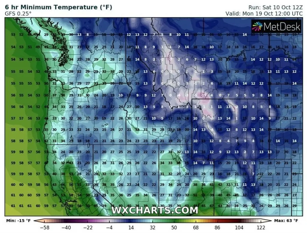
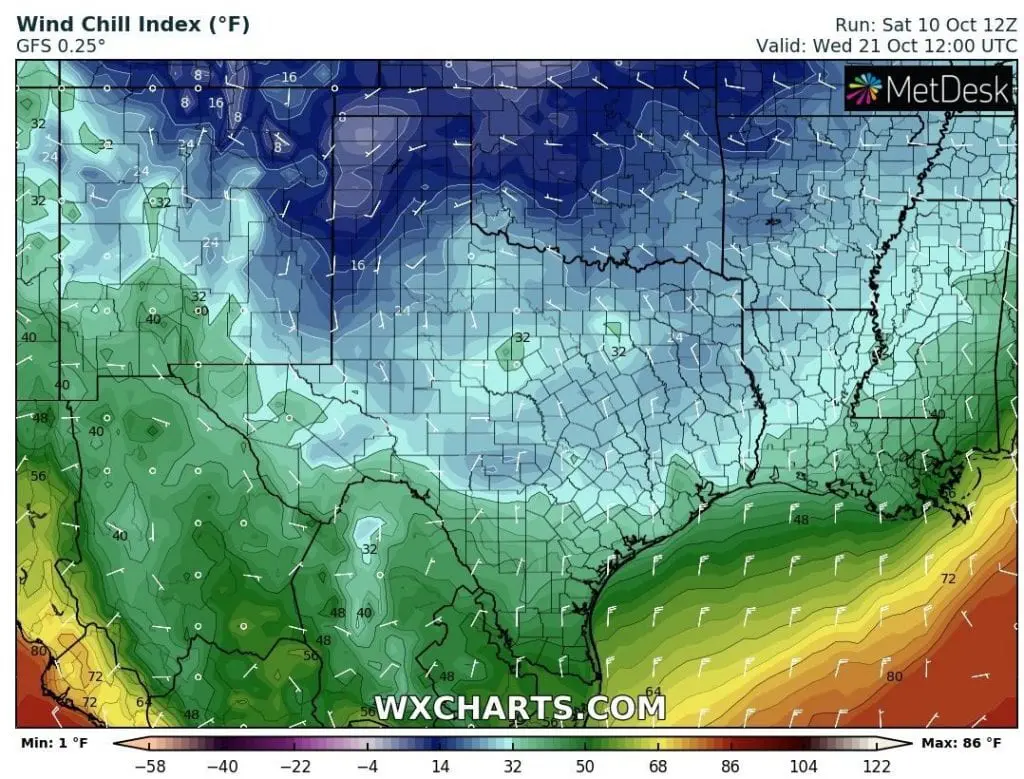
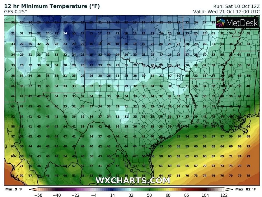
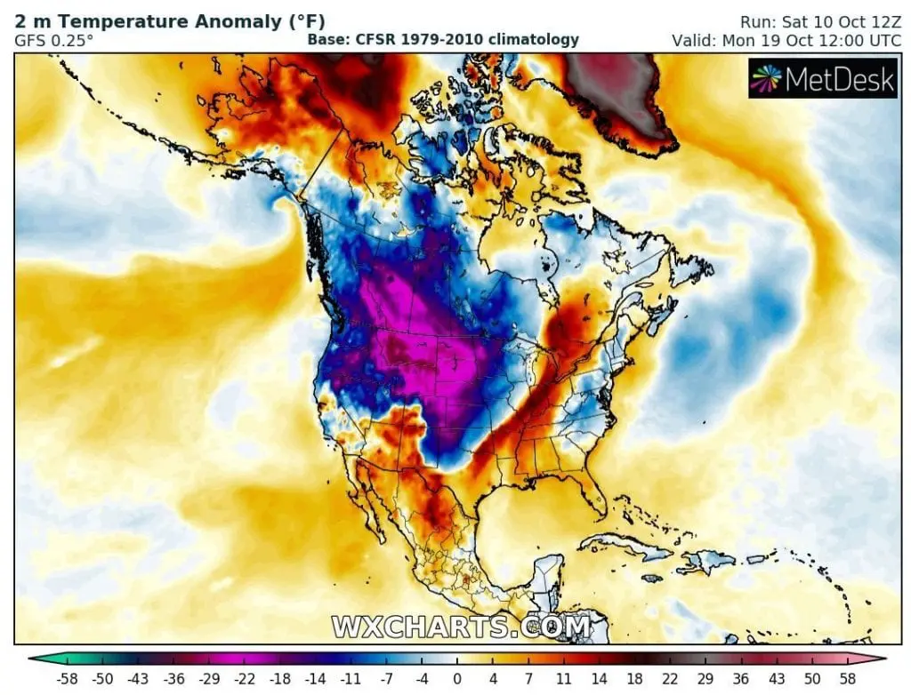
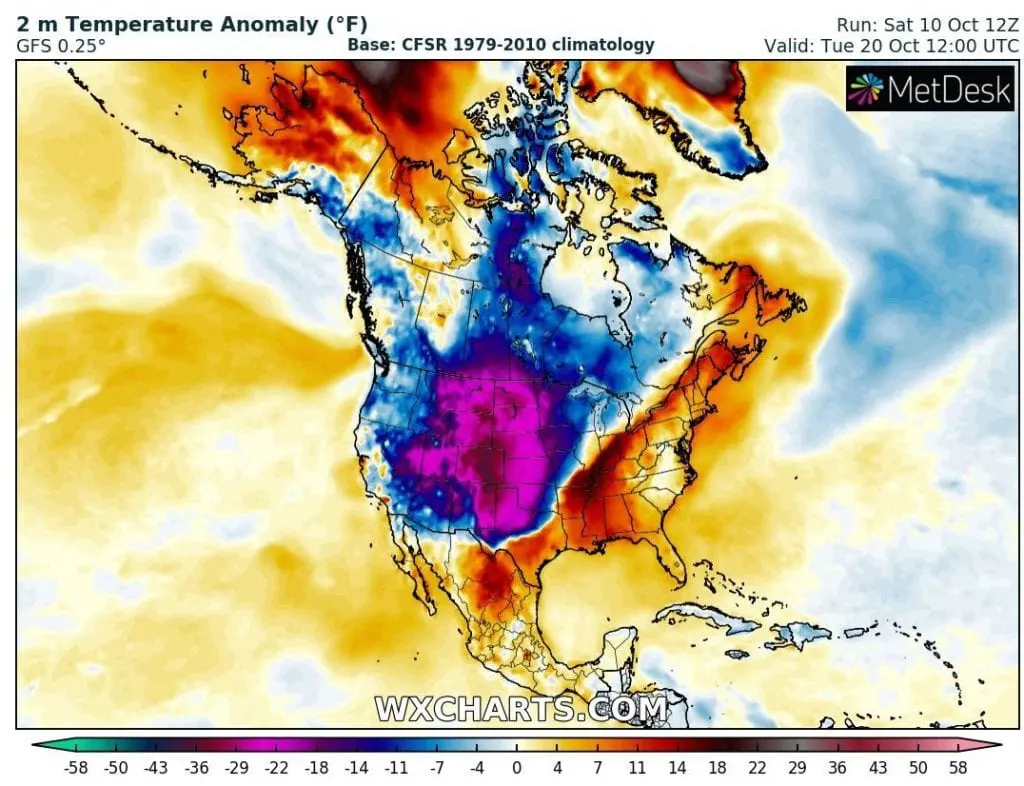
Extremely cold weaher will start already on Wednesday in northern – northwestern states and cold air will quickly spread over large parts of territory of the USA, with the first peak on Friday and at the weekend, and the second, abnormally cold October peak, around Tuesday, 20. October, with deadly low temperatures in mountainous areas, in Colorado, Wyoming and Montana with minimum temperatures of up to -15°F (-26°C) and wind chill of up to -24°F (-31°C).
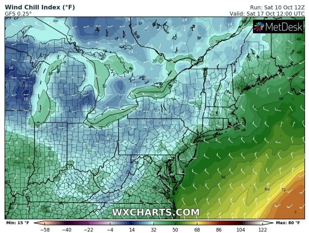
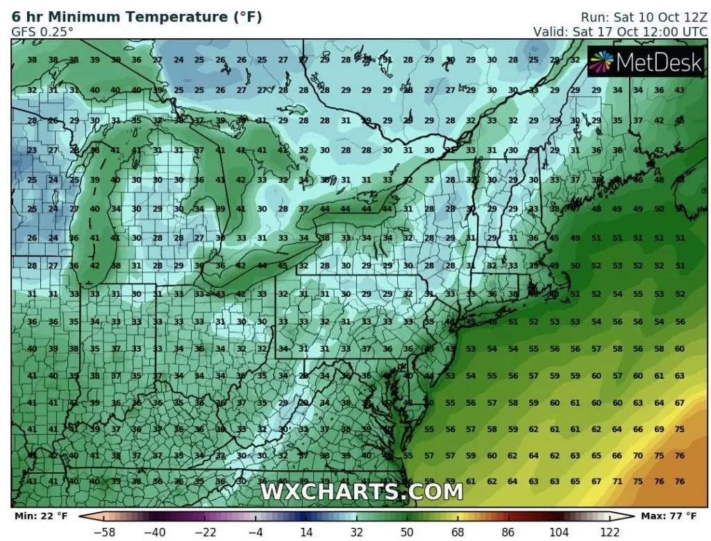
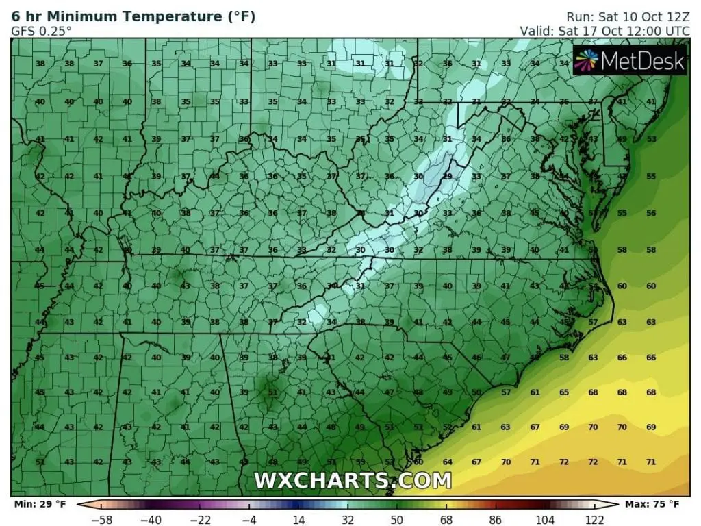
Extremely cold will be already on Friday, 16. October 2020 in lowlands around Great Lakes area, with freezing windchill temperatures only up to +16°F (-9°C) and snowy and windy conditions with frosts.
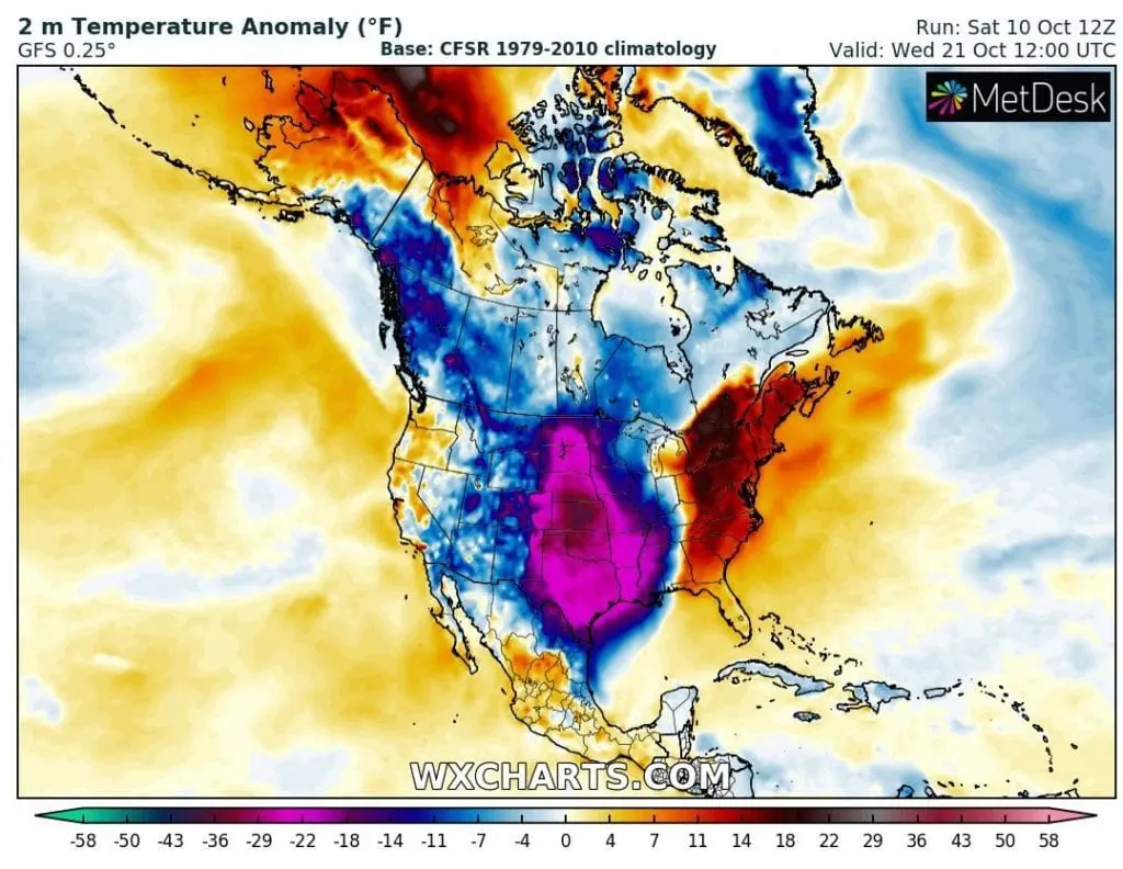
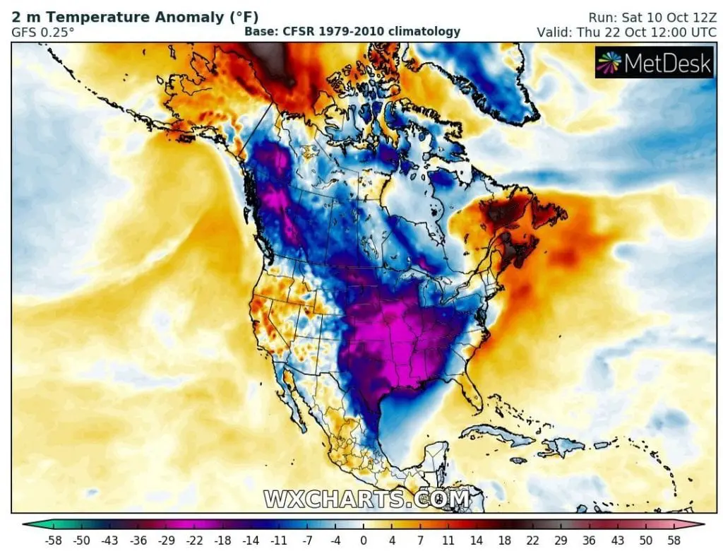
Extreme cold weather will arrive around 20. October to the southern parts of the USA, Gulf Coast and Mexico, too, with the first possibility of ground frosts or frosts in southern areas.
Around 20. October 2020, temperature anomalies -30°C below long-term temperature average are forecasted mainly for parts of Central US and we can to pronounce, that it will be the first serious winter season Arctic blast in 2020/21.
According to NOAA, extremely low AO index, almost -5 is around 20. October possible. It means, that around the Northern Hemisphere will be created a belt of extremely cold, Arctic air, with prematurely early-winter conditions in parts of moderate climate zone, with stormtracks of cyclones on polar front shifted up to subtropical areas.
During the extremely strong AO- (negative phase of Arctic Oscillation with AO index around -5), cold and dry Arctic air fills anomalously southern regions in moderate, in meanders of jet-stream subtropical and tropical zones, too, meanwhile Arctic is extremely warm, without cold air masses.
Exactly circulation patterns like that, were predicted to late autumn and early winter 2020 in Mkweather Autumn and Winter forecasts /https://mkweather.com/2020/08/22/europe-autumn-2020-forecast-mkweather-accuweather-maps-and-analysis/; https://mkweather.com/2020/07/29/first-forecast-for-winter-2020-21-early-powerful-coldwaves-nov-dec-then-weakening-of-cold-pattern-and-warm-jan-feb-mar/; https://mkweather.com/2020/09/24/updated-forecast-for-winter-2020-21-still-nao-ao-in-first-half-of-winter-nao-ao-in-second-half-of-winter-permanent-la-nina-and-surprisingly-easterly-qbo-possible//, with main drivers of climate system linked with a global climate change, in the one side, but with exact predictions or estimates of oscillations such are QBO, ENSO, AO, NAO, MJO, PNA, Arctic ice sea and temperature indices, NH Snow Cover index, evolution of Global warming hole anomaly over Northern Atlantic, Solar cycle, recent volcanic eruptions or AAO (watch situation in the Southern hemisphere during the last winter/JJA 2020).
If AO (or NAO) indices won´t rise above 0 until the end of October, or even November 2020, cold weather patterns will be persisting over continents of Northern Hemisphere until the start of the winter 2020/21, with possibility of very strong frosts before a Christmas 2020.
This type circulation (if we are considering extremely low AO / NAO indeces with cold and dry air in anomalously lower latitudes), should be too linked with rapid outbreak of COVID-19 disease during next months thanks to this viruses – supporting weather type.
It is possible, that not only powerful coldwaves, but too very hard times full of next restrictions and lockdowns are waiting us, therefore stay safe and watch current forecasts, warnings and weather news, with Mkweather, too.
Chosen days with extremely low predicted Wind Chill Index, Minimum Temperature and T2m Anomaly across the USA during the possible deadly coldwave between 15.-25. October 2020 (wxcharts.com):