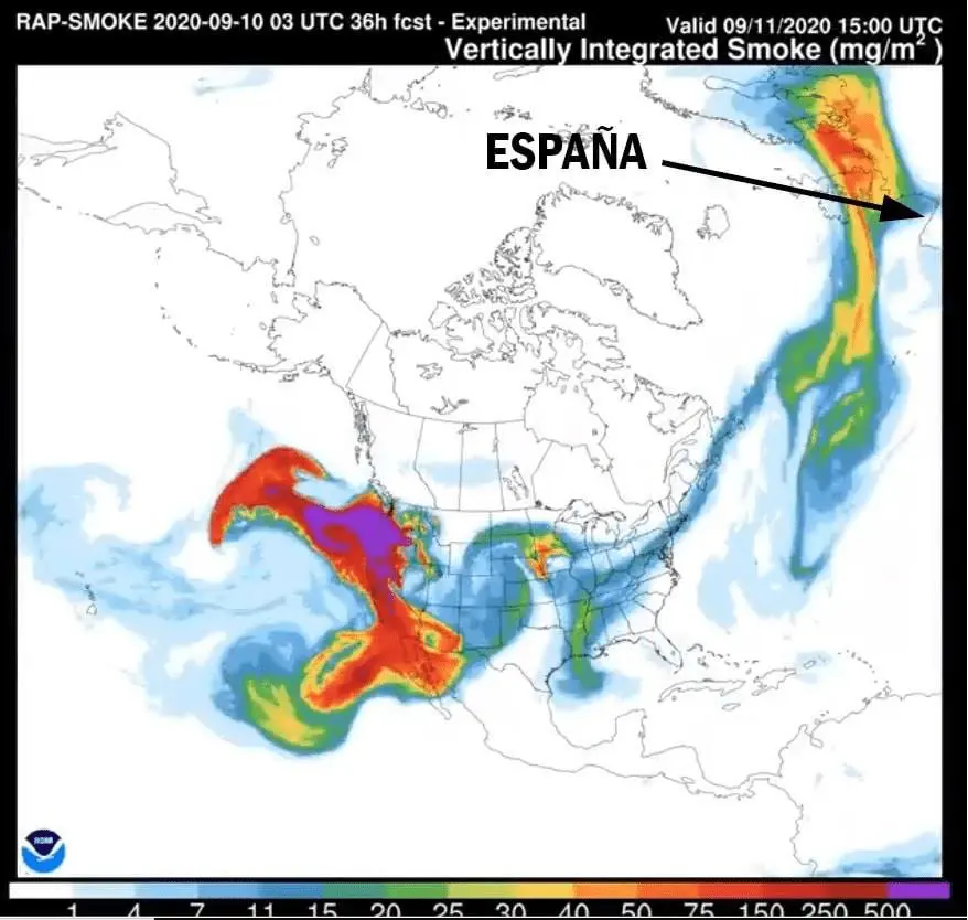
Smoke from wildfires across West US during last days has overcome Atlantic and has shifted above Europe!
Informed about this FB page Jurnal de Vreme with links to meteopage METEOHELLÍN from Spain.
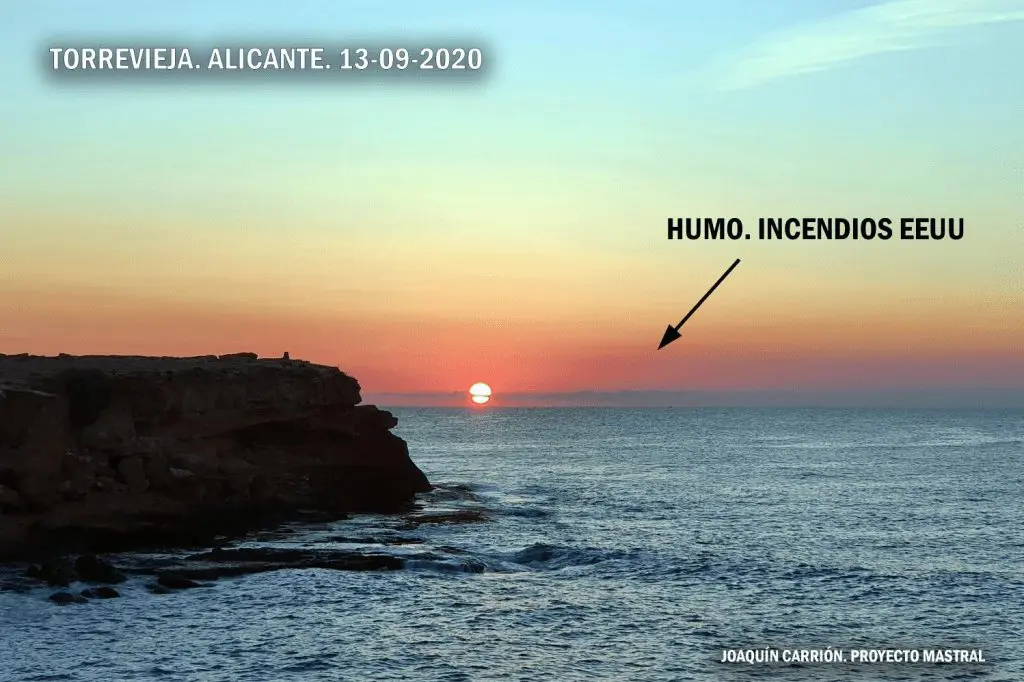
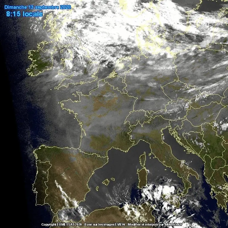
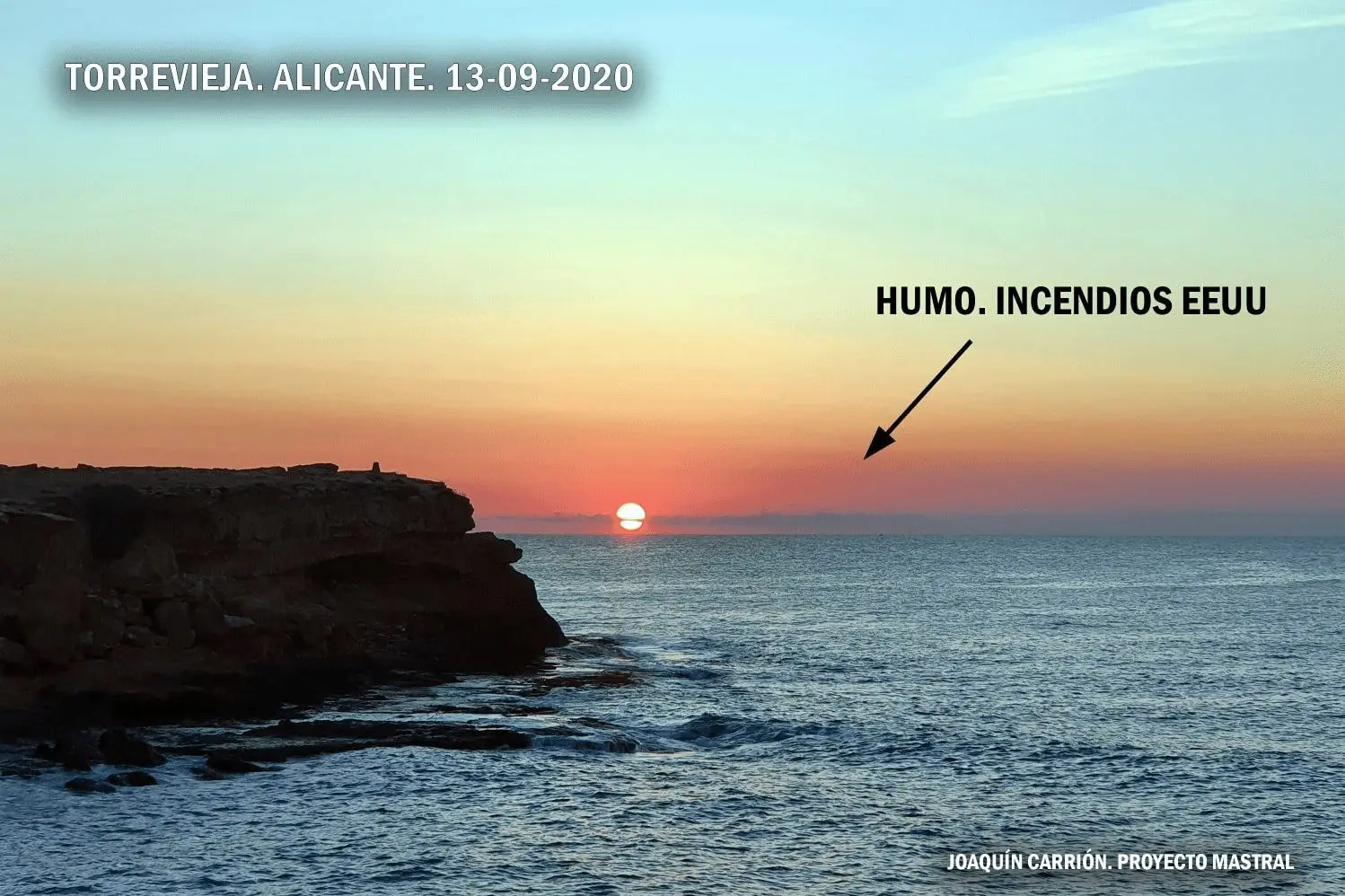
Dust above parts of Europe is very well documented by Vertically Integrated Smoke (mg/m2) parameter outputs from NOAA, satellite images and too, photos from places, where dust has been visible without any special technique.
After dust appeared above Spain, British Isles and Scandinavia on Friday. On Sunday and Monday a “dust cloud” has shifted over western and central parts of Europe and has continued with southeastward direction.
West US wildfires are the worst wildfires in US history /https://mkweather.com/2020/09/13/californian-and-oregon-fires-44-341-mil-acres-31-dead-500-000-people-in-oregon-evacuated-air-quality-as-you-have-smoked-25-cigarettes-per-day// and they are result of extremely hot summer (Deathy Valley and Los Angeles absolute temperature records both, Phoenix more than 50 days above 110°F). Dry and hot weather with extreme fire risk will be continue until December 2020 according to NOAA, therefore, situations with North-American dust over Europe could repeat during next months.
Infographics: Vertically Integrated Smoke (mg/m2) parameter (NOAA), photo from Alicante, Spain and satellite image /Jurnal de Vreme, Meteohellín/