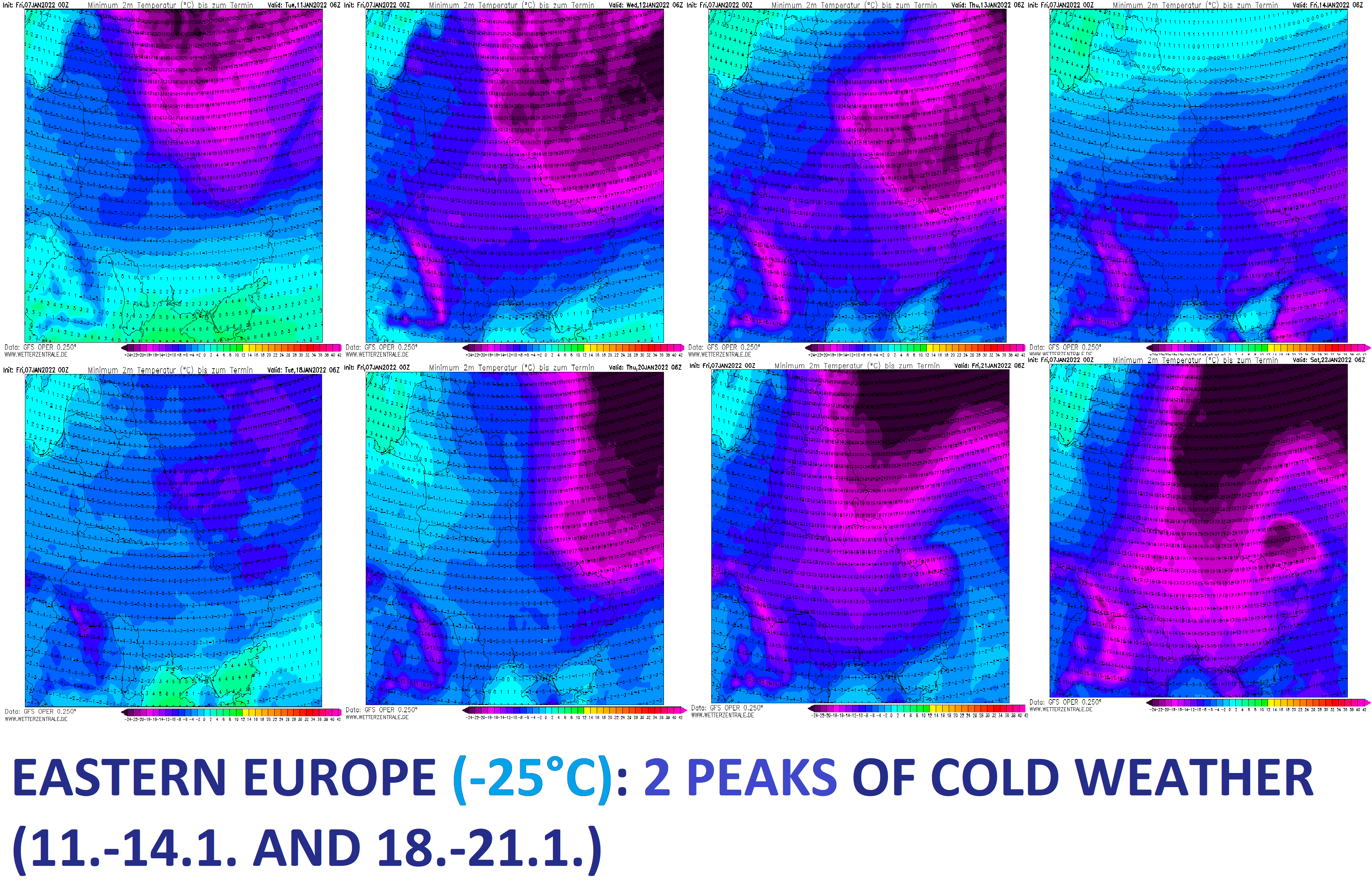
Eastern Europe (-25°C) with 2 peaks of severe winter (11.-14. and 18.-21. January 2022)
An upcoming Greenlandic, Arctic, and Siberian blasts above Europe should according to the latest runs of GFS persist above Europe long 10-12 days and bring the next anomalously cold period and snowfall.
In the next series of articles, we will look gradually at predicted temperatures and snowfall in Continental (Central) Europe, British Islands, France, Iberia, Italy and Balkan, Eastern Europe, Turkey, and Scandinavia.
For Eastern Europe (Ukraine, Belarus, Baltic region), GFS in the last runs has seen severe coldwaves with peaks around 11.-14. and 18.-21. January 2022, with severe frosts in eastern and mountainous regions (the Carpathians) up to -20/-25°C, maybe very rarely -30°C, in European Russia up to -40°C.
Maximum temperatures should drop below 0°C, with ice days (all-day frosts) hitting almost all-region, temporarily, and even, Arctic days, with maximum temperatures below -10°C will be relatively common during peaks.
In many parts of Eastern Europe, snowing, creating a new snow cover, or regionally blizzards, are forecast.
Prolonged extremely cold weather should have an effect on health, power outages, or problems in travel, especially in mountainous regions.
In metropolitan cities, minimum temperatures will be higher, around -15/-20°C, rarely up to -25°C up to -25°C will be in Carpathian valleys, too, easternmost regions it should be up to -30°C, parts of European Russia should reach -40°C.
Coldwave will be gradually shifting eastward from Europe, above Western Asia, and finally above northern India, with a possible peak of Winter 2021/2022 in many regions.
The first round of frosts is forecast to start already in around 4 days, therefore it´s very probable, that severe frosts will really come, long-term forecasts will be updated on Mkweather, soon.

Illustration picture: wetterzentrale.de
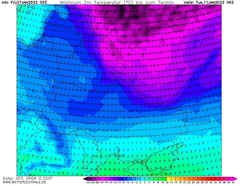
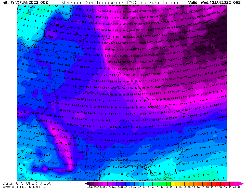
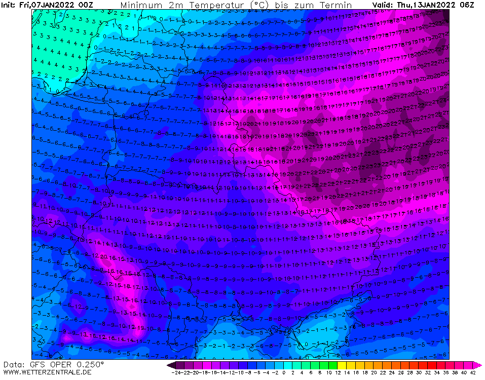
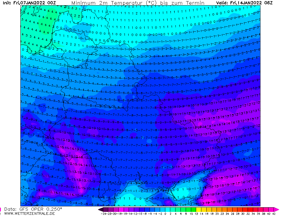
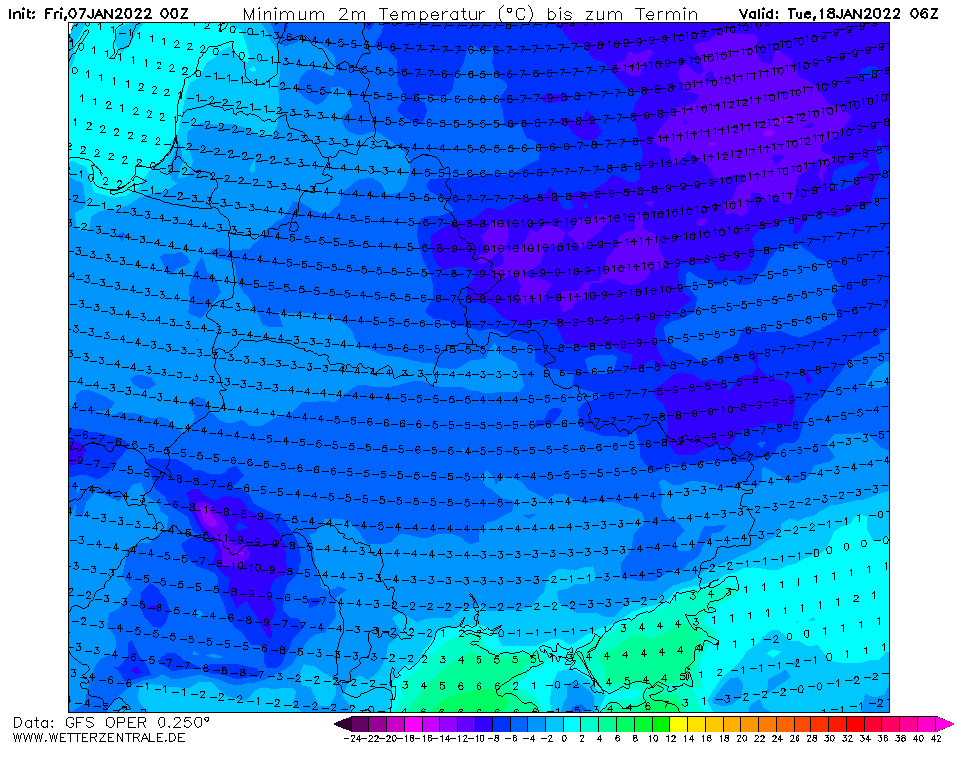
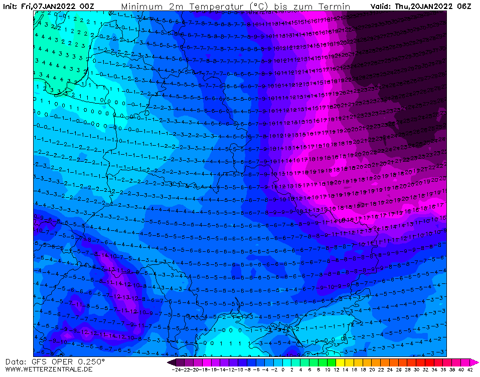
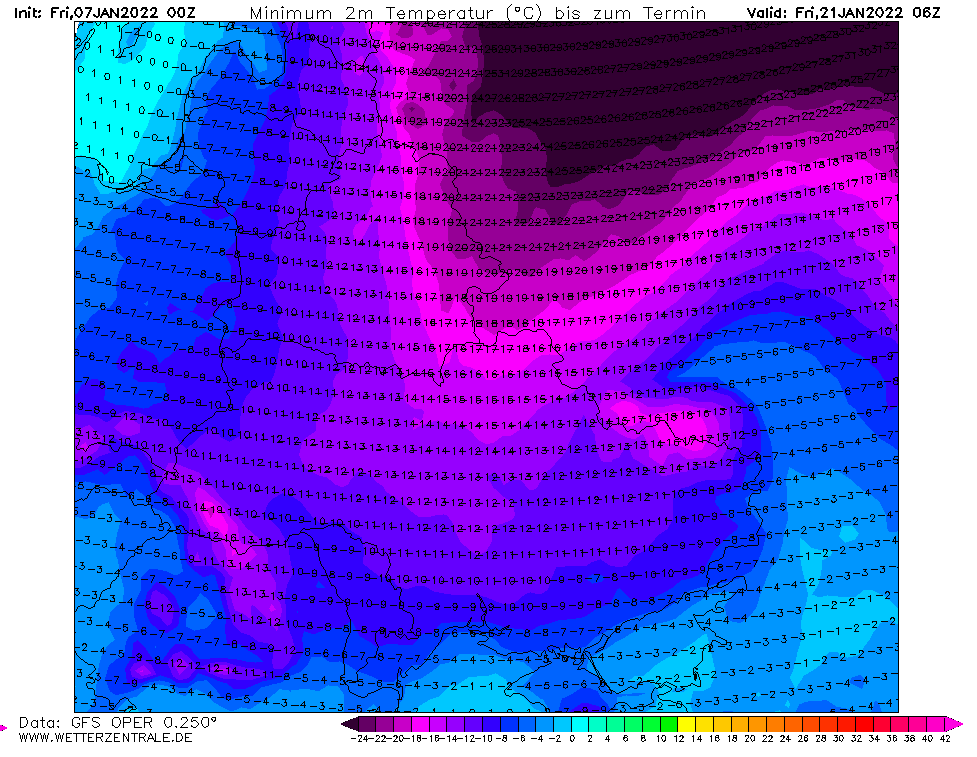
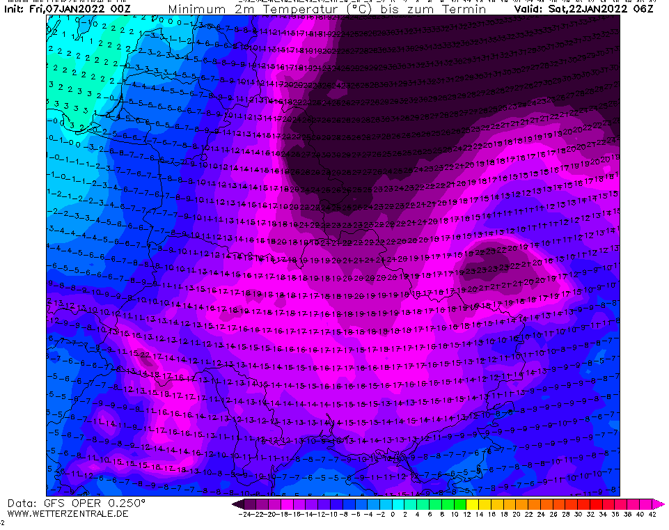
Source: wetterzentrale.de
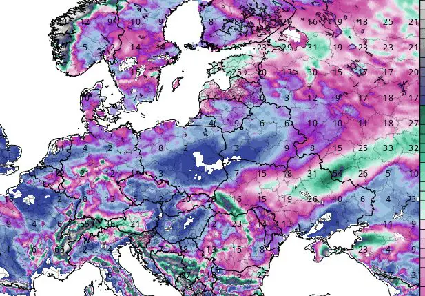
Expected snowfall. Source: tropicaltidbits.com (7.1. 12Z)


