Ex-hurricane Isaias is bringing damaging winds, flooding rain and tornadoes
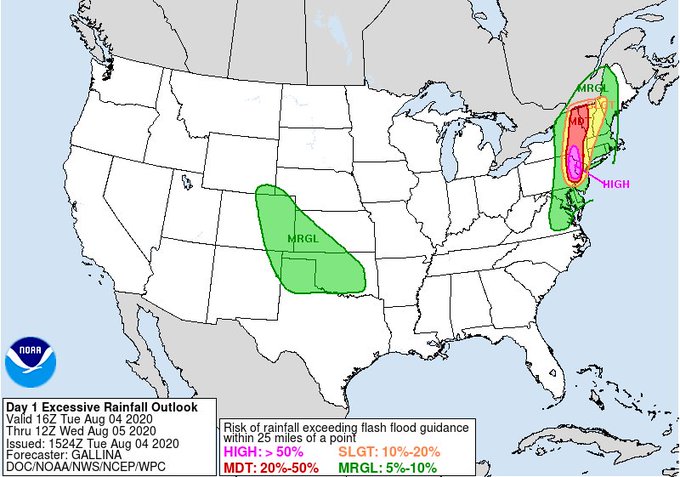
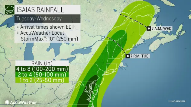
Near East Coast, Isaiash for several hours was strenghtening to 1st category and then hit East Coast and southern Northeast of US. Sustained winds in maximum of development of hurricane reached 85 mph / 137 km/h. After arrival above a land, flooding storms, tornado watch and severe wind were present. In larger region was heavy rain 4 – 8 inches (100 – 200 mm) expected (see a documentation).
Isaias is linked not only with damaging storms, gusty storms, coastal effects and floods, but too with coldwave in Midwest /https://mkweather.com/2020/08/03/autumn-weather-is-beginning-across-midwest-international-falls-already-39f-39c//.
Moderate alerts before excessive rainfal up to Ontario and Quebec are on Wednesday valid, then system will be weakening and suddenly will change shift of its stormtrack from northward to the eastward and during rest of a week, such as ex-tropical cyclone will shifting southerly from Greenland further with European direction.
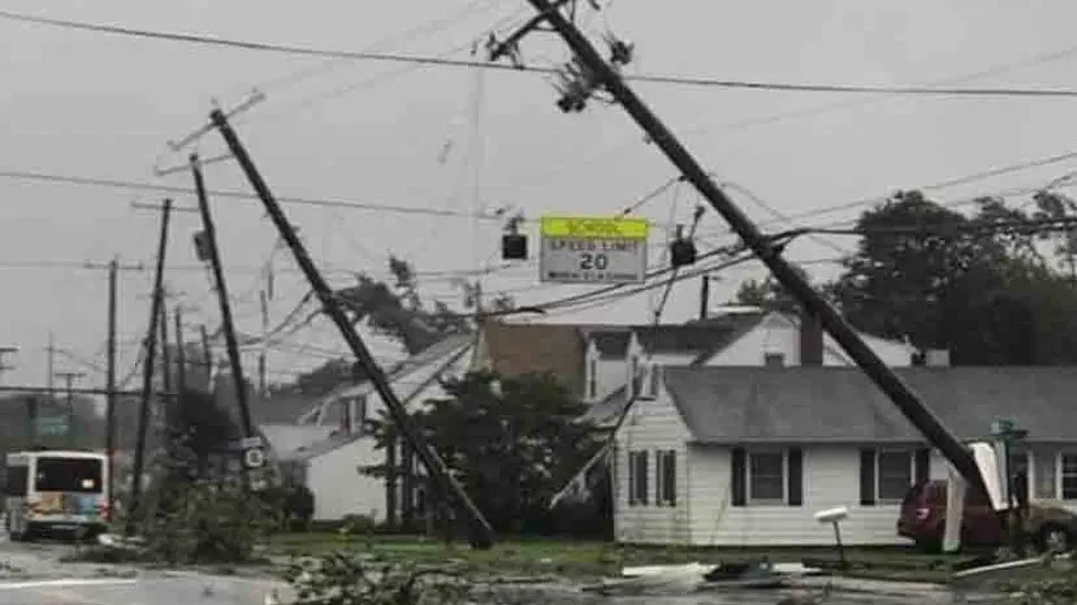
Flood watch is in Tuesday evening live from Washington D.C. to Maine and Canadian borders. Wind gusts in area could reach rarely up to 80 mph / 130 km/h and storm-driven tornadoes were already confirmed e.g. from Delaware.
In Eastern Asia, typhoon Hagupit is doing problems too and near Philippines, next tropical depression is developing.
Hurricane season 2020 is very strong and tropical storm and hurricane activity is very early, but still not so much such e.g. in 2005. We will monitor the situation and will bringing current tropical storm / hurricane news during the next months – the peak of hurricane season.
Documentation from Weather Nation, Accuweather, Wunderground and Tropicaltidbits