Ground frosts are possible in Great Lakes area and frosts in Ontario during next 10 days

As we announced during on Thursday /https://mkweather.com/2020/08/13/extremely-hot-west-vs-very-cold-east-us-is-waiting-big-changes-of-circulation-storms-will-be-weakening//, a big coldwave in eastern half of US is expected.
Situation crystallizes gradually, and meteorological models are expecting 2 big waves of cold over Norther America till end of August 2020.
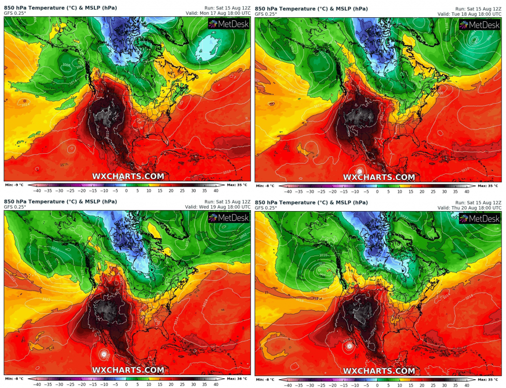
First coldwave hit eastern half US and East-Central Canada during next 4 days, from Monday to Thursday 17.-20. August 2020, with temperatures in 850 hPa below 0°C over northern Ontario and below 5°C near US borders in Great Lakes area. In air mass such this, local ground frosts are possible in Great Lakes area and regular frosts in northern parts of Ontario.
Cold air will flood the whole territory of eastern half of US and stormy and hot pattern will be replaced with more calm, colder pattern, with weaker storm activity, only in Midwest will be risk of severe T-storms and tornadoes in contact with hot air mass over west half of North America.
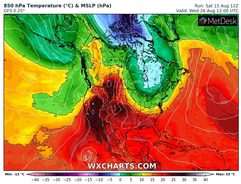
Second cold wave, from the next weekend, will be very powerful in large parts of Canada and Great Lakes area, with even lower temperatures than previous, but later it hits mainly Northeast, Mid-Atlantic and East Coast.
On the West/Southwest, excessively heatwave is ongoing and extremely hot weather stay here minimally till end of the August.
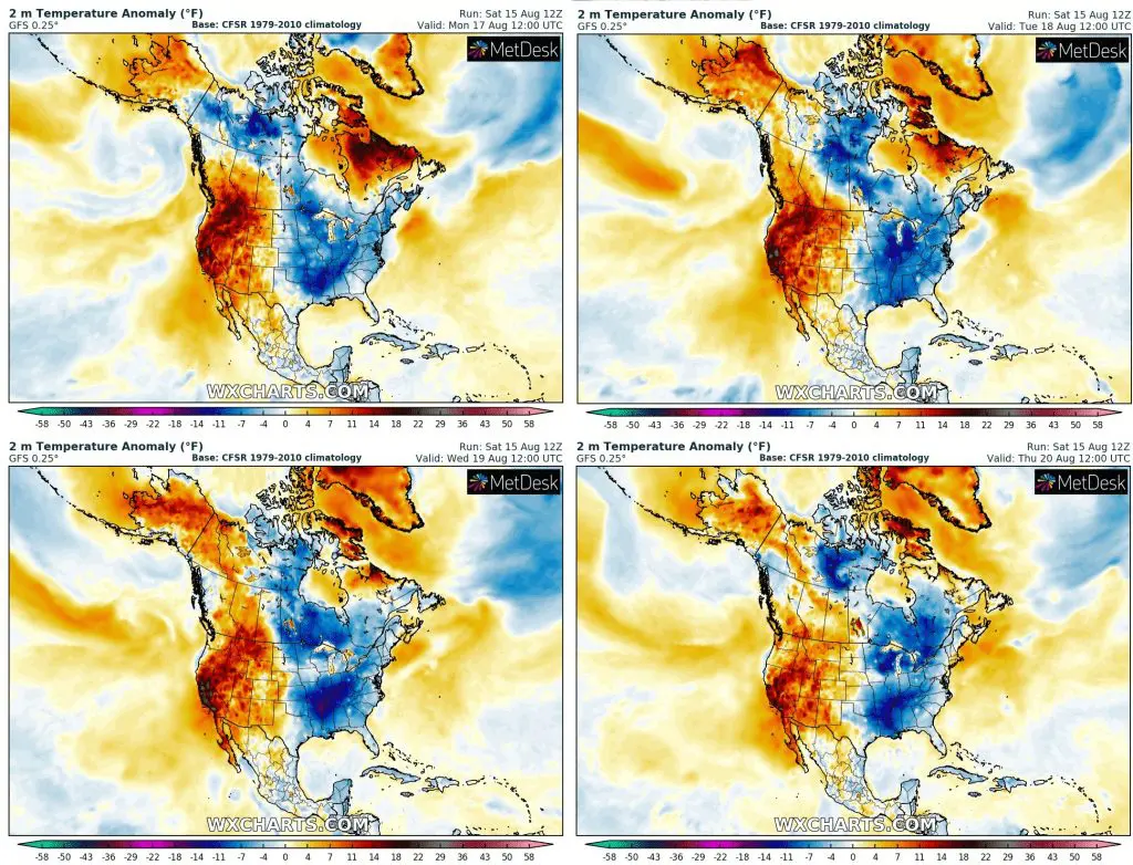
Expected anomalies of temperature in 2 metres over North America from Monday to Thursday 17.-20. August 2020, wxcharts.com:
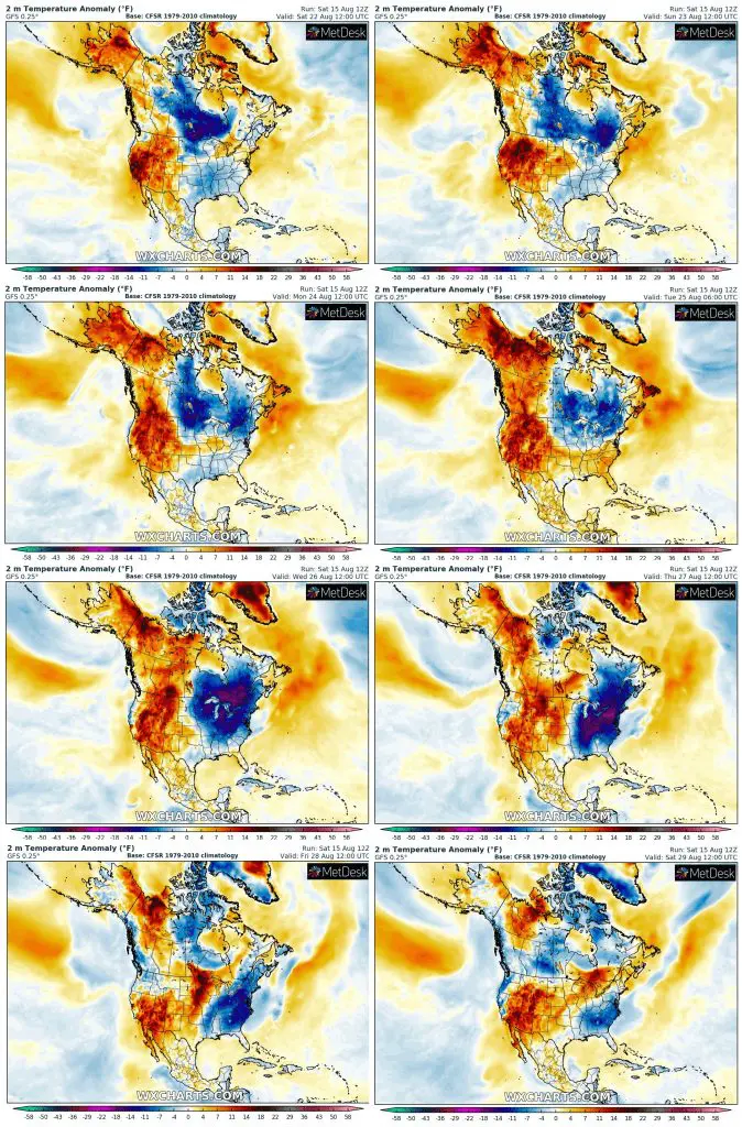
Expected anomalies of temperature in 2 metres over North America from 22. to 29. August 2020, wxcharts.com:
T850hPa from Monday to Thursday, 17.-20. August 2020 and in the middle of second coldwave around 26. August 2020, wxcharts.com: