High flood risk for Lebanon, Israel, parts of Syria, Iraq, Iran, Egypt, Libya, Turkey, and Cyprus: The first significant flood event in Iraq killed 11
In the last period, local floods were reported from Oman or Jordan, but the worst has come above the Middle East only in the last days and hours, with severe floods in Kurdistan, northern Iraq.
The city of Erbil was flooded for the second time in 6 weeks, with a result of 1-1,5 meters high floodwater and 11 dead.
Before the arrival of extreme rains into northern parts of the Middle East and Turkey, we have warned already in the last Mkweather article /https://mkweather.com/turkey-4-year-seasons-in-1-anomalous-rainfall-snowfall-and-cold-blast-in-outlook//.
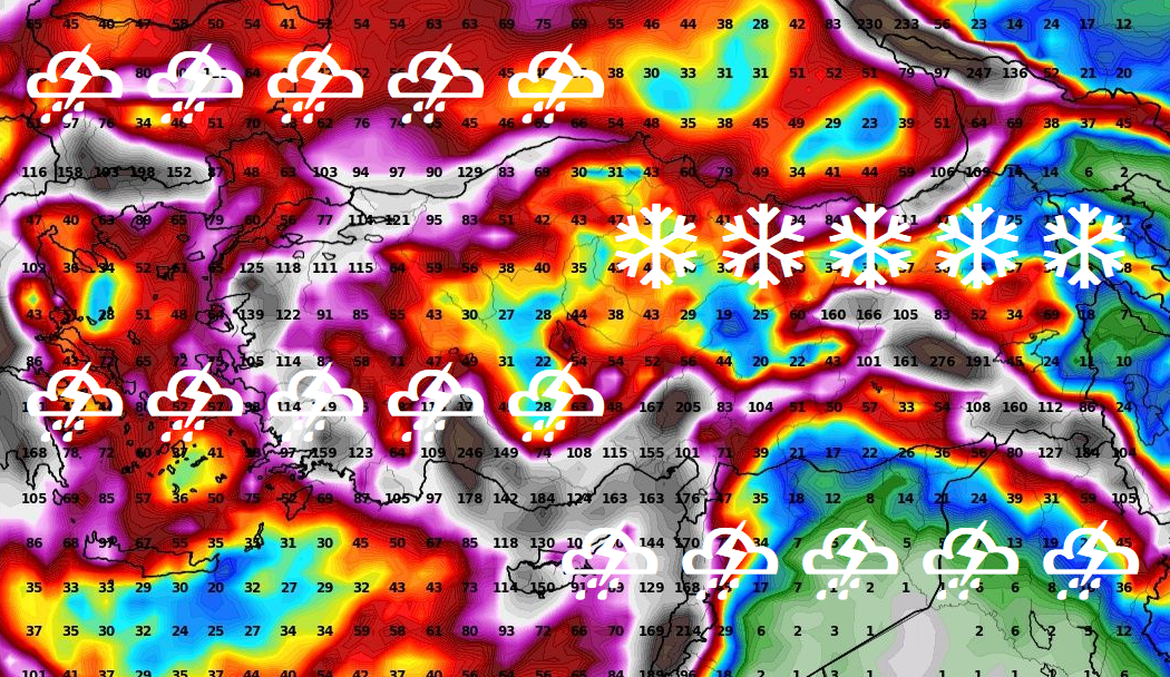
In Turkey and the mountains in the Middle East, even, snowing and frosts are forecasted. Ground frosts or rare snowfall should appear in lower situated areas, below 1000 MASL, too.
A reason of the cooldown is that anomalously cold air from Europe, which has brought between 23. November – 17. December 2021 many temperature and snowfall records /visit our homepage: https://mkweather.com//, has already shifted above the northern Middle East, together with a powerful cooldown, precipitation, wind, and cloudiness.
The initial factor for this cooldown and flood risk in the region was NAO- phase lasting from late November to early December 2021, which was linked with many Mediterranean pressure lows, which such as Western Disturbances continued on their way just above the northern Middle East and Turkey.
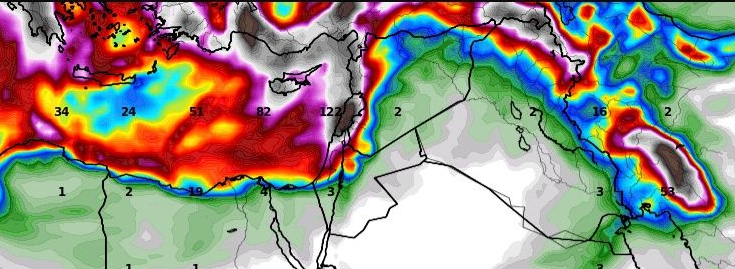
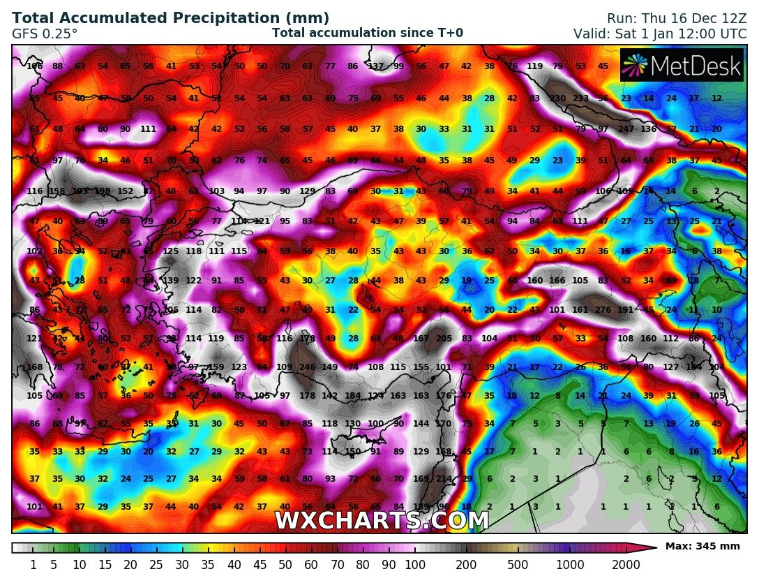
The worst however should only come – high flood risk is valid mainly for Lebanon, Israel, the coast of Syria, eastern Iraq, Turkey, parts of Iran, and NW Jordan.
Regionally, 100-300 mm, locally up to 500 mm rainfall in a very short time is in mentioned regions possible, especially along the eastern Mediterranean coast, in Lebanon, northern Israel, Syrian coast, Cyprus or southern Tukey.
Western Turkey and Greece should be hit heavily, too and heavy rains should surprise the coast of Egypt or Libya.
After 10. January 2022, a gradual shift into the NAO+ phase is forecasted, therefore a cold and stormy period in the second half of December and in early January 2021-2022 should be considered such as the peak of Winter 2021/2022 in the region. It agrees with our Winter 2021/2022 forecast for continents of the Northern Hemisphere /https://mkweather.com/winter-2021-2022-forecast-for-northern-hemisphere//.