Labrador is under the snow! Extreme powerful cyclone has shifted above eastern Canada last weekend and this week, with blizzard conditions firstly in Toronto /https://mkweather.com/2020/11/25/toronto-19-4-cm-and-denver-12-7-cm-with-newest-snowfall-records-on-sunday-and-tuesday-22-24-november-2020//, where dropped 20 cm of snow / 24 hours (a new record for 22. November) and then in Quebec and Newfoundland, where blizzard conditions were extremely crazy!
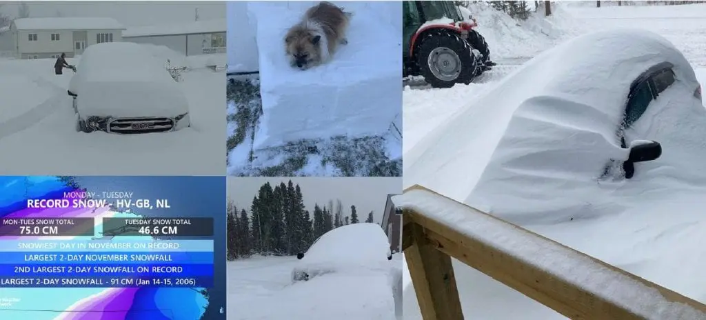
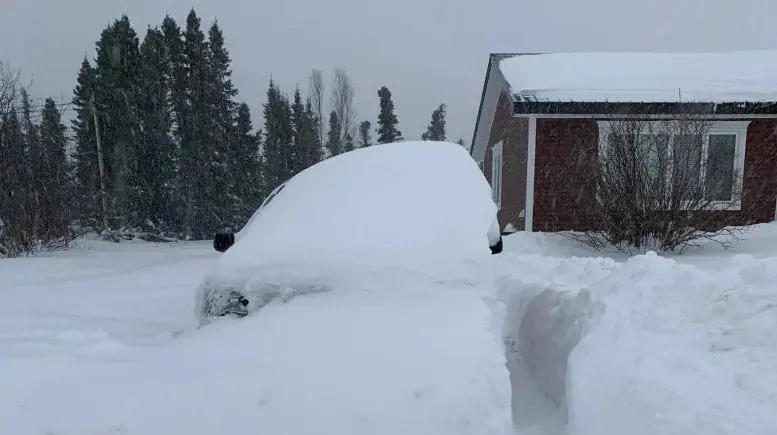
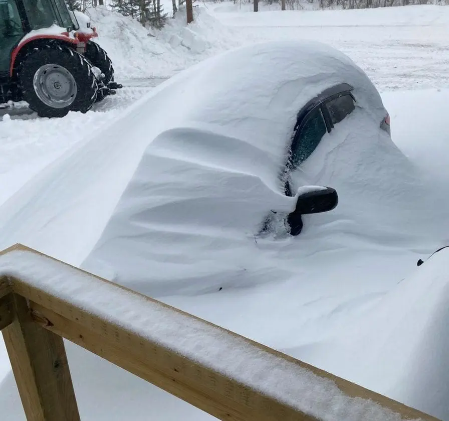
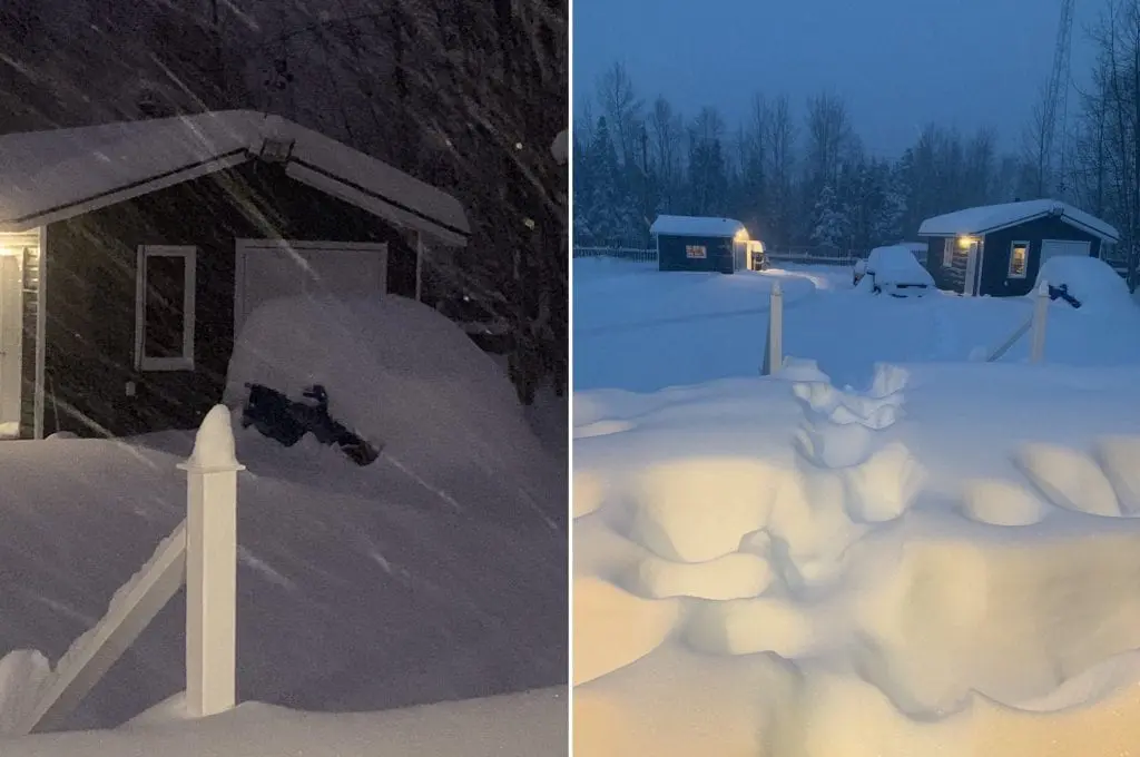
Everything in parts of Labrador and Newfoundland has ended up under the snow.
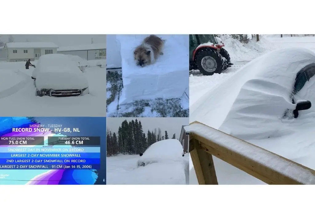
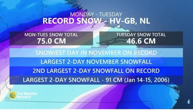
This week, between Monday and Wednesday, 23.-25. November 2020, 75 cm of snow has fallen in the station in Newfoundland for 48 hours and it is the second highest snowfall in all-time history! Only 14.-15. January 2006 fell in Happy Valley-Goose Bay more snow than in last days, 91 cm.
It is the 5th time in the town’s history, since records began in 1942, that a 70+ cm snowfall event has been recorded according to The Weather Network /https://www.theweathernetwork.com/ca/news/article/photos-labrador-buried-under-historic-70-cm-of-snow-towns-shut-down/.
Schools were closed, mail delivery was halted, flights were cancelled according to cbc.ca /https://www.cbc.ca/news/canada/newfoundland-labrador/labrador-blizzard-newfoundland-wind-1.5813768/.
Blizzard was associated moreover with wind gusts around 100 – 120 km/h, therefore, windchill and conditions for survival were extremely bad for people outside.
At the end of November and the first December day, next storm with blizzard conditions in southern Ontario, Quebec and parts of Midwest and Northeast is expected /https://mkweather.com/2020/11/26/extreme-storm-hits-northeast-on-30-november-1-december-2020//, what should bring next severe snow conditions in the area.
Only in Ohio state and its neighborhood should fall up to 50 cm of snow and similar should be situation in some parts of southeastern Canada.
Infographics:


Read more: