Hurricane Iota: Rapid intensification and Category 5 not impossible! (Next deadly hurricane in Central America)
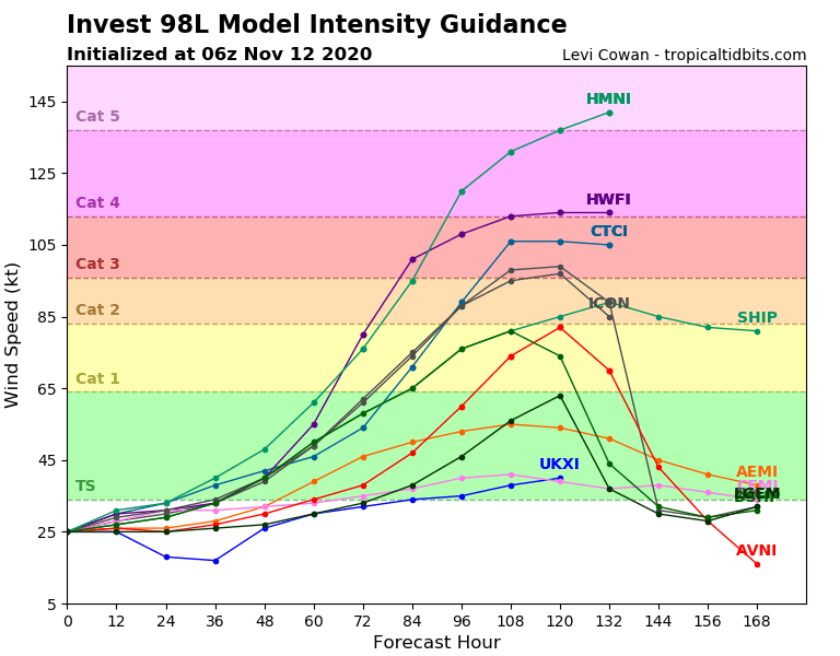
Currently developing storm in the Caribbean, next expected tropical storm and hurricane Iota should be even more stronger, than was expected before 24 hours!
About possibility of rapid intensification we have written in previous article /https://mkweather.com/2020/11/11/iota-should-surprise-as-almost-a-major-hurricane-in-central-america-pro-hurricane-conditions-of-mjo-around-30-11-again//, when forecasting tools have not seen stronger variants of development of the system.
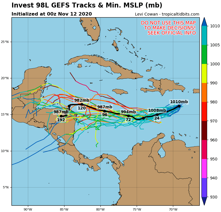
Its true, that waters of southern Caribbean are extremely warm and track of expected hurricane Iota will have westward direction – direction above these warm waters of Caribbean sea, with almost any obstacles in the form of islands or bigger land areas.
Thanks many favorable expected conditions, few models not exclude variants with Category 4 or Category 5 development of Iota already in next 120 hours / 5 days – until Tuesday, 17. November 2020.
On Friday and at the weekend we will see, how will be forecasts changed and if updated will favor rapid intensification or not.
For now is very probable, that countries of Central America hit after Eta in a very short time next major hurricane, with possible deadly impact from Panama to southern Mexico – mainly in Nicaragua, Honduras and Guatemala.
Eta such as strong Category 4 hurricane, was the second strongest November hurricane ever (with more than 250 killed), therefore, next Category 4 or Category 5 in the same region would be very big surprise. Circulation parameters are however good – La nina and wet MJO, with mentioned relief conditions…
Let´s be surprised (and mainly prepared)!
Infographics: tropicaltidbits.com: