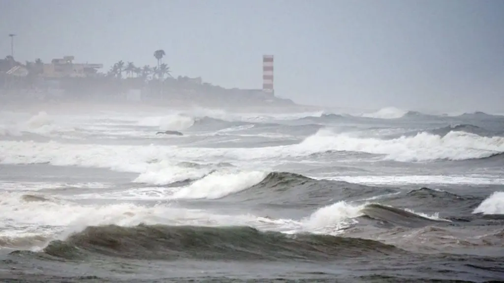
Altough London is not under influence of jet-stream and southern England in Thursday reported summer day /+25,5°C/ (Pershore), from the northwest is coming unrequested change – a powerful cold front, which is bringing these times in many parts of NW Europe significant worsening of weather with rain and strong wind. The worst situation is in west Iceland, where is valid warning 2. level from meteoalarm.eu and Icelandic Meteorological Office, strong winds reports too Scotland and Norway and Finland are preparing to high sea waves. Around 7:00 Icelandic time NW Iceland (260 MASL) reports only +2,2°C and heavy rain /https://en.vedur.is/weather/observations/areas/west-fjords/#group=13&station=32390/ – it was a conditions close to snowing.
Wind gusts in Iceland during last hours are reaching severe values, according to reports in ECWD the most strongest wind gust the meteorologists observed in Hraunsmúli in NW Iceland – 160 km/h (44 m/s). Strong winds has arrived to Scotland already – Aonach Mor is reporting 120 km/h, Cairngorm 119 km/h and Cairnwell 96 km/h. Norway is reporting 90 km/h for now. It is possible that these values will be higher during a Friday and Saturday and stronger wind will appear gradually in a rest of UK´s territory.
Warnings for for the whole of Europe, Canada and the USA for next 3 days
For big interest of our warnigns we have expanded the offer of warnings for Europe and North America (US and Canada) for next 3 days! You can now see on our webpage summary maps, which including of every state in Europe / territory in US and Canada and color warnings before severe weather phenomenas.
As we can see on maps, Eastern, East of Central Europe and Balkan will be bothering severe storms during the next 3 days, while Southwestern Europe alive a heatwave and Northwest had to be prepare for regionally wind or rain events. Heatwaves will come back to Caucasian area and Turkey very quickly and storms in Russia can be in contact with hot air from south above +20°C /68°F in 850 hPa.
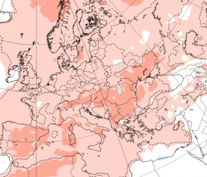
Heatwaves for Northern regions is GFS expecting in Friday only in the end of July – 30.7.2020 with T850hPa above southern Germany +20/+22°C what could be a potential for +36/+38°C (97/100°F) in this area and over +15°C in 850hpA above northern coast of Germany and Denmark with temperatures up to +32°C (90°F).
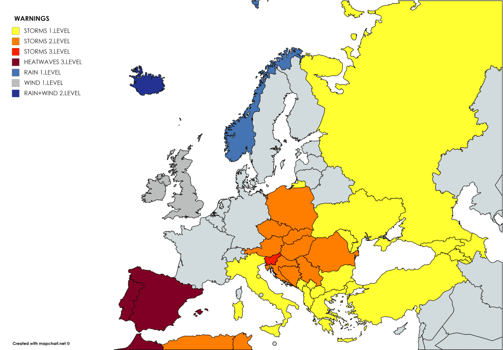
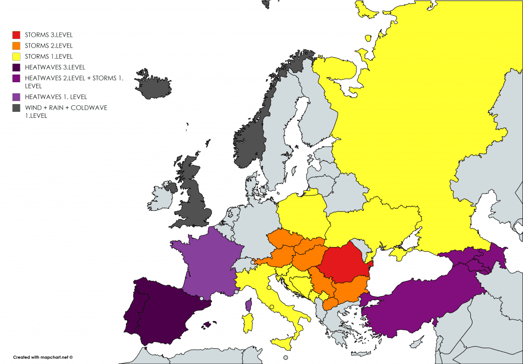
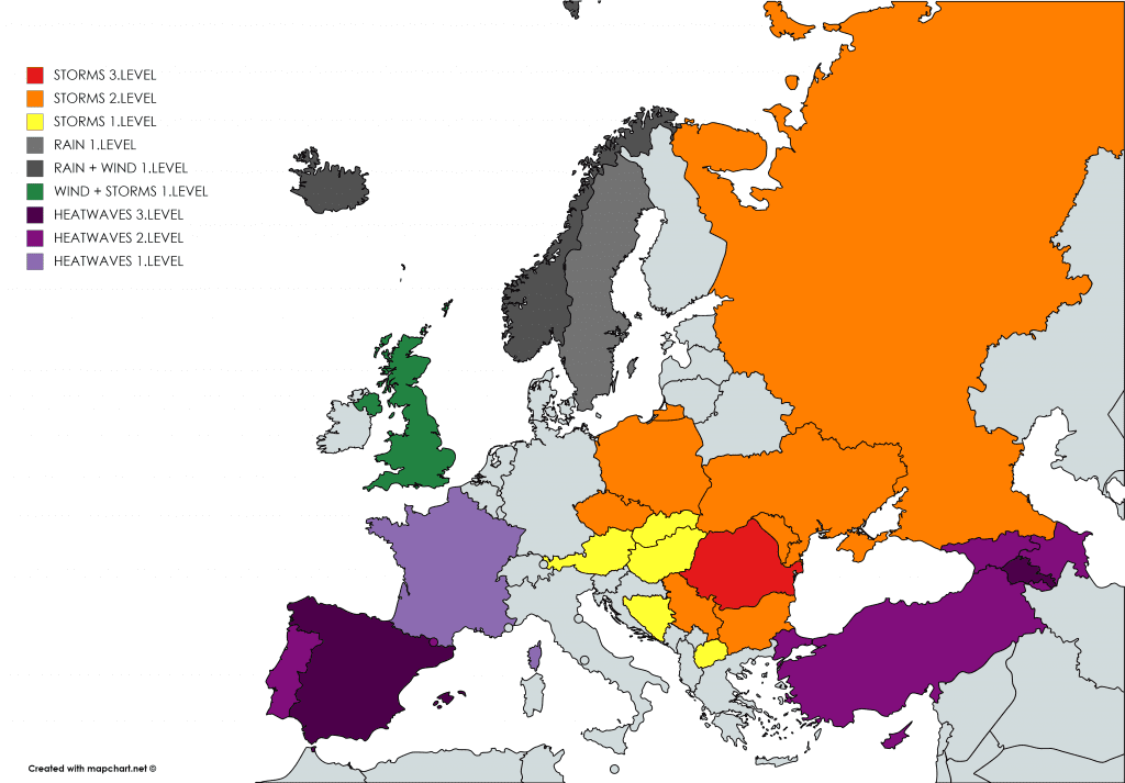
Our warnigns you will find here: https://mkweather.com/warnings/; https://mkweather.com/warnings-2-day/; https://mkweather.com/warnings-3-day/; down: forecast T850hPa from GFS from wxcharts.com to 30.7.2020
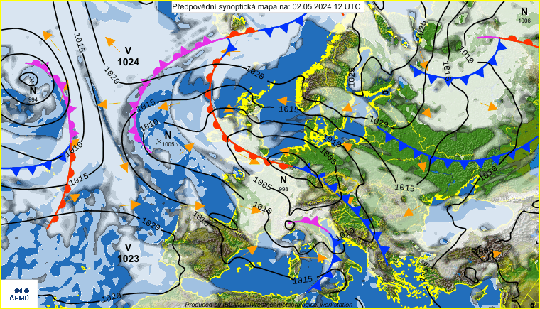
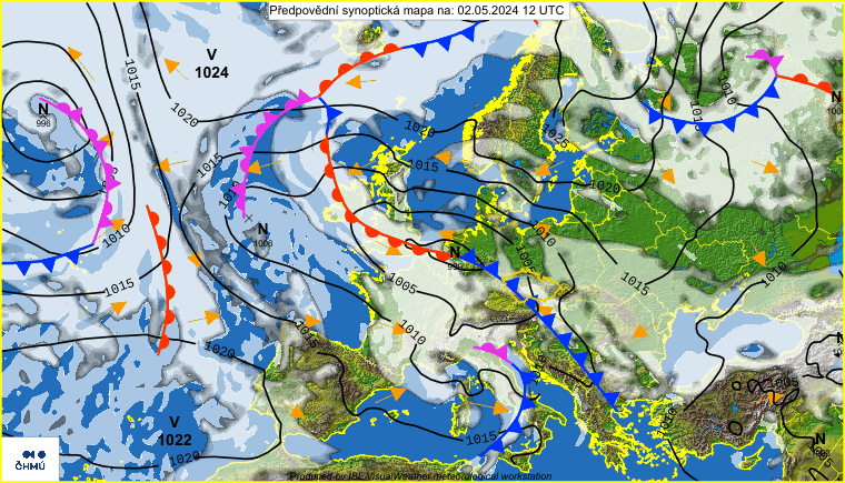
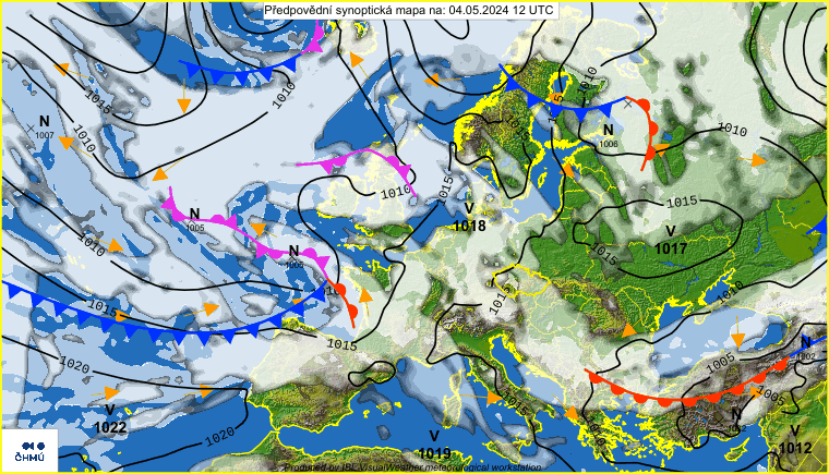
Synoptic forecast for next 3 days from chmi.cz – powerful cold front brings next round with fresh air from Northwest
The most severe coditions for storms in Great Lakes area and Midwest, the largest anomalies from average temperature on the Eastern Coast
Many states of the US in the Northwest/Midwest are waiting during next 3 days severe storms – in Friday mainly KS, MO, OK and AR with combination of very hot air and area of Great Lakes and Quebec. In the Southern US will be furthermore extremely hot, but at the weekend, largest anomalies of temperature across US will shift into Eastern coast resp. Northeast.
In California are reporting wildfires /https://www.wunderground.com/article/news/news/2020-07-16-california-wildfire-coalinga-mineral-fire-evacuations/, but in the Southwest temperatures will drop slightly during next days. West Canada and Alaska are waiting signs of regional heavy rains or winds.
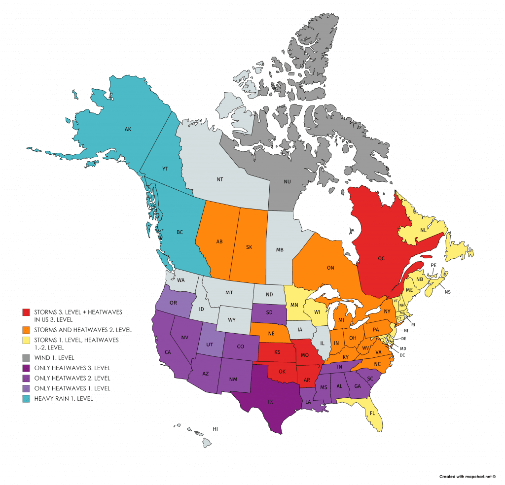
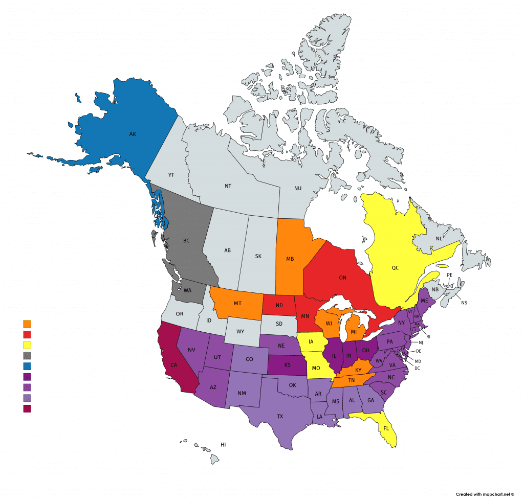
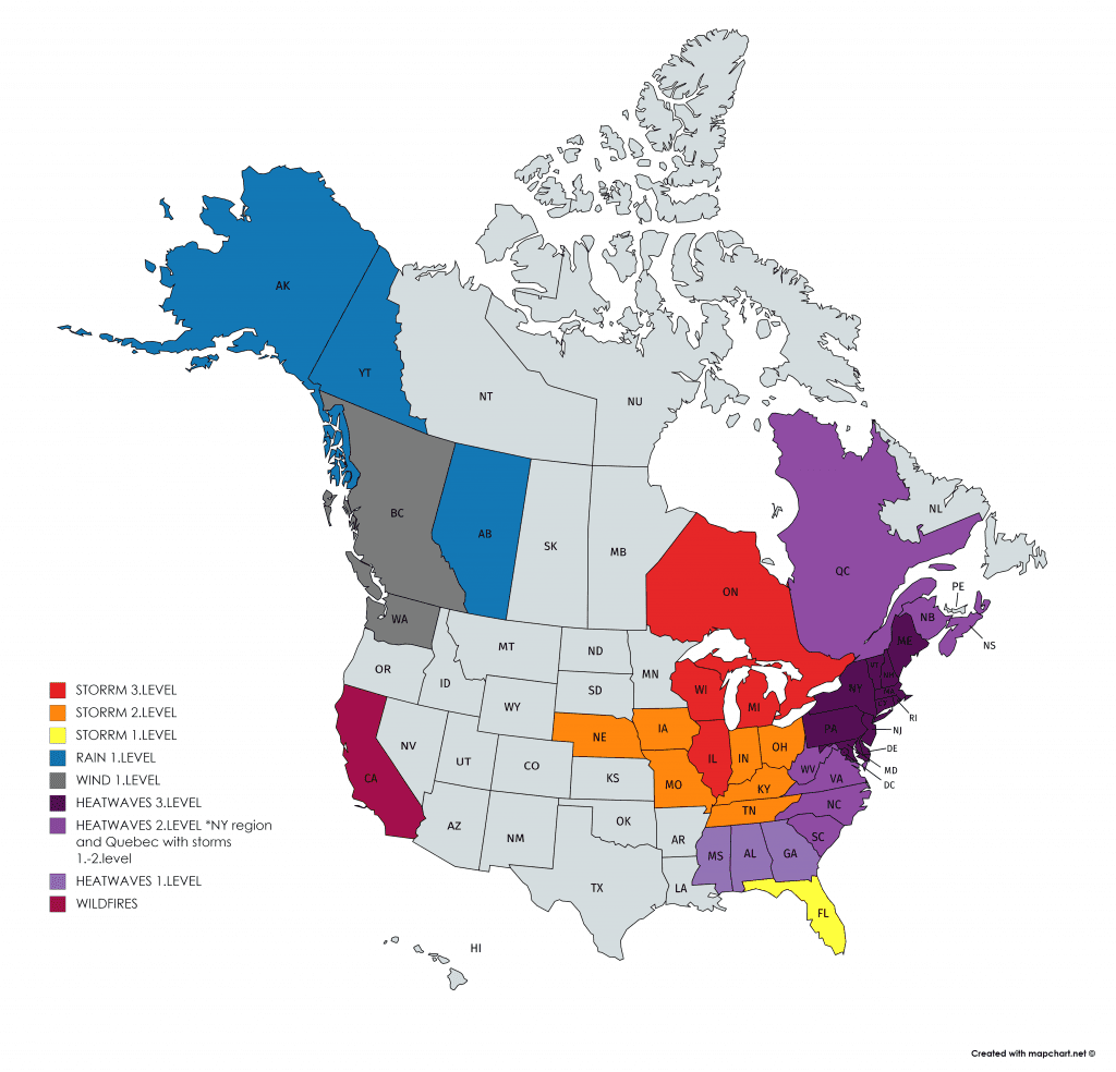
Our warnings for US and Canada for next 3 days /https://mkweather.com/warnings/
