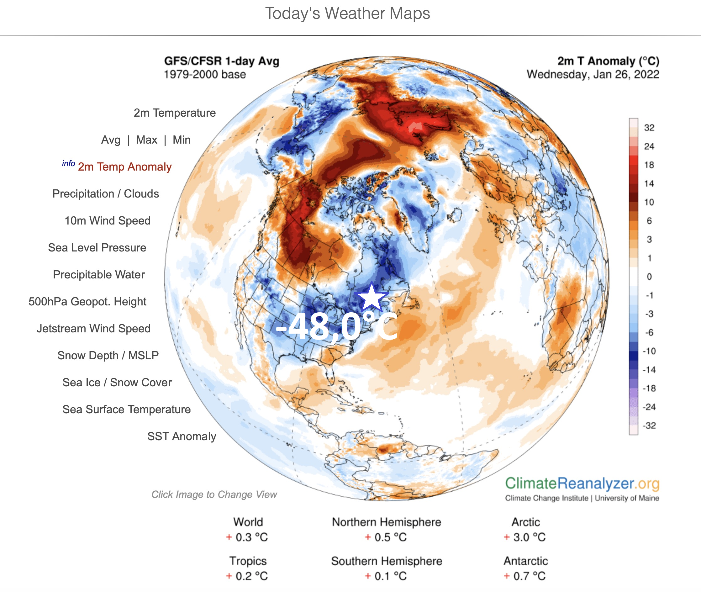
Quebec hit extreme frosts up to -48,0°C, Ottawa reported the lowest temperature since 1996, -31,8°C and experiences with the coldest January since 2004
In the next 3 Mkweather articles we will return back to North America and we will look at 2 events linked with extreme Arctic winter (in Canada and the central and eastern third of the USA) and then 1 warm spell event in the Southwest, with winter heatwave and wildfires.
Firstly, we will look at the coldest parts of the continent, in Canada.
Extremely low temperature, only -48,0°C in Lac Benoît, was surprisingly measured in southern Quebec near Saint Lawrence River.
It´s only 2,1°C above the all-time station record from the year 2005.
It´s the lowest temperature measured in eastern Canada in Winter 2021/2022, so far.
Anomalously cold times however hit in the Great Lakes region, too, with measured -31,8°C in Ottawa on 23. January 2022 (maximum temperature this day only -16,7°C).
This temperature is the lowest measured value in the Canadian capital since 1996 when -33,1°C was measured /https://www.cbc.ca/news/canada/ottawa/extreme-cold-weather-forecast-ottawa-gatineau-temperature-1.6326662/.
Moreover, Ottawa suffers the coldest January since the year 2004, a few days before the end of the month so far, and the next severe frosts are in the next period predicted.
Windchill (real-feel) temperatures during the coldest days are reaching up to -40°C in the capital city.
Soon, Nor´Easter is forecast for the region of New England, Northeast, the USA, which hit parts of southeastern Canada, with blizzard conditions, too.
A peaking of Winter 2021/2022 is possible in the first February 2022 week /https://mkweather.com/ecmwf-forecast-for-the-usa-until-14-march-2022-after-last-2-cold-weeks-return-of-very-warm-south-and-east-with-a-possible-kentucky-like-pattern//, then the warm spell to the western half of Canada will come, but overall, until 15. March 2022, still many cold air masses will be persisting above parts of the country. Great Lakes region and southeastern Canada should be hit by storms or warm spells from the eastern USA, temporarily (link above).
Source: Thierry Goose Twitter


