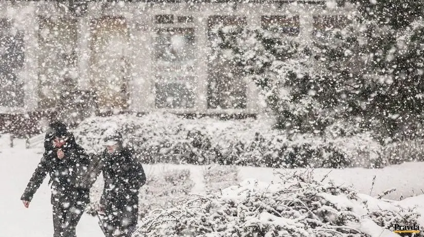
The first snowfall in large parts of Slovakia and Moravia from Tuesday to Wednesday, 13.-14. October?
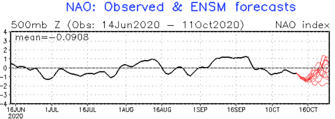
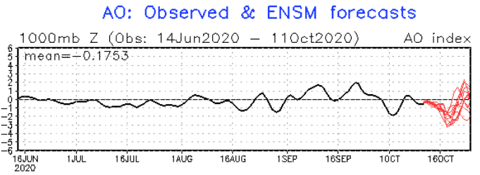
NAO and AO indices reach soon their peak of declining trend and over more and more southern latitudes is flowing extremely cold air, at first with rain and wind and then with frosts or even possible snowing in parts of Europe.
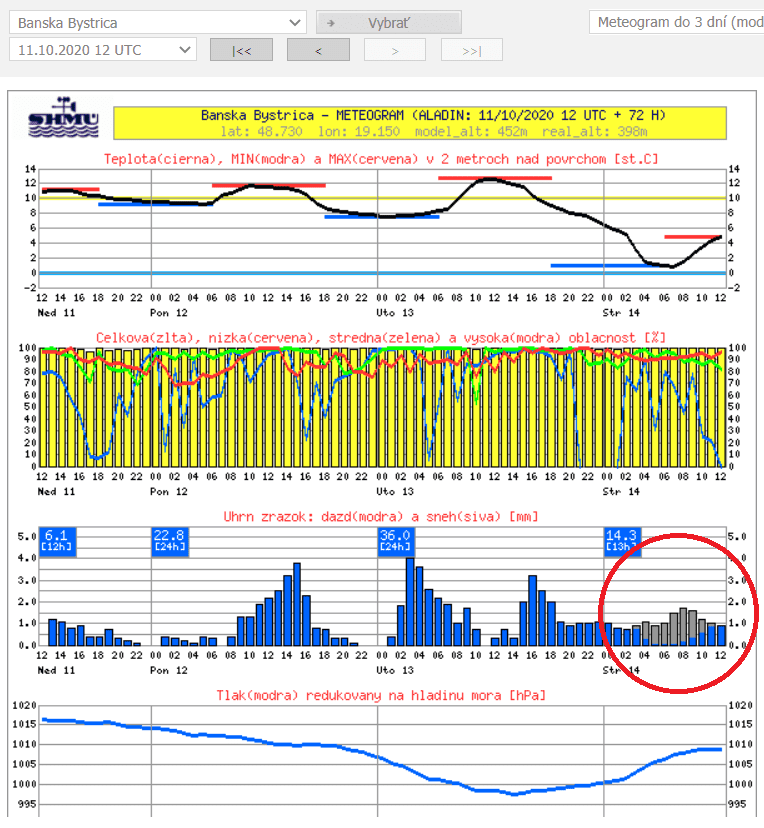
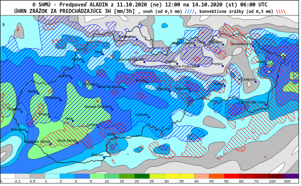
Very surprising outputs of meteorological models has surprised meteorologists in Slovakia and Czechia, with expected snowfall over large parts of Slovakia and Moravia during night from Tuesday to Wednesday, 13.-14. October.
Snow should surprise almost all Central Slovakia, but too western parts of Eastern and northern parts of Western Slovakia. In Czechia, Moravia should alive very early snowfall in 2020.
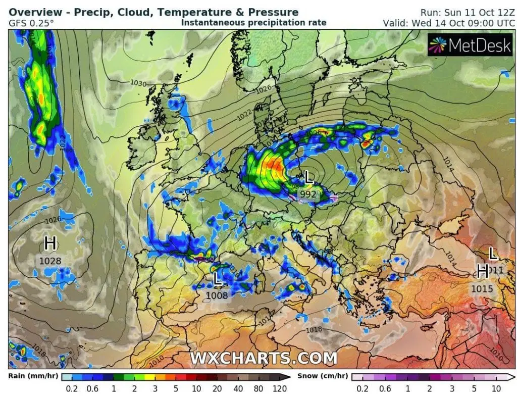
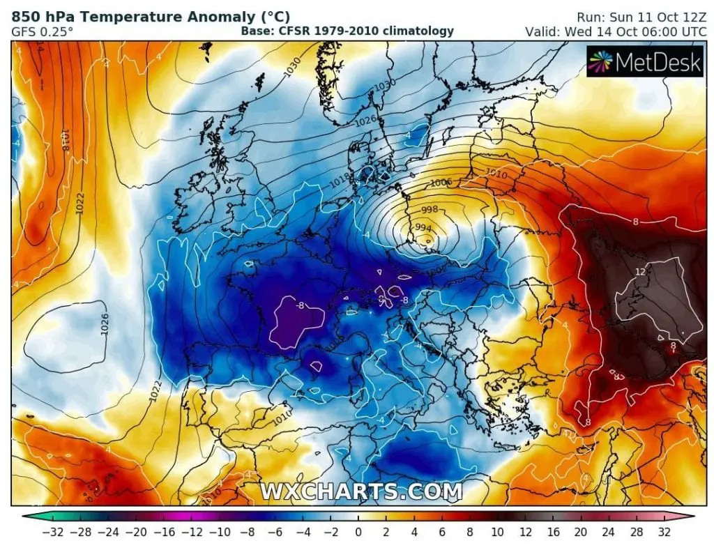
Extremely cold and humid air will shift over the Western Carpathians on the back side of cyclonic system over Germany and Poland, with temperature in 850 hPa anomalies almost -8°C from long-term averages.
Possible snowing in lower altitudes in Slovakia and Moravia is only one of the manifestations of powerful coldwave with long duration in Europe /https://mkweather.com/2020/10/09/coldwave-in-europe-will-be-longer-and-stronger-10-days-of-cold-weather-between-9-18-october//.
In Mediterranean, for example, a powerful Mediterranean storm, or even medicane, is expected from Sunday to Monday, 11.-12. October 2020 /https://mkweather.com/2020/10/08/red-warnings-before-possible-medicane-for-italy-greece-tunisia-and-balkan-on-monday-11-october-2020//, in other parts, heavy rain or severe winds make problems.
Powerful coldwave is too linked with rapid spreading of COVID-19 across Europe (viruses have better conditions for spreading in cold /and too dry/ weather).
If you live in Slovakia or Moravia and like snow, enjoy a Wednesday morning and stay safe. Cold weather will be persisting in region until the end of October 2020 according to the newest runs of GFS, with almost any temperature neutral or warmer days, with only extremely cold peaks of coldwaves divided by colder weather.
Infographics: shmu.sk, wxcharts.com, NOAA: