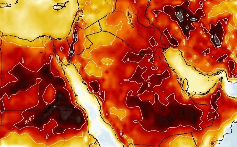
The Middle East expects the next +50°C heatwaves, in October should arrive floods and cold days
Although Saudi Arabia is after early August floods, in the next periods are severe storms possible only in Yemen, while some storm activity is forecasted from northern Iraq, northern Iraq, northern Syria, Lebanon, southwestern Saudi Arabia, and southwestern Oman.
Forecasts for the region until 25. August 2021 are extremely hot, with regional maximum temperature +50°C and more – mainly in the Persian Gulf.
In the first August decade, from temperature records, we should mention Qatar with +49,0°C or Muscat, capital of Oman, with +48,0°C.
Heatwaves above the Middle East will have a partially Saharan origin – all Sahara will be until the end of Summer and still in September 2021 flooded by extremely hot tropical air masses, which will lead to heatwaves in the Middle East, Mediterranean, and partially Central Asia.
The bigger change for the Middle East, with possible severe floods, storms, cooldowns, and low temperatures is possible around October 2021, when a strong NAO- phase is forecasted, for now, with Mediterranean lows shifting eastward.
The first half of Winter 2021/2022 brings probably alternating of warm NAO+ and cold NAO- phases and the second half of Winter 2021/2022 should arrive peak of winter, not only in the Middle East but across all Northern Hemisphere, according to preliminary estimates.
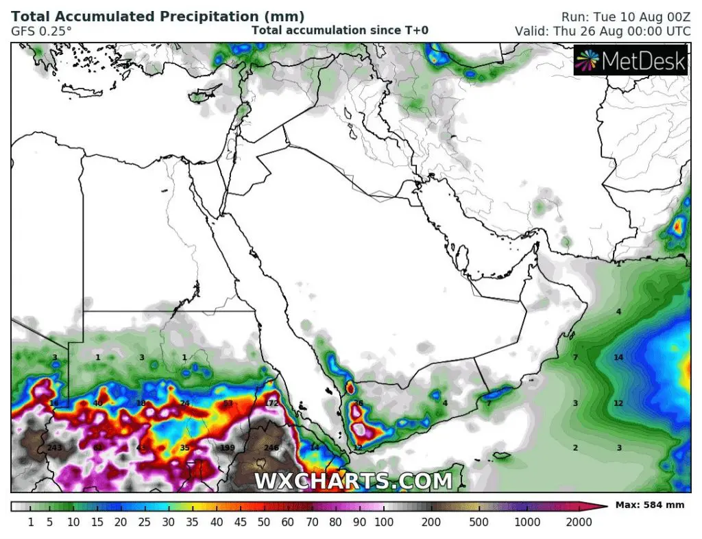
Source: wxcharts.com


