Updated September outlook for US: Hot and fires in West, Cold Northern Plains and Midwest, Southeast stormy and any hurricanes till 20. September
NOAA and Weather Nation posted an updated outlook for September 2020.
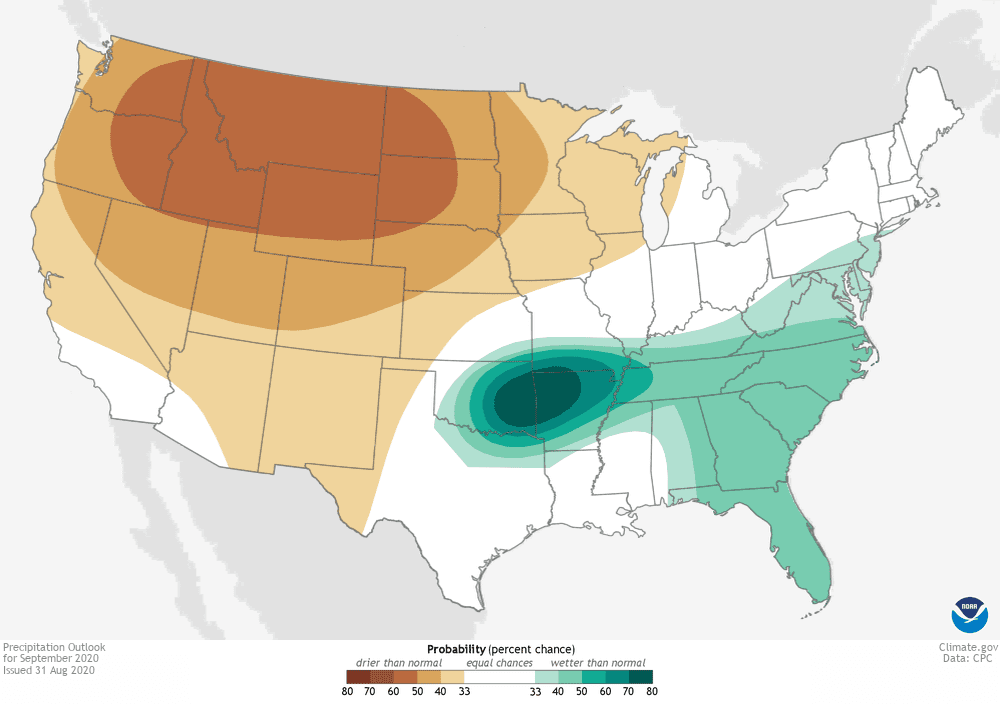
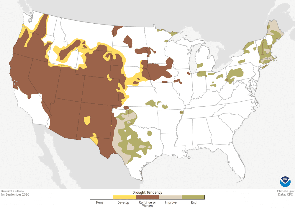
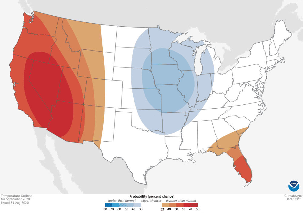
It isn´t a lot of changes in comparison to our notices from the end of August 2020 /https://mkweather.com/2020/08/25/forecast-for-september-2020-us-heatwaves-drought-and-fires-in-west-warm-in-northeast-and-humid-in-southeast//, but cold pattern in Midwest and North Plains and rainy pattern in parts of eastern half is more significant.
Prediction for West is in 3 words: hot, dry and fires!
Above Midwest will pour out Arctic air masses during minimally next 2 weeks, with extremely cold conditions temporarily.
Between temperature gradient on the West and on the East will be favorable conditions for tornadoes.
Although, till 20. September any hurricanes over territory of the US aren´t expected /https://mkweather.com/2020/09/01/any-hurricanes-in-the-usa-until-20-september/; https://mkweather.com/2020/09/02/hurricane-nana-hits-central-america-and-southern-mexico//, hurricanes and tropical storms over Caribbean and Atlantic will be pulling colder air from the north to Midwest and Southeast between cold air masses and tropical air masses will be more stormy.
We will see soon thanks to forecast models, if the next hurricane will arrive during 3rd decade of September or we will be waiting for next tropical threat longer, till October or November 2020. In this case, Laura could be the worst event in Atlantic hurricane season 2020. Probability of the next hurricane for the period 20. September – 10. November is however very high.
Updated September outlook for US from NOAA: