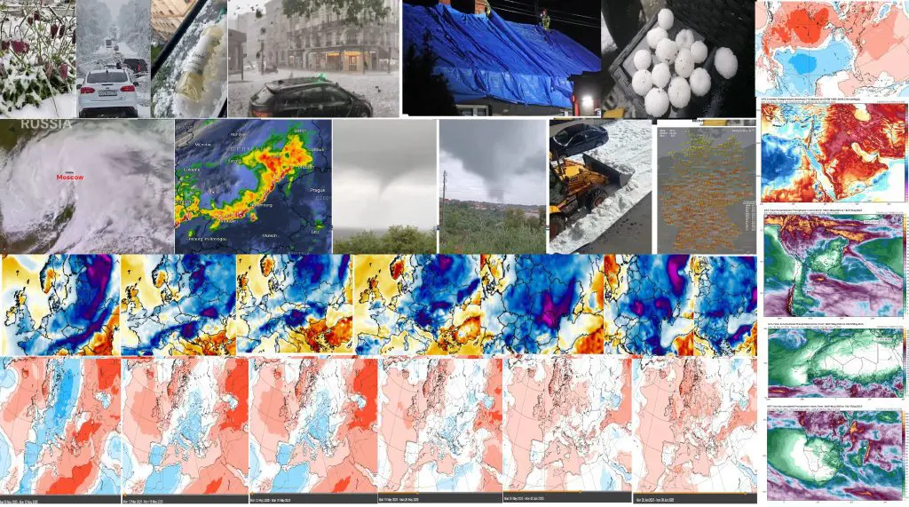
Weather report for 4. May 2025: Cold 7 days for Europe ahead, Summer 2025 will start with extreme heatwaves +35°C (!), Moscow under snow in May (a 116 y record!), Paris with egg-sized hailstorm (Strasbourg +30,0°C), tornadoes in Portugal, Denmark, Sweden and Germany (here +30,4°C), 5 cm hail in Poland and Austria (Wien +30,3°C), Slovakia +30,0°C, storms in Ukraine, -12,0°C in Sweden, +1,2°C in Dublin and ground frosts in Baltic states / Severe storms in E half of the USA and some monsoon on SW, the first summer serious heatwaves in outlook / Extreme heatwaves in the Middle East (Saudi Arabia +47,9°C), Central Asia, SE Asia and China (Xingyang +42,0°C) continue / heavy rainfall in north South America and equatorial Africa and savannas / Australia and Oceania with extreme heat, too / Arctic sea extent suspiciously above expected values
Europe
In Europe in the last days was peaking tropical early-May heatwave /https://mkweather.com/weather-report-for-1-may-2025-continental-europe-after-tropical-heatwave-frosts-and-snow-in-basins-finland-102c-the-netherlands-295c-germany-288c-severe-storms-hit-easter// with extremely high temperatures from Ireland, at the first, to Turkey an Russia, at the ending.
From interesting values, Ferrara, Italy, reported +32,0°C, Bolzano, Italy +29,6°C, Zenica, Bosnia and Herzegovina +31,6°C, Mostar, Bosnia and Herzegovina, +31,4°C, Loznica, Serbia +30,7°C, SW Germany +30,4°C, Mannheim, Germany +29,9°C and Frankfurt am Main, Germany +29,7°C, Berlin +29,0°C, Poysdorf and Wien, Austria +30,3°C and Innsbruck, Austria +29,4°C, Malacky, Slovakia +30,0°C, Rimavska Sobota, Slovakia +29,5°C, Strasbourg, France, +30,0°C and Paris +29,4°C, Calarasi, Romania +29,9°C, Baja and Gyor, Hungary +29,9°C, Crnomelj, Slovenia +29,8°C, Chur Ems, Switzerland +29,8°C, Westdorpe, the Netherland +29,5°C, Mohyliv Podilskyi, Ukraine +29,4°C, Vaduz, Lichtenstein, +29,4°C, Doksany, Czech republic +29,2°C, Antwerpen, Belgium +29,0°C, Kleine Brogel, Belgium +28,9°C, Slubice, Poland +28,7°C, +27,6°C and Brize, Norton, the UK (the hottest May day since 1953!) and and the end of April a historic temperature of +25,9°C in Ireland /https://x.com/MetEireann/status/1917682360474062967/.
Before an arrival of hot air from the west, between extremely hot air masses above Central Asia (Turkmenistan up to +43,3°C – in all Central Asia more than 10°C above April monthly temperature records in the last week: https://mkweather.com/weather-report-for-1-may-2025-continental-europe-after-tropical-heatwave-frosts-and-snow-in-basins-finland-102c-the-netherlands-295c-germany-288c-severe-storms-hit-easter/) and hot air arriving from the west, cold air mass surprised Moscow region, where more than 100-year May snowfall records occurred, with heavy snowfall on 1.-2. May 2025, with many Tweets on X. 116-year snowfall record was broken in Moscow and the surrounding region on May 1 and 2, with 43 mm falling in 36 hours, amounting to 70 percent of the monthly norm.
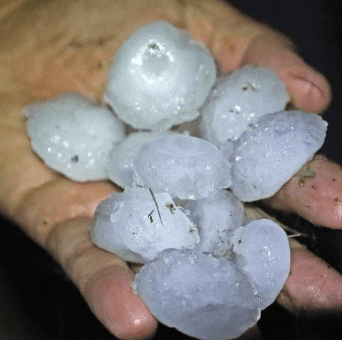
After extreme, regionally historic heatwave, severe cold front, with heavy rains, severe lightening, gusty winds, large hail up to 5 cm and even, tornadoes, was and still is continuing in its way trough Europe southeastward.
From metropolitan areas, the worst weather hit mainly Paris, with severe hailstorm and havoc on the streets. Wind gusts in the city reached up to 100 km/h.
Severe storms gradually hit Portugal, Spain, France, Benelux, Germany, the Alpine region, Italy, Central Europe, Baltic region, Ukraine and Balkan.
In Portugal, 2 tornadoes appeared, the first with IF1.5 and the second IF1 strength (videos below).
One tornado appeared in Germany, too, near Oppenwehe on the West, while 2 waterspouts occurred between Denmark and Sweden.
Severe hailstorms were reported from central Germany, southern Poland, SE Austria and West Ukraine, with extremes up to 5 cm hail in Magdalenka, Poland and Rudersdorf, Austria. Severe storms hit other countries in Europe too, e.g. Hungary, Slovakia, Moldova, Romania, and others.
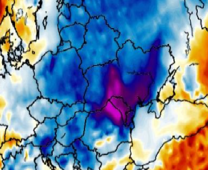
In the next week (5.-11. May 2025), severe cooldown, with ground frost in lowlands, frosts in basins and even snowfall in valleys below 1000 MASL in the Alps, the Carpathians and Balkan is expected – Mkweather will watch it. Maximum temperatures during this cooldown will reach only under +10°C regionally in lowlands in continental Europe, in valleys only below +5°C in the coldest day.
The cold air is already flowing above Scandinavia, Baltic region, Belarus and the UK, where in the last hours, severe frosts and ground frosts were observed: Latnivaara, Sweden -12,0°C, Vaala Pelso, Finland -10,2°C, Kilpisjarvi Saana, Finland -9,8°C, Utena, Lithuania 0,0°C, Jogeva, Estonia +0,1°C, Daugavpils, Latvia +0,2°C, Drumalbin, the UK, +0,2°C, Lynutpy, Belarus +1,1°C, and even Dublin, Ireland +1,2°C.
Summer 2025 in Europe however, according to current ECMWF charts on 6 weeks ahead, will start with severe heatwaves, which will start in westernmost parts of the continent already after 20. May 2025, and until 10. June 2025 will spread across the continent, with possible reaching +35°C threshold in continental Europe. Mkweather Forecast for Summer 2025 in Europe you will find here: https://mkweather.com/summer-2025-forecast-for-europe/.
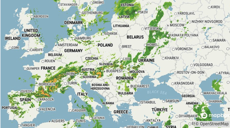
A current weather radar in Europe: https://www.accuweather.com/
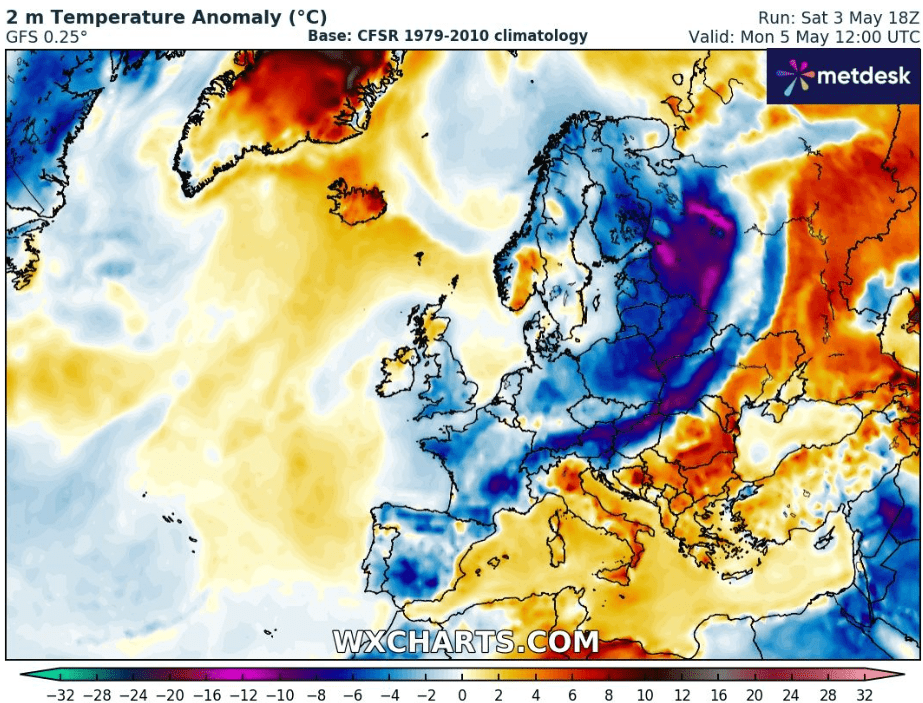
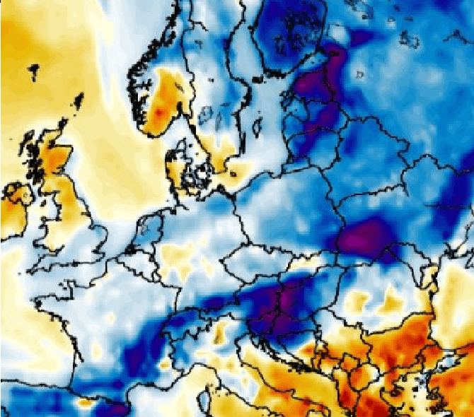
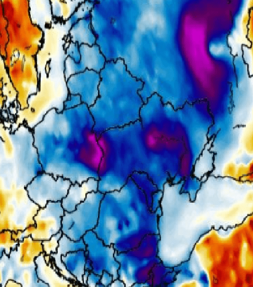
A 2-m temperature anomaly in Europe after a cold front shift, on 5. May 2025 12Z. Source: https://www.wxcharts.com/
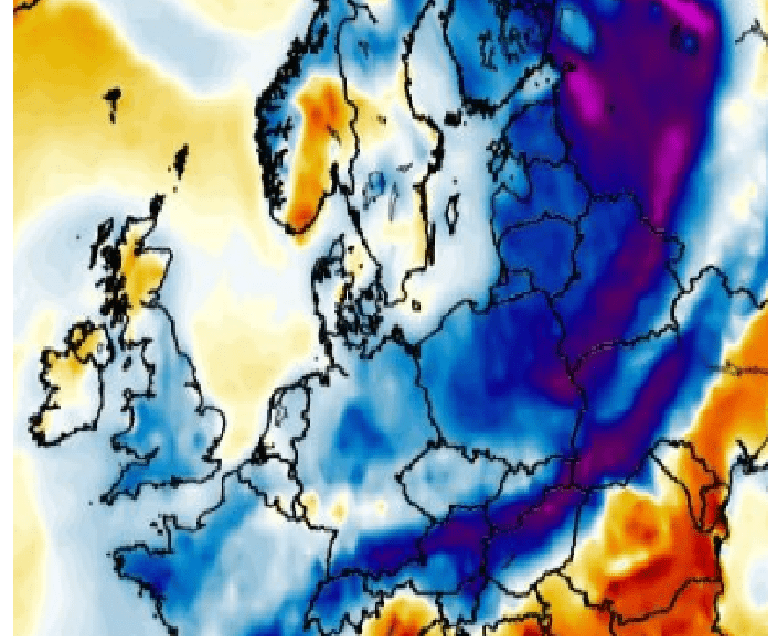
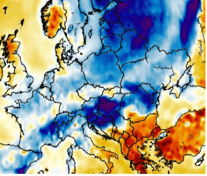
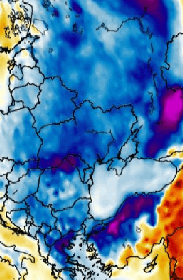
2 m temperature anomalies in the next 7 days (5.-11. May 2025 in Europe). Source: https://www.wxcharts.com/
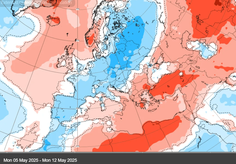
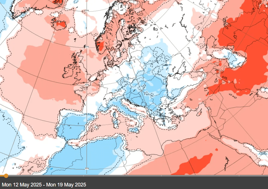
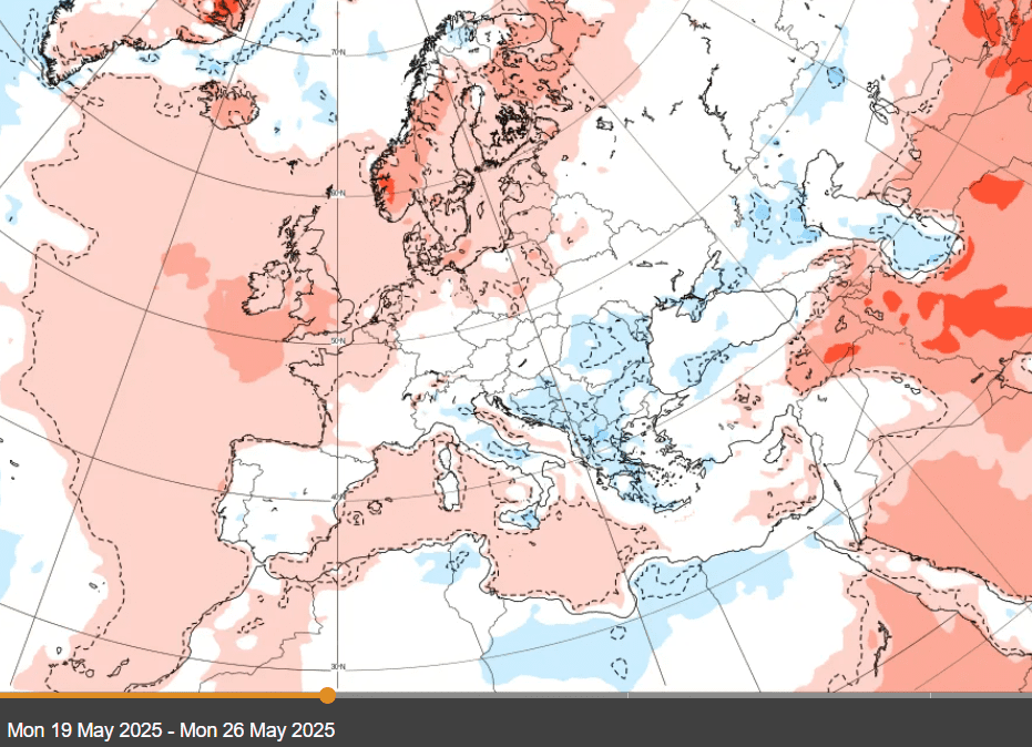
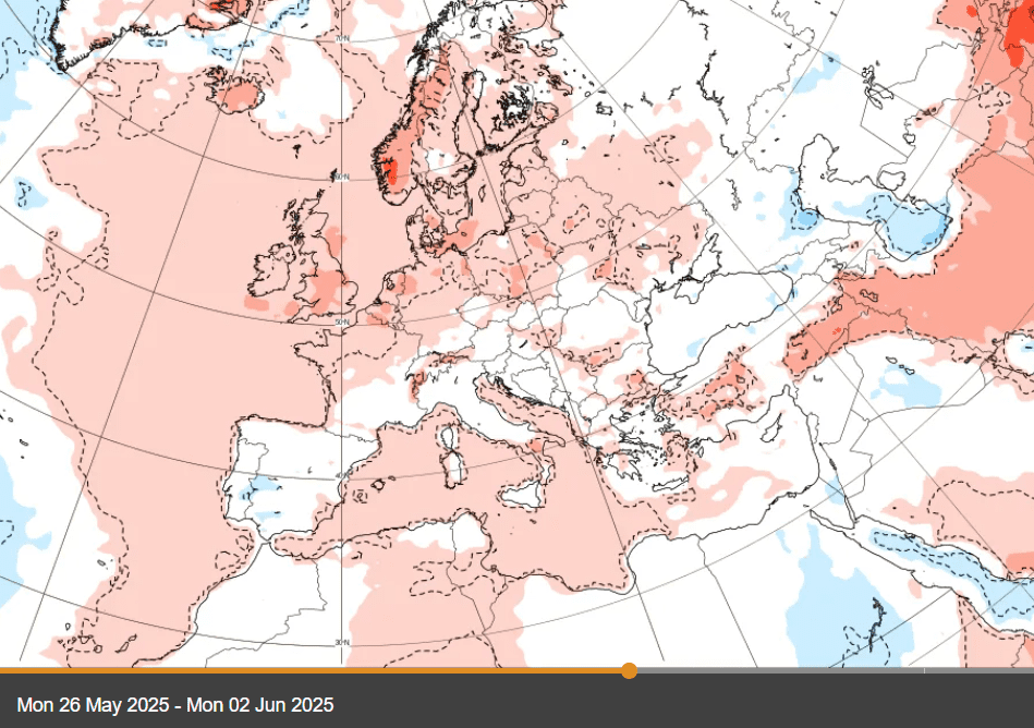
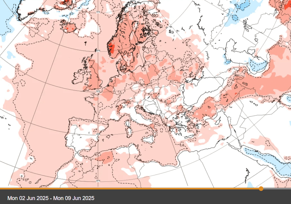
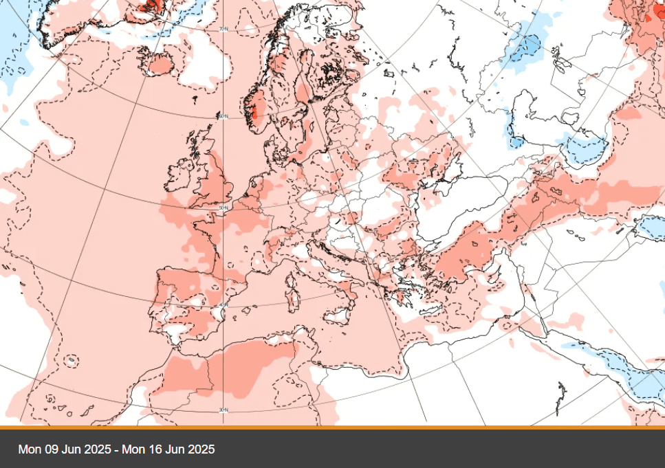
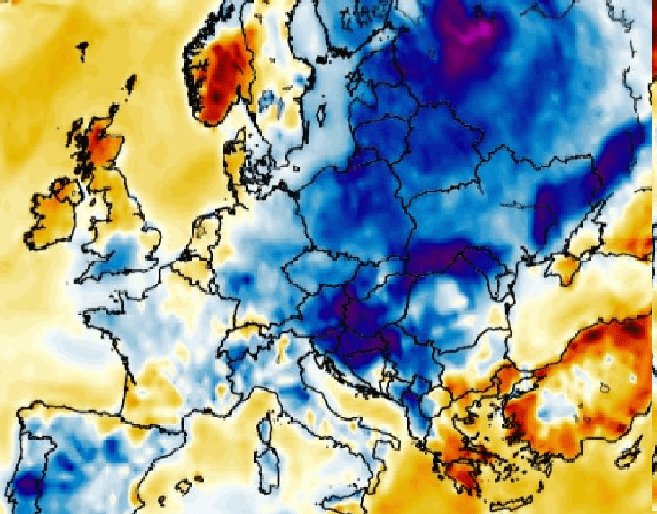
6-week temperature forecast for Europe. Source: https://charts.ecmwf.int/
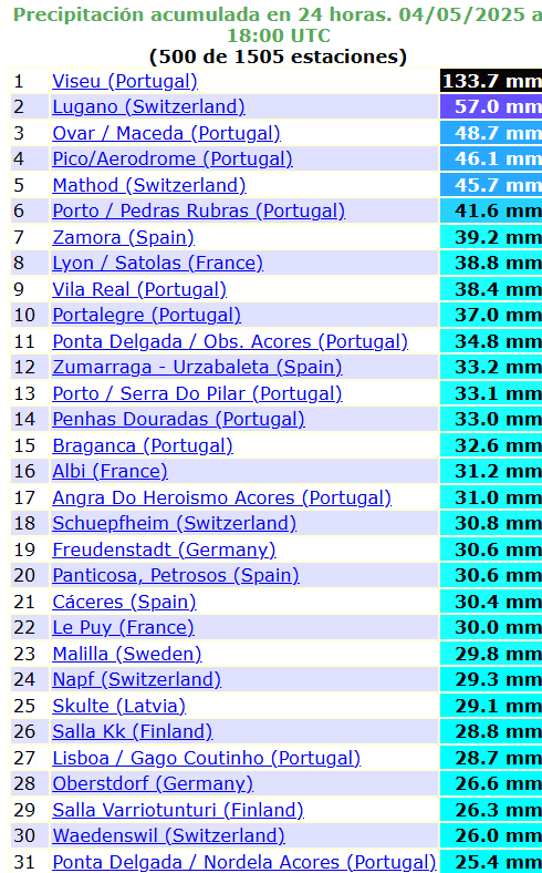
Source: https://ogimet.com/ranking.phtml
HISTORIC MAY SNOW IN MOSCOW
SEVERE HAILSTORMS IN PARIS
2 TORNADOES IN PORTUGAL
SEVERE HAILSTORMS IN SPAIN
STORMS AND TORNADO IN GERMANY
TORNADOES / WATERSPOUTS IN DENMARK AND SWEDEN

Source: https://www.facebook.com/photo?fbid=10233304863235925&set=pcb.10233304863835940
5-CM HAIL IN POLAND AND AUSTRIA


STORMS IN UKRAINE
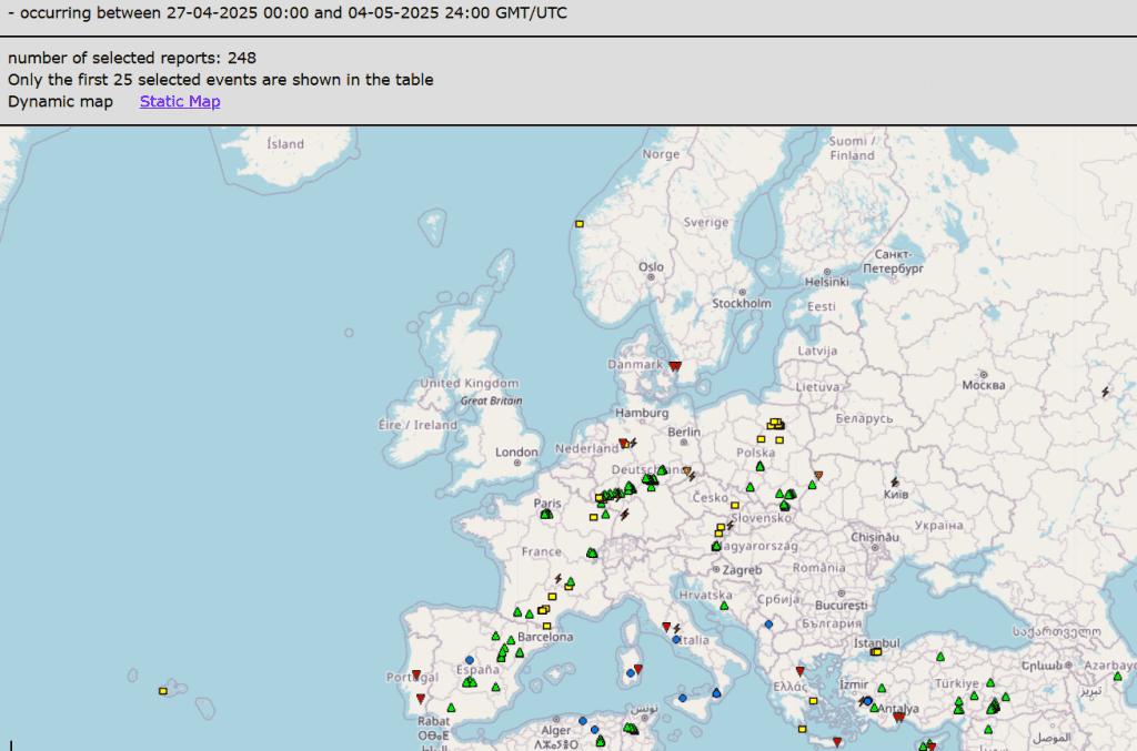
ESWD reports in the last 10 days. Source: https://eswd.eu/cgi-bin/eswd.cgi
HEATWAVES IN GERMANY
HEATWAVES IN THE UK AND IRELAND
North America / The USA
As we described in Summer 2025 forecast for North America and the USA /https://mkweather.com/summer-2022-forecast-for-north-america-strong-wildfire-season-and-early-hurricane-season-are-predicted//, above-precipitation pattern above Eastern half of the USA and closest Canada and the Caribbean is expected.
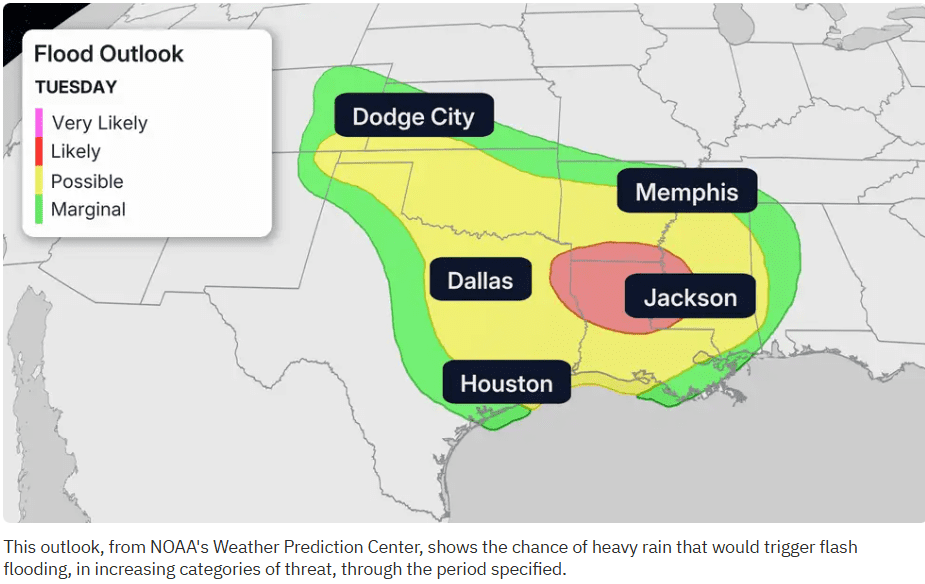
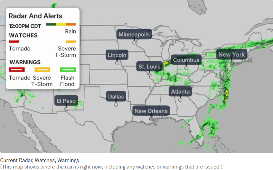
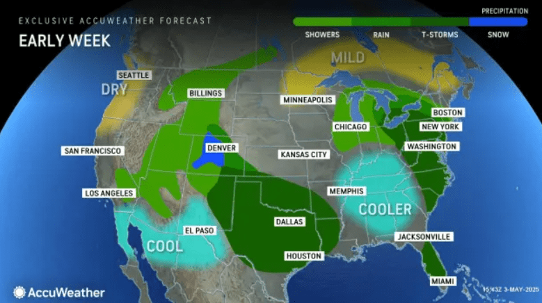
In this pattern, above the eastern parts of the US are occuring and are expected severe storms in the USA and closest Canada and Mexico already in these days, with severe storms forecast in South – mainly Texas, Oklahoma, Louisiana, Arkansas and Mississippi, then for parts of Northeast, Mid-Atlantic, the Great Lakes region and Florida early next week.
Showers above the Rocky Mountains and some monsoon in Southwest are expected, too, in SW after long time of drought in Spring 2025.
Central-eastern USA and the US-Mexican border regions will be cold and Northwest dry, while in eastern Canada will be warm.
Before storm line surprised high minimum temperatures Washington DC area, with +21°C / above 70°F temperatures at the night, which are at level of temperature records and summer-like temperatures.
Outlook for the USA is very hot, with firstly widespread cold anomaly above southern and eastern half of the country, but gradually with a significant warmth up above all territory, with the first serous heatwaves mainly in the second half on May 2025 and in the first half of June 2025, with a possibility of severe storms, mainly in eastern half.
Related stories from the USA from other weather pages:
Plains, South, Northeast Stuck In A Soggy And Stormy Pattern This Week:
Rounds of severe storms to impact Central, East US:
Soggy South Central states: Intense downpours to renew flooding risk
Days of rain to soak parts of Northeast
Source: https://www.accuweather.com/en/weather-forecasts/days-of-rain-to-soak-parts-of-northeast/1770592
Source: https://www.accuweather.com/en/weather-forecasts/days-of-rain-to-soak-parts-of-northeast/1770592
Weekend storm could be SoCal’s last rain for months:
Second arrest made in one of New Jersey’s largest wildfires:
Source: https://www.accuweather.com/en/weather-news/new-jersey-wildfire-arson/1768430
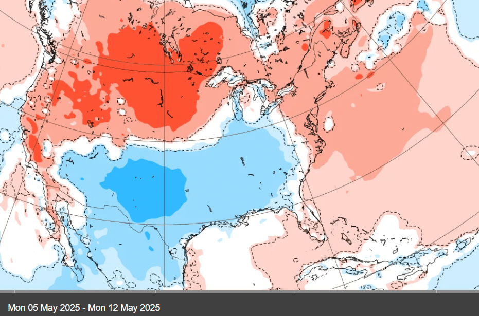
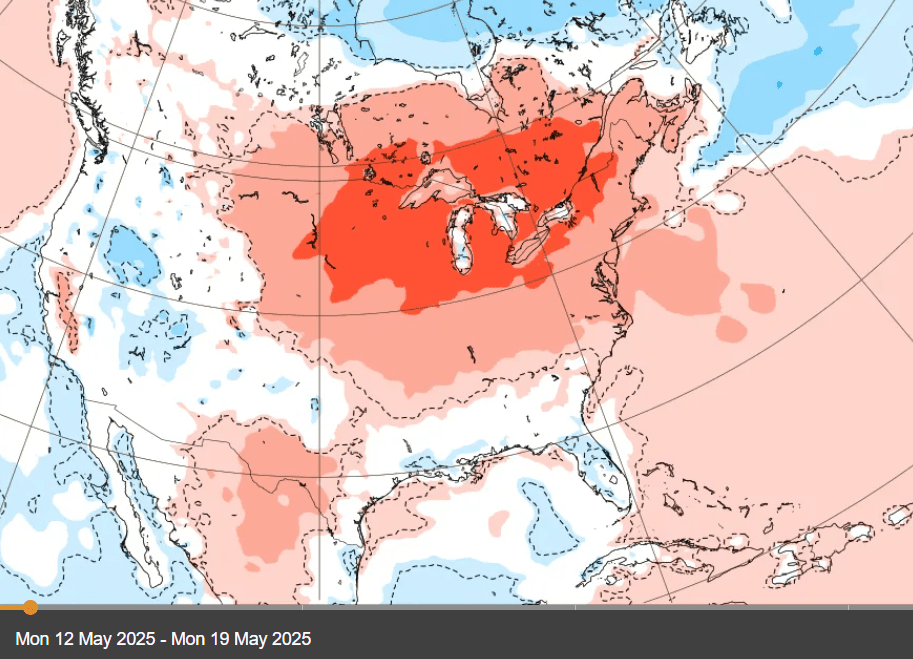
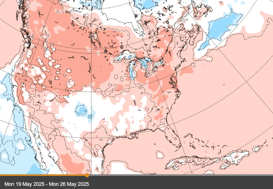
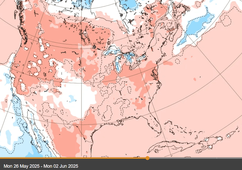
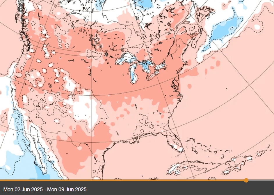
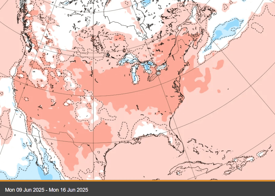
A 6-week ECMWF temperature forecast for the North America and the USA. Source: https://charts.ecmwf.int/
Asia
Historical and never-happen before heatwaves are suffering Asia, furthermore.
After extreme late-April and early-May temperatures up to +49,0°C in Pakistan, +48,9°C in Kuwait, +47,6°C in Saudi Arabia, +47,0°C in Iran/Iraq, +46,6°C in UAE, +44,9°C in Israel, and abnormal (10°C above monthly records – more extreme event like +49,6°C in Canada or +40,0°C in Arviat, Nunavut) +43,3°C in Turkmenistan /https://mkweather.com/weather-report-for-1-may-2025-continental-europe-after-tropical-heatwave-frosts-and-snow-in-basins-finland-102c-the-netherlands-295c-germany-288c-severe-storms-hit-easter//, Saudi Arabia on 3. May 2025 broke another records with +47,9°C in Al-Nuairyah and +47,3°C in Buqayq. In Iran, +46,5°C was measured in Dayyer Port on the coast. Oman in Sohar, +45,1°C – a new April all-time record, reported only a few days before. Kuwait City at the beginning of May 2025 reported maximum temperature of +46,4°C.
Extreme heat has continued in China last days, with anomalous +40,2°C in Xingyang and +42,0°C in Xingyang province. Moreover, regenerating of heatwaves above Central Asia is expected with the next temperatures above +40°C, even in Kazakhstan, with tropical heat in parts of Mongolia and Siberia, too.
Tanjung Karang in Indonesia broke its all-time May record, with +35,9°C on 4.5.. Minimum temperature of +26,2C at Gorontalo, is a record high minimum for May.
Tropical Depression 99W Invest is still shifting over seas near Philippines
HISTORICAL ASIAN HEATWAVES – THE MIDDLE EAST AND CENTRAL ASIA
HEATWAVES IN CHINA
RECORD HEAT IN INDONESIA
99W Invest Tropical Depression near Philippines
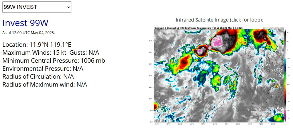
Source: https://www.tropicaltidbits.com/storminfo/#99W
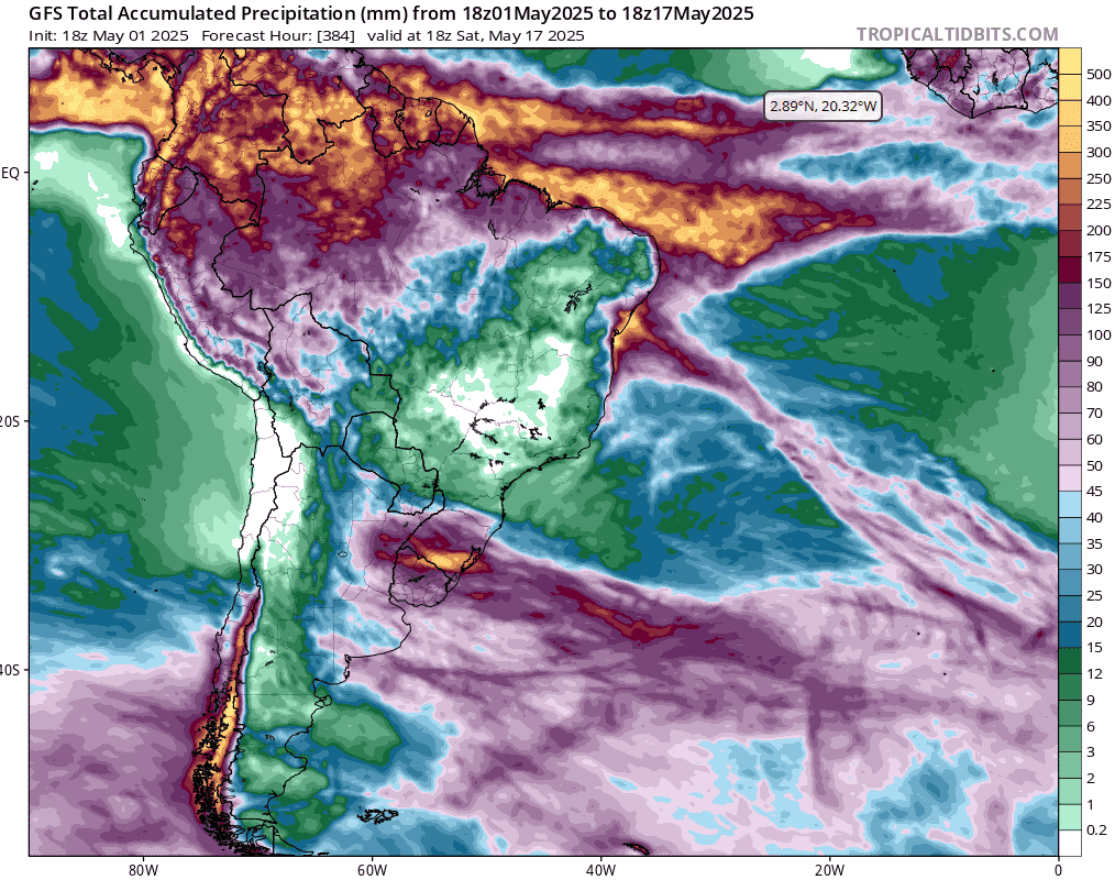
South America
Heatwaves from Chile and Patagonia will shift in the next period to northern parts of Argentina, Paraguay, Bolivia and southern Brazil.
Peru, Ecuador, Colombia, Venezuela, Guyana, Suriname, French Guyana and Amazon, Brazil will stay colder.
Heavy rainfall until 17. May 2025 are expected mainly in Ecuador, Colombia, Venezuela, northern Amazon, Uruguay and southernmost Brazil.
RAINFALL OUTLOOK FOR SOUTH AMERICA
Source: https://www.tropicaltidbits.com/analysis/models/
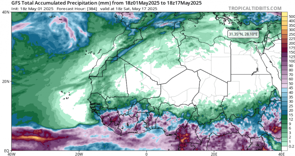
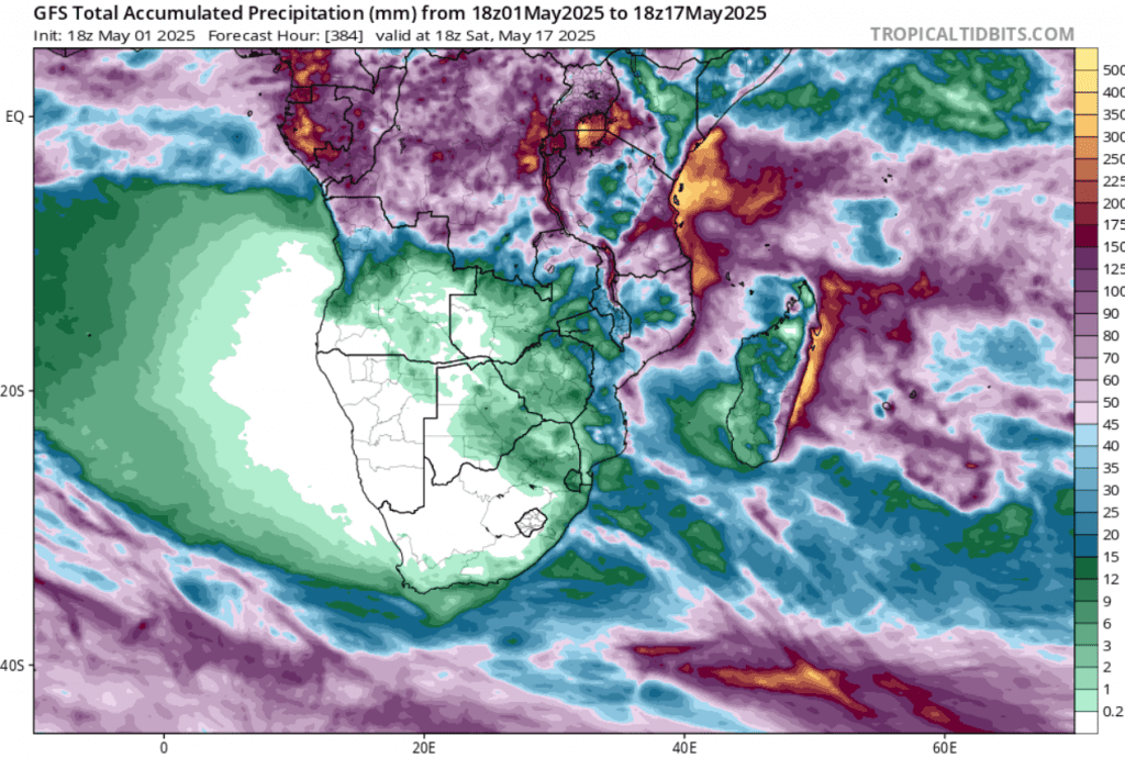
Africa
More outputs from Africa you can find e.g. here: https://mkweather.com/weather-report-for-may-3rd-2025-unseasonal-heat-in-central-continental-europe-30c-in-austria-and-hungary-high-temps-along-mid-atlantic-us-seaboard-31c-in-virginia-and-maryland-midd/.
Above south-African states will continue severe Autumn 2025 heatwaves, with the next summer-like temperatures, e.g. +35,6°C in Skukuza, +34,5°C in Hoedspruit or +34,2°C in Thoyondou, South Africa.
Madagascar reports very hot +37,5°C late-autumn temperatures (Mahajunga) at the start of May 2025.
Mozambique reported a supertropical night with +25,0°C Tmin in Tete.
+35,1°C is the new May record for Juan de Nova Island, French Territories in Indian Ocean.
In the next period, Western Sahara countries will be extremely hot and eastern parts of the deserts mainly in Libya and Egypt colder, but gradually, mainly in the second half of May 2025, heatwaves will spread eastward and then above the Middle East, too.
According to accumulate precipitation forecasts until 17. May 2025, heavy rainfall and floods are expected mainly in Cameroon, Equatorial Guinea, Gabon, parts of Congos, Uganda, Tanzania, Rwanda and Burundi, such as in parts of Ethiopia.
STORM FORECAST FOR TROPICAL FORESTS AND SAVANAS
Source: https://www.tropicaltidbits.com/analysis/models/
SOUTH-AFRICAN HEATWAVES
EXTREME HWATWAVES IN INDIAN OCEAN
Australia
Australia stays relatively hot and dry in late Autumn 2025, with above +30°C expected in Perth region, Southwest.
Very warm with temperature records was in the last days in Tasmania, too, with +23,1°C in King Island and +21,1°C in Smithton.
Fua Motu in Tonga, Oceania, reported its hottest May day in history with +31,3°C.
Pekoa in Vanuatu reported the hottest May day in history, too, with +32,7°C, +27,5°C in Saratmata in the new record for the hottest May night in the country.
RAINFALL FORECAST FOR AUSTRALIA
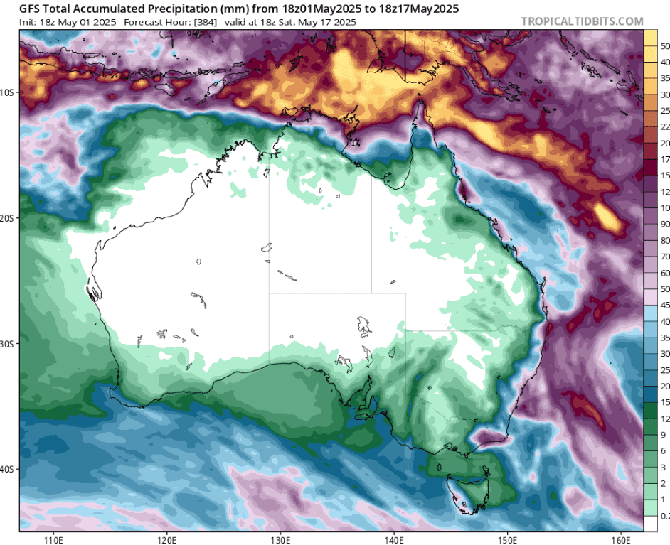
Source: https://www.tropicaltidbits.com/analysis/models
SUMMER-LIKE WEATEHR IN TASMANIA IN MAY
HOT OCEANIA
The Arctic and Antarctica
As we can notice on the graph below, the Arctic sea extent anomaly is closer to normal in the last period and this anomaly is starting to be relatively suspicious.
This anomaly should be linked with a relatively neutral or slightly-above average AO and NAO index in the last weeks /https://www.cpc.ncep.noaa.gov/products/precip/CWlink/daily_ao_index/ao.shtml; https://www.cpc.ncep.noaa.gov/products/precip/CWlink/pna/nao.shtml/, with cumulating of Arctic air masses concentration more northward.
Antarctica remains relatively cold in early May 2025.
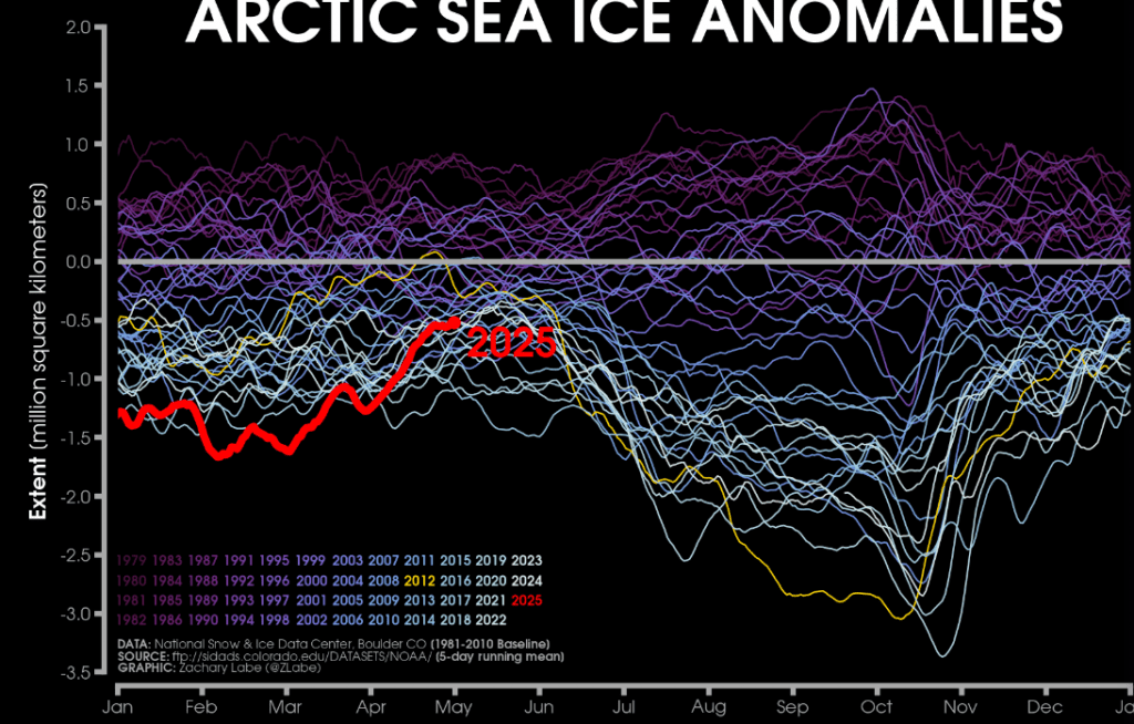
Source: https://zacklabe.com/arctic-sea-ice-extentconcentration/
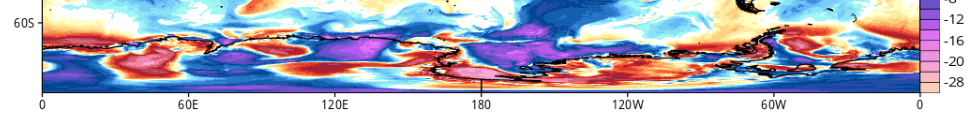
Temperature anomalies above Antarctica on 5.5.2025. Source: https://www.tropicaltidbits.com/analysis/models


