Summer 2022 forecast for North America: strong Wildfire season and early Hurricane season are predicted
Summer 2022 is here already in 4 months and we are bringing the first continental updates of predicted weather patterns for Europe, North America, Asia, Africa (Winter+Summer 2022), Australia (Winter 2022), South America (Winter 2022), and Antarctica (Winter 2022).
This article will look at the forecast of Summer 2022 conditions in North America.
A few main factors will be affecting conditions during an upcoming Summer 2022:
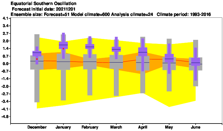
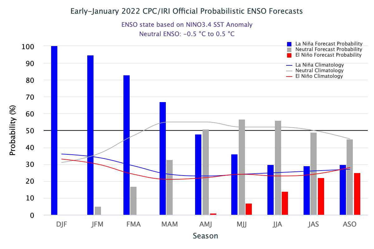
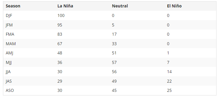
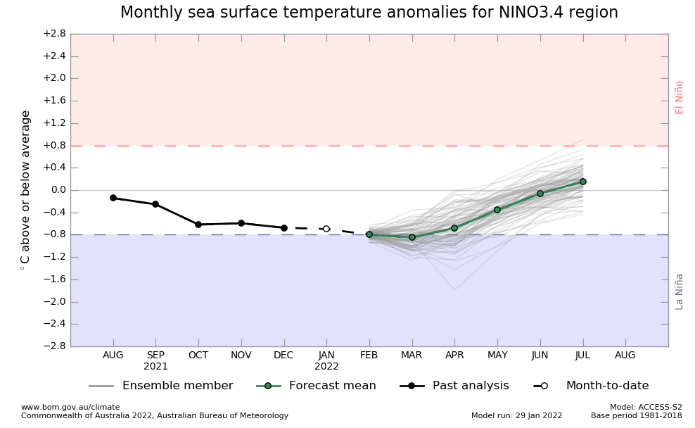
1. Weakening La Nina: During Summer 2022, a shift from La Nina to El Nino will be ongoing (Spring will be La Nina, yet, but Autumn probably El Nino already). The previous 2 La Nina Years should be associated with accumulated colder Earth conditions. Hopes for El Nino forecast mainly from Autumn 2022 – Hurricane season 2022, therefore, should start relatively stronger, but in Autumn 2022 won´t be probably so strong such as the last 2 years /https://mkweather.com/the-first-hurricane-season-2022-forecast-a-busy-season-amo-weaker-than-2020-2021-upcoming-el-nino//. La Nina is more fertile in Mexico and Central America, El Nino is bringing drought to Canadian Prairies /https://mkweather.com/el-nino-is-coming-autumn-2022-a-big-changes-in-circulation-patterns-worldwide//.
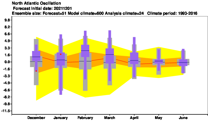
2. Mostly NAO- and AO-: After the year 2000, approximately 2/3 of winters were NAO+, while 2/3 summers NAO-. It should mean more stormy eastern parts of the continent, but still very strong heatwaves, thanks to longer Rossby Waves with higher amplitude far to the north.
3. A shift of Hadley Cell northward: The shift of Hadley Cell northward should push summer patterns to more northern regions, as usual. Often it should be manifested by the stronger effect of Hawaii and Azores high to the coasts of North America, NW Africa, and Europe, despite possible NAO- (Icelandic and Aleutian stormtracks are in summer months significantly limited).
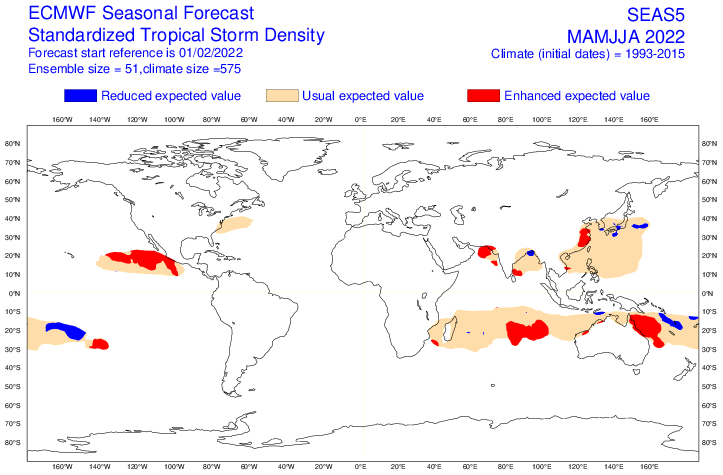
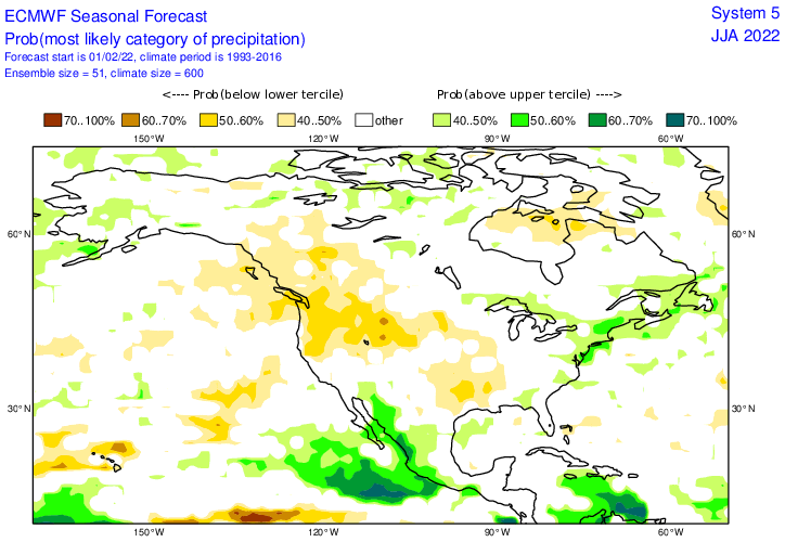
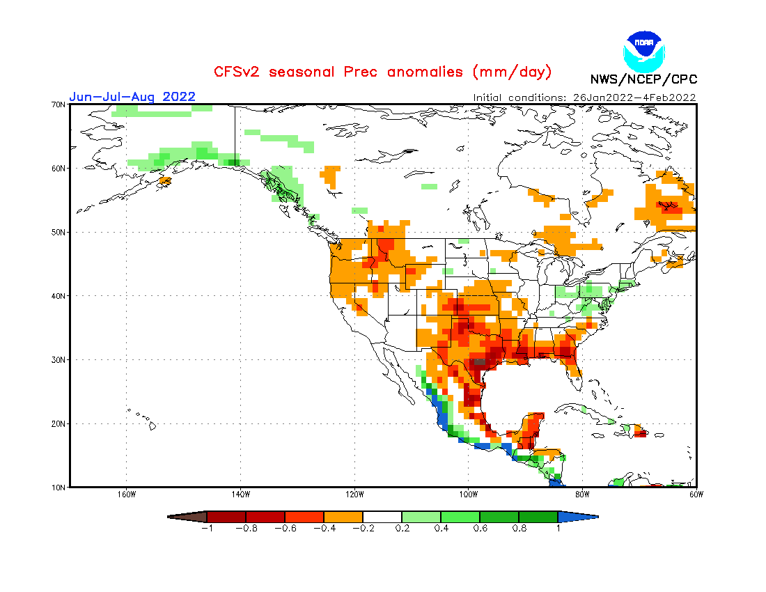
4. Stronger start of Hurricane season: Despite weakening La Nina, thanks to AMO+, is expected the next above-average Hurricane season 2022. It should mean more ex-tropical storms and ex-hurricanes at the end of Summer 2022 in North America, especially in the second half of the summer. mainly in the Florida region and East Coast. Texas and Eastern Mexico should be mostly drier than average. Mainly, an extremely strong early Pacific hurricane season is predicted.
5. A possible colder Arctic than usually: Arctic experiences partially thanks to La Nina with colder years and it´s possible that it won´t be a very warm season in Summer 2022, yet. SSTs of many Arctic seas are predicted to be below the temperature average in the summer and cold blasts should be in northern parts of North America (Alaska and N/NW Canada) relatively frequent (in comparison with the previous decade).
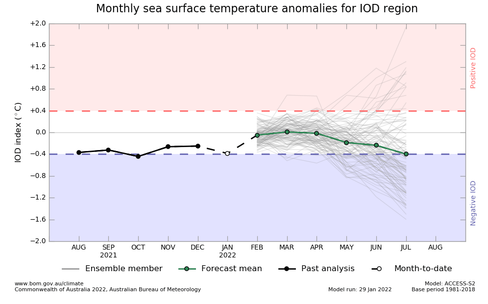
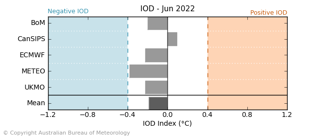
6. Negative IOD: Correlates with NAO- and extreme drought along the coast of eastern Africa and very stormy SE Asia. The decline of the IOD index should be linked with NAO- in the European sector.
7. QBO in Westerly phase: Support for zonal airflow, despite possible NAO- / AO- conditions.
8. AMO+: Warmer seas near North America with effect on stronger hurricane season and ex-tropical disturbance in late summer in Europe.
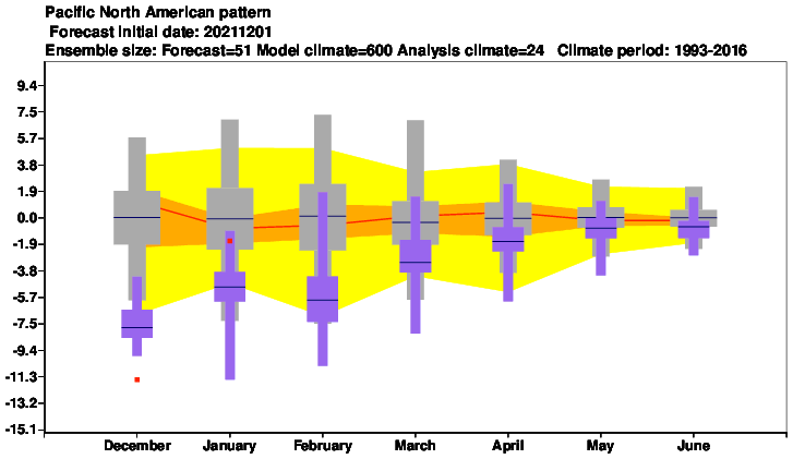
9. Remnants of NE Pacific Warm Blob: Remnants of warm anomaly above N Pacific should be linked with colder Alaska and N/NW Canada and negative PNA from previous seasons.
10. Return of PNA from negative to neutral values: This Neutral phase PNA should be surely closer to the hot and dry pattern above the western and the hot and stormy pattern above the eastern half of the continent, common for PNA+. Negative PNA is bringing lower pressure in the West and higher in the East /https://www.climate.gov/news-features/understanding-climate/climate-variability-pacific%E2%80%93north-american-pattern/.
11. Awakening sun activity: should be linked with warmer global signals not only in Summer 2022 but in the next years.
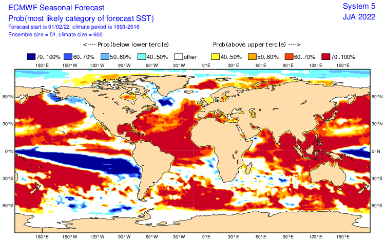
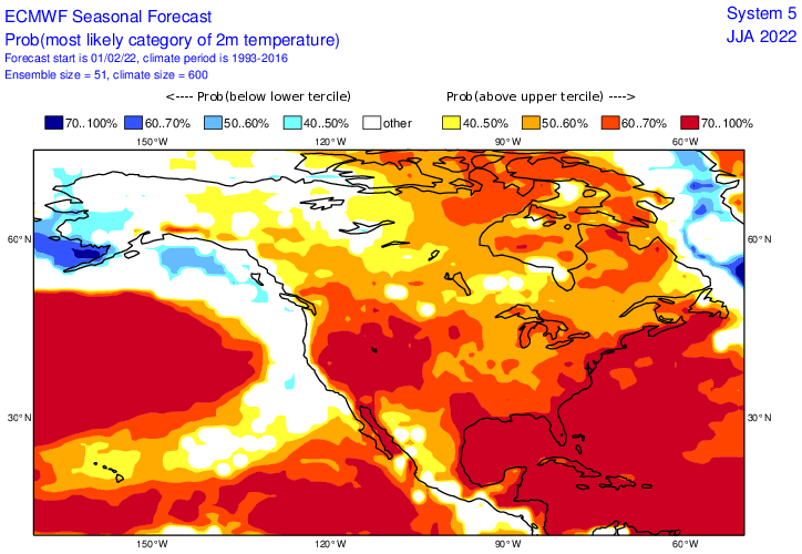
12. SST: mostly warm SSTs along the southern and eastern USA should be associated with stronger storm (and hurricane) activity. Colder Pacific coast and waters near Greenland are predicted – the first probably associated with stronger Hawaii high, the second is linked with GW hole southward from Greenland, from melting fresh water in the region.
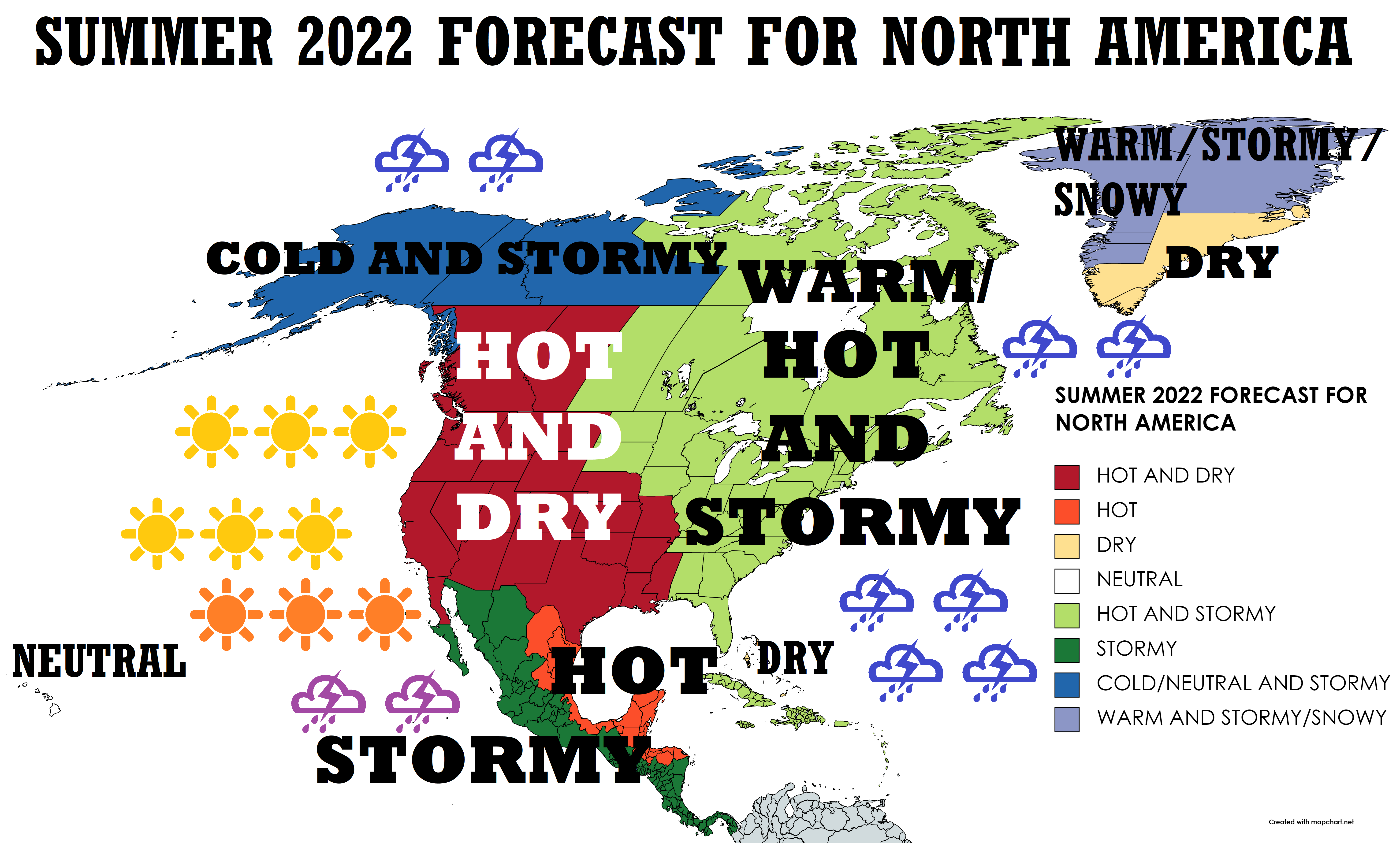
Now, we should look at a forecast map for Summer 2022 for North America and 8 main sectors, with similar regimes of weather:
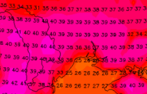
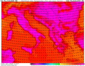
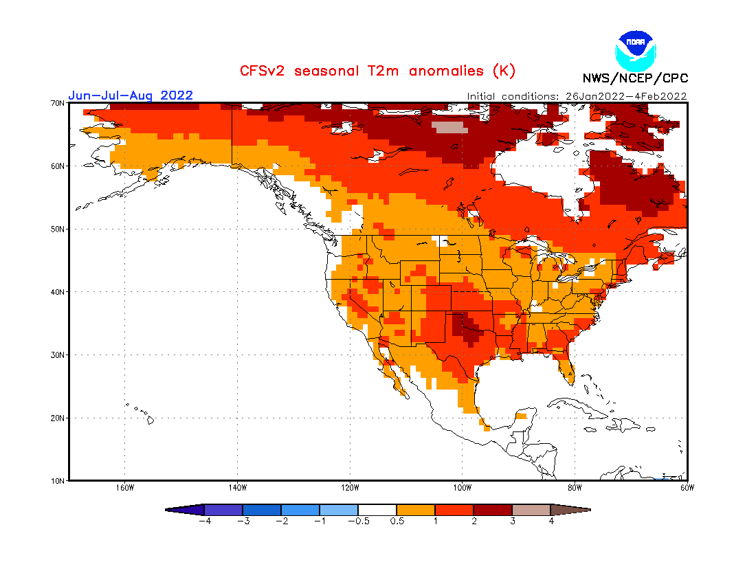
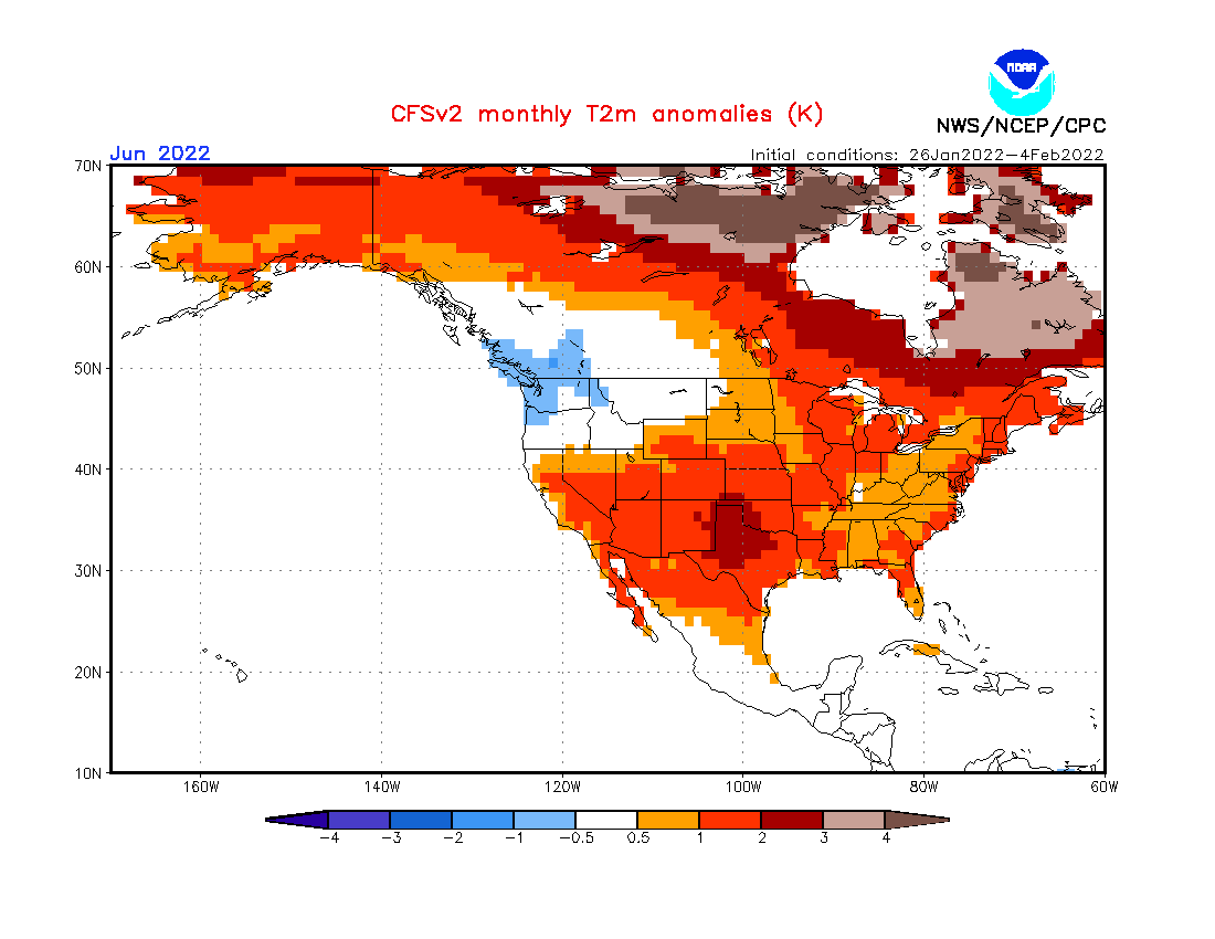
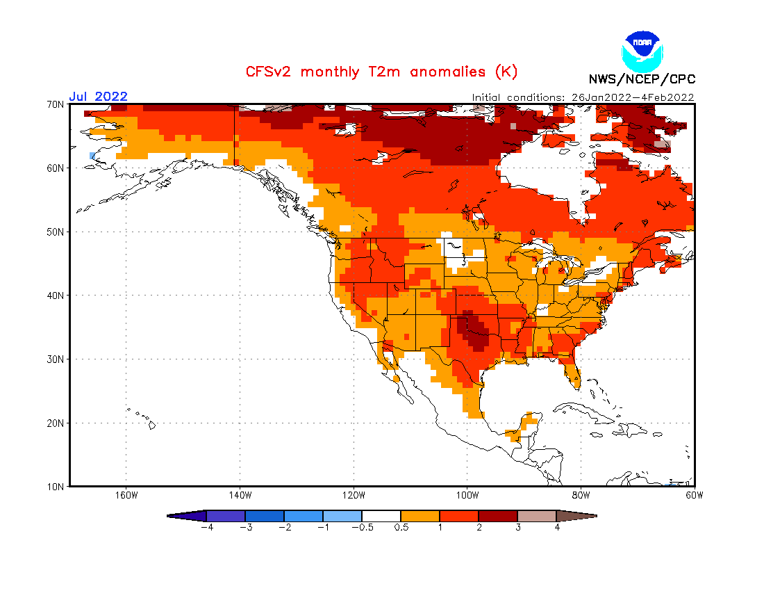
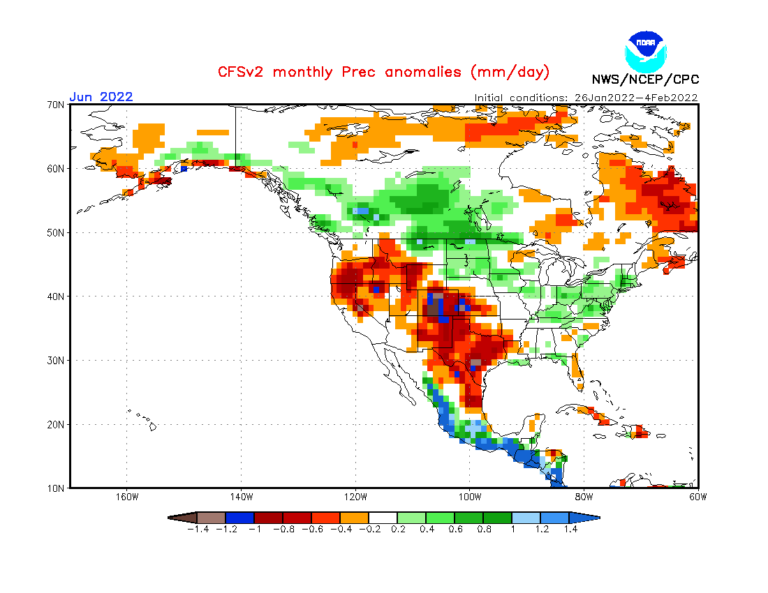
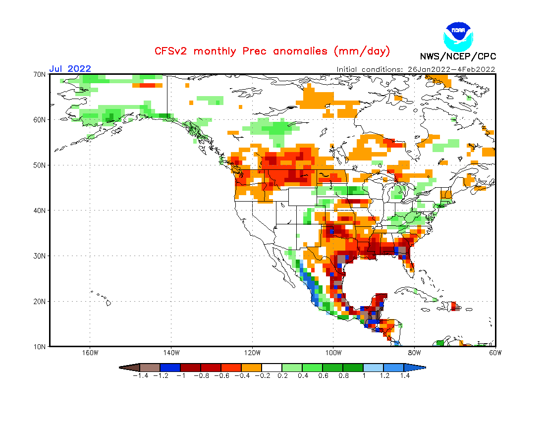
A) HOT AND DRY (WESTERN HALF OF THE CONTINENT – DARK RED): Mostly La Nina dry and hot southern USA – this anomaly should be spreading anomalously northward, similarly such as during the last summer, with heatwaves in SW Canada (Hadley Cell, Atmospheric blocking via Heat Domes). Possible heatwaves up to +50°C in populated parts and +55°C in Death Valley during the peaking summer, problems with drought, wildfires, in agriculture and water supplies. Possible deadly heatwaves. Very strong wildfire season.
B) HOT (EASTERN MEXICO – RED): Precipitation mostly neutral, with the uncertain start of Hurricane season 2022, but an accumulation of hot tropical air, up to +52°C during the peaks. Possible drought alternating with early hurricanes or tropical disturbances. AMO+ with warm waters of Mexican Gulf, but weakening La Nina should cause weaker hurricane season such as in the last 2 years in the region. In Autumn, northern Mexico should report relatively stronger monsoon rains, thanks to El Nino.
C) DRY (SOUTHERN GREENLAND – YELLOW): Mostly low geopotential above Greenland during summer, but southern parts mostly dry, with possible heatwaves up to +25°C, alternating with storms. A possible NAO- with a weaker (shallower) Icelandic low. Strong continental ice melting and creating GW Hole in northern Atlantic. Probably a little warmer season than previous = more melting and more NAO-/AO- in Autumn 2022. Bahamas drier, too (less early hurricanes?).
D) NEUTRAL OR SLIGHTLY WARM OR DRIER (HAWAII – WHITE): Mostly neutral or slightly warm or drier weather, with summer and tropical days, possible severe storms such as drier periods. On the western and southern side of stationary high pressure, maybe affected with some ex-hurricanes from Pacific Mexican coast, later.
E) HOT AND STORMY (EASTERN HALF OF THE CONTINENT – LIGHT GREEN): More typical for La Nina, with a combination with NAO- / AO-, later possible early hurricane season activity, with an effect of AMO+. IOD+ supporting the possible NAO-. More typical for PNA+ (stormy anomaly). A possible heatwaves up to +45°C in the south, up to +40°C in the Northeast, and above +30°C in Hudson Bay. Possible often floods, tornado and hurricane activity above the seasonal average, possible severe storms with heavy rains, hail, gusting winds (derechos), powerful lighting activity or tornadoes, especially in the eastern Midwest, then Mid-Atlantic and Northeast. Canada regionally less stormy with some dry periods.
F) STORMY (WESTERN MEXICO AND (MOSTLY WESTERN) CENTRAL AMERICA – GREEN): La Nina more fertile in the western coast of Mexico – very powerful start of Pacific Hurricane season is expected, with often floods, severe winds, and stronger disturbances such as usual. Temperature anomalies therefore lower than in eastern Mexico. Temperatures up to +52°C in Baja California and northern desert parts during drought and heatwaves. Central America mostly very stormy, too, with busier tropical activity, similarly large parts of the Caribbean.
F) COLD/NEUTRAL AND STORMY (ALASKA, N/NW CANADA – DARK BLUE): Still effects of La Nina, remnants of N Pacific Warm Blob and relatively colder Arctic, such as NAO-/AO-. Not so hot, above +30°C in southern parts during the peaks, but very stormy, maybe rarely snowy, with some Arctic cold blasts and possible relatively higher amounts of Arctic sea ice. SSTs above the northern seas of the Arctic mostly colder still. A possible more often floods, rare snowfall and episodical frosts.
F) WARM/STORMY/SNOWY (NORTHERN AND WESTERN GREENLAND – LIGHTER BLUE): Low geopotential (air pressure) above the region, with many storms or blizzards, in western parts above +20°C during the peaking of the season. However mostly warm, with stronger ice melting such as in the previous season. NAO- and blocking situations will be possible. Above northern Arctic mostly low-pressure anomalies and colder SSTs than in the last decade, with possible problems for ships.
Spring (Autumn) 2022 forecasts are available here: Europe /https://mkweather.com/spring-2022-forecast-for-europe-early-dry-late-stormy-very-warm//, North America /https://mkweather.com/spring-2022-forecast-for-north-america//, Asia /https://mkweather.com/spring-2022-forecast-for-asia//, Australia and Oceania /https://mkweather.com/autumn-2022-forecast-for-australia//, South America /https://mkweather.com/autumn-2022-forecast-for-south-america//, Africa /https://mkweather.com/spring-and-autumn-2022-forecast-for-africa-mostly-stormy-and-hot-south-colder//, and Antarctica /https://mkweather.com/autumn-2022-forecast-for-antarctica-snowy-with-severe-blizzards//.
Mkweather Summer 2022 forecast for North America. Base map: https://mapchart.net/europe.html
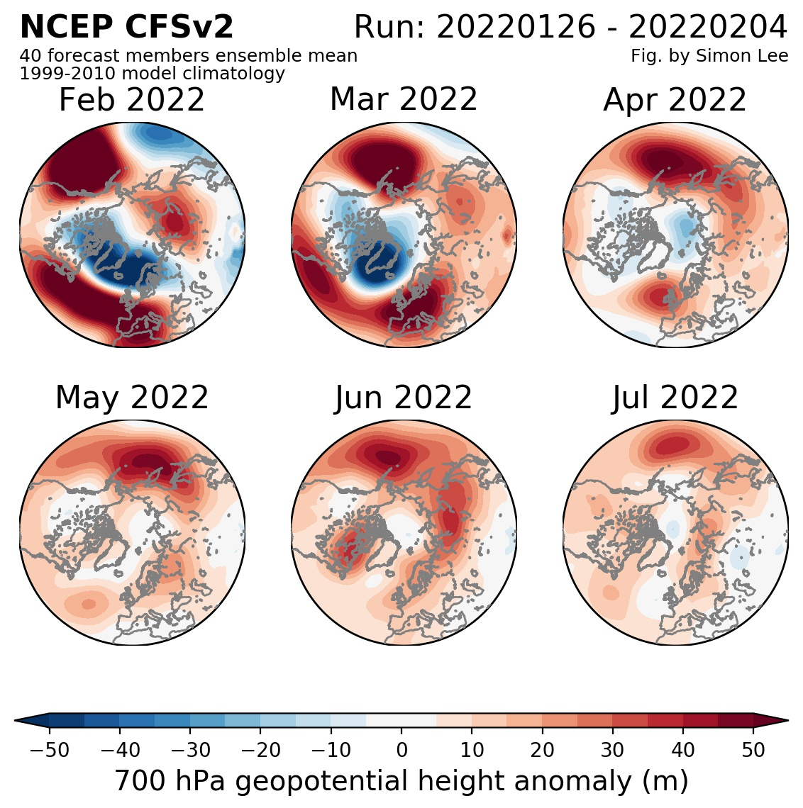
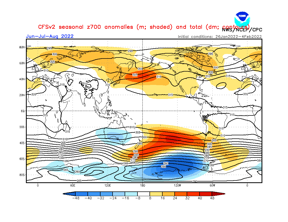
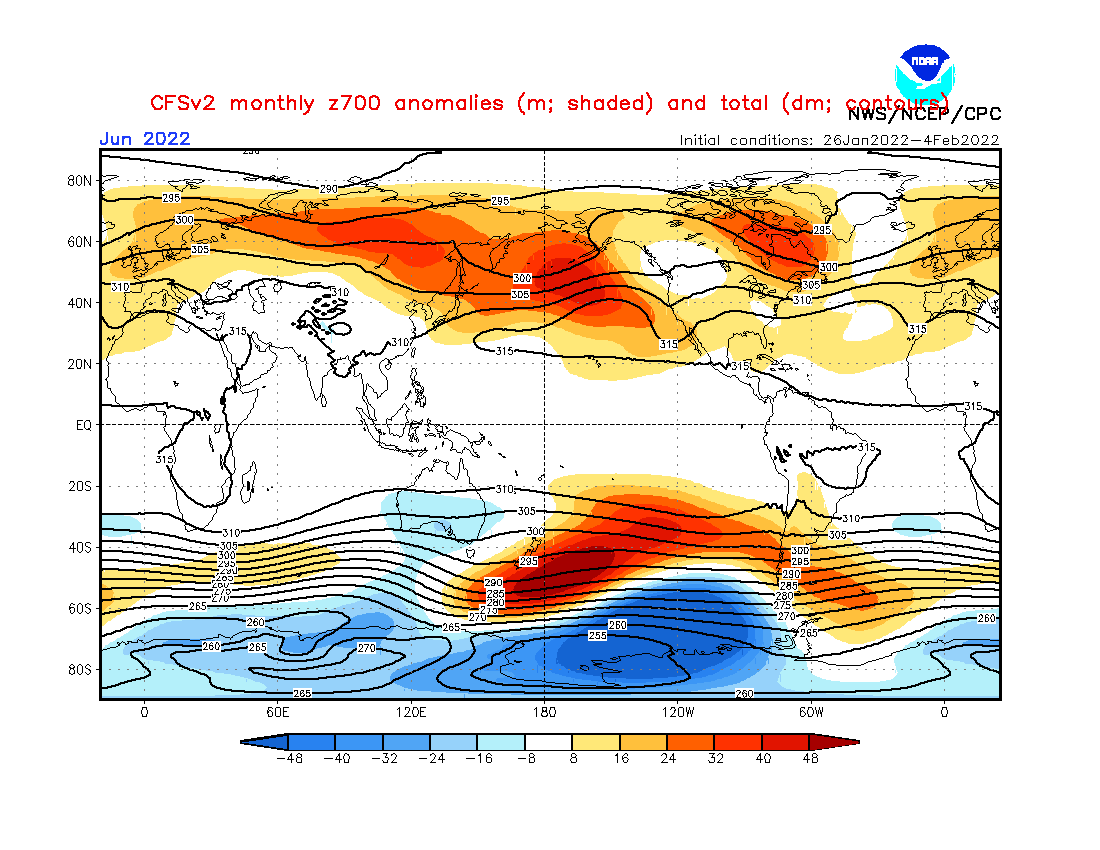
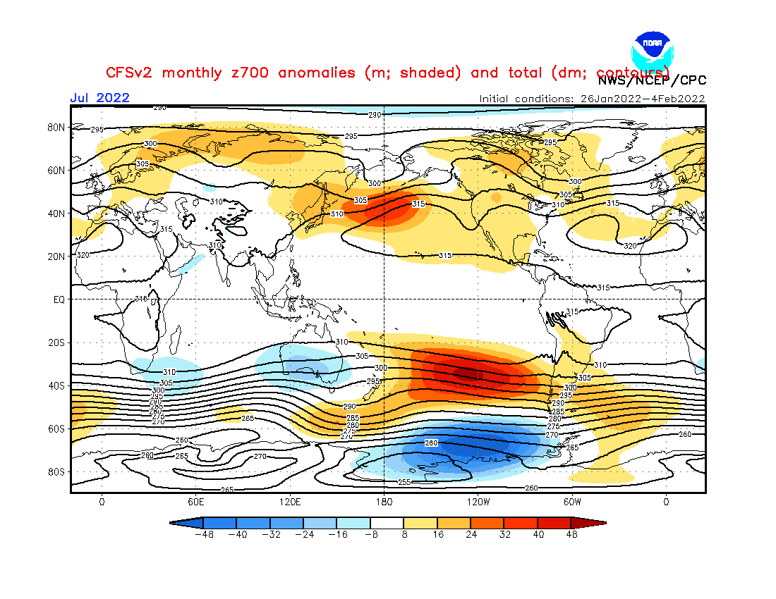
Source: https://simonleewx.com/cfsv2_monthly-anomalies/
Source: https://www.cpc.ncep.noaa.gov/products/CFSv2/CFSv2_body.html
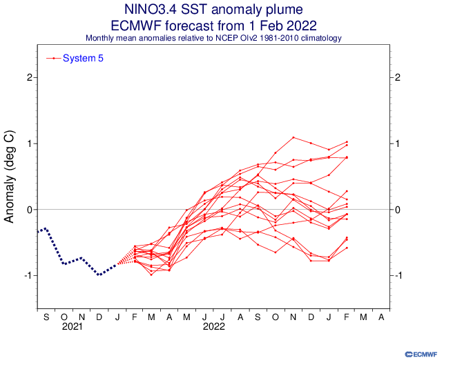
Source: https://iri.columbia.edu/our-expertise/climate/forecasts/enso/current/?enso_tab=enso-cpc_plume
Source: https://iri.columbia.edu/our-expertise/climate/forecasts/enso/current/?enso_tab=enso-sst_table
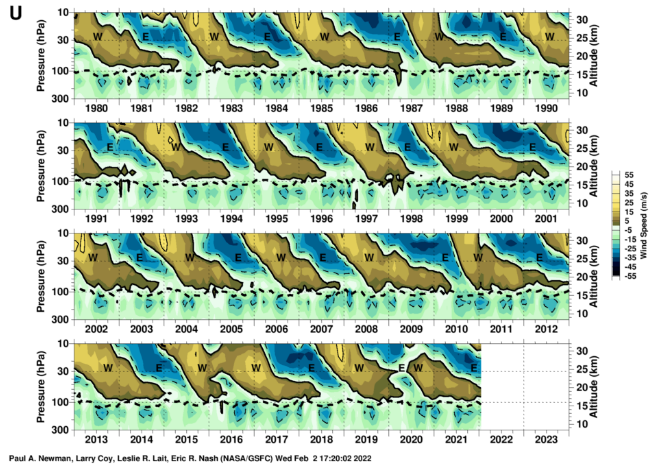
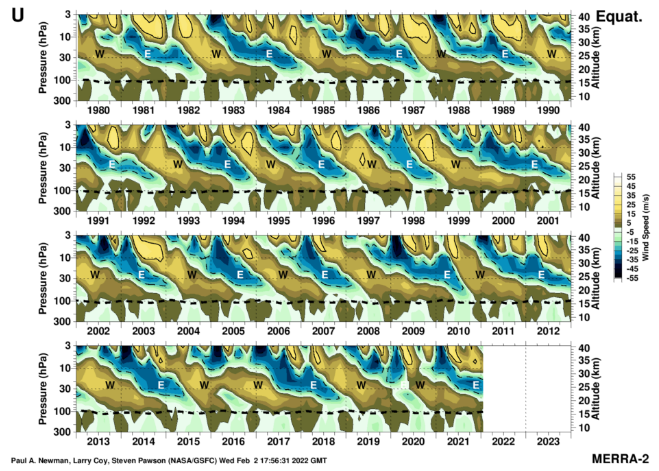
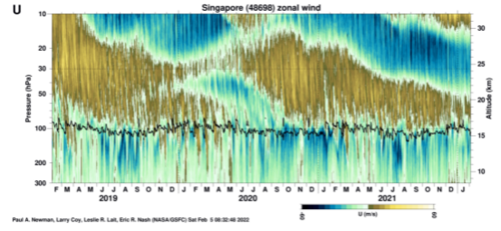
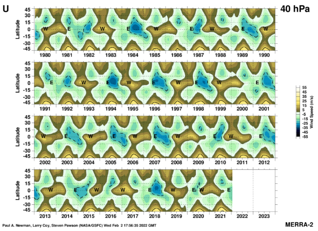
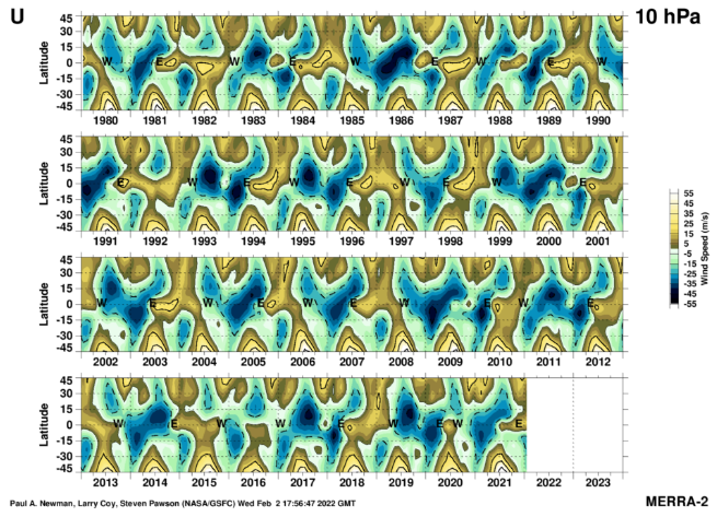
Source: https://acd-ext.gsfc.nasa.gov/Data_services/met/qbo/qbo.html
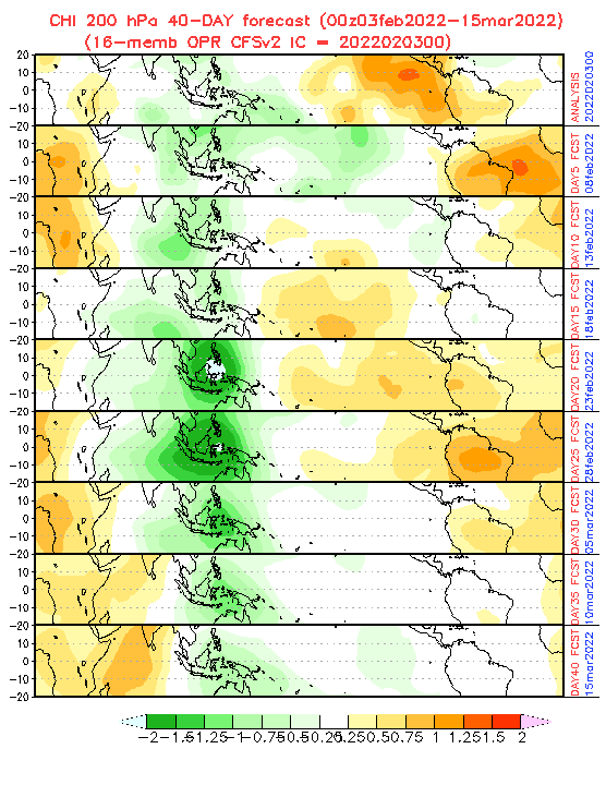
Source: https://www.cpc.ncep.noaa.gov/products/people/wd52qz/mjo/chi/cfs.gif
NAOi. Source: https://www.cpc.ncep.noaa.gov/products/precip/CWlink/pna/norm.nao.monthly.b5001.current.ascii.tabl0e
AOi. Source: https://www.cpc.ncep.noaa.gov/products/precip/CWlink/daily_ao_index/monthly.ao.index.b50.current.ascii.table

AAOi. Source: https://www.cpc.ncep.noaa.gov/products/precip/CWlink/daily_ao_index/aao/monthly.aao.index.b79.current.ascii.table
PNAi. Source: https://www.cpc.ncep.noaa.gov/products/precip/CWlink/pna/norm.pna.monthly.b5001.current.ascii.table