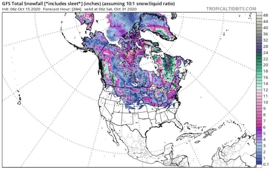
Winter already in October! Unprecedent October snowfall in USA and Canada thanks to negative phase of Arctic Oscillation

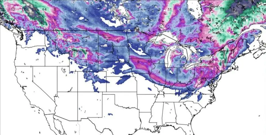
Available forecasts until 31. October are shocking, with snowfall in almost half territory of the USA and all Canada and extremely cold blasts with frosts, snowing and unseasonably winter conditions thanks to AO- phase (negative phase of Arctic Oscillation).
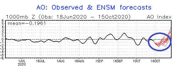
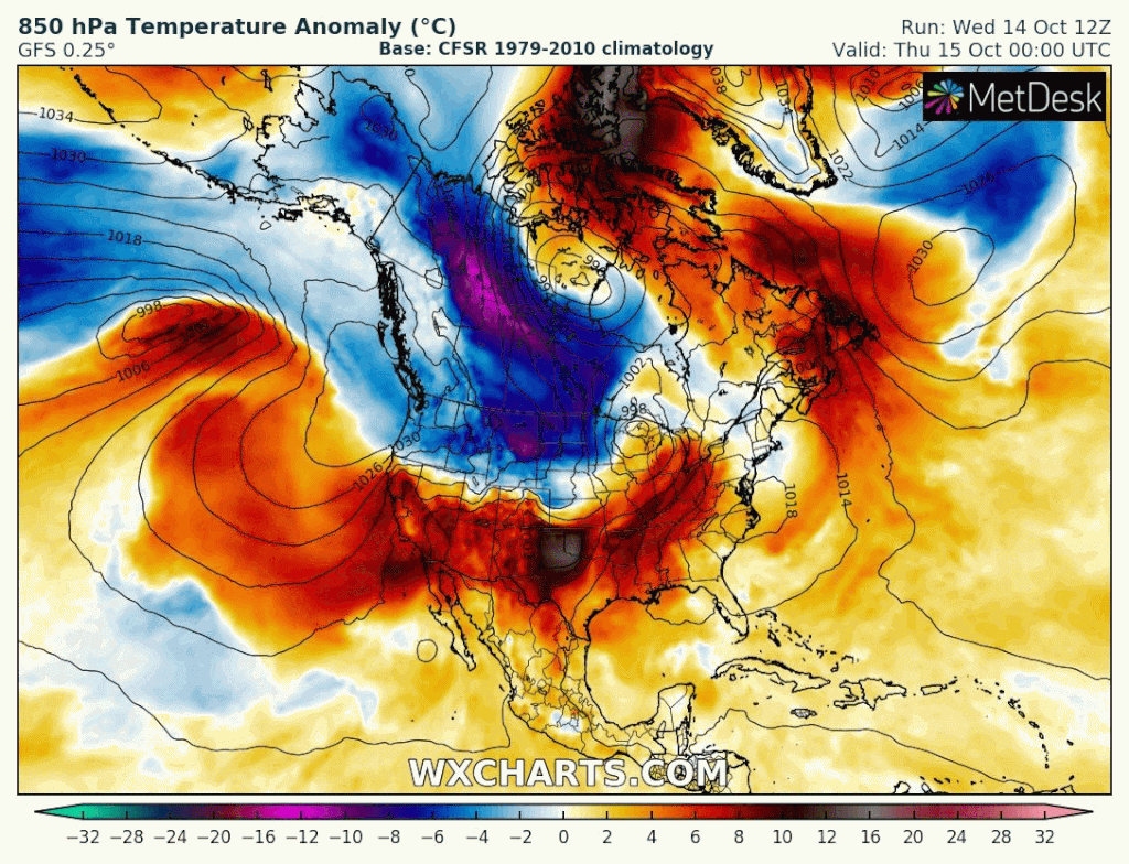
AO index will decline during next week up to -3, what means significant shifting of Arctic air masses to the southern latitudes, not only in the USA, Canada and Mexico, but too in Europe and Asia (and northern Africa).
Tracks of cyclones on polar front will be shifted over subtropical regions, while moderate climate zone will be flooded by extremely cold and dry Arctic air for a time.
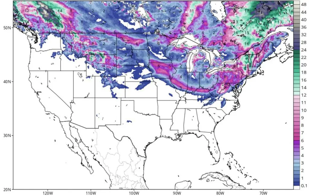
Extremely October amounts of snowfall are expected mainly in British Columbia and Quebec in Canada, but snow cover or minimally flying snow flakes has appear not only in Northern USA and Northern Plains, but too in Midwest, Northeast and partly even in Mid-Atlantic. Snow cover should appear in so southern states such as Kentucky or Virginia and snow flakes rarely in Tennessee or North Carolina.
Extreme snowfall in British Columbia should be party associated with La-nina pattern too.
USA, except of southwestern states, expect 2 big coldwaves until the end of October 2020 – the first with peak already between Saturday and Wednesday 17.-21. October, second, probably longer, between Thursday 22. October and end of a month.
Extreme cold conditions with severe frosts and regional snowing expects Europe too until the end of the month. Arising of NAO and AO index projected to the start of November 2020 should be linked with possible warmer period at the start of November 2020 in both continents.
Infographics: NOAA, tropicaltidbits.com, wxcharts.com