36 tornadoes up to F3 confirmed during Isaias, the Plains, Midwest with severe storms at the weekend, first autumn cold spell in parts of US and Canada and powerful heatwave in eastern half of Canada (104°F/40°C) around 20.8. ?
After hurricane Isaias, a confirming tornado events is ongoing, with 36 confirmed tornadoes and more possible tornado events across the whole east and northeast coast of US.
1 EF-3, 6 EF-2, 18 EF-1 and 11 EF0 tornadoes was confirmed, mainly across Mid-Atlantic and Northeast region. In Delaware, recorded tornado, with longest path ever – 29,2 miles (47 km), was observed.
Over Northern Plains and parts of Midwest, severe storm activity is forecasted and already reported too during the weekend 8.-9. August 2020. Severe storms warnings are available in our page too /homepage or https://mkweather.com/2020/08/08/warnings-for-sat-sun-mon-8-10-august-2020//.
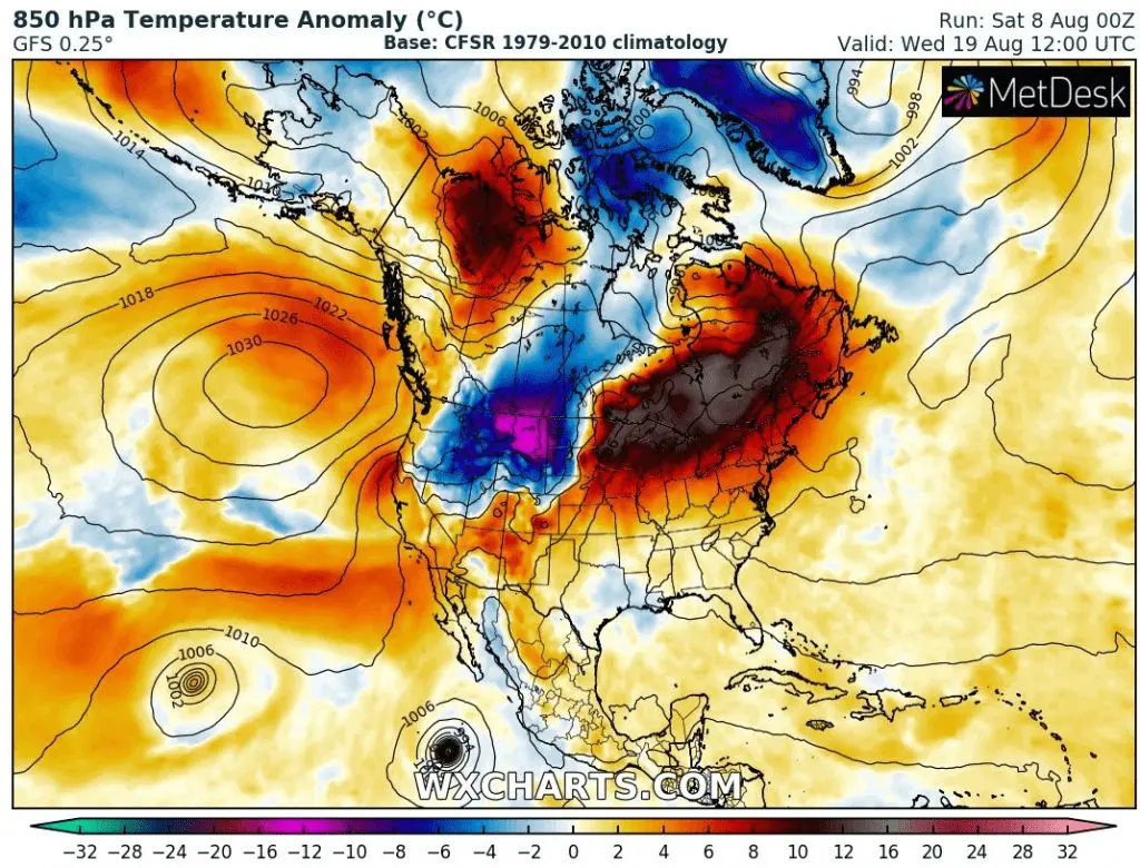
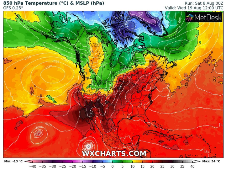
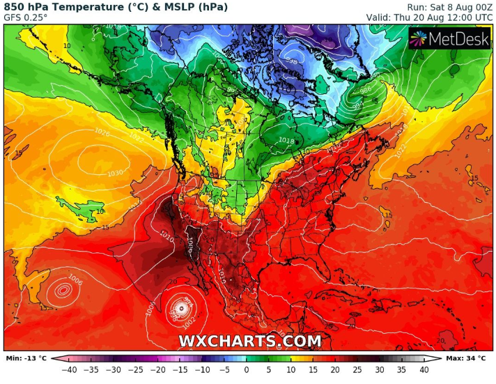
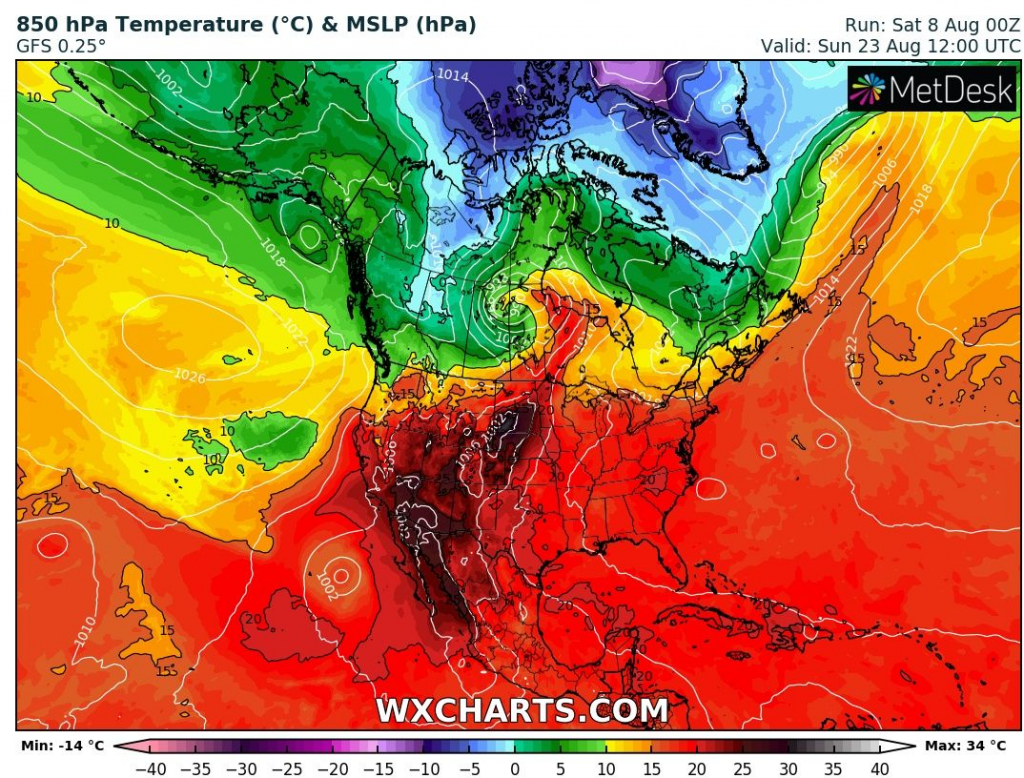
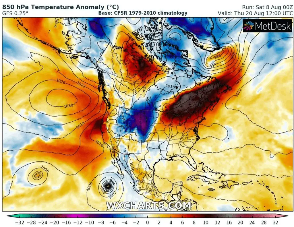
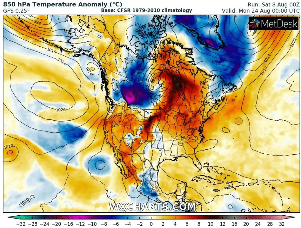
For long-term forecasters, can be very interesting an outputs of meteorological models, e.g. GFS for days around 19.-23 August, with powerful codlwave above western and central parts of Canada and northwestern part of US during these days.
Temperature in 850 hPa below 0°C could be very close to US borders during this period and temperatures in 2 meters with anomalies up to -15°C from long-term average. It appears, that autumn 2020 is behind the corner. On the other hand, eastern half of Canada could alive really hot times with temperatures up to 104°F / +40°C.
Tornado documentation from Weather Nation and Accuweather:


Storm in Northern Plains and Midwest documentation from Weather Nation and Accuweather:


Expected coldwave + heatwave 19.-23. August in parts of Canada and US according to Wxcharts.com:

Sources:
https://www.weathernationtv.com


