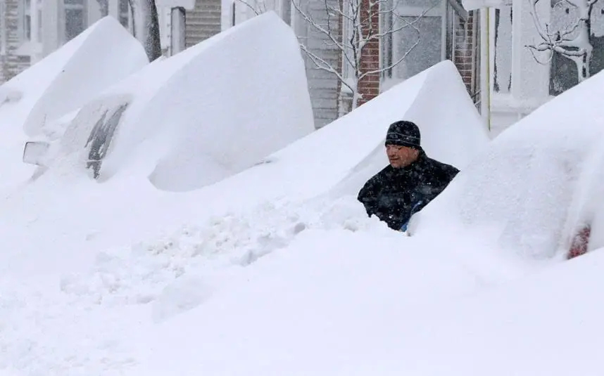
Although coldwaves will be divided by warm spells, until the end of November 2020 will be in the USA permanently regions with cold winter conditions.
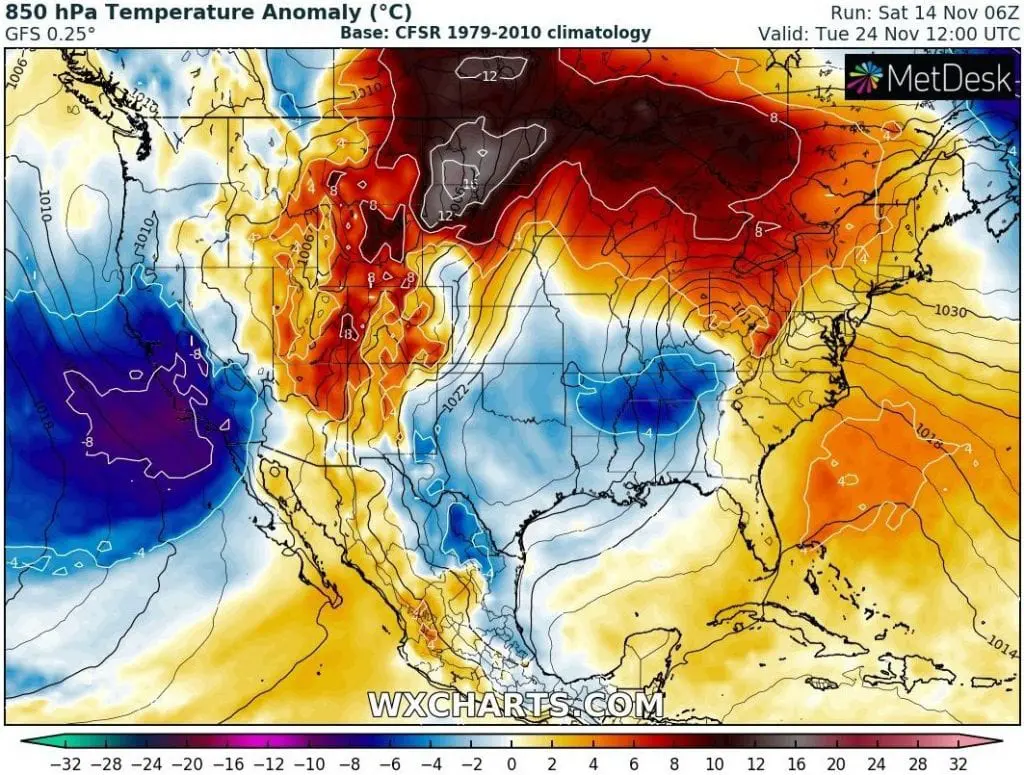
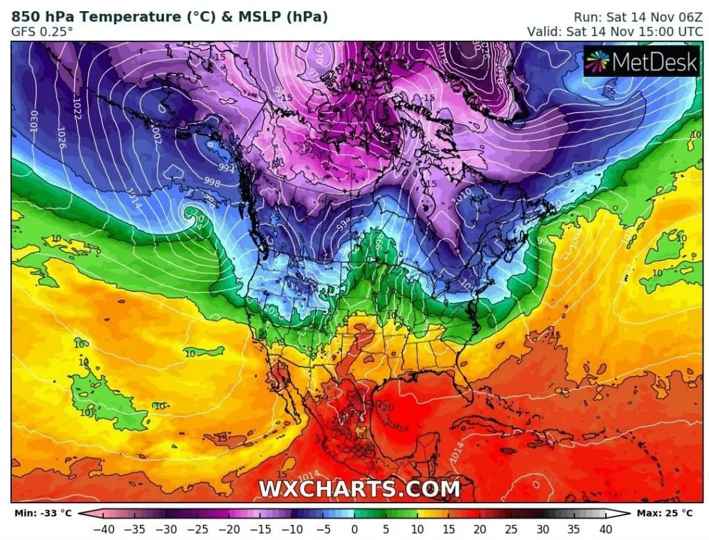
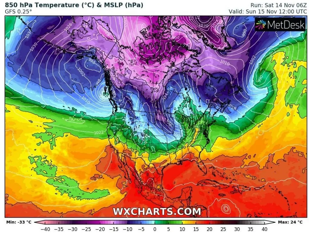
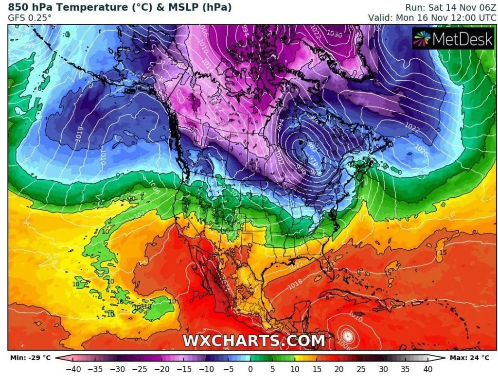
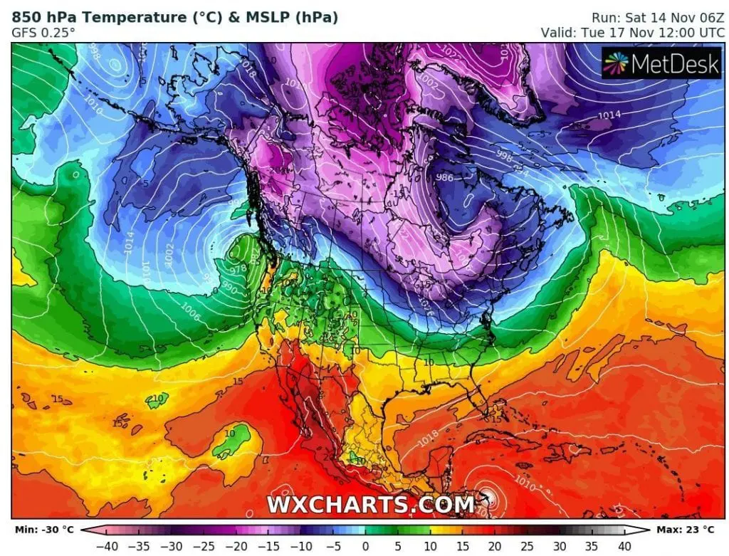
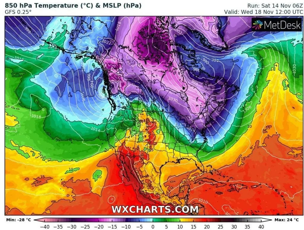
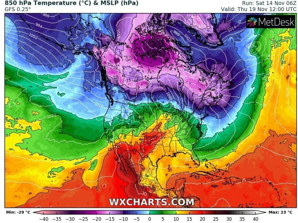
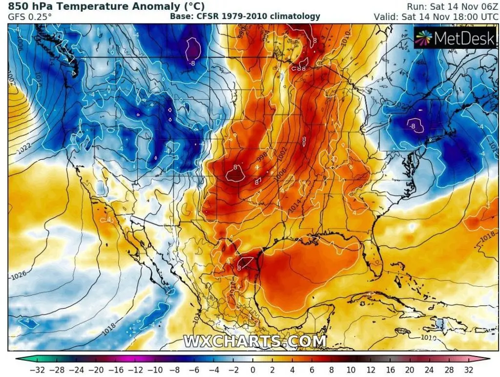
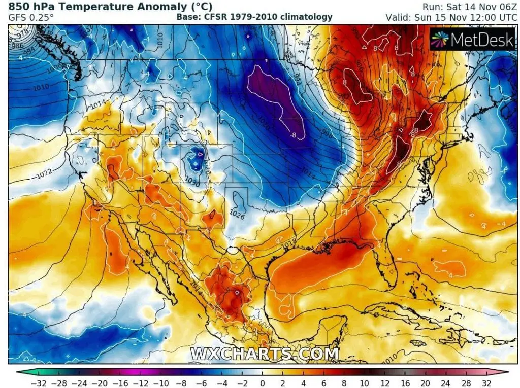
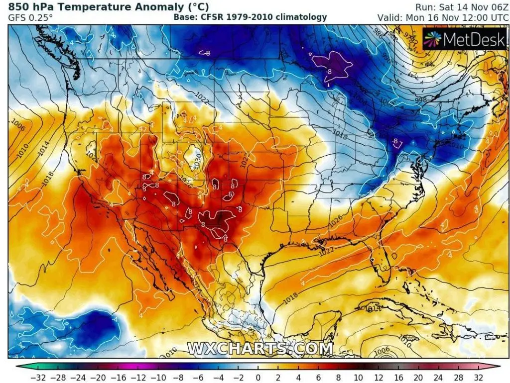
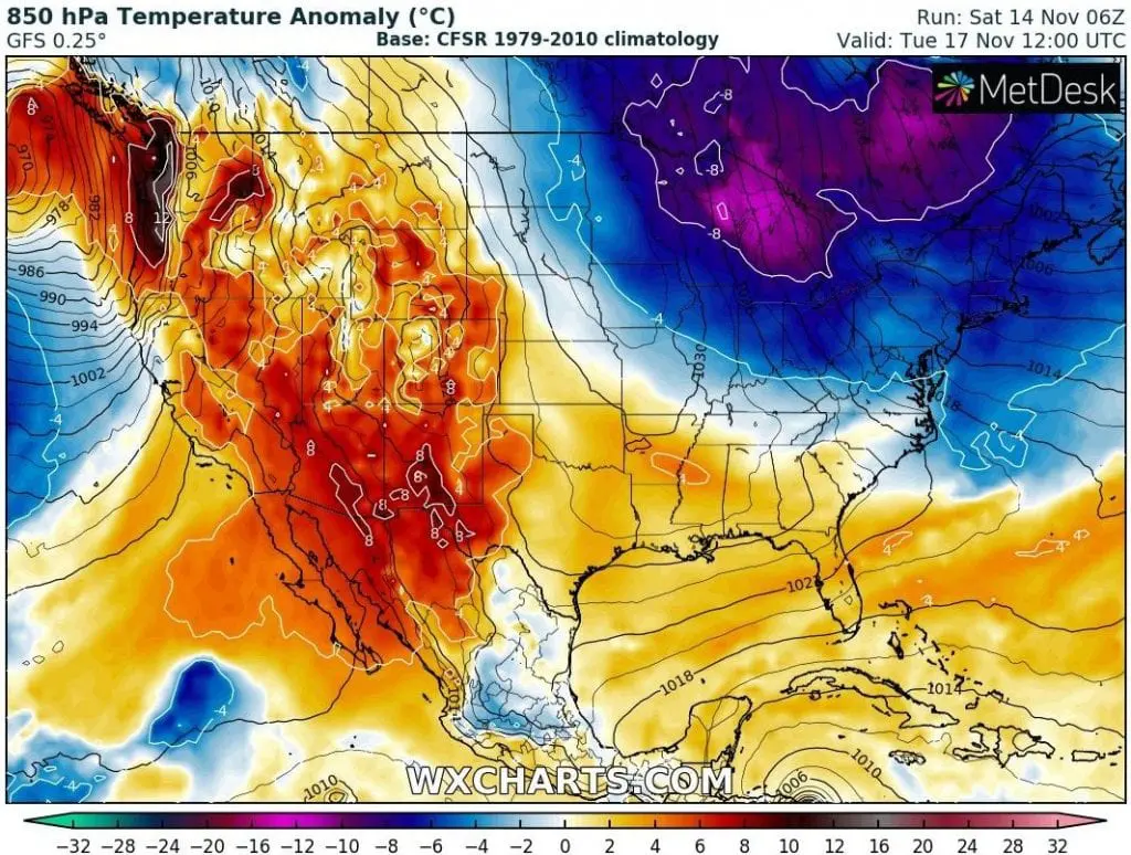
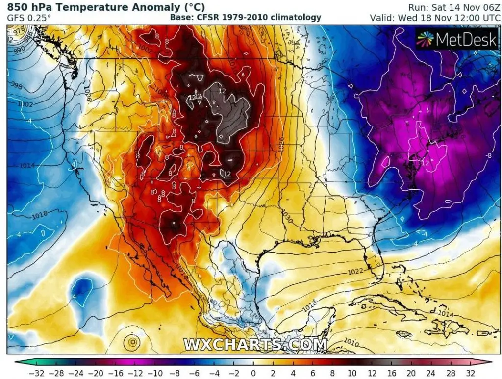
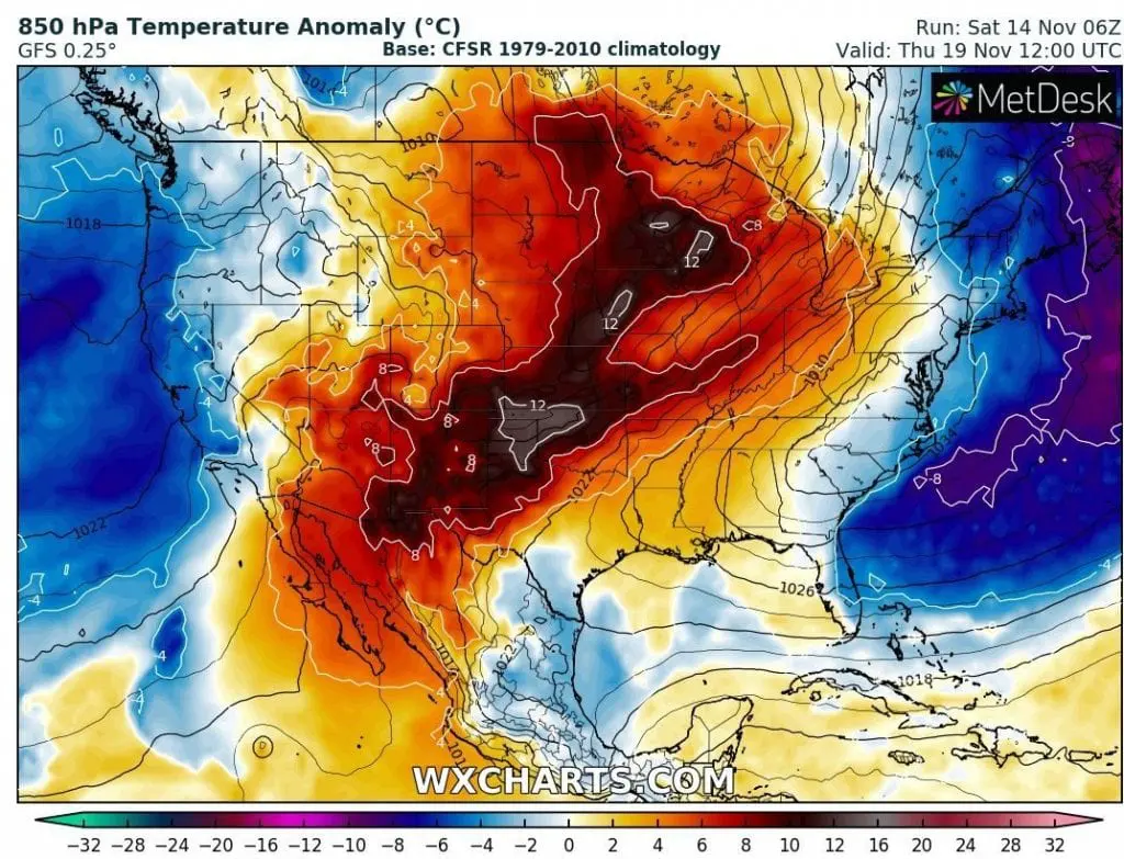
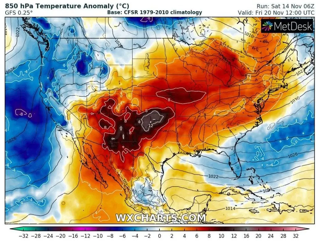
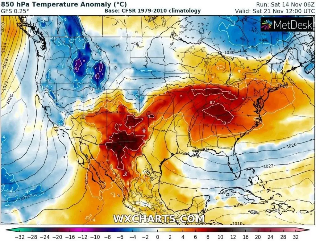
The strongest coldwave will be probably the first, which hit between 14.-19. November almost whole territory of the USA, expect of southernmost regions, with the strongest negative temperature anamalies.
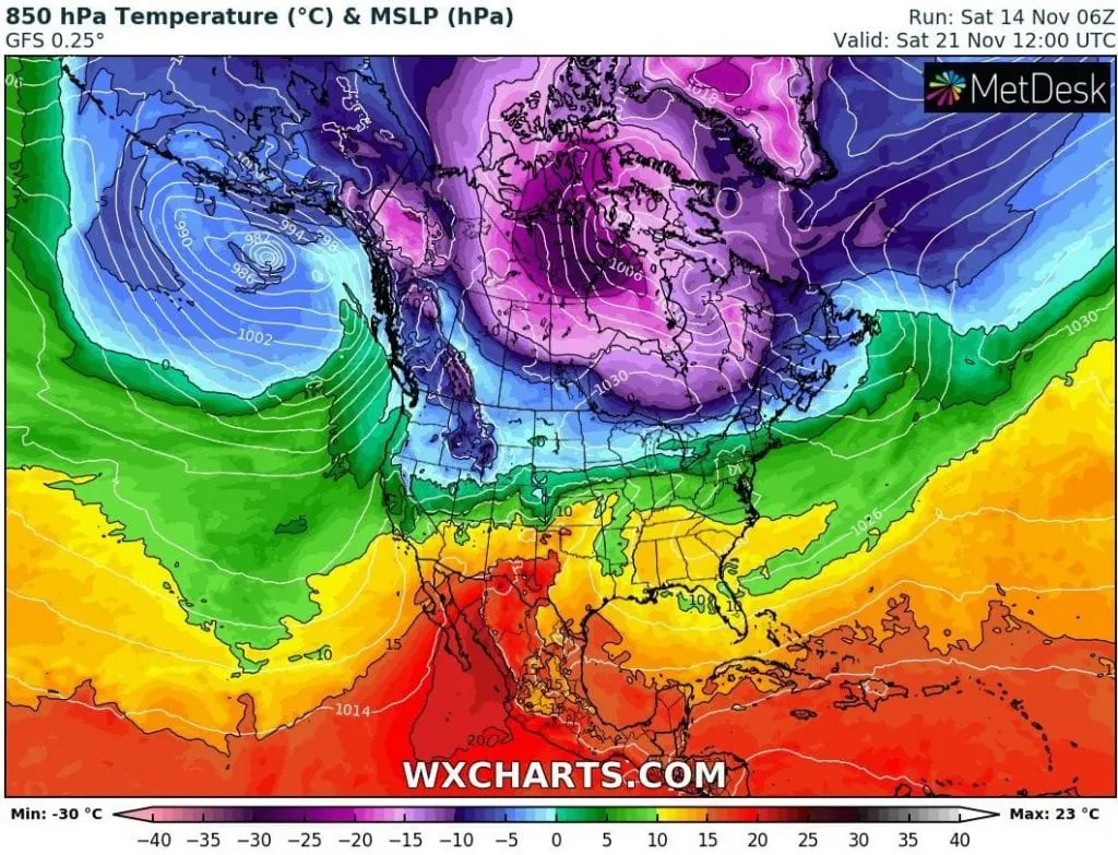
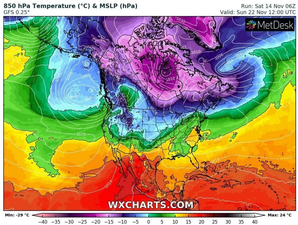
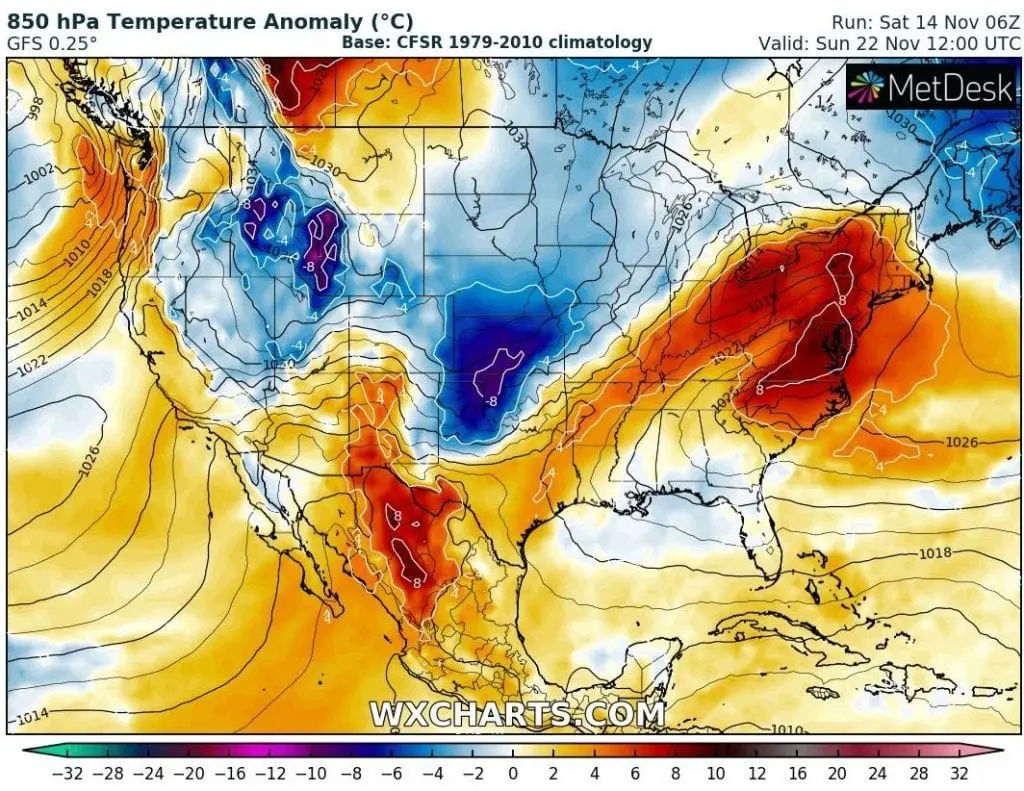
The second coldwave between 20.-23. November will be weak and hit mainly western half of the USA. Temperature anomalies will be light, but thanks to late season, it should bring winter conditions to colder regions.
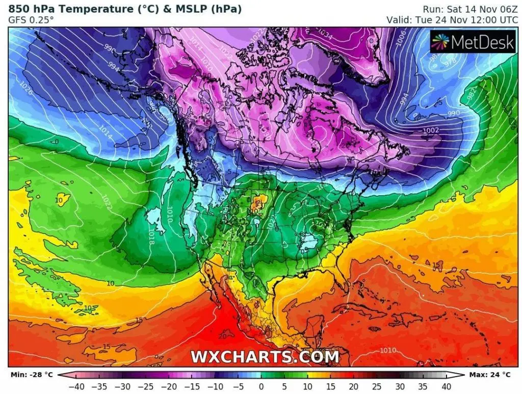
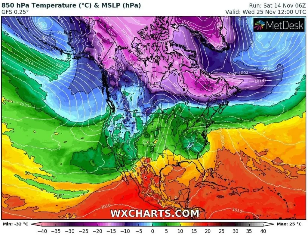
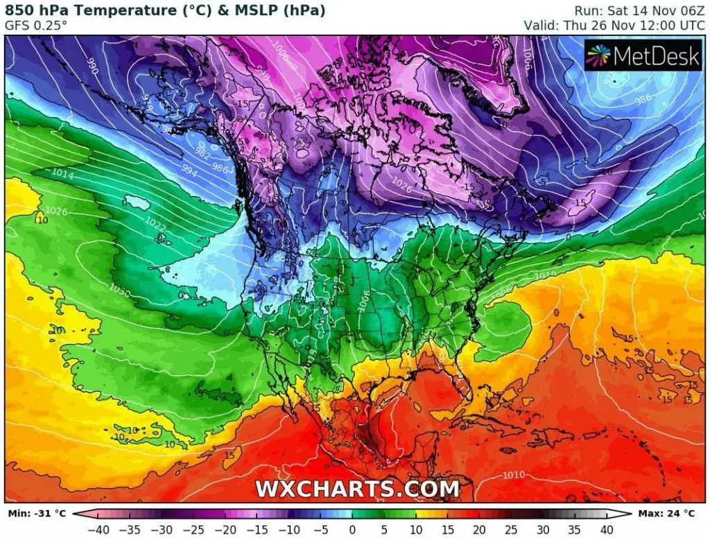
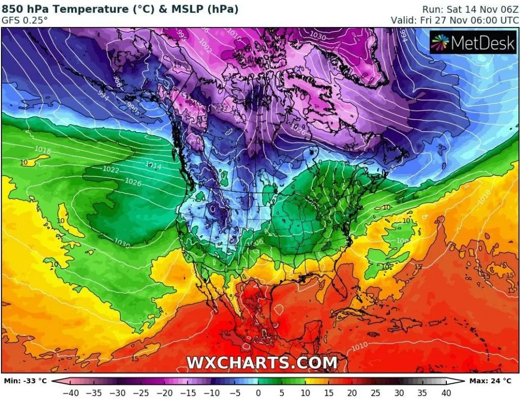
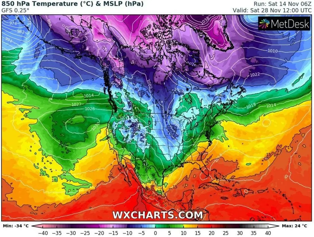
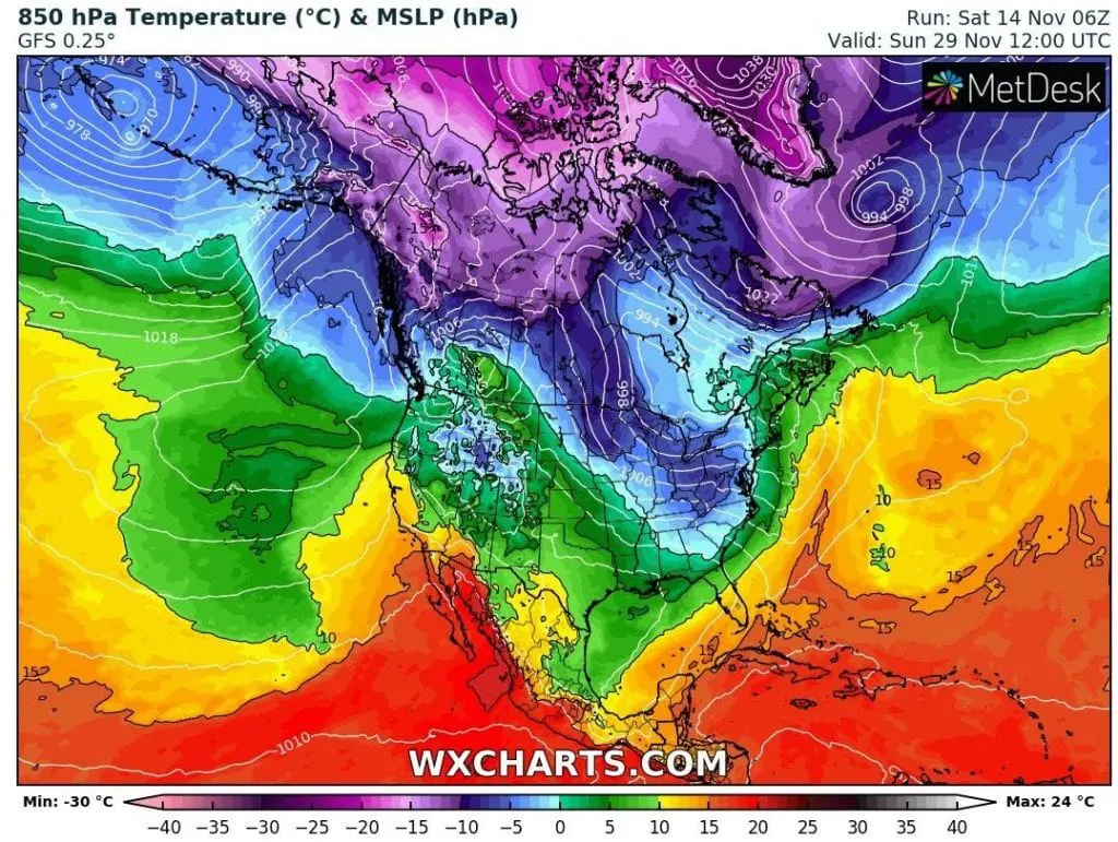
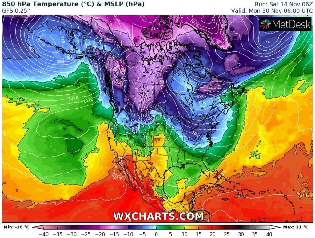
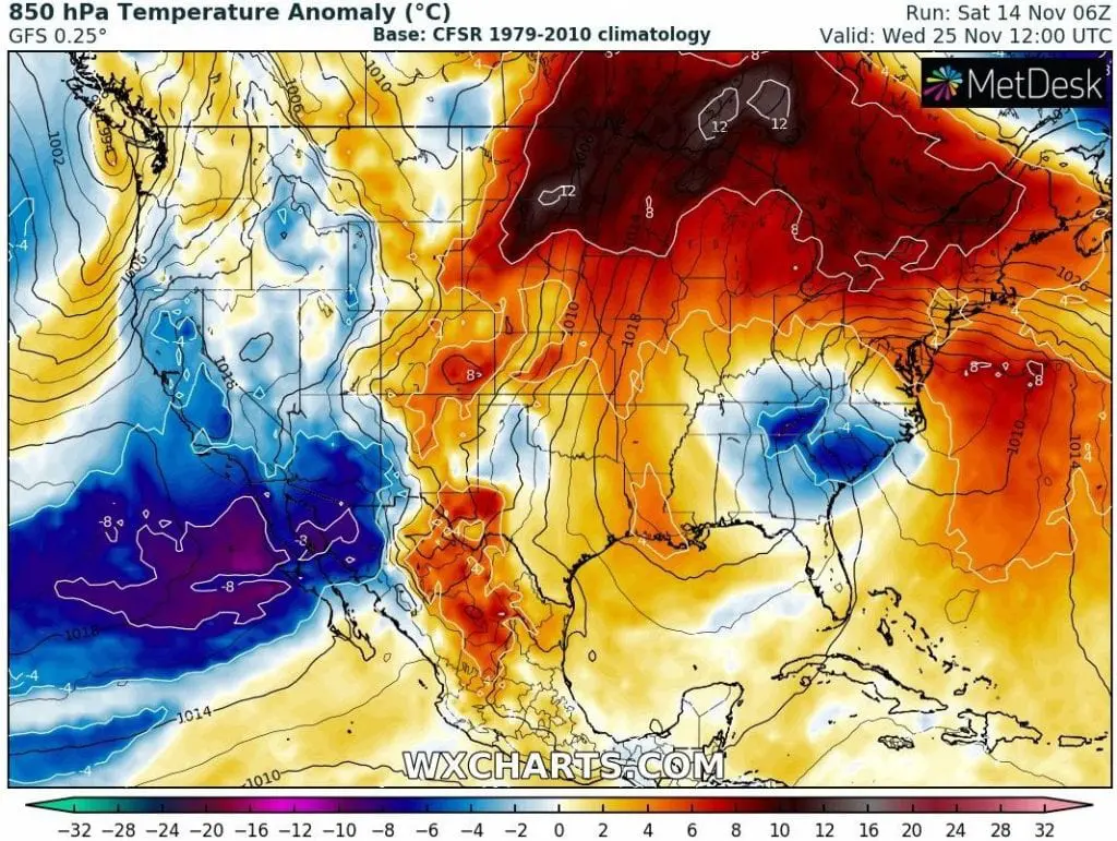
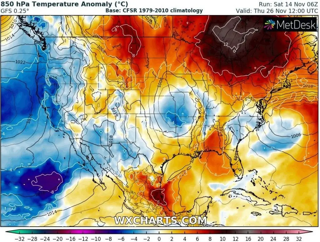
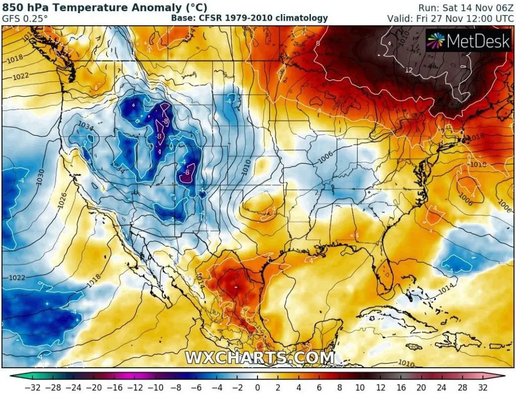
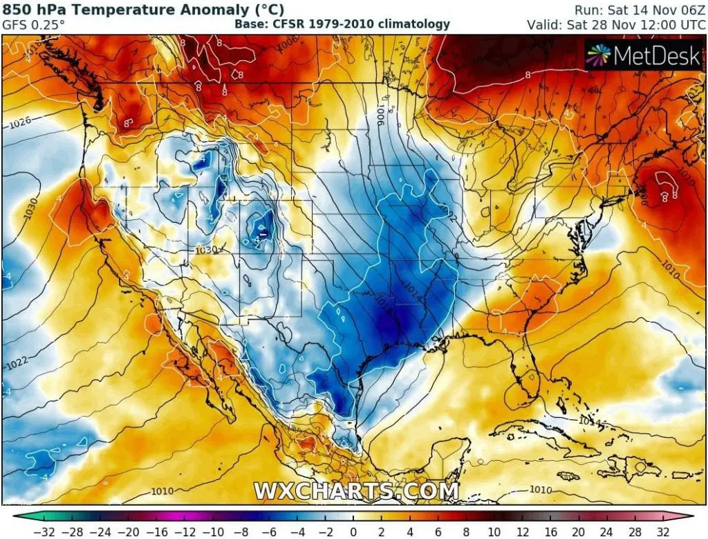
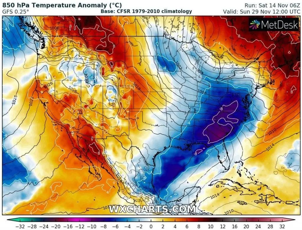
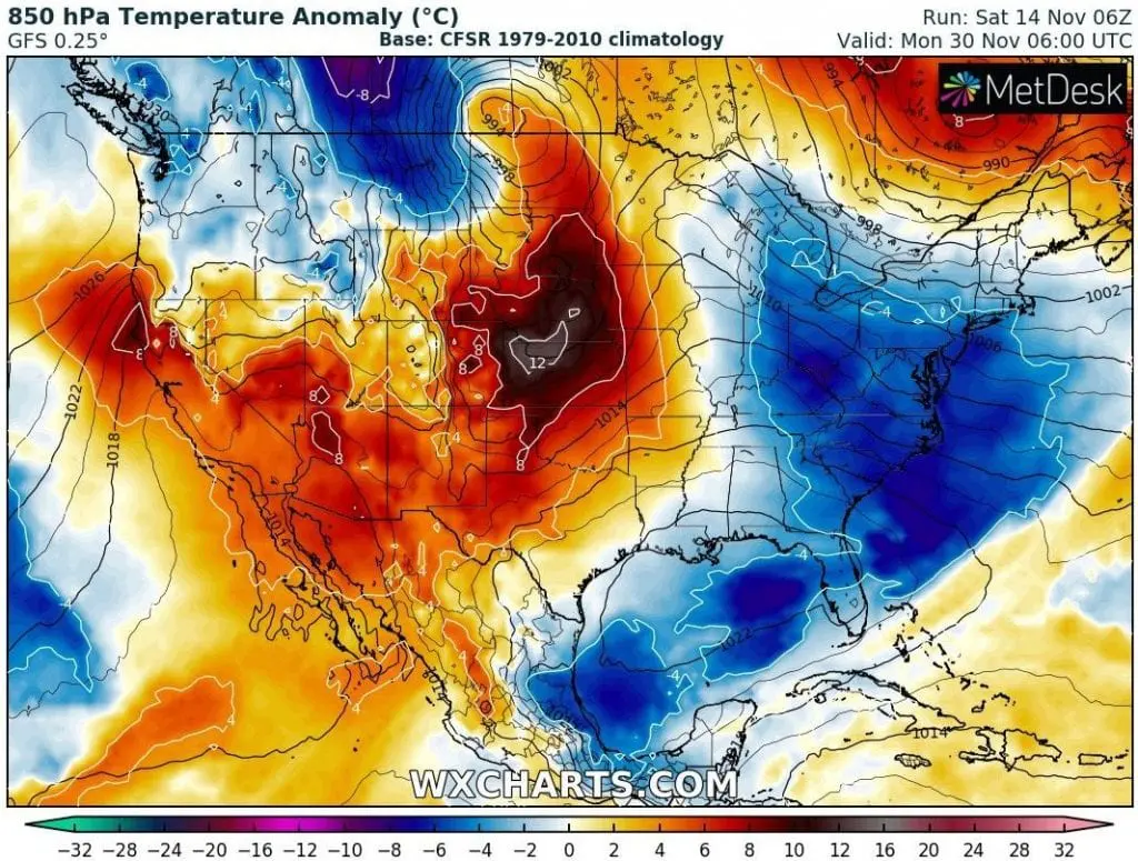
The third coldwave, preliminary between 24.-30. November will start too in the West, but gradually cold air will shift over rest of territory. Temperature anomalies will be firstly weaker, but gradually stronger in chosen regions.
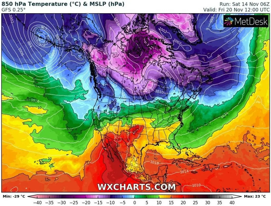
The warmest will be across the USA mainly between coldwave transitions, but there will be big differences between West and East and between North and South during the coldwaves, too.
Snowy conditions are forecasted mainly for western and northern half of the USA and almost all Canada.
The strongest temperature anomalies from long term average will appear in East Coast and Northeast around 18. November 2020, almost -15°C (15 degrees Celsius below average).
Despite of expected neutral conditions of AO and NAO, end of autumn 2020 should bring next early coldwaves not only in the USA (and Canada), but too in Europe /https://mkweather.com/2020/11/13/europe-under-the-snow-with-20c-frosts-it-starts-already-next-week//.
Coldwave 1: 14.-19. November 2020
Coldwave 2: 20.-23. November 2020:
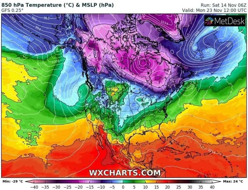
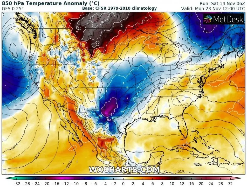
Coldwave 3: 24.-30. November