First forecast for Christmas 2020 in Europe: Higher chance of cold and snowy weather

Its already Friday, 20. November 2020 and into Europe has come the first coldwave from series of long-term cold weather expected – probably until Christmas 2020!
Extremely cold air within a strong part of polar vortex will be next month moving from Alaskan and Canadian part above Greenland´s and Northern Atlantic sector up to Europe, with really cold and snowy times during the peaks of coldwaves.
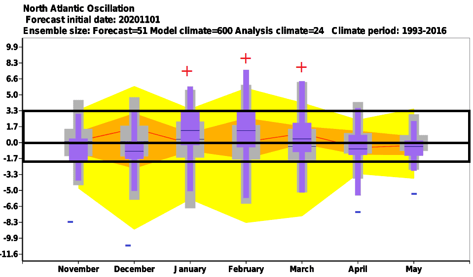
According to the newest outputs of ECMWF model, monthly forecast for December 2020 is favorable for a negative phase of NAO (negative North Atlantic Oscillation index), what means, that coldwaves linked with polar vortex should stay in Europe longer, than was before a time estimated.
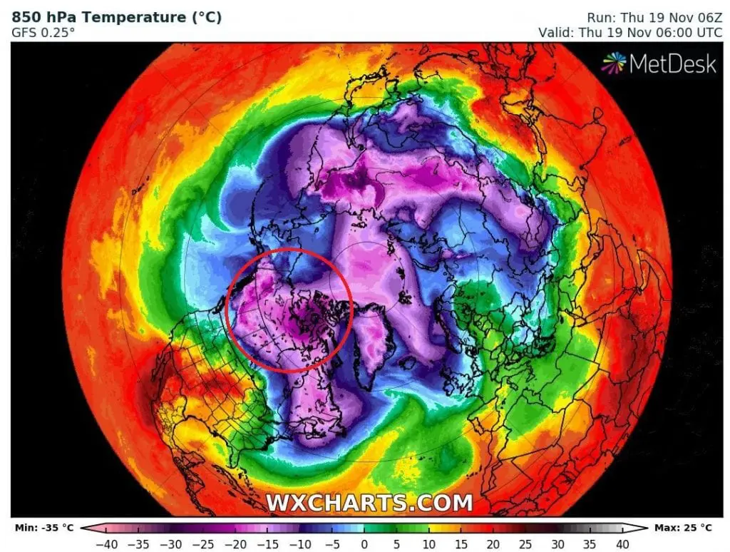
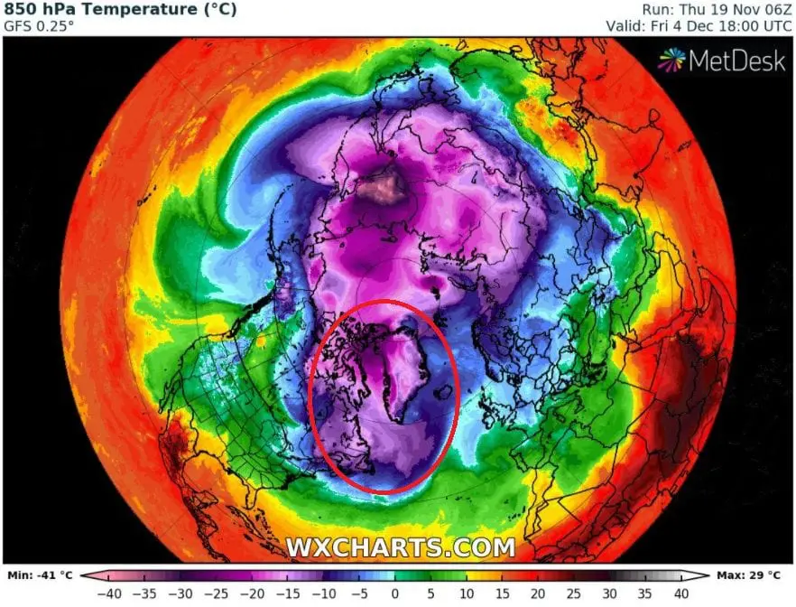
Transition of these very cold air masses from Canadian above Greenlands sector we should notice in maps of temperature in 850 hPa in Northern Hemisphere from wxcharts, below.
On graphs under T850 hPa maps we should see forecasted temperature in 850 hPa, precipitation and geopotential in 500 hPa for next 32 days (until 22. December 2020).
We chose cities, where should be seen a transition of polar vortex above Europe during period before Christmas and around Christmas 2020, the most.
From graphs for Torshavn (Faroe Islands), Exeter (the UK) and Madrid (Spain) we should notice, than closely before Christmas, little increase of temperature and geopotential (air pressure) is forecasted, what should mean, that regions should be already on the back side of polar vortex around Christmas 2020.
It doesnt immediately mean, that it will be warm at Christmas 2020 – on the back side of polar vortex is Arctic flow in dry Arctic and Siberian air the strongest, but gradually, it will change to western and southern flow with Azores high.
Meanwhile western Europe should be at Christmas at the end of circa month lasting cold period, graphs for Norrkoping (Sweden), Prague (Czechia) or Rome (Italy) are still very cold and with low geopotential, what should mean, that polar vortex will be still or before the end of its influence in central region of Europe, still with higher probability of cold and snowy conditions as usual.
Finally, the cities such as Bucharest (Romania), Zagreb (Croatia) or Athens (Greece) have the end of curves around 22. December 2020 in even colder air in deeper pressure, what should mean, that polar vortex bringing cold and snowy conditions is for this the most eastern part of Europe the most probable.
Mkweather will be forecast for Christmas 2020 for Europe, but soon for the USA and Canada, too, regularly update and discuss with the newest outputs of meteorological and climatological models, until 24. December 2020.
Infographics: apps.ecmwf.int, wxcharts.com: