Powerful cyclone Nivar hits India! (and Arabian Peninsula): 300 km/h wind gusts expected!

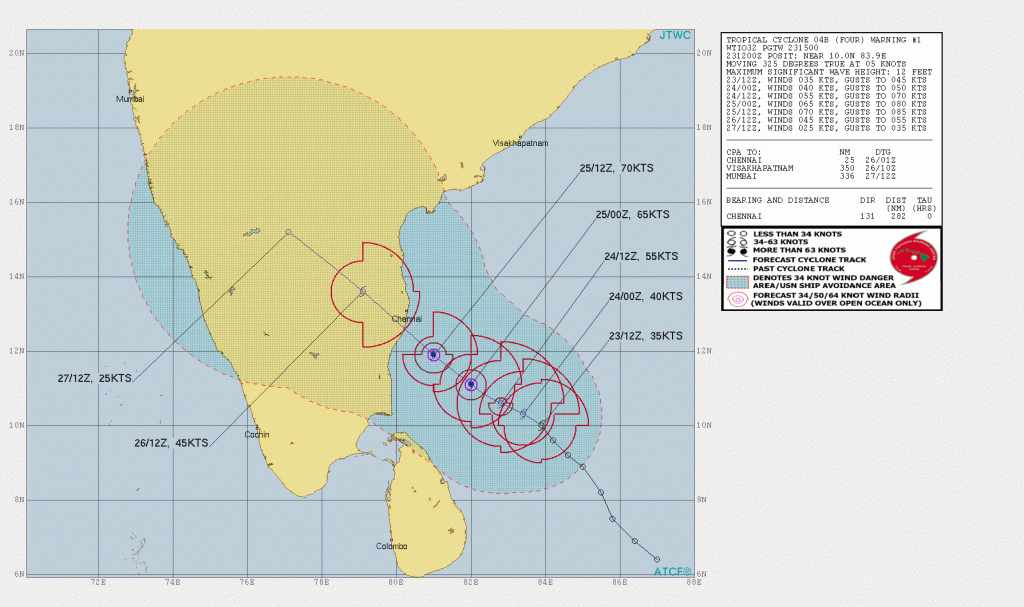
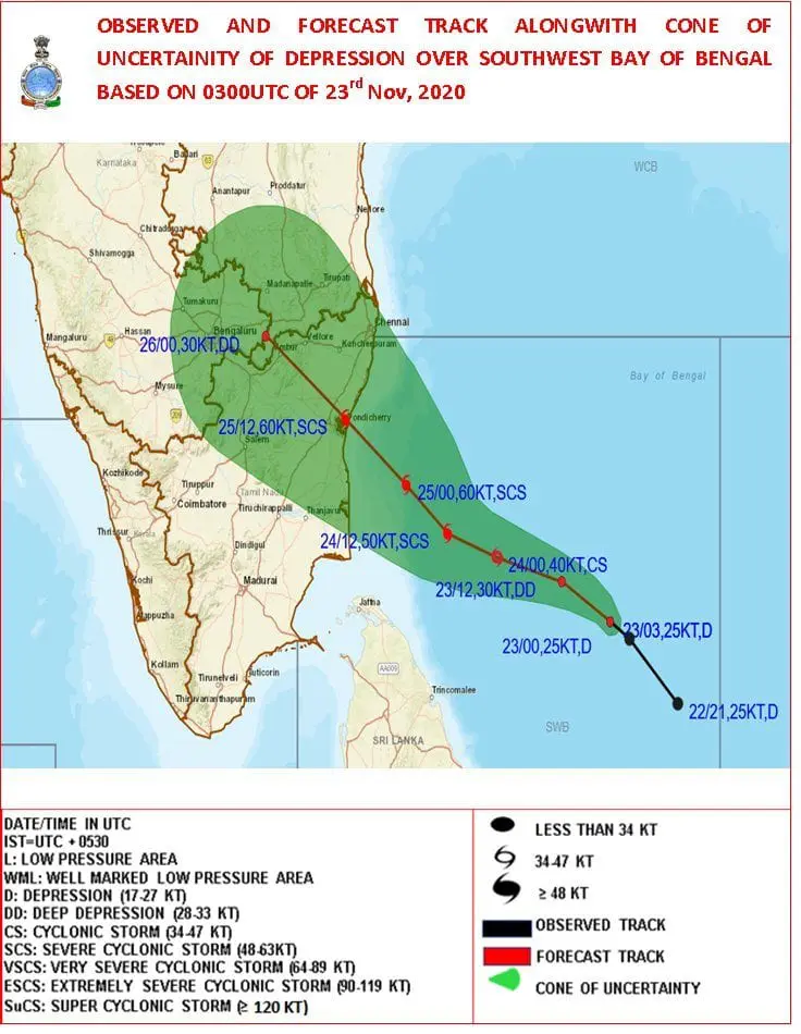
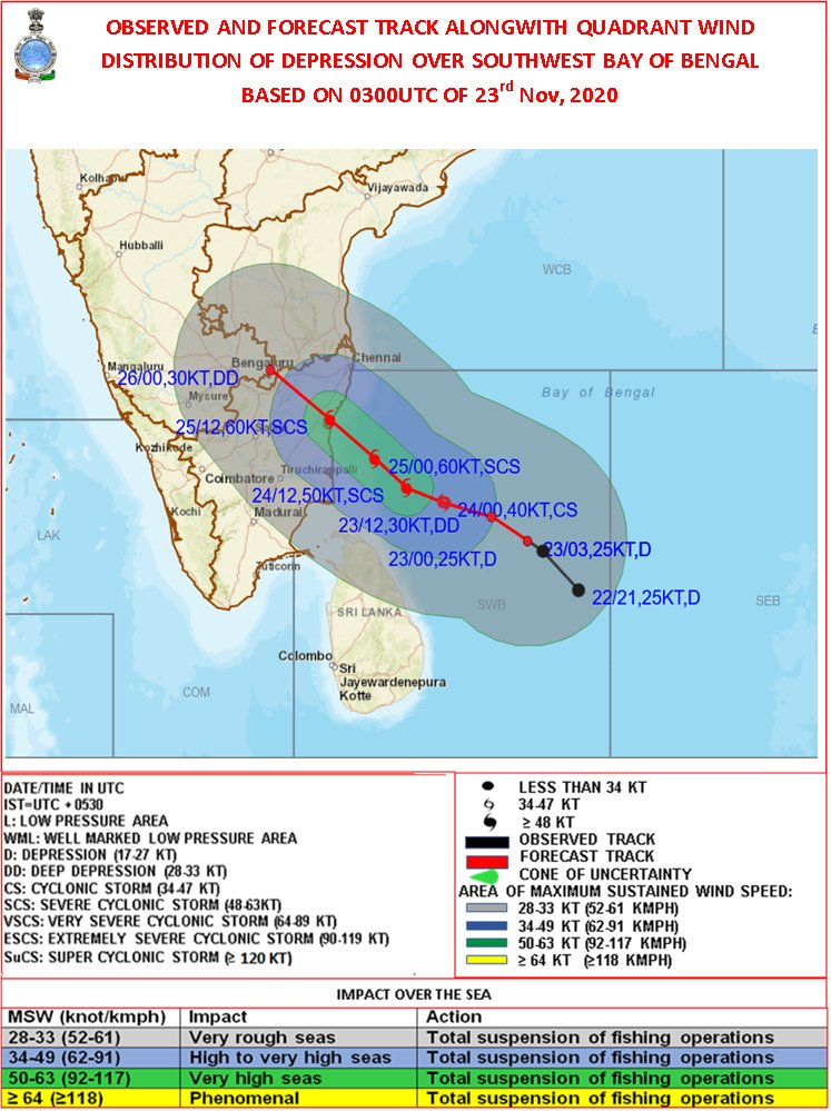
Next dangerous cyclone in Indian Ocean! Powerful cyclone Nivar hits southeastern India and northeastern Sri Lanka already on Wednesday, 25. November and after landfall in India, it will continue above Arabian Sea towards Arabian Peninsula!
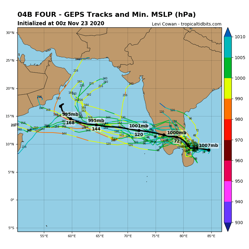
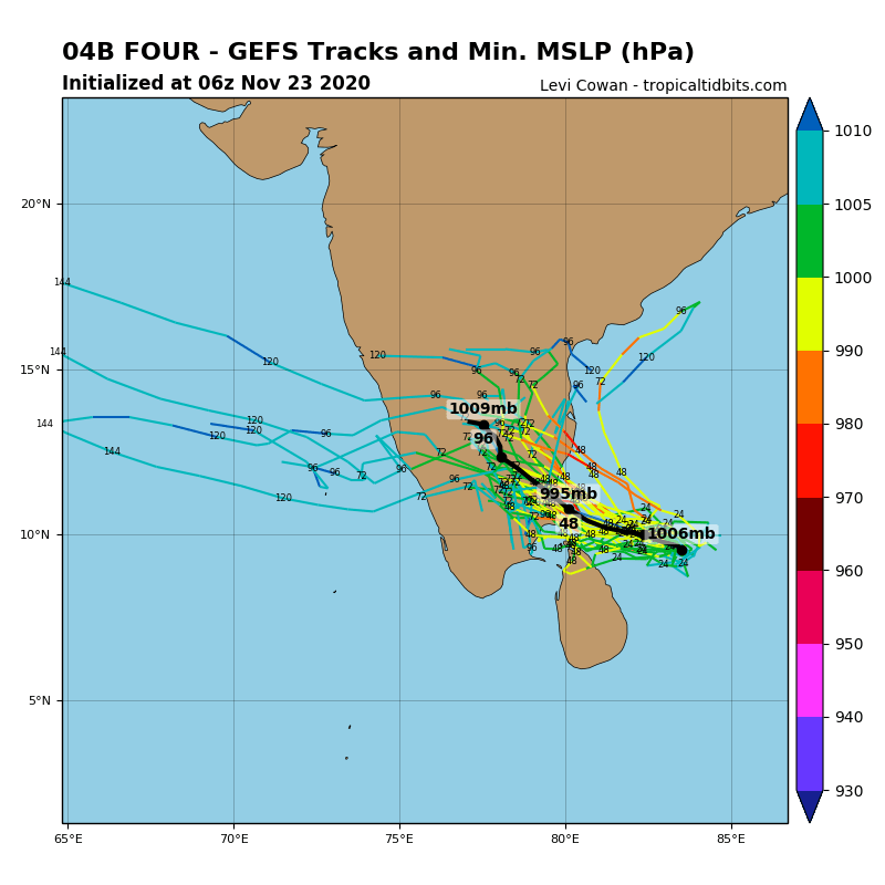
Indian Ocean currently disposes extremely explosive conditions thanks to strong wet MJO phase and La-nina and after record cyclone Gati, which hit such as the first cyclone with hurricane-power in history Somalia at the weekend /https://mkweather.com/2020/11/22/the-first-somalian-hurricane-gati-category-4is-bringing-2-year-rainfall-for-48-hours//, next extreme tropical threat has appeared over Bay of Bengal.
From this powerful cyclone, Nivar, should become next hours a storm with very similar intensity, such as from cyclone Gati in Somalia on Sunday, 22. November 2020 – with sustained wind gusts around 200 km/h and Category 4 hurricane equivalent.
From Nivar, one from deadliest storms of the year 2020 should become.
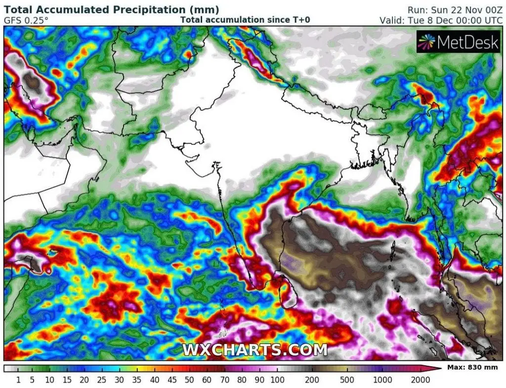
In southeastern India, rainfall up to 1000 mm with floods are expected already during current workweek – it brings the largest threat mainly during bringing landfall in the coastal region around Wednesday, 25. November 2020.
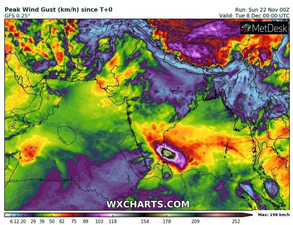
Expected wind gusts should reach around 300 km/h in time of maximal development.
Above the land, system will be weakening, but it re-strengthens over Arabian sea around the weekend and should hit southern parts of Arabian Peninsula, mainly Oman and Yemen early next week.
If you live in the region or plan a vacation in the area, watch current weather news, forecasts and warnings for better preparedness. Mkweather will watch the situation next days and brings first videos from event around Wednesday, 25. November.
Infographics: tropicaltidbits.com, wxcharts.com, IMD, NOAA: