Laura kills 11 in Haiti and Dominican republic, Cat3+ threat for the US, Marco is weakening
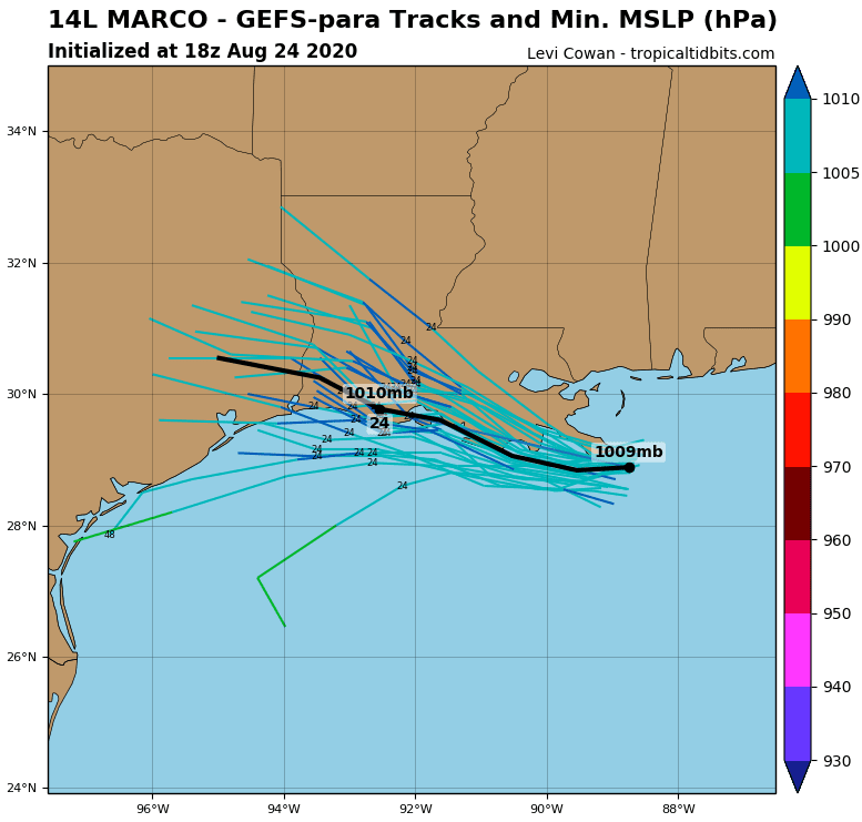
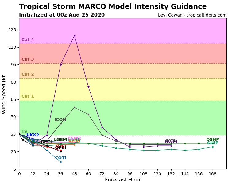
While Marco is already weakening above land and it caused less damages than was expected, tropical storm Marco will strengthen to hurricane and it is very possible that even to a major hurricane Category 3, soon. Category 4 is not excluded too, for now.
Marco has brought rain 11,83 inches (300 mm) to parts of northwestern Florida with flooding effect, but Laura in Caribbean was furthermore destructive.
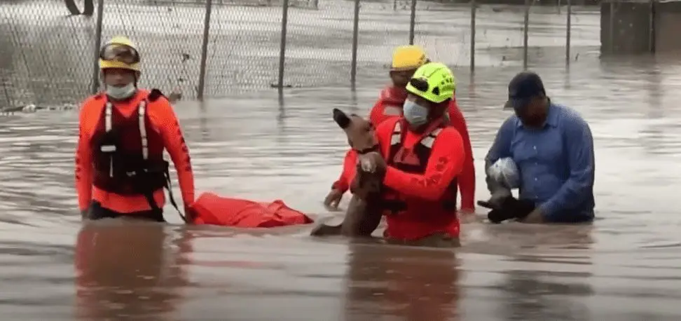
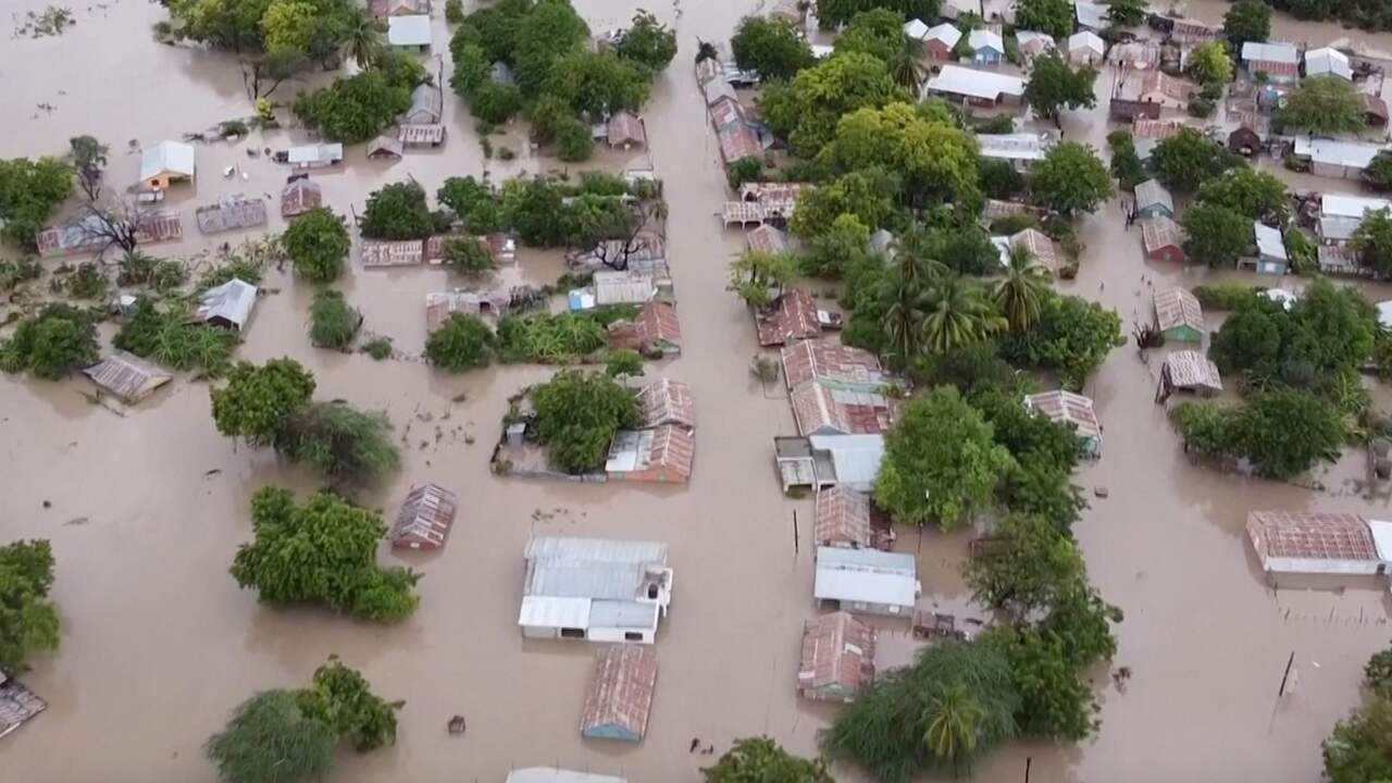
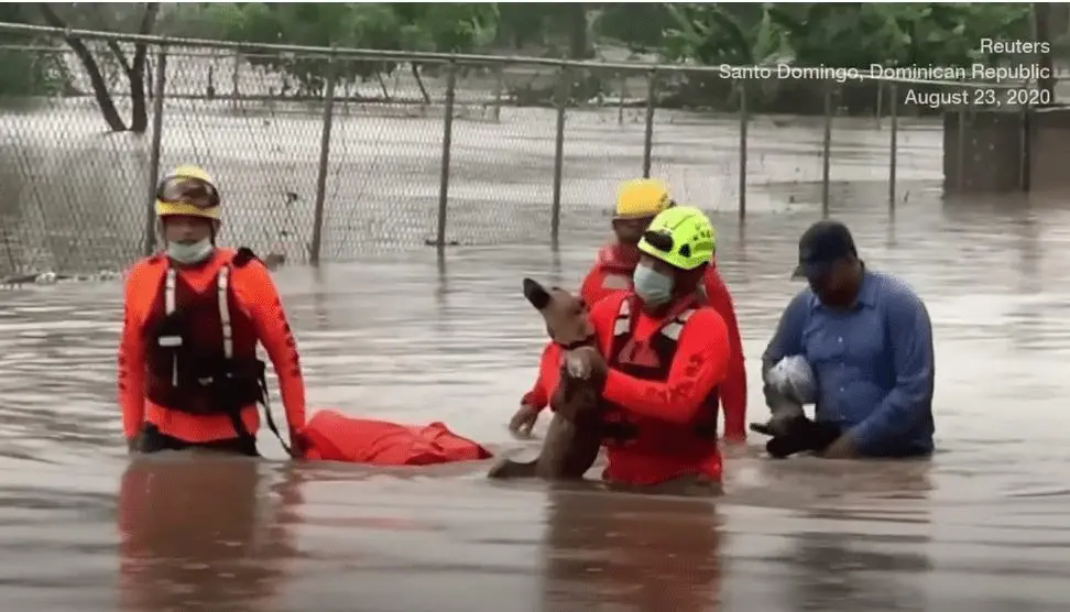
In Haiti and Dominican republic Laura (as a tropical storm!) caused severe floods and 11 killed. Big damages are reported from Cuba and Puerto Rico.
Laura hits Gulf Coast from Wednesday to Thursday and from Florida to Texas are valid warnings and hurricane watchs.
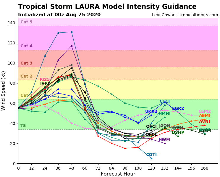
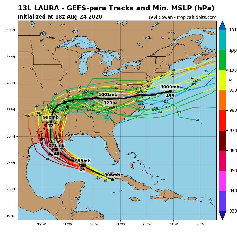
Situation in Caribbean can predict, that Laura will be another level for southern US coast such as Marco, then its needed to prepare to powerful, probably major hurricane with severe winds, heavy rain, wild seas and flooding effect.
After Laura hit Gulf Coast, it will continue northward and then above Midwest will change a trajectory to eastward and above Mid-Atlantic will shift over Atlantic ocean. It´s possible, that strong ex-hurricane will cause heavy rain in parts of continental US, too.
Photogallery of impact Laura from Caribbean:


Current forecast of intensity and expected trajectory of Laura and Marco:
Sources:
https://www.cbsnews.com/news/tropical-storm-laura-marco-texas-gulf-coast-louisiana-today-2020-08-24/
https://finance.yahoo.com/news/thousands-evacuated-two-storms-head-235510543.html
https://tropicaltidbits.com/storminfo/


