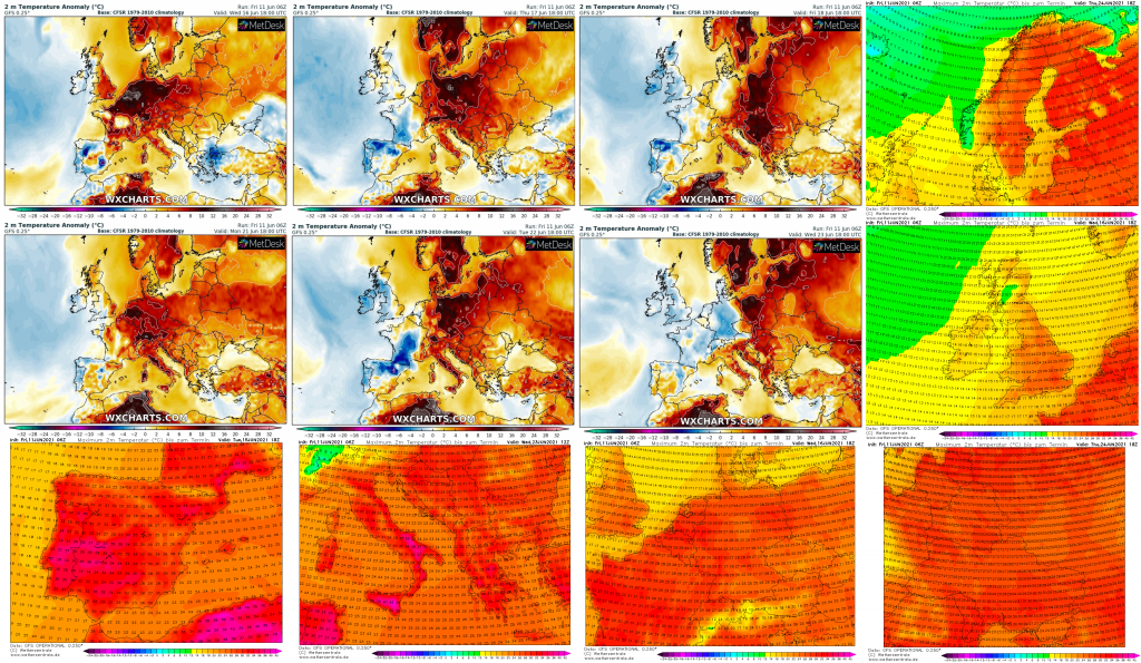
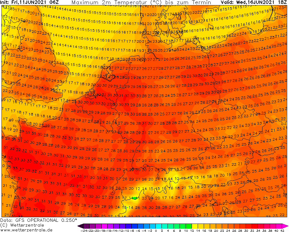
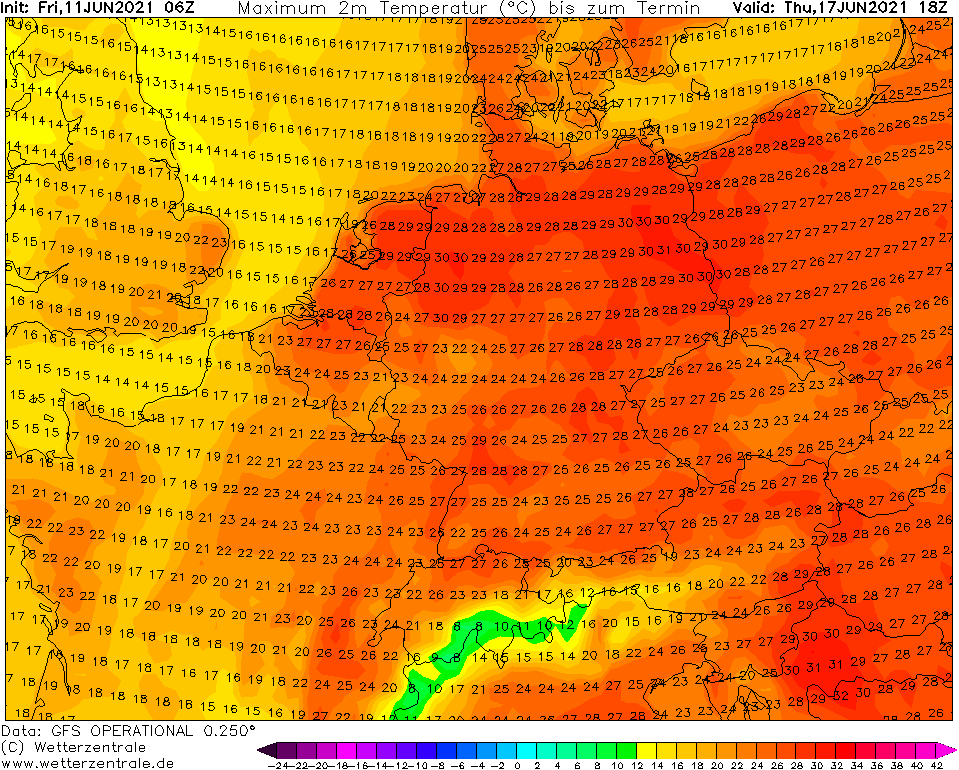
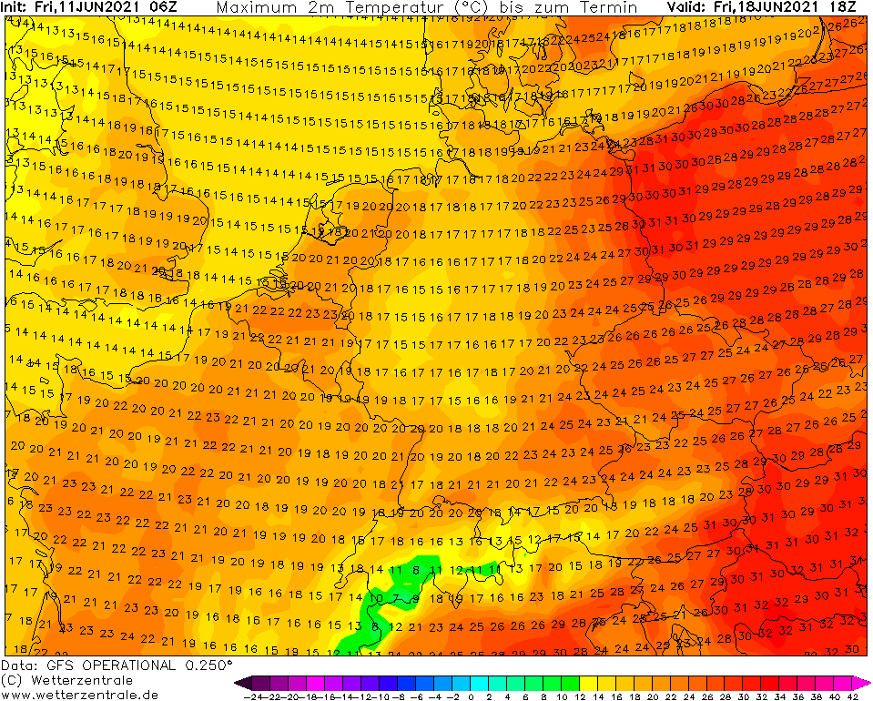
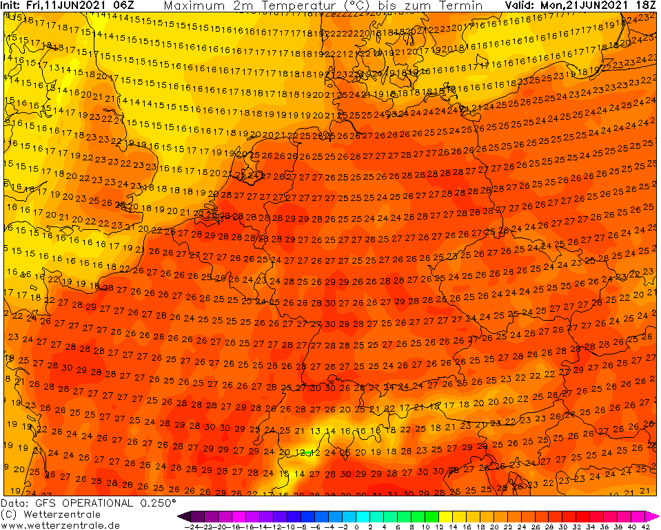
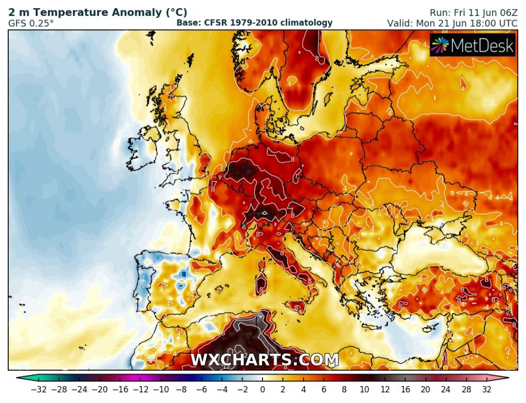
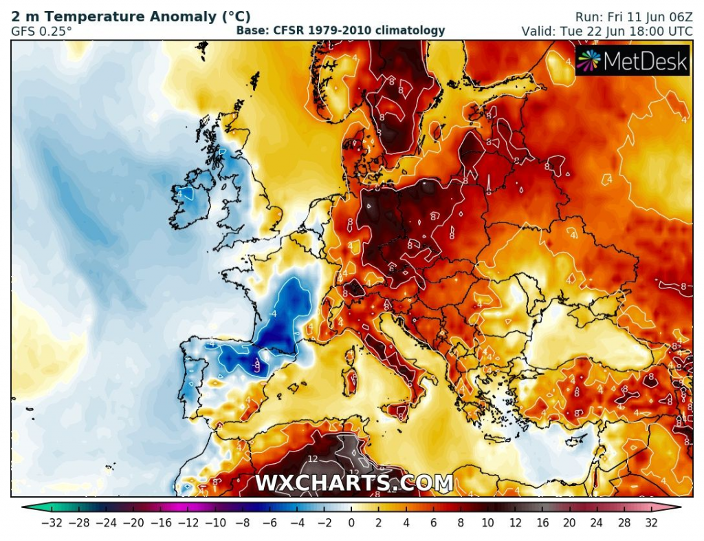
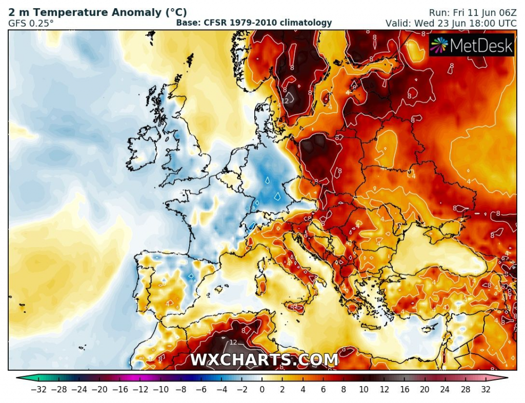
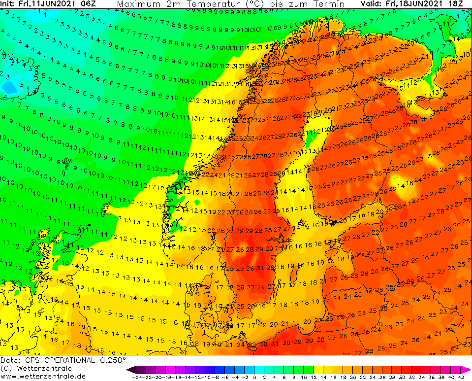
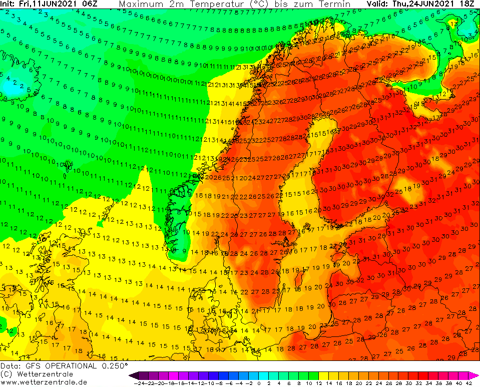
Mediterranean +45°C, Central Europe +35°C, Scandinavia +34°C and the UK +32°C: Heatwaves will come in 2 peaks, around 16. and 22. June 2021
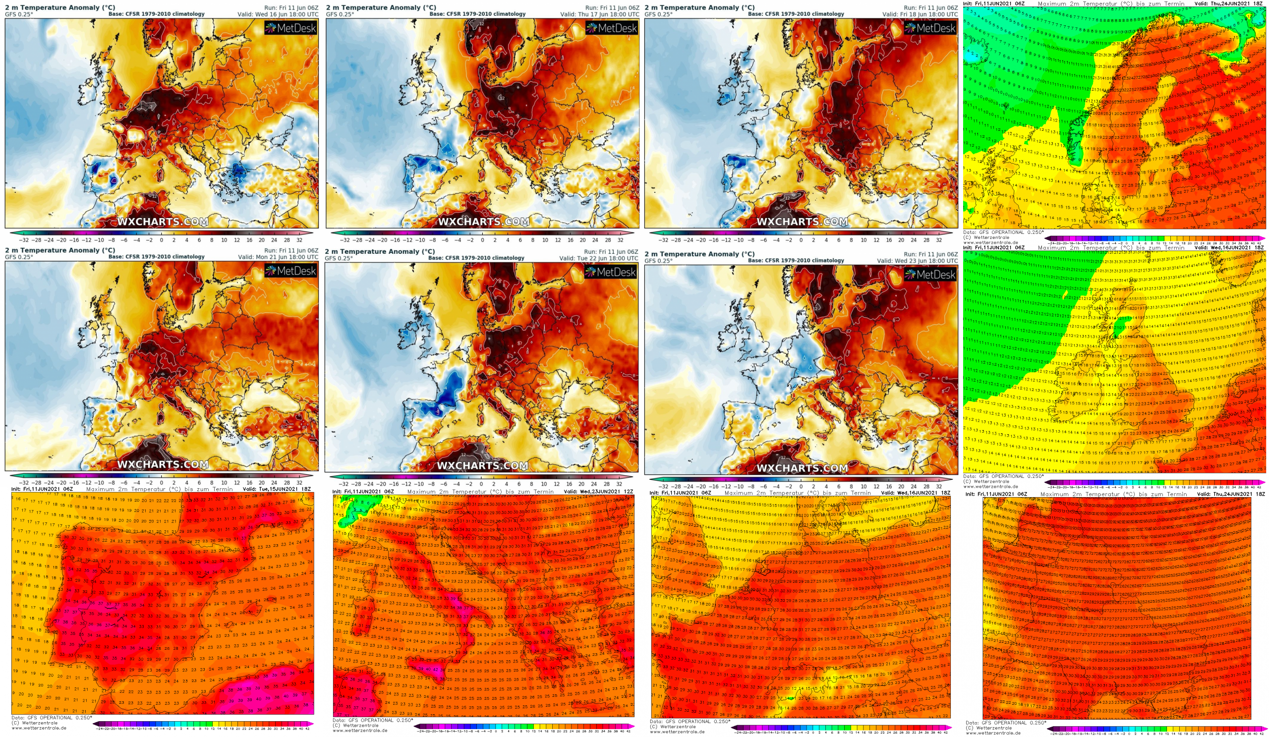
Supertropical heatwaves (+35°C) for continental parts of Europe are confirming and coldwave between two peaks, in central parts of the continent around 16. and 22. June 2021, will be milder, but with possibility of severe storms from northern Spain to Poland.
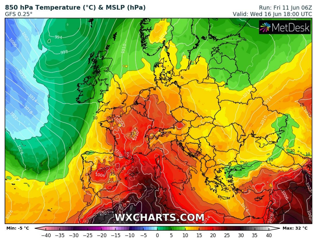
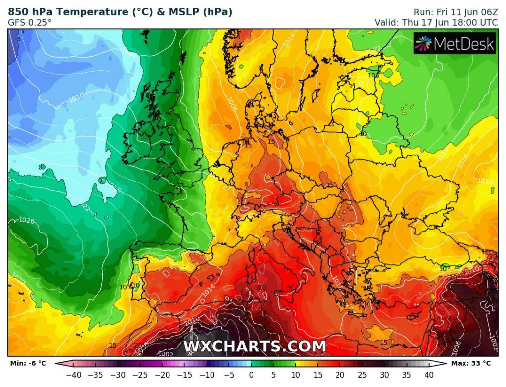
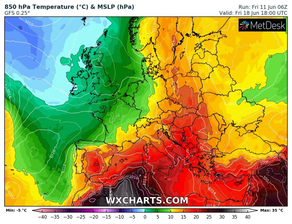
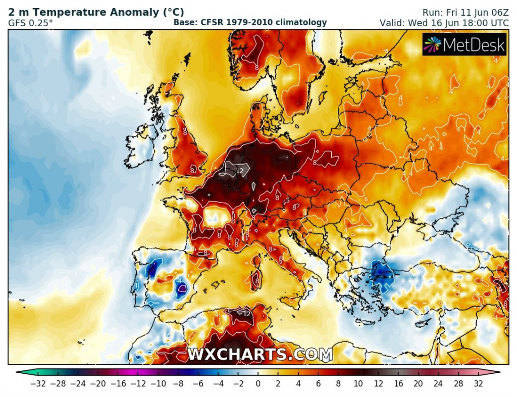
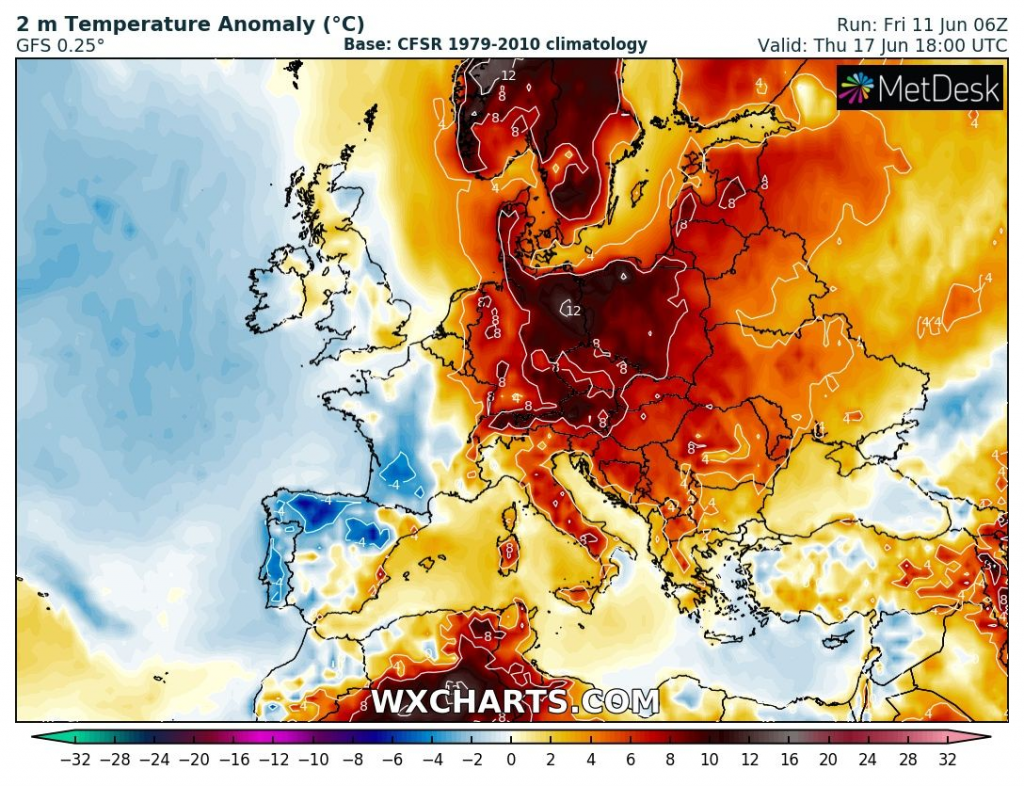
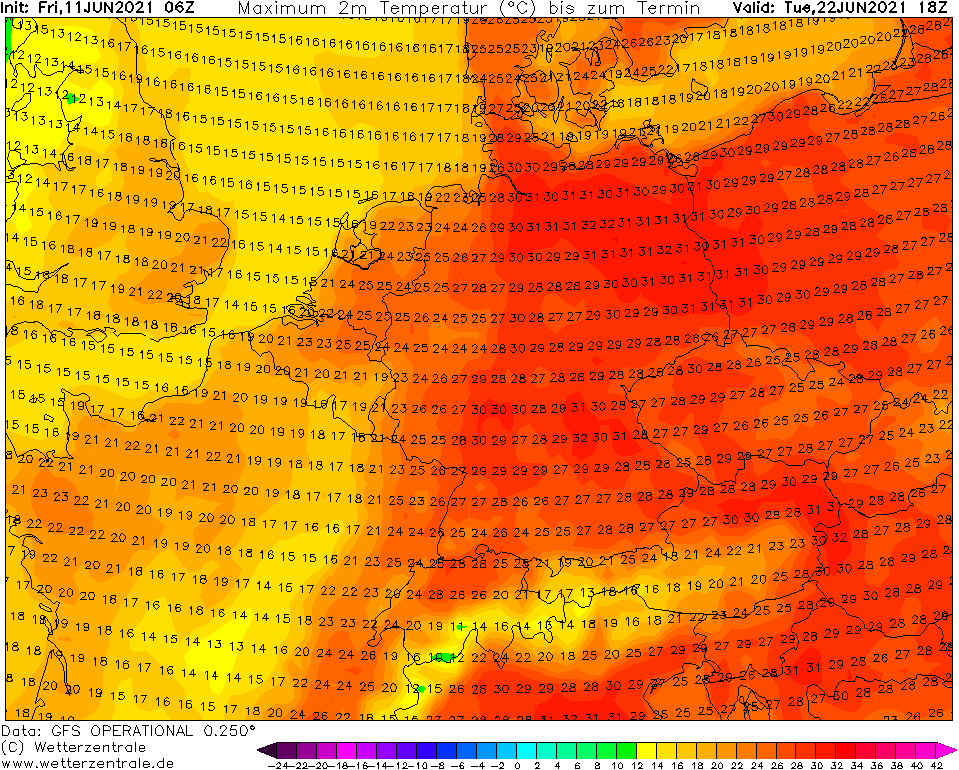
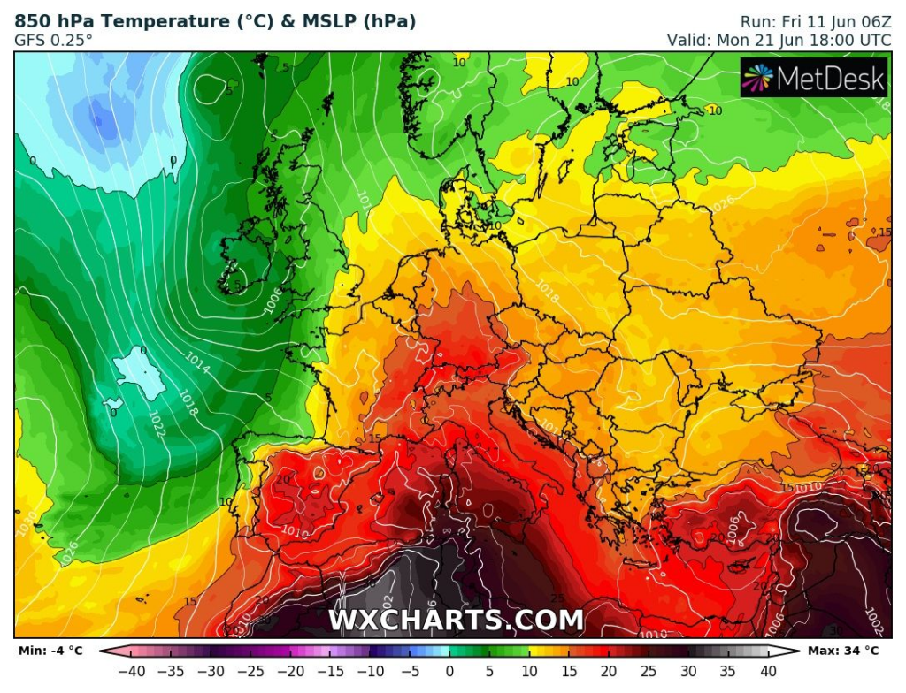
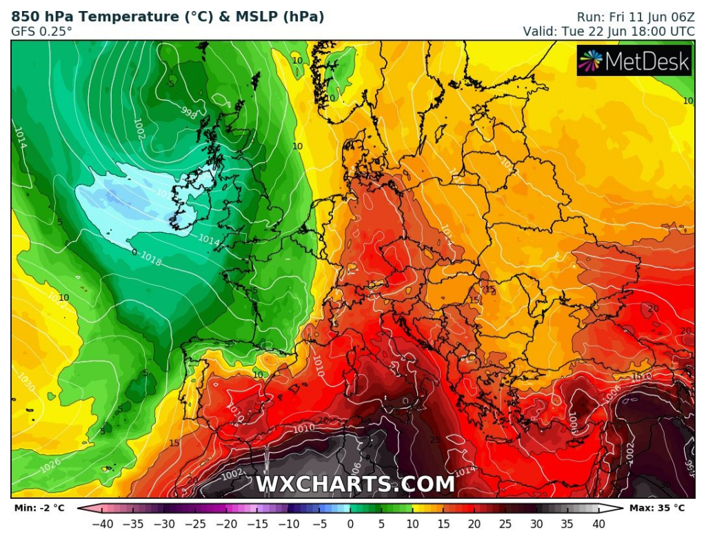
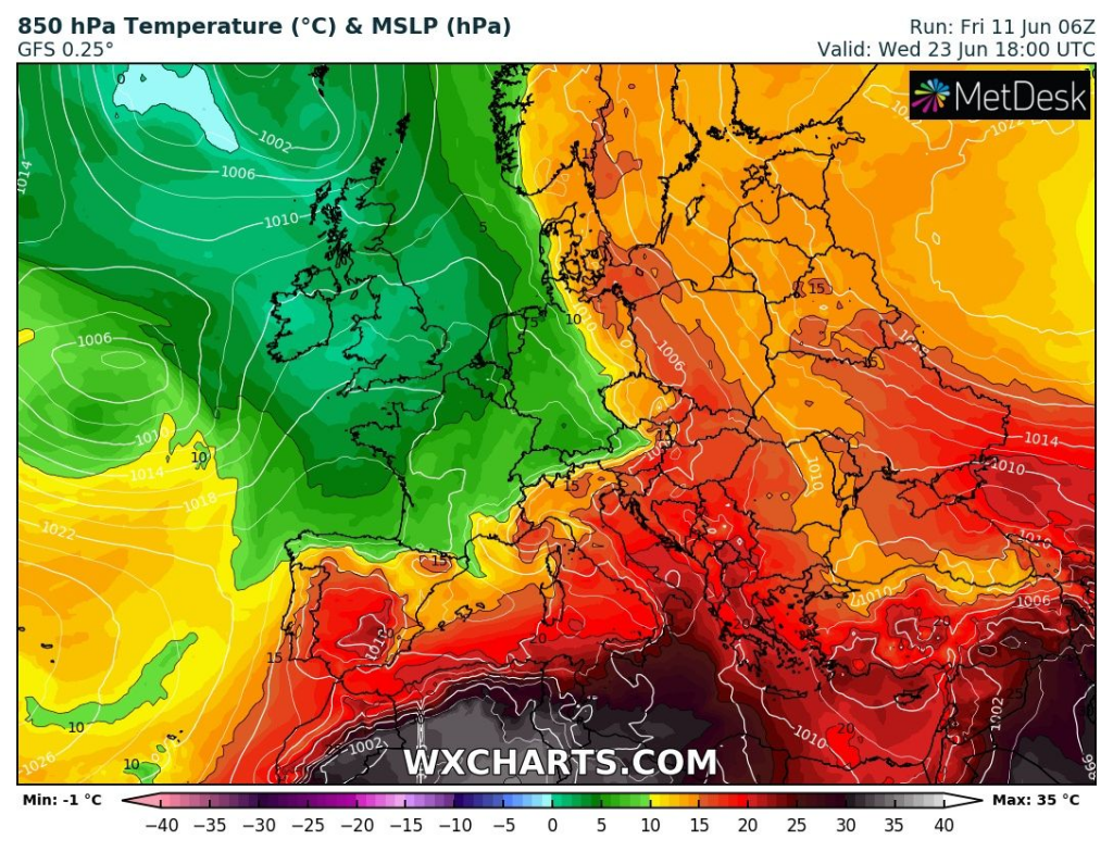
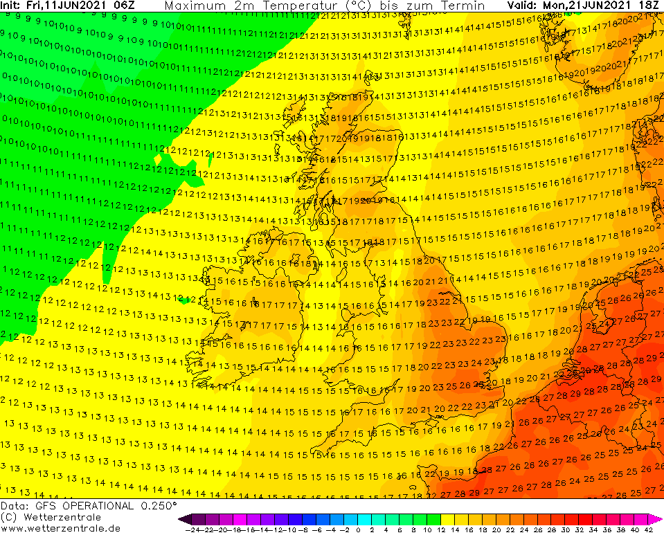
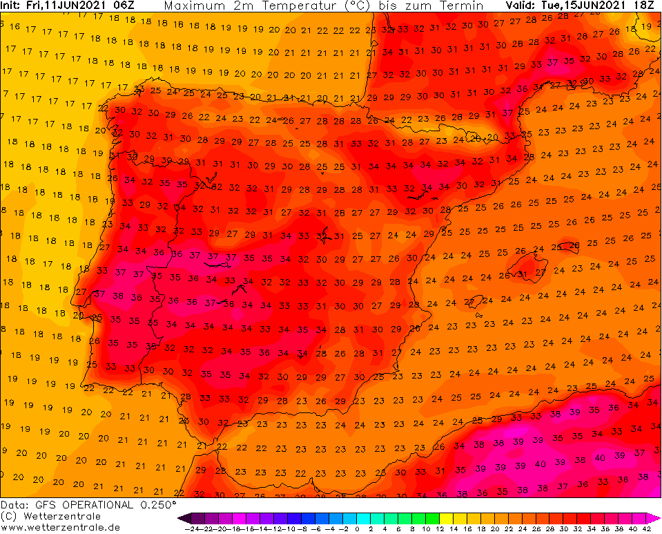
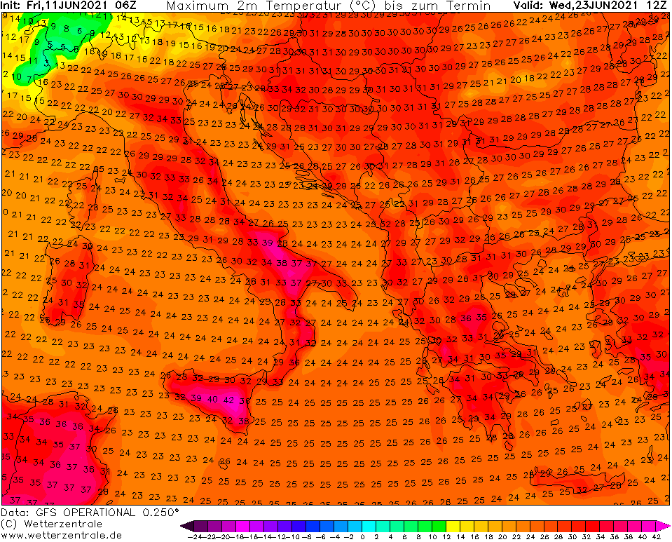
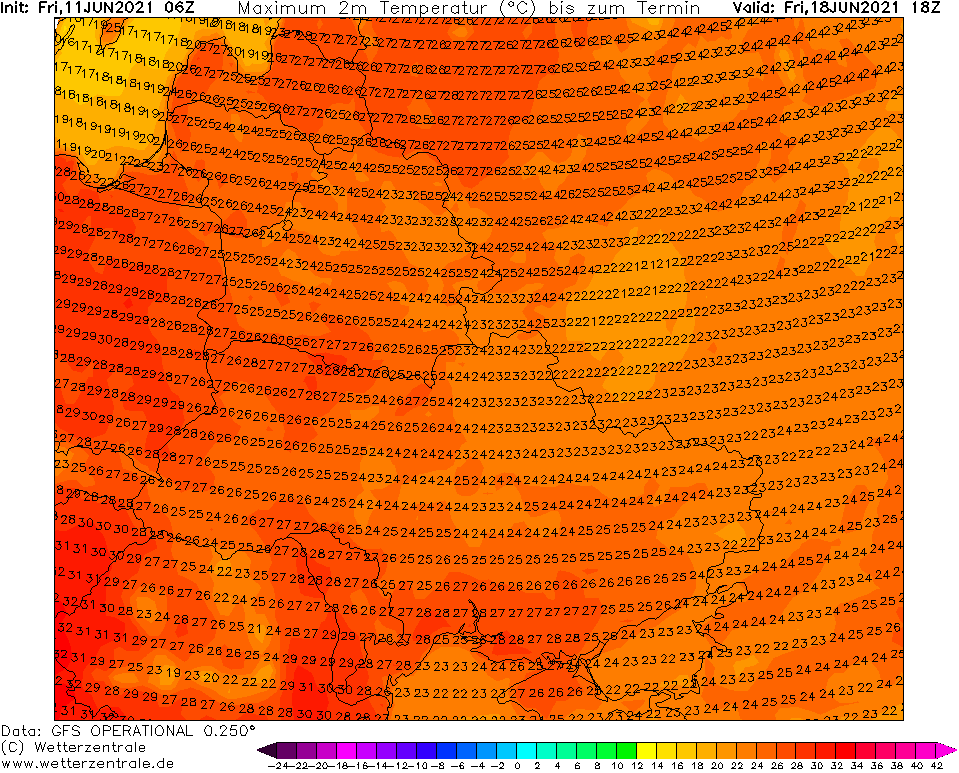
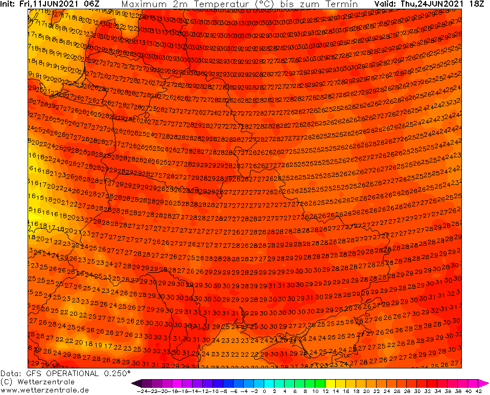
+35°C in central parts of the continent from northern France to Poland should be broken in 2 peaks between 16.-18. June and 21.-23. June 2021 (16. and 23. with possibly hottest stations).
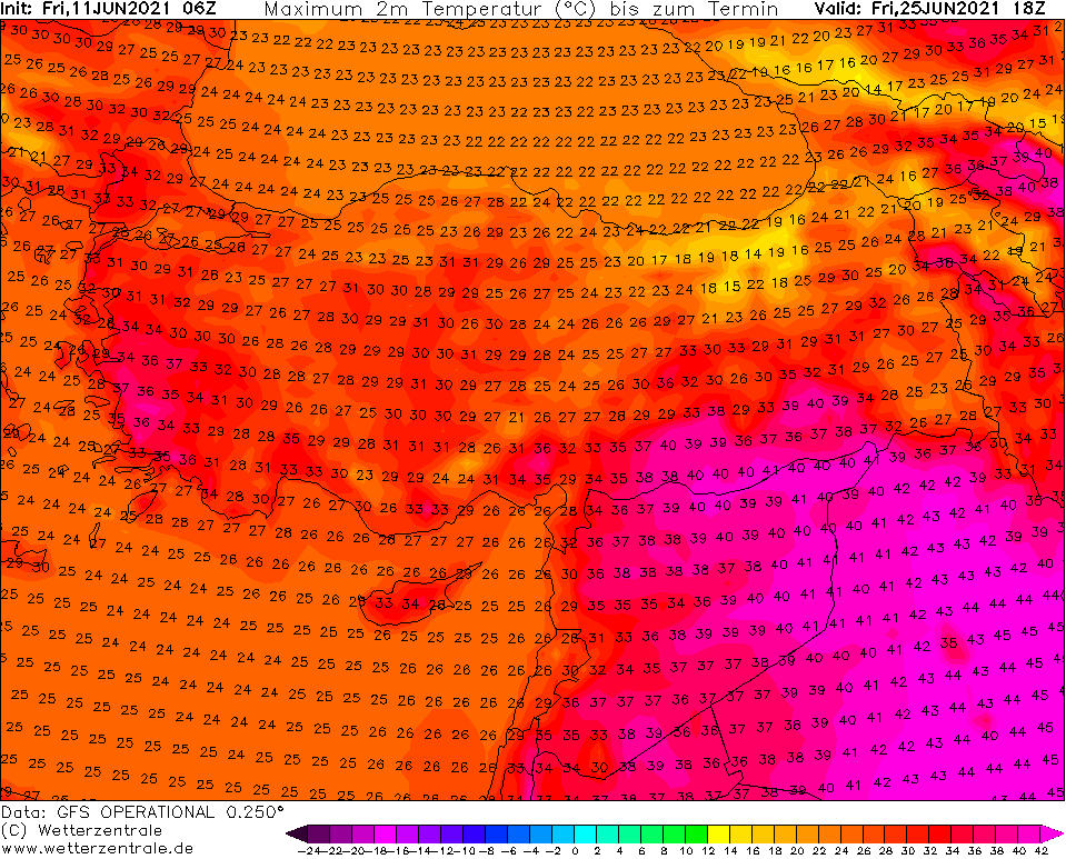
The hottest air masses should gradually hit almost all Europe. In Mediterranean, the hottest forecasts have shifted from the Spain (only +40°C forecasted now) into Italy (up to +45°C possible now), Greece an Balkan see now only up to +40°C.
In continental Europe, +35°C is possible to break in northern France, Benelux, Germany, Switzerland, Austria, Czechia, Slovakia and Hungary.
Extremely hot will be in Scandinavia, in western Finland, +34°C is possible, while in Sweden, +33°C should surprise soon.
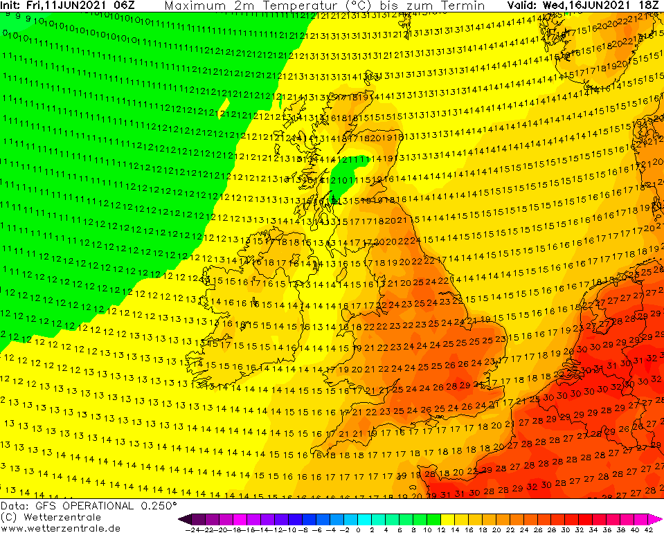
Forecasts for the UK stay relatively the same, with maximum +32°C during the first heatwave and only +29°C during the second one (NW Europe will be between 20. June and 10. July according to our Experimental Summer forecast often under the effect of Arctic air masses /Experimental forecast for Summer 2021 update: colder 20.6.-10.7., hot blocking high above Eastern Europe in July (2010 pattern), peaks around 15.6, 15.7. and 5.8. and autumn after 20.8. – mkweather/.
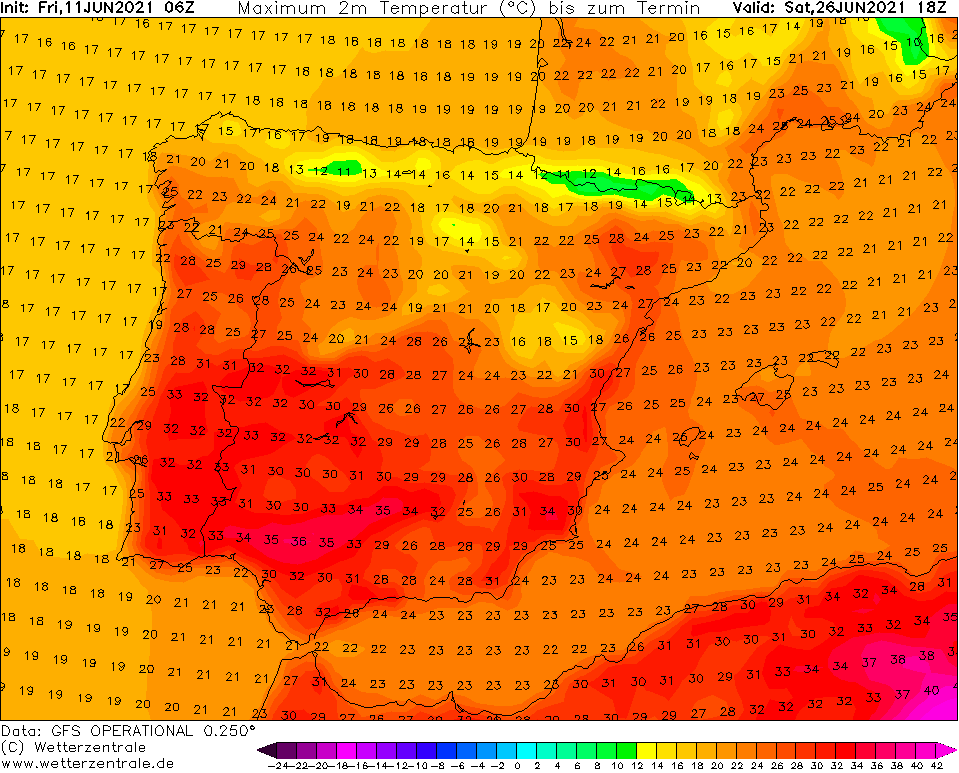
In Eastern Europe and Turkey, both heatwaves will arrive only later, with creating of mega-heatwave, with temperatures up to +35°C in Ukraine, +34°C in Baltic states, +45°C in SE Turkey and +40°C in western Turkey. It should be a start of the next blocking situation over European Russia, which should continue in July 2021 with severe drought and later wildfires and record heatwaves.
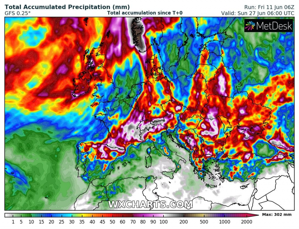
Severe storms are however not forecasted only after the first heatwave /The strongest storm in Europe in 2021? Germany, Poland, Czechia, Austria, Switzerland, N Italy and Sweden around Friday 18. June 2021 – mkweather/, but surprising storms should replace the second one, too – it needs to wait for more reliable outputs until the end of the next workweek, which regions will be hit with full power (currently it appears to lines from northern Spain to Poland).
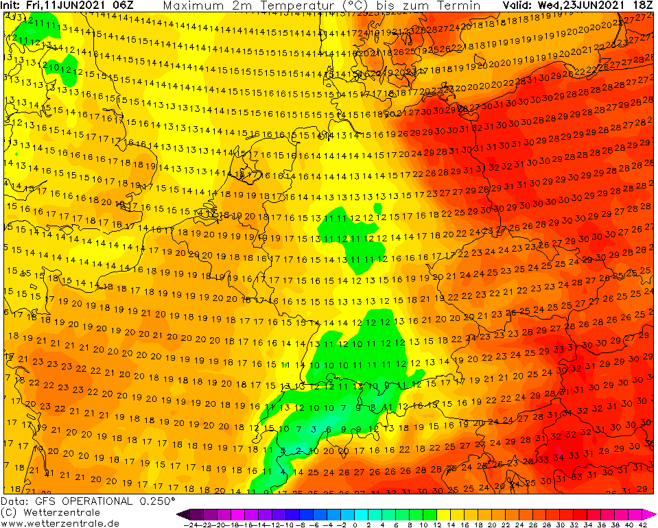
Rest from heatwaves should give between 20.6. and 10.7., such was mentioned before, mainly NW Europe, including British Islands, where T850 hPa isotherma below 0°C will probably appear during this period, with possibility of very cold days, heavy rains or ground frosts.
The next big heatwaves are according to current Experimental Summer 2021 forecast (link above) forecasted around 15. July and 5. August 2021, but it should change, yet.
Situation in July should very strongly look like development in 2010 – we will be near it and bring fresh news on Mkweather.
The first heatwave:
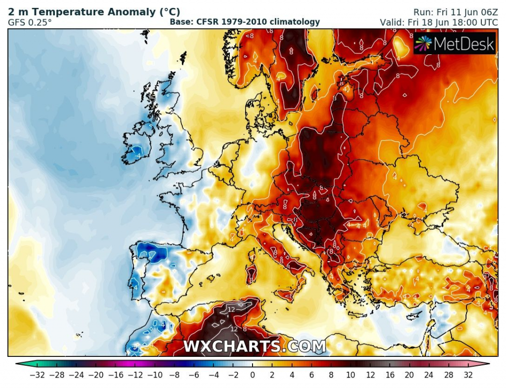
The second heatwave:
Accumulated precipitation:
Regions:
Infographics: wetterzentrale.de, wxcharts.com


