Switzerland 320 mm/48 hours, Poland red warnings, Slovenia 7 cm hails, extreme storms next 3 days in Adriatic, Carpathian and Baltic region + VIDEOS
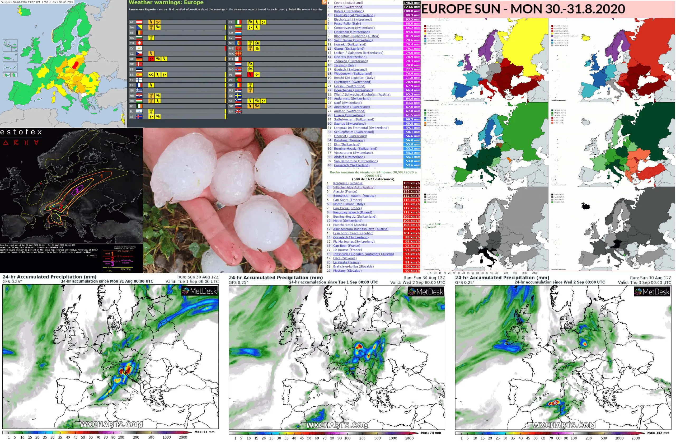
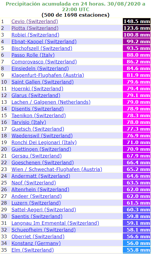
Severe storm line on Sunday shifted over eastern Central Europe and northern Adriatic, but Switzerland still reports enormous amounts of rainfall.
Only at the weekend, in Cevio, Switzerland, 416 MASL has dropped 320 mm of rain / 48 hours. There are the list Switzerland stations with 24-hours precipitation amounts 100-150 mm from Friday to Sunday.
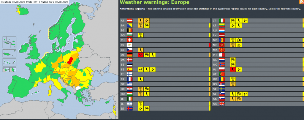
Severe stroms accociated with severe wind gusts, hails, heavy rainfall or lighting occurred already in Austria, Czechia, Slovakia, Poland, Hungary, Slovenia and Croatia in Saturday evening and on Sunday.
In Italy, on Saturday fell 8 cm hails, in Slovenia on Sunday 7 cm hails are reported.
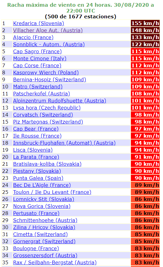
Storms are bringing severe wind gusts to mountains around 150 km/h (Kraderica, Slovenia, 155 km/h, Villacher Alpe, Austria 148 km/h). Wind gusts are reaching almost 100 km/h in lowlands and basins too (Innsbruck, Austria, 94 km/h, Bratislava, Slovakia, 90 km/h).
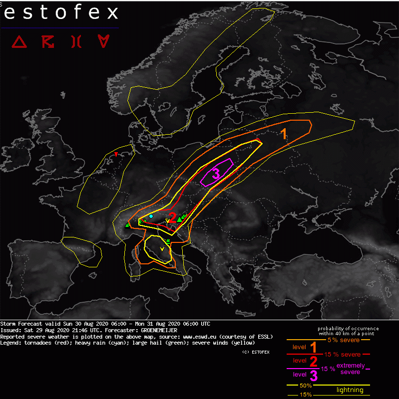
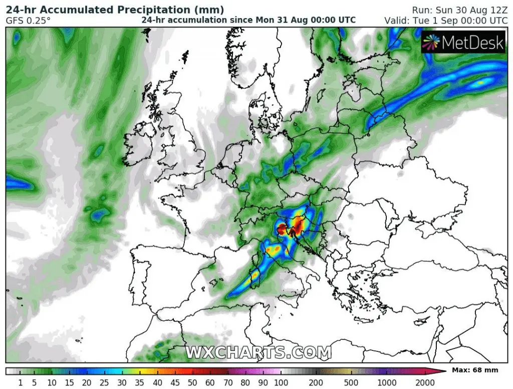
On Monday, the most severe storms are expected in northern Adriatic (Italy, Slovenia, Croatia), Austria, western Hungary, western edge of Slovakia, Poland, Latvia and Lithuania.
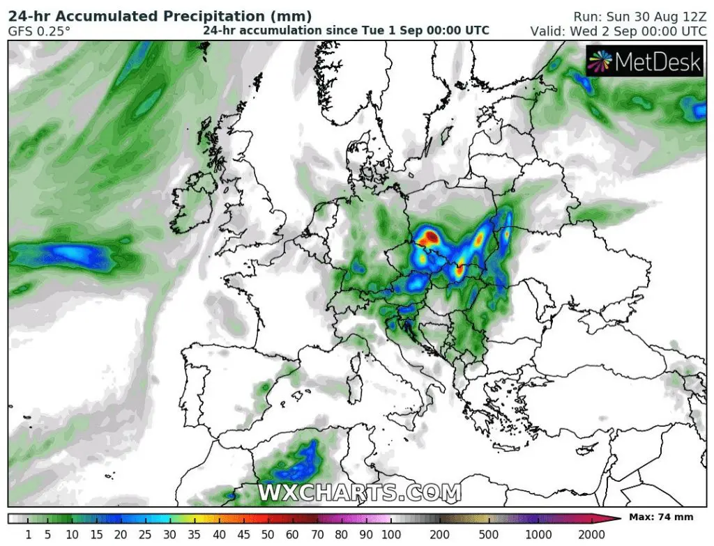
During Tuesday, the most severe storms shifts over Carpathian region (Slovakia, Hungary, Czechia, Poland, western Ukraine), Austria, Slovenia and western Belarus. Some activity will be in Croatia, Serbia and Romania too.
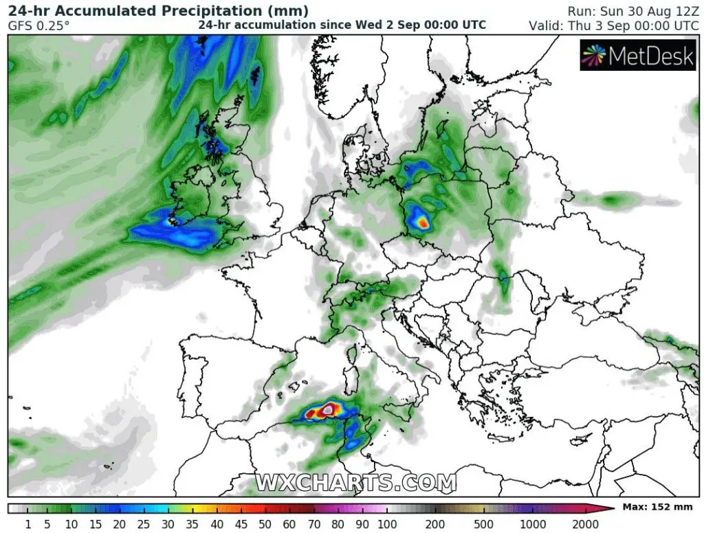
On Wednesday, remnants of storms will shift over Poland, Kaliningrad region, Baltic sea, Sicily, Tunisia and NE coast of Algeria. At the same time, ex-hurricane Laura will come over British Isles and causes next windstorm.
Videodocumentation – 1. Ajjacio, Corsica, Saturday 29.8.2020; 2. Italy (Asti) 29.-30.8.2020, 3. Sopron, Hungary Saturday 29.8.2020/apocasie.sk
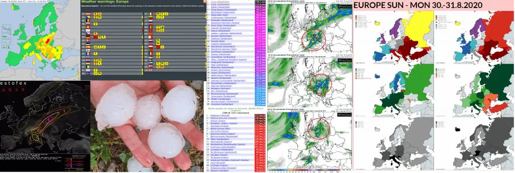
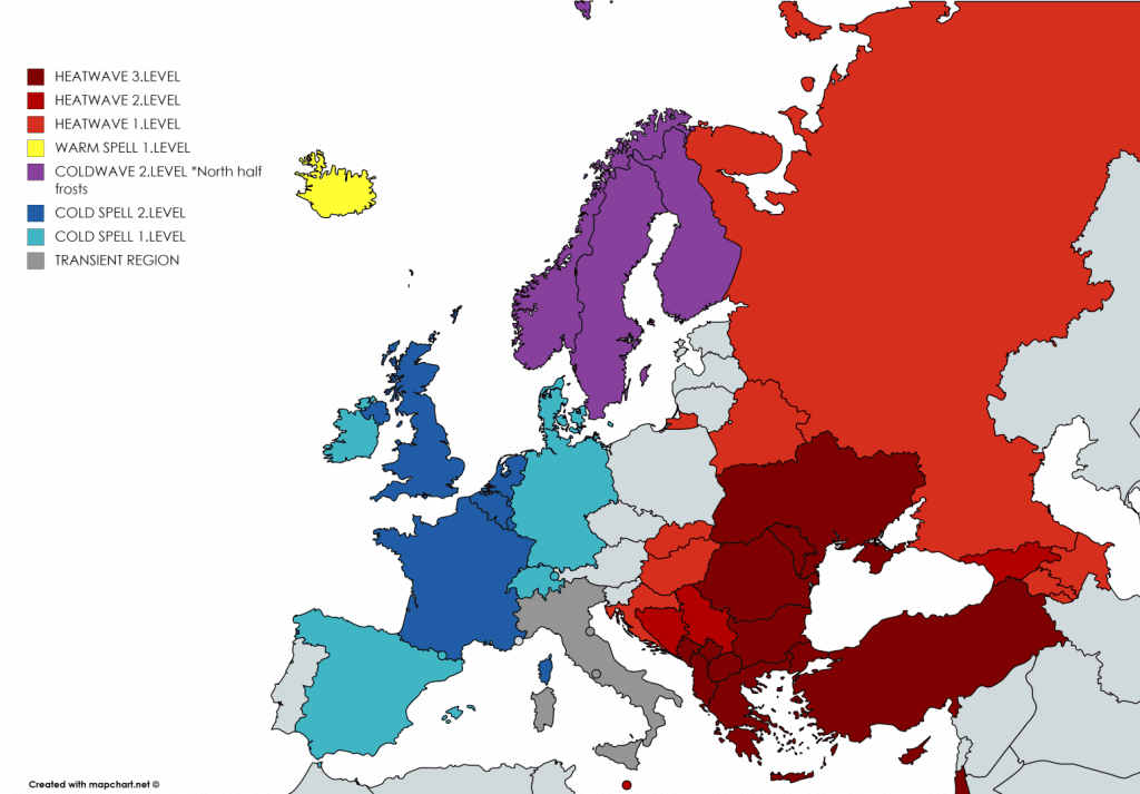
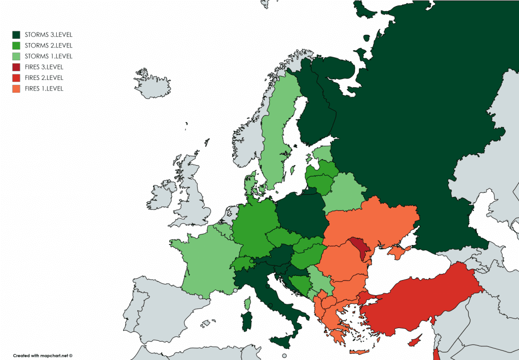
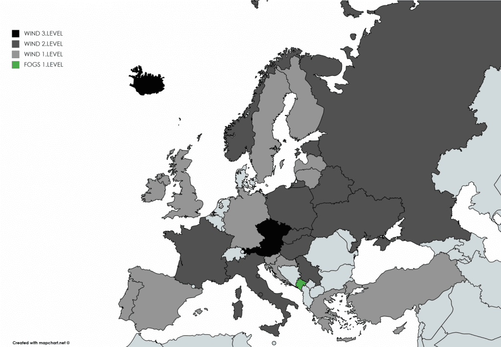
Infographics: Warnings from Meteoalarm, ESTOFEX, reported hails from Slovenia (ESWD), the strongest rainfall and winds in Europe (Ogimet), forecasted 24-hour rainfall (from storm activity) – Wxcharts and Mkweather warnings valid for Monday 31.8.2020: