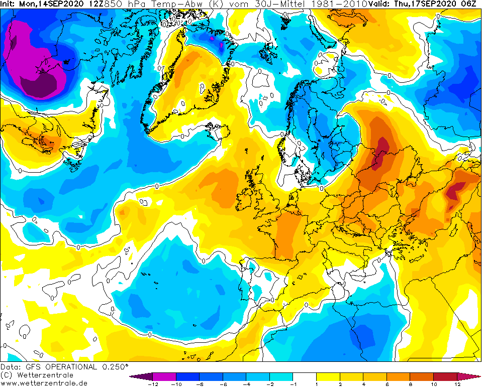
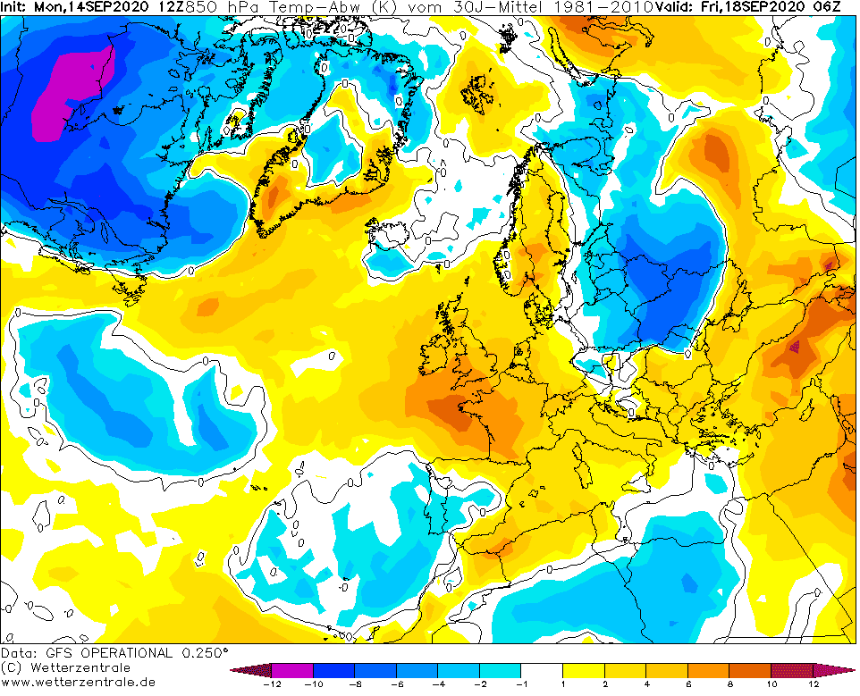
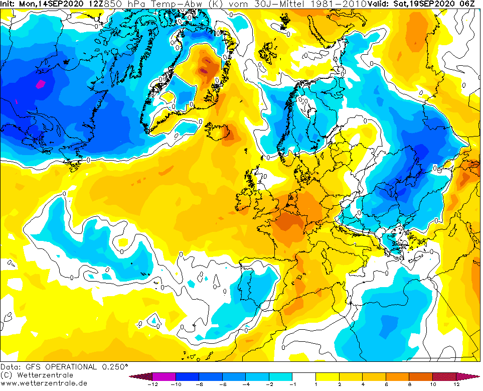
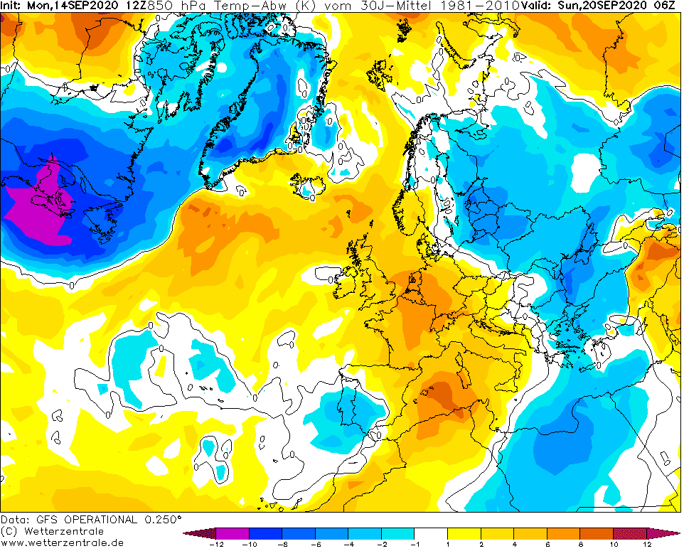
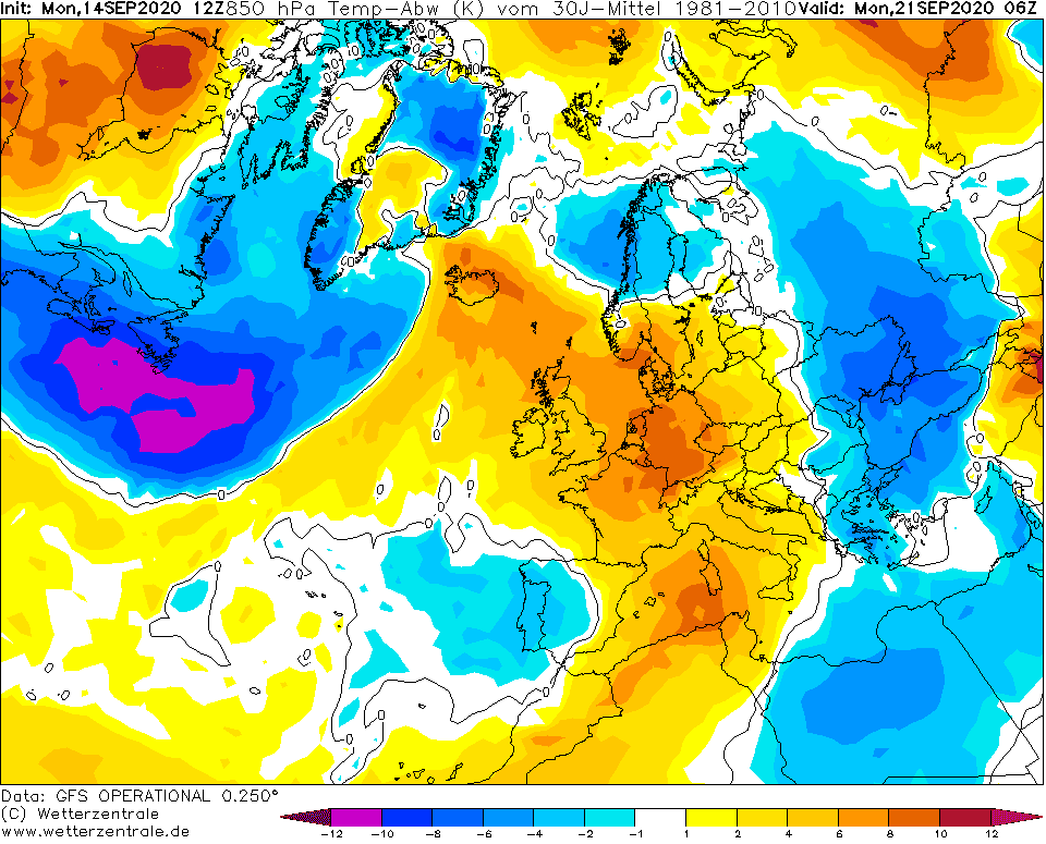
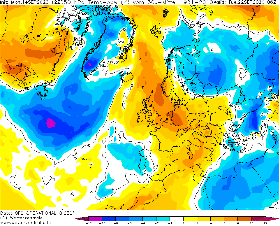
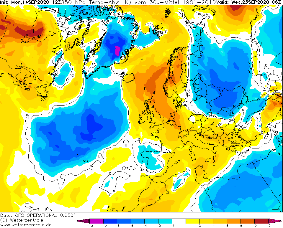
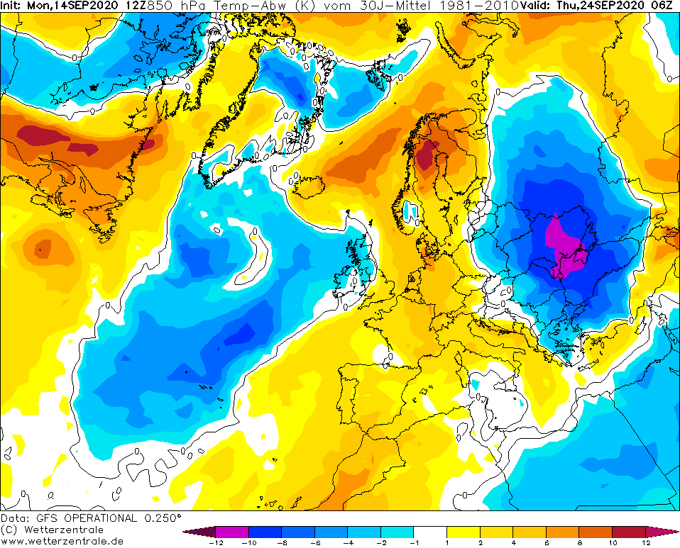
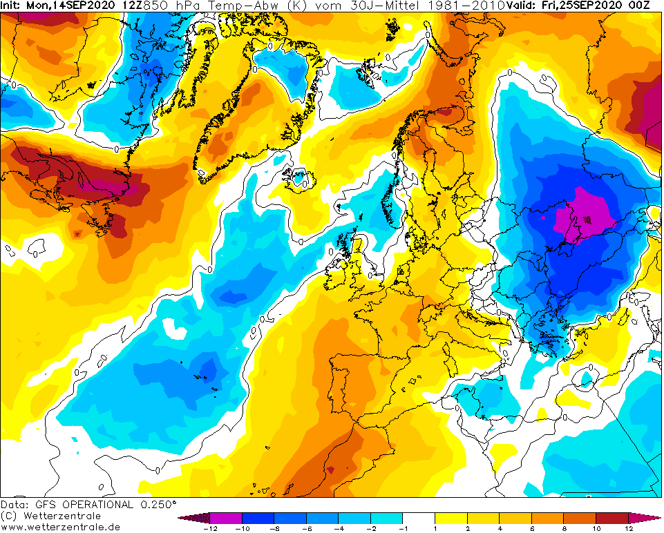
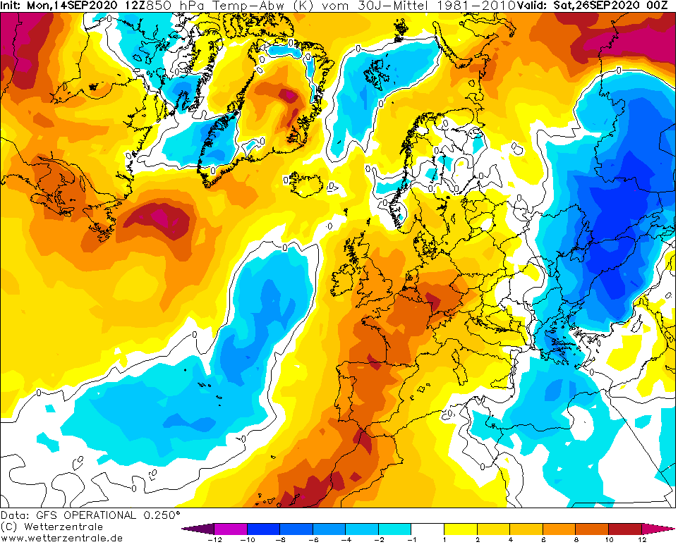
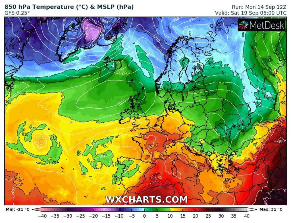
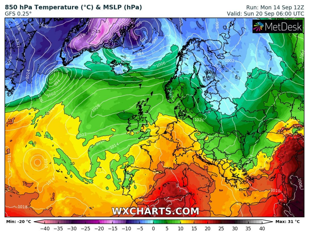
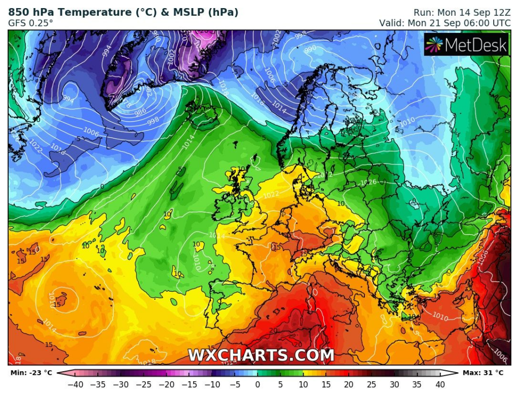
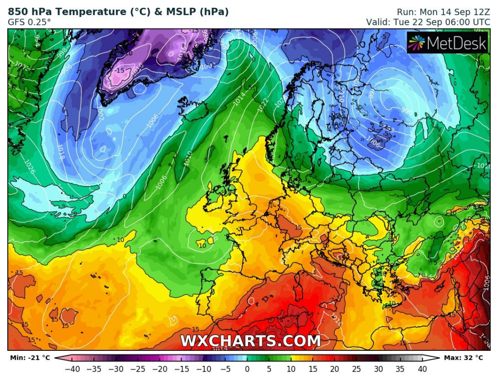
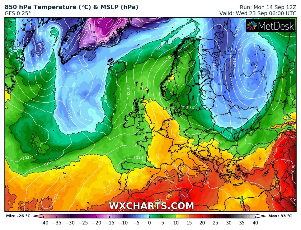
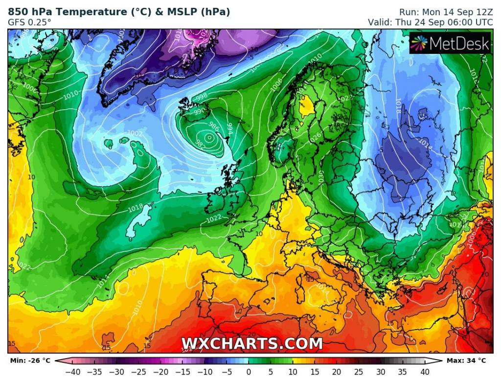
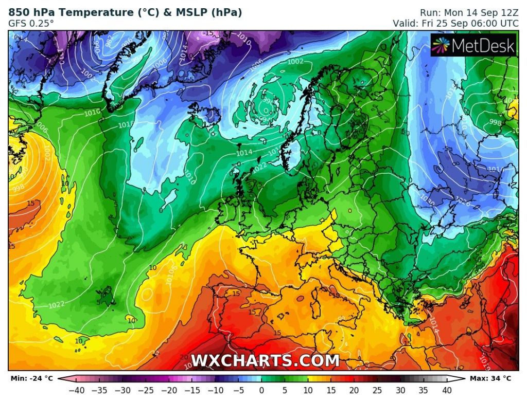
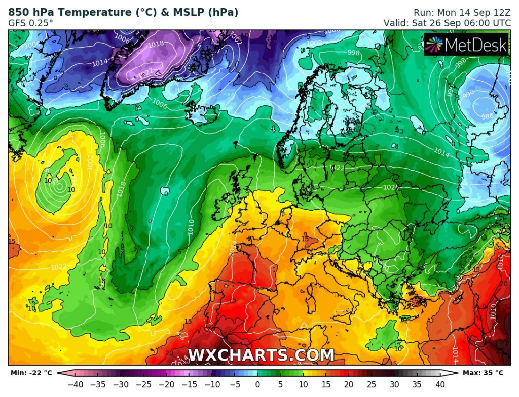
10-day coldwave hits parts of Scandinavia, Baltic region, Eastern Europe, East-Central Europe, Balkan, Russia and Turkey between 17.-26. September

Scandinavian blocking high will be moving from British Isles – Scandinavia region across Central and Eastern Europe above Black sea region between 17.-26. September 2020, with powerful coldwave from Finland to Turkey.
The most of cold days hits Baltic states, Belarus and Ukraine, but cold blast hits temporarily parts of Scandinavia, East-Central Europe, Balkan, Turkey and European Russia.
For some days, GFS predicts temperature anomalies -12°C below September long-term temperature average – mainly over Black sea area.
In mountainous regions in air mass in 850 hPa with temperature only -5/0°C could hit regular frosts 0/-5°C, rarely in frost basins around -7°C.
Ground frosts will be possible in lowlands along Danube, Vistula, Dnieper or Volga river during mentioned 10-day period.
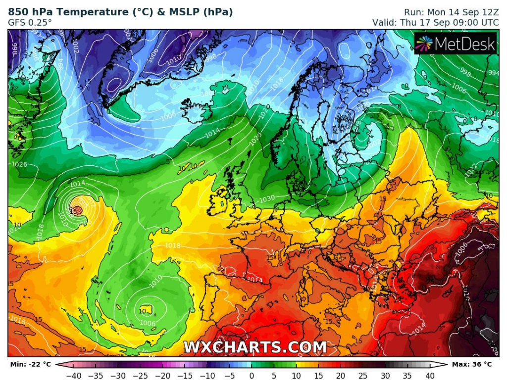
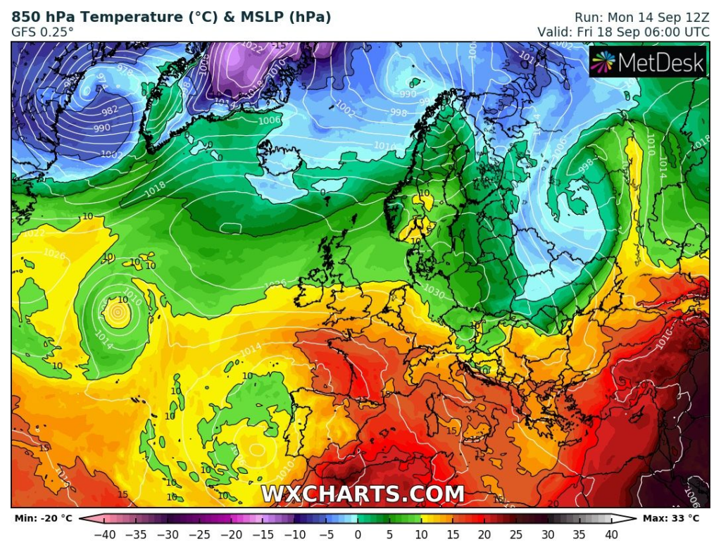
The highest probability of frosts in East-Central Europe will be around Friday, 18. September and Wednesday and Thursday 23.-24. September. Over Balkan, Turkey and southern European Russia, the coldest will be last days of the period. Around 24.-25. September below -5°C in 850 hPa over Ukraine could appear.
Snowing will be rarely during this coldwave thanks to dry and cold Arctic air, but still possible in northern parts of NE Europe and Russia, on the back of low pressure system.
Dryness of the air is the most important factor near cooling down of cold air during cold blast, therefore it is possible, that temperatures in 2 m will be locally more than 10°C lower than in 850 hPa, in valleys. Frosts therefore could occur in “green” areas on the wxcharts maps below.
T850 hPa between 17.-26. September 2020 /wxcharts.com:
T850 hPa anomaly between 17.-26. September 2020 /wetterzentrale.de: