Typhoon Noul after Vietnam (253 mm/10 inches) already in Thailand (291 mm/11.5 inches) and Myanmar (after +40,4°C heatwave), rainfall hits Bangladesh and India soon
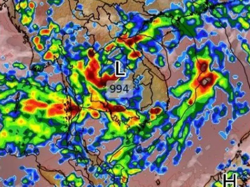
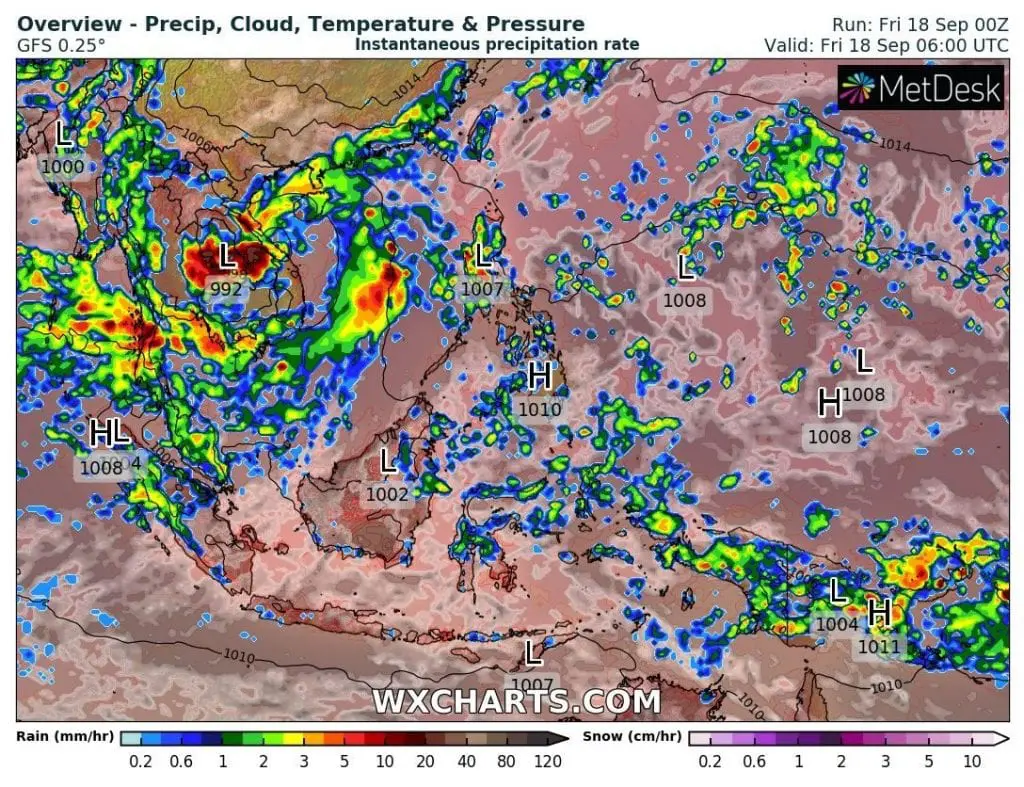
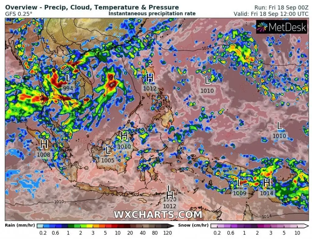
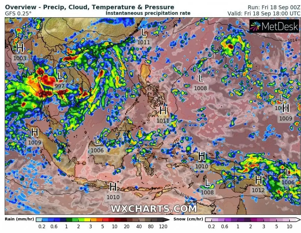
Southeastern Asia alives hard moments, with extreme rainfall linked with typhoon Noul, which degrade above land to a tropical storm and continues on its way above Bengal Bay.
Before an arrival of typhoon (according to Vietnamese scale Cat 3 above South China Sea) on the land, a powerful heatwave has worried a subcontinent with the highest maximum temperatures in Chauk, Myanmar, +40,4°C / 104,7°F and in Hua Hin, Thailand +37,2°C / 99°F on Thursday.
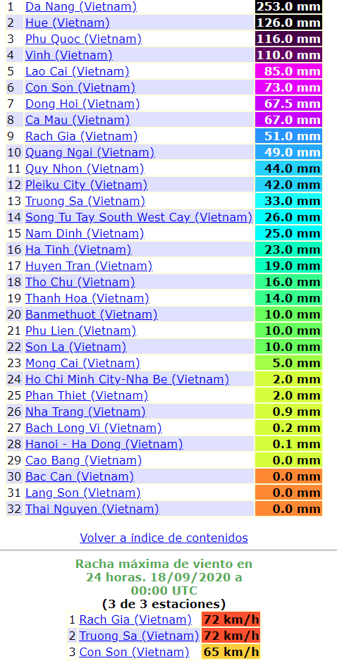
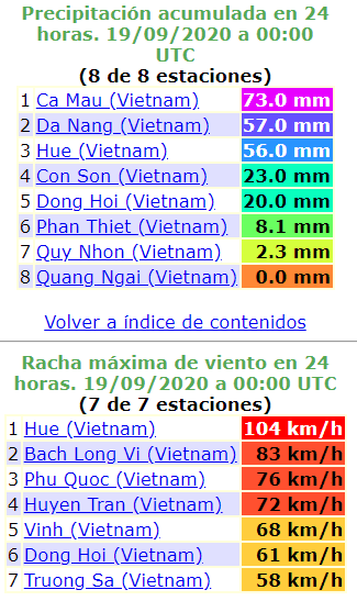
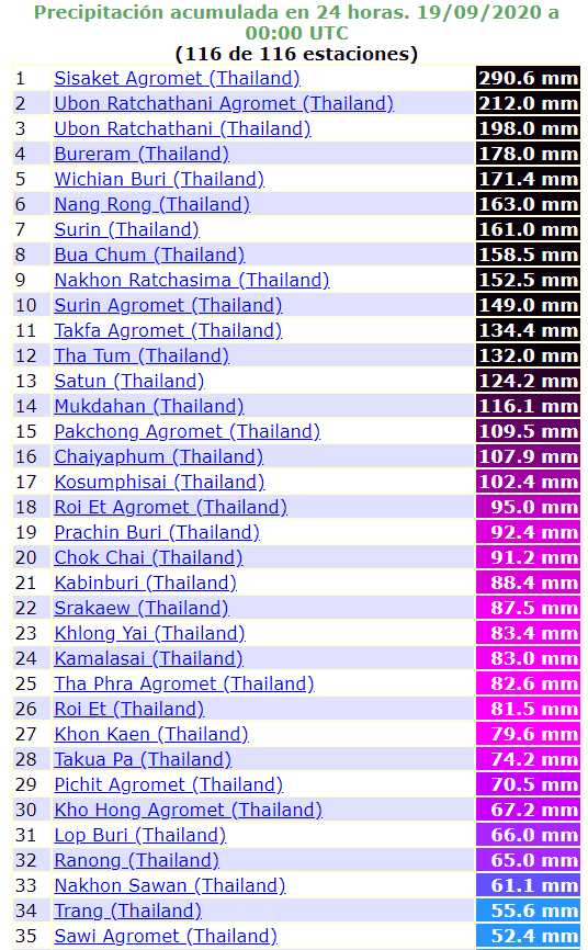
Typhoon has brought above land extreme rainfall with 24-hour precipitation amounts regionally up to 300 mm (Da Nang in Vietnam on Thursday 253 mm and Sisaket in Thailand 290,6 mm on Friday).
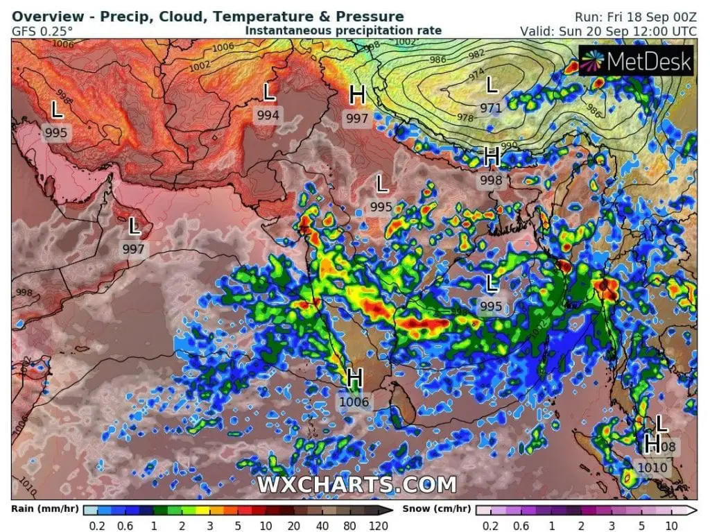
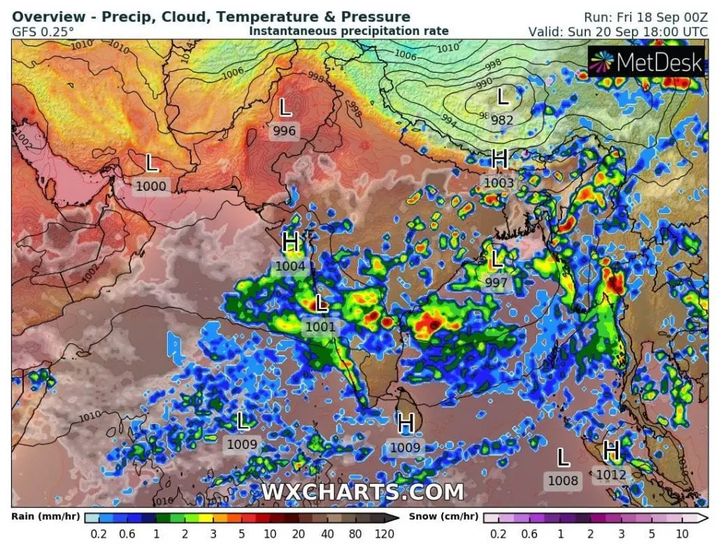
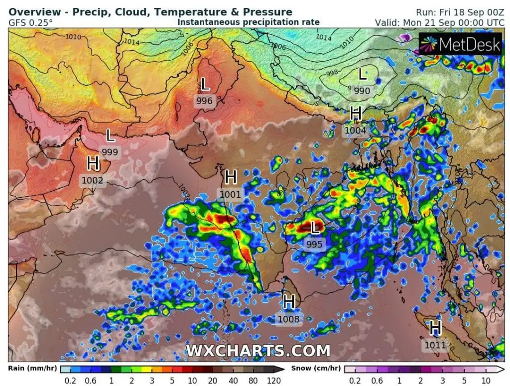
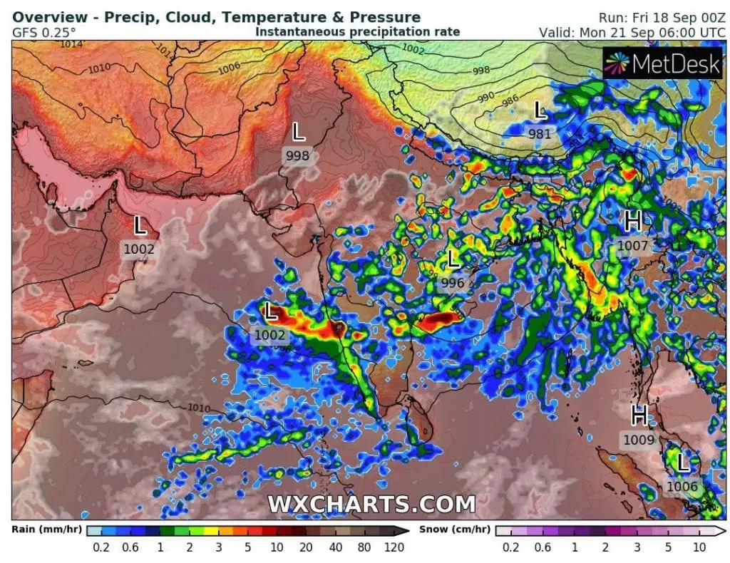
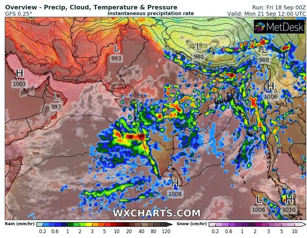
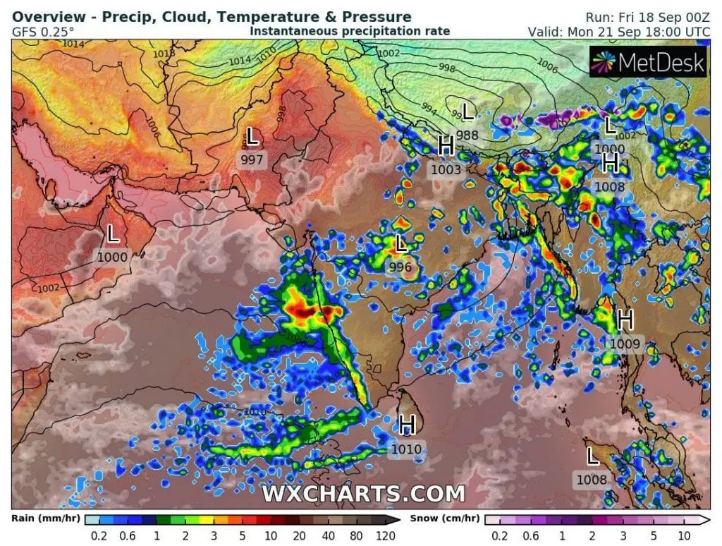
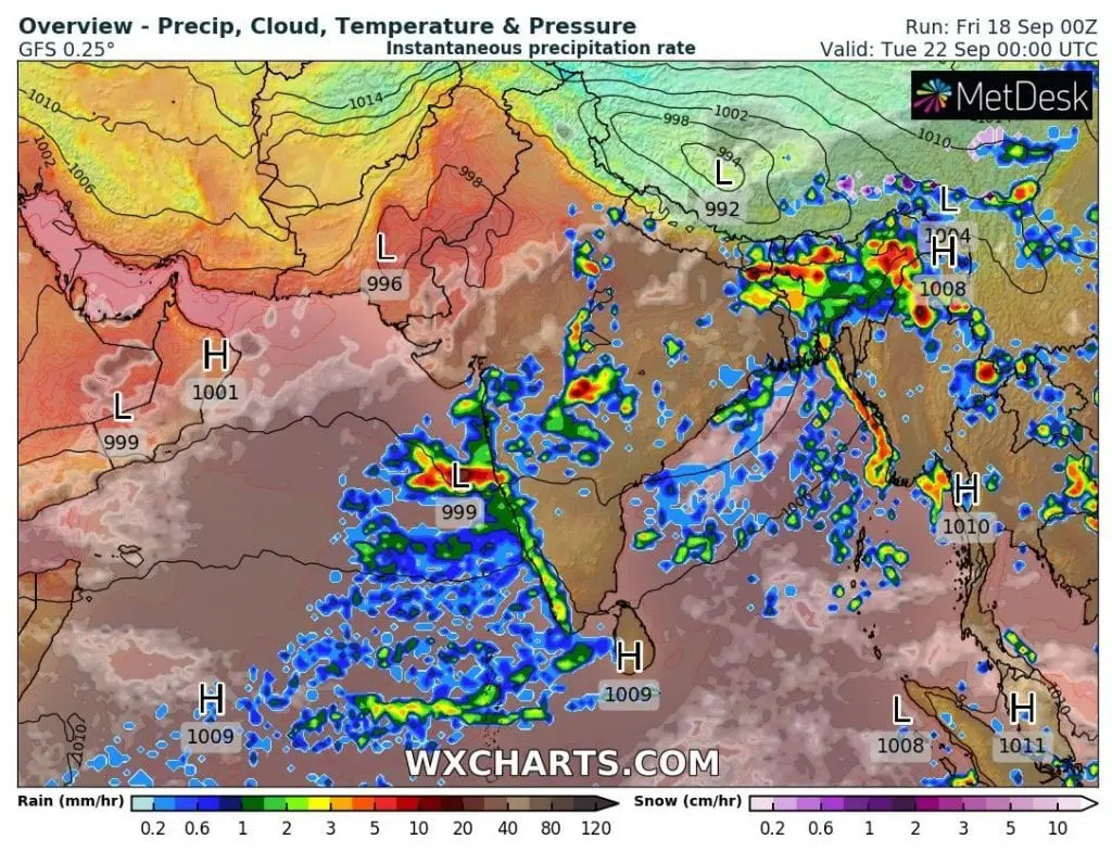
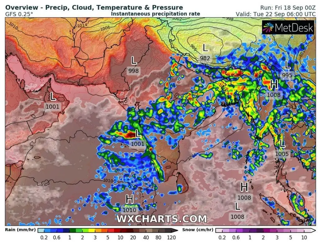
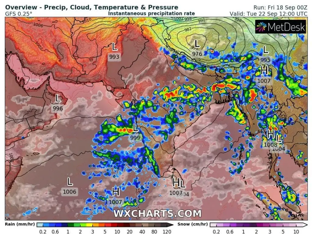
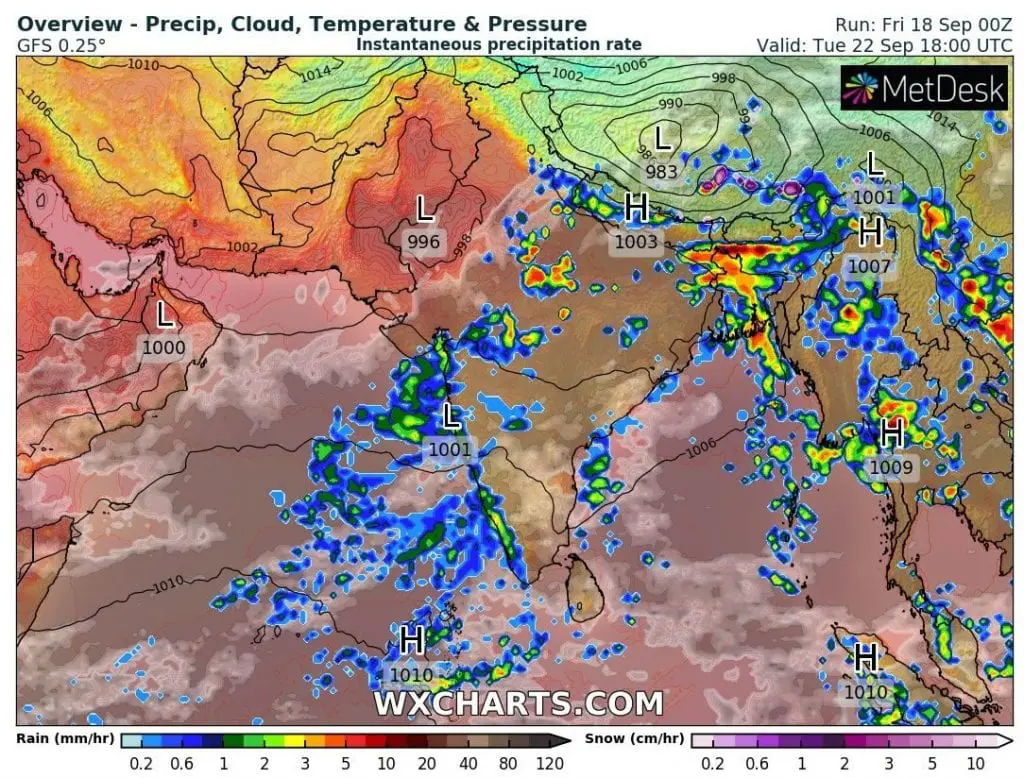
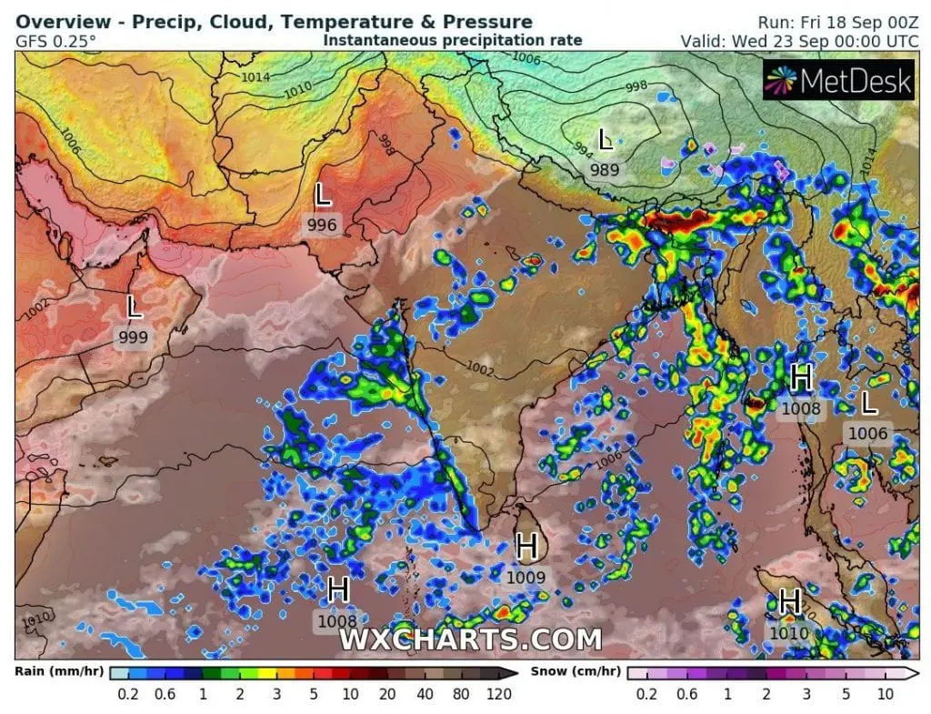
Heavy rains are expected to continue in Myanmar, with possible even higher precipitation amounts (as in Thailand and Vietnam) at the weekend. Then, remnants of typhoon / tropical storm could regenerate above Bengal Bay and will aim towards Bangladesh and India, where brings next heavy rain events early next week.
So high precipitation amounts are almost always associated with damaging floods, therefore, if you live in region or you are here on vacation / holidays, be careful at the weekend and early next week and watch current weather news, warnings and forecast. Mkweather will bring update of situation linked with Noul during next days.
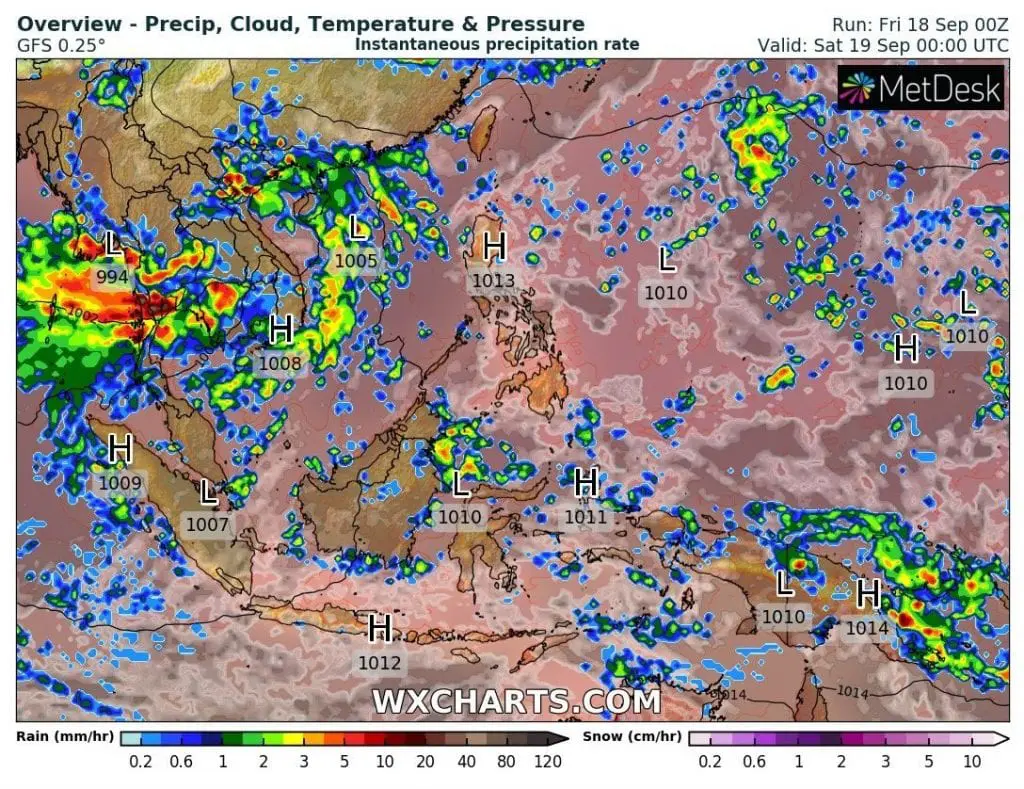
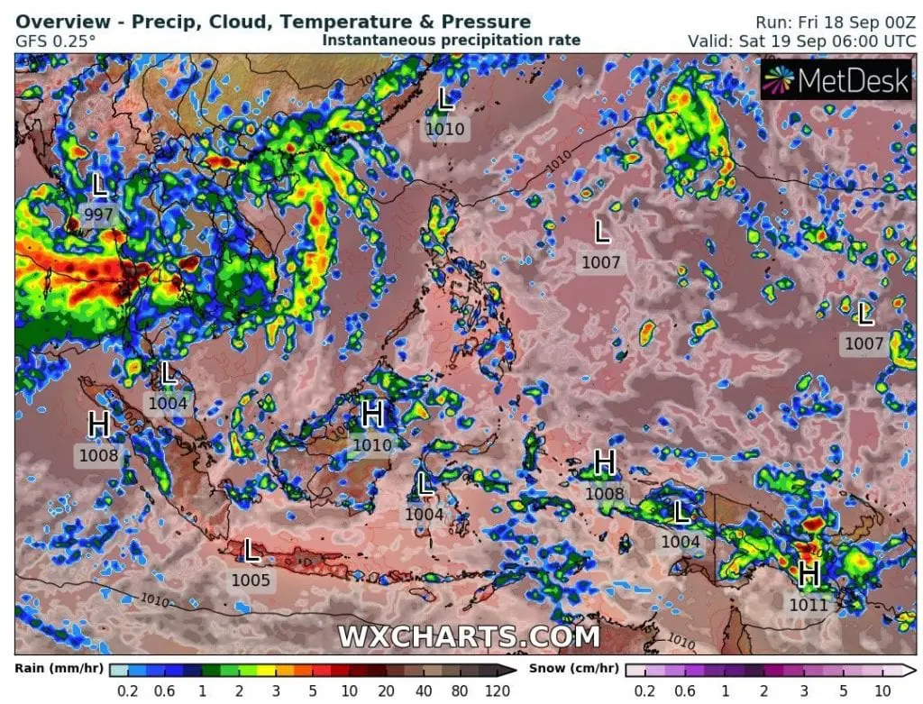
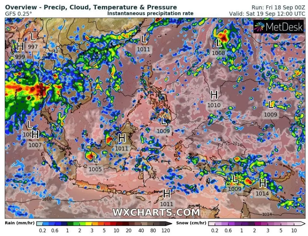
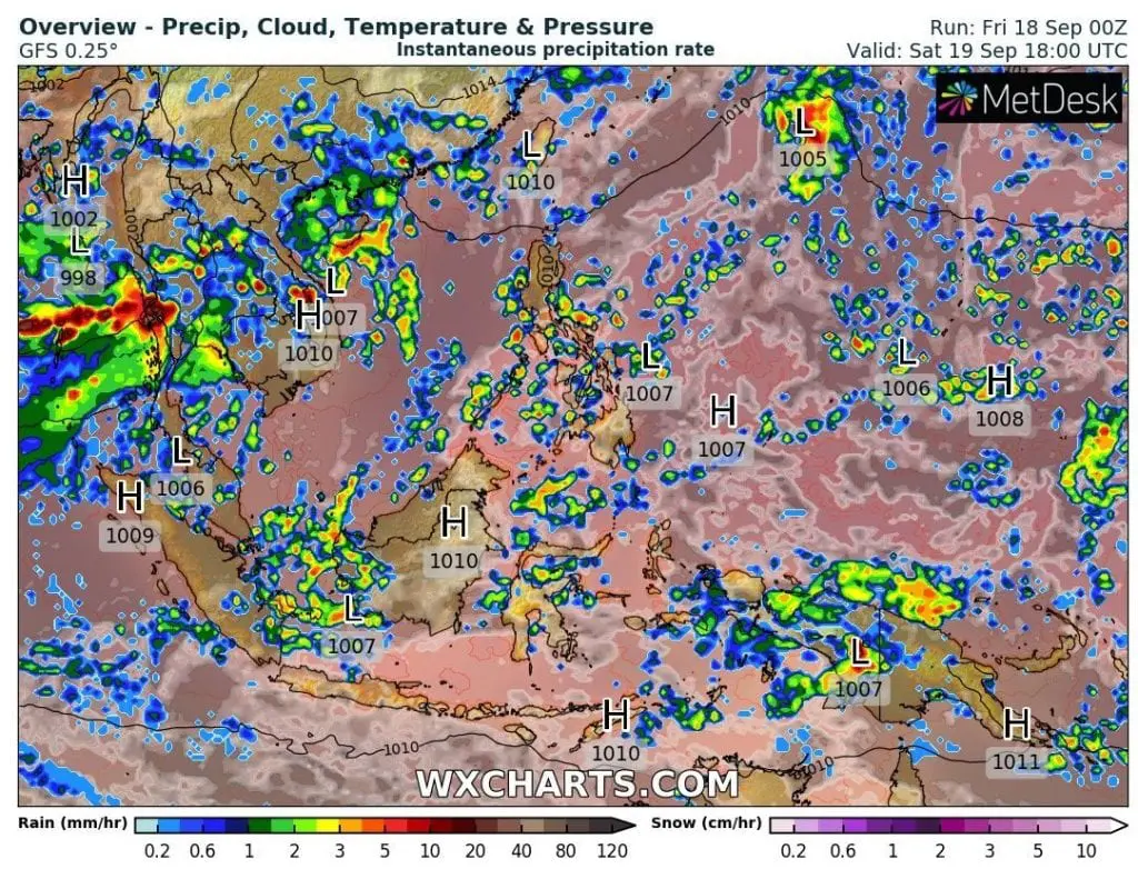
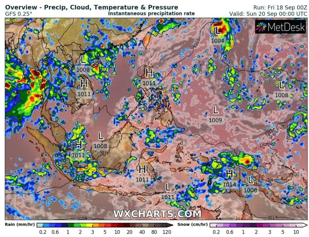
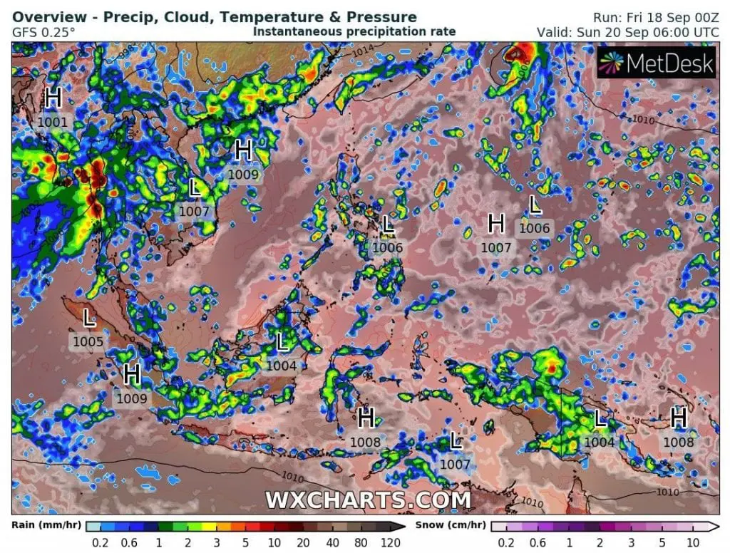
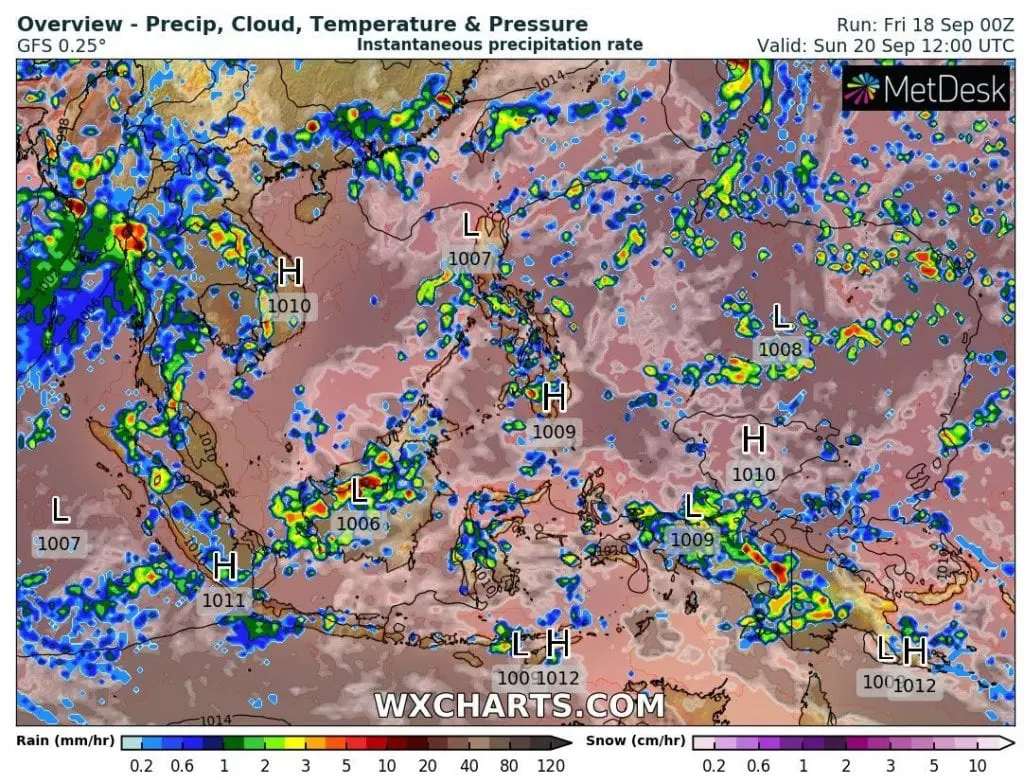
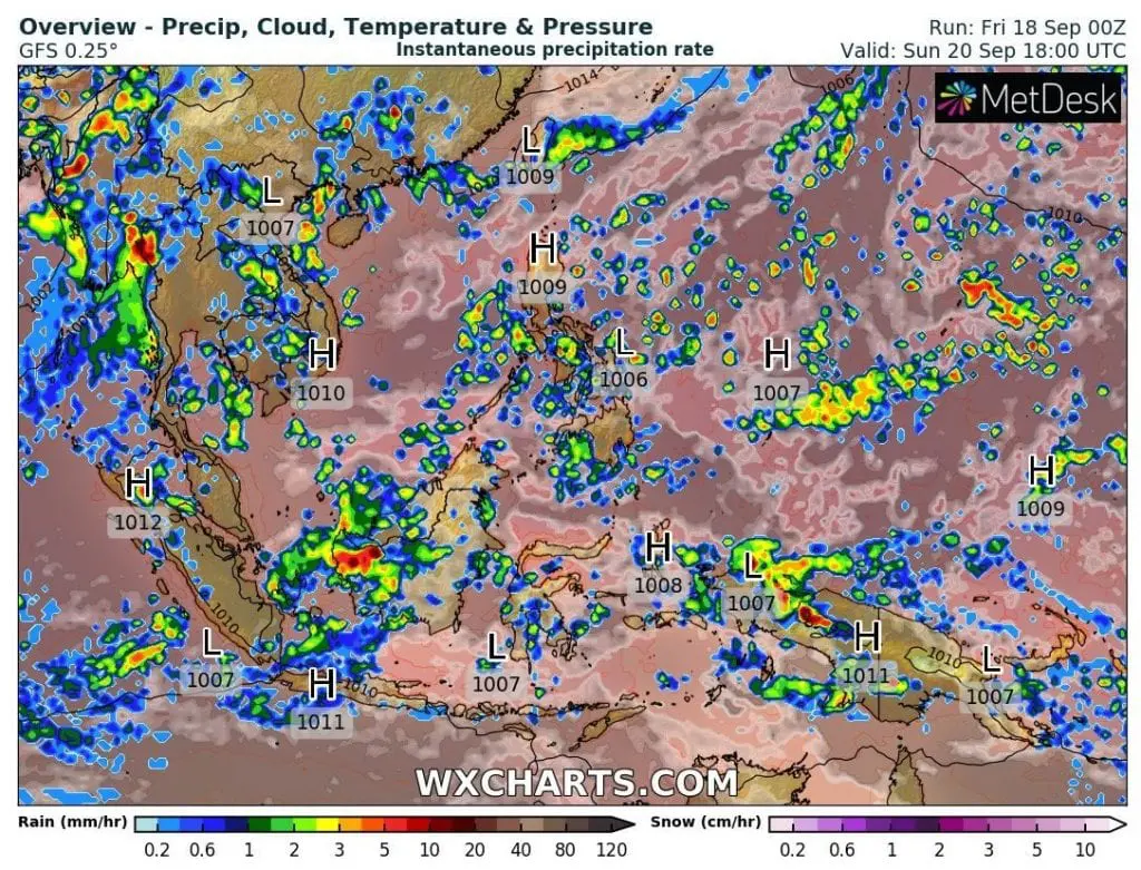
Predicted transition of typhoon Noul above Southeast and South Asia from Friday to Tuesday, 18.-22. September 2020 /wxcharts.com:
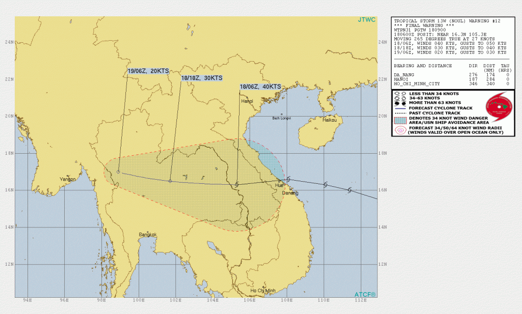
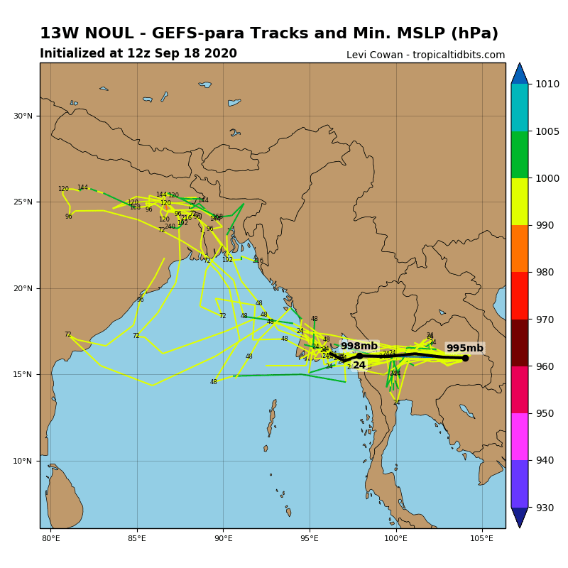
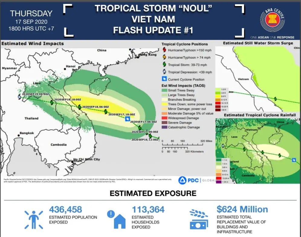
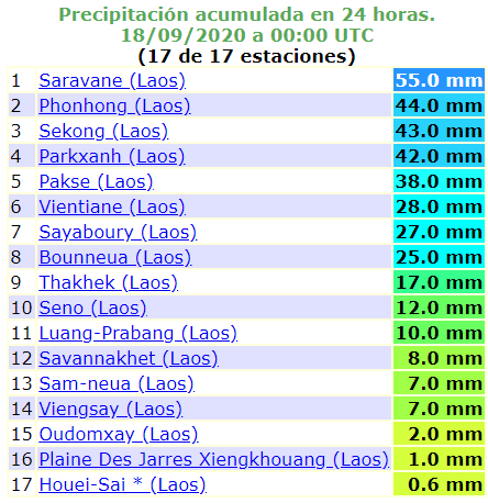
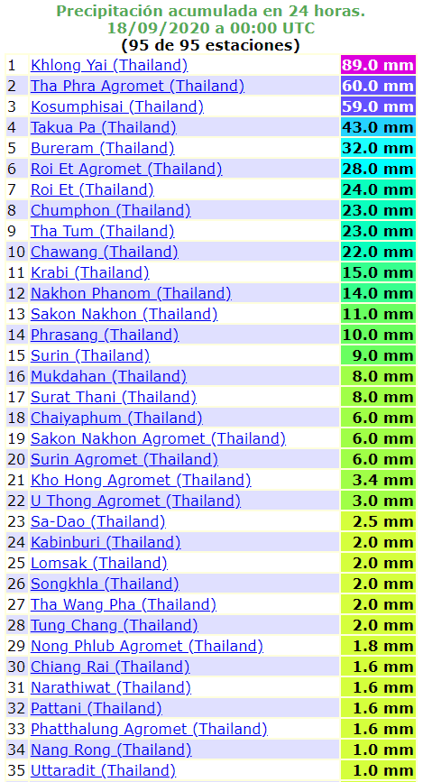
Infographics: Typhoon Noul parameters (tropicaltidbits.com), impact in Vietnam (reliefweb.int) and measured precipitation (or winds) (ogimet.com – available data):