Edinburgh after floods (37 mm / 1 hour), a short heatwave in the UK already on next Friday forecasted
Around half-month precipitation, July rainfall fell in Edinburgh on Sunday, 4. July 2021 in an hour (37 mm), which immediately caused flash floods in the city.
Streets were flooded, with affected traffic, some properties were damaged, people on bus stops were standing on benches…
It´s not a surprise, because the UK has been located since the half of June 2021 in contrast with Europe in cold sectors of returning cyclonic systems and stationary frontal boundaries above Western Europe.
Colder and more stormy weather above the British Islands should contribute to an unfavorable situation with the COVID-19 outbreak, while outbreak in Italy should be associated with extremely dry Saharan air.
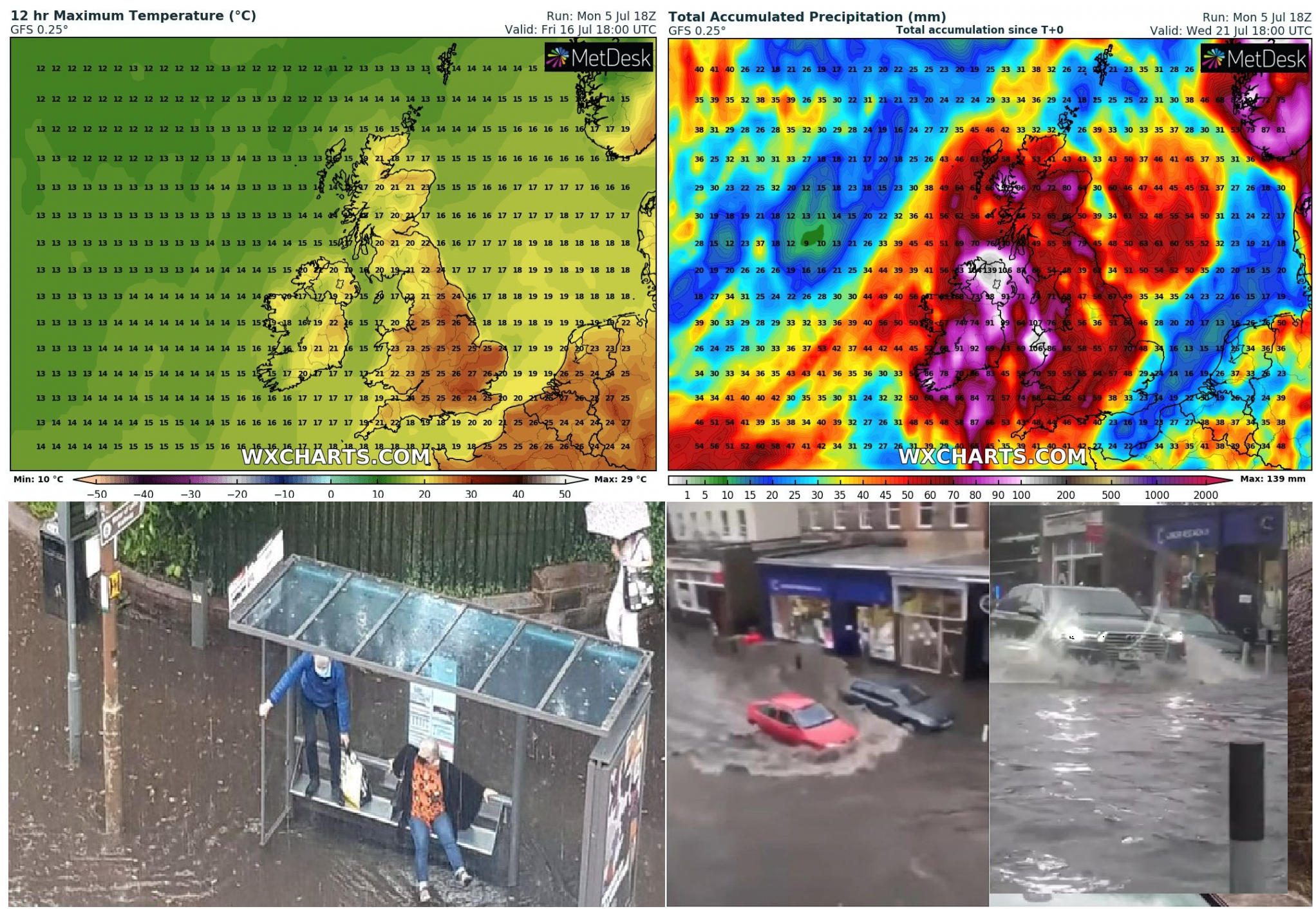
The next cold times with rounds of storms are forecasted for the UK and Ireland for the next 16 days, too, but around Friday, 16. June, the short peak of a heatwave is forecasted, with the first possible tropical temperatures (+30°C and more) in parts of England (mainly the London region and East England).
The highest rainfall is forecasted in the upcoming period in Ireland, Northern Ireland, and both coasts (west and east) of the UK, while easternmost and Central England should be very dry.
The next local flashfloods are therefore possible and maybe, the next little tornado will somewhere appear /https://mkweather.com/an-ef1-tornado-in-london-damages-and-scared-people-were-reported//.
Development of weather in June and July and forecasted patterns in July 2021 until now agree with Mkweather Summer 2021 forecast for Europe, with colder NW sector of Europe, with weaker heatwaves such as the rest of the continent /https://mkweather.com/summer-2021-forecast-for-europe-hot-and-dry-pattern-as-leading-heatwaves-drought/; https://mkweather.com/first-forecast-for-summer-2021-in-europe-la-nina-and-nao-hot-summer-is-probable//.

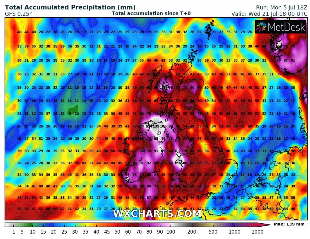
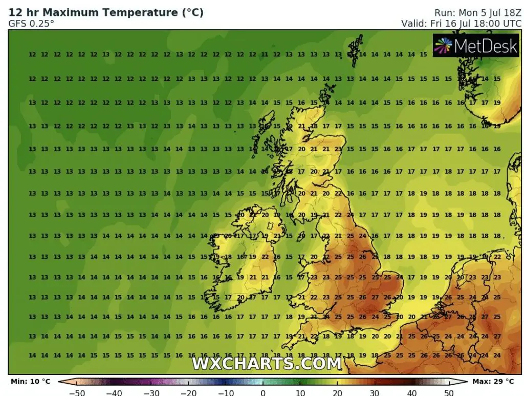
Source: wxcharts.com


