In previous article we have informed, that Europe hit / hits this week 5 windstorms /https://mkweather.com/2020/10/31/windstorms-are-here-netherlands-198-km-h-the-uk-178-km-h//. 2 of these windstorms are / will be ex-hurricanes – Epsilon on Tuesday, 27. October and Zeta on Sunday, 1. November 2020.
While Epsilon has brought significant rainfall mainly in North-American-Atlantic Isles, Zeta hit the USA in full power almost as a major hurricane (strong Category 2 hurricane), with 110 mph / 177 km/h wind gusts on the coast of Louisiana, and has continued farther along southeastern USA and mid-Atlantic and northeast back above the Atlantic.
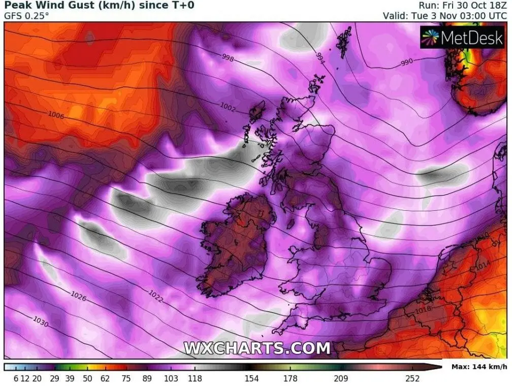
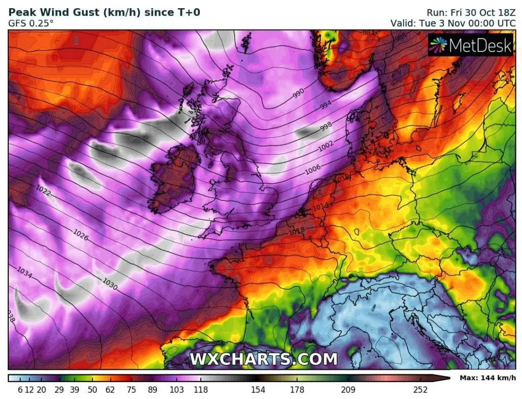
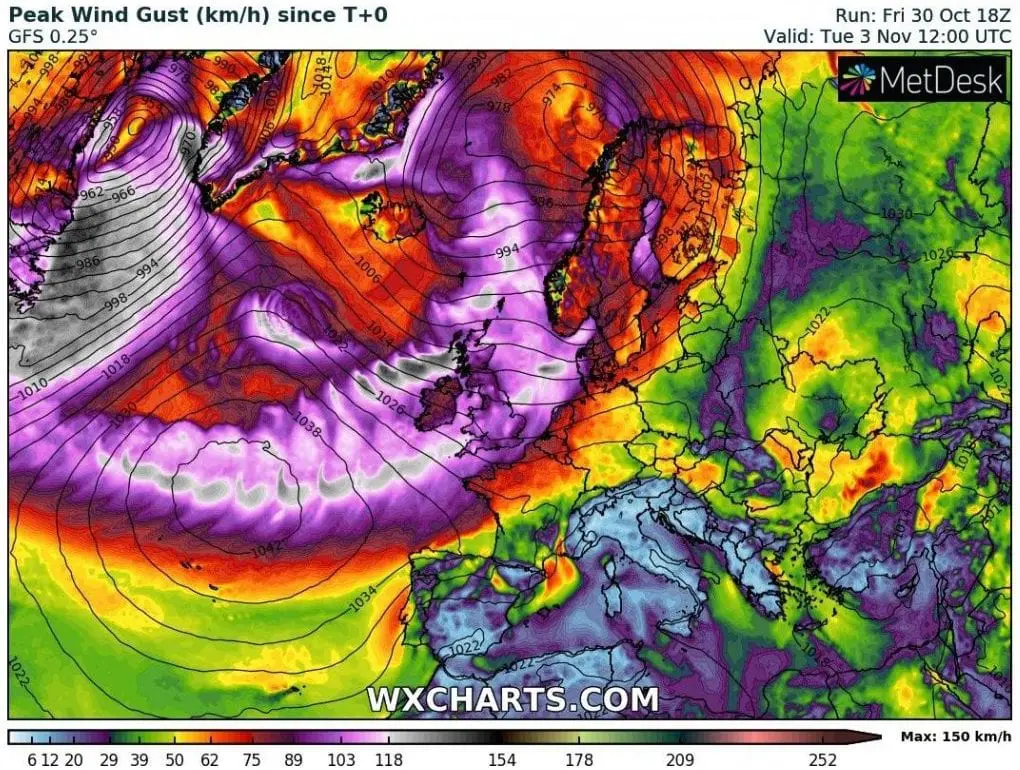
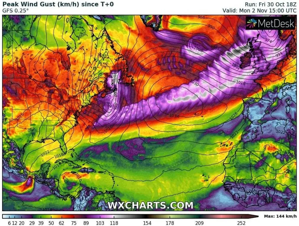
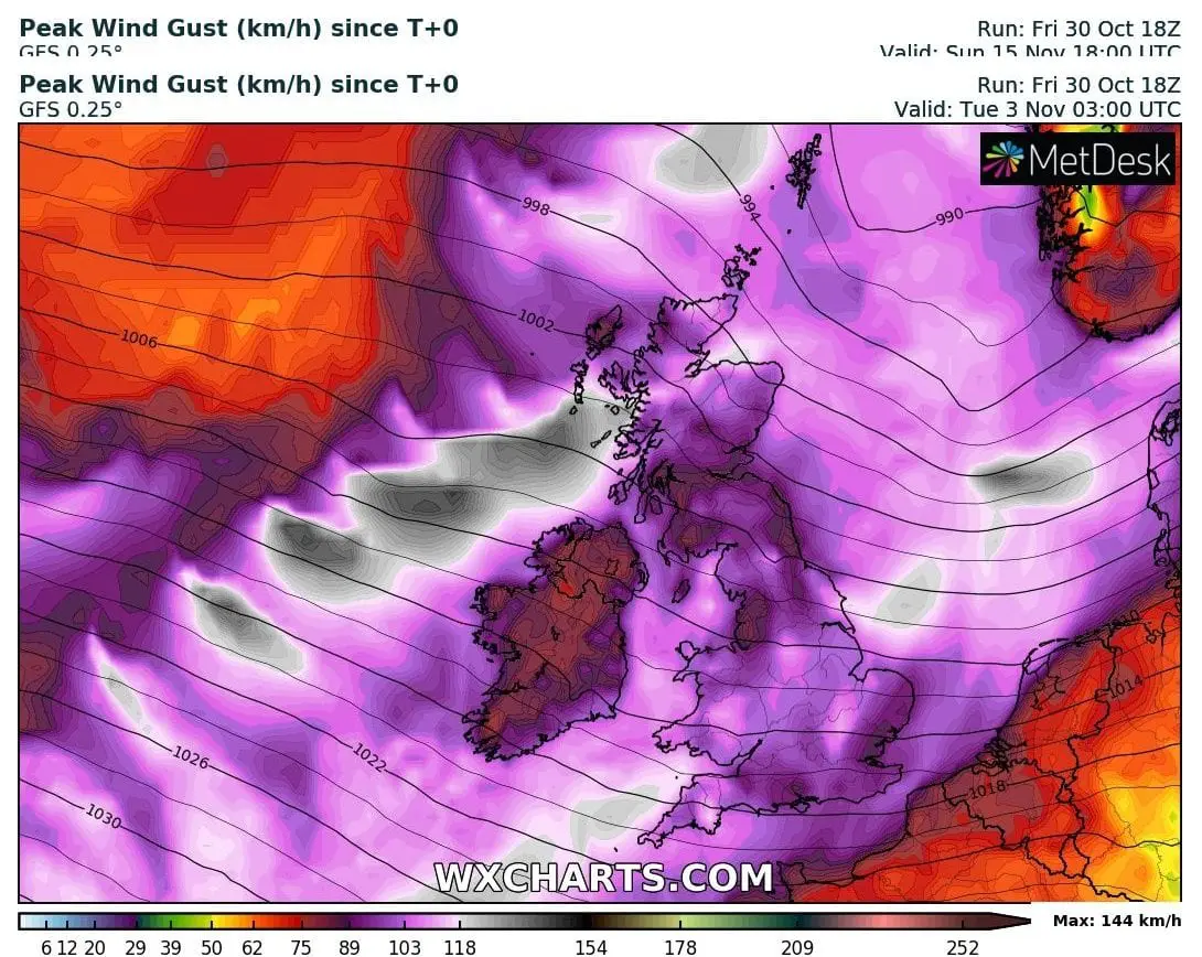
From Atlantic, quickly-shifting system (ex-Zeta) in strong westerly flow, already on Sunday, 1. November will arrive above land of Europe – mainly Ireland and the UK, with possible wind gusts even stronger than first windstorm pressure low from Saturday, 30. November 2020.
Windstorm low pressure systems has brought for now maximum wind gusts up to 198 km/h in the Netherlands and 178 km/h in the UK on Friday and Saturday, 29.-30. November 2020 /more in link above/.
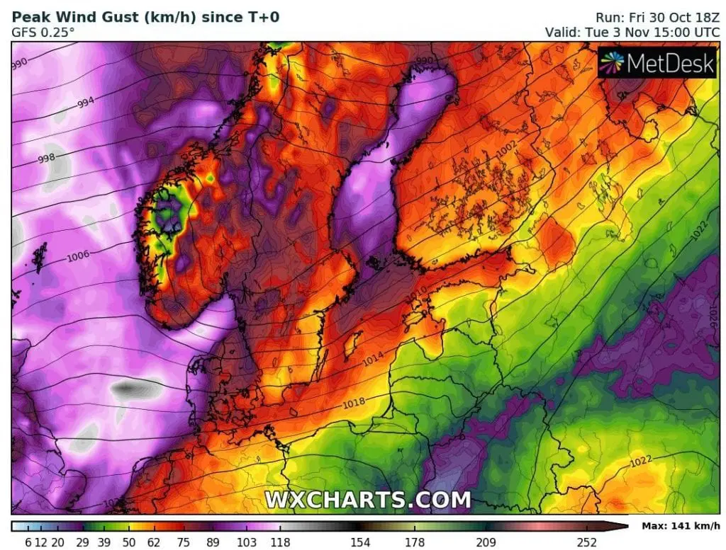
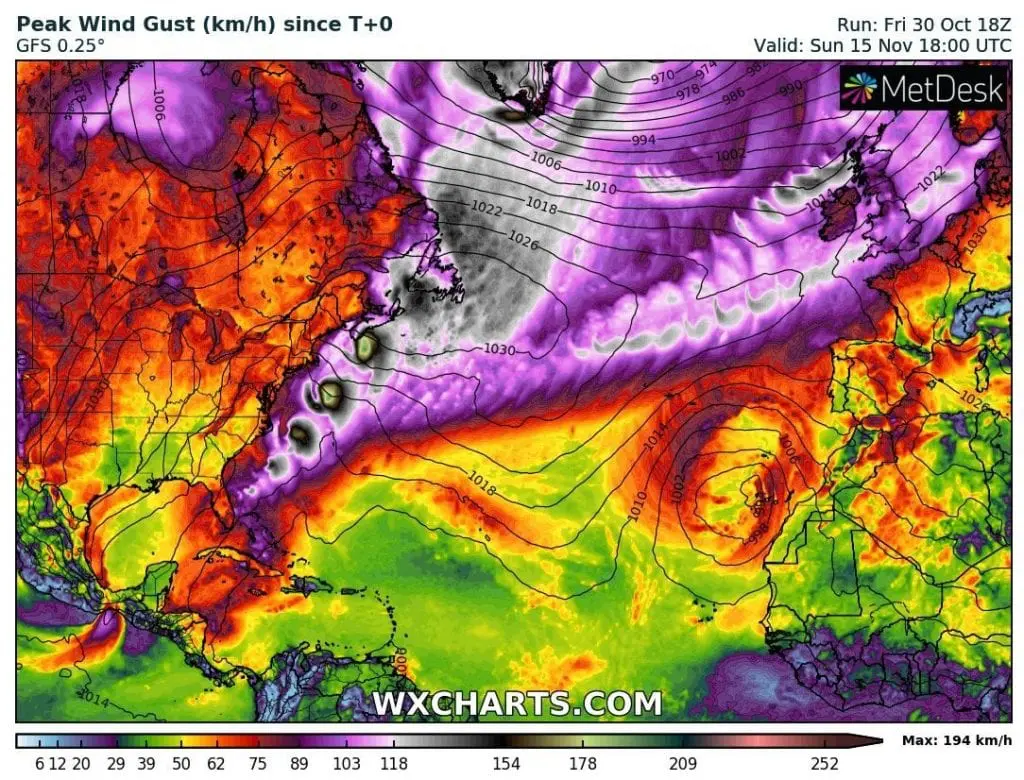
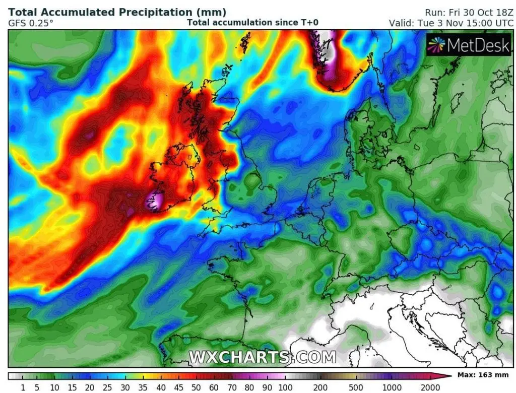
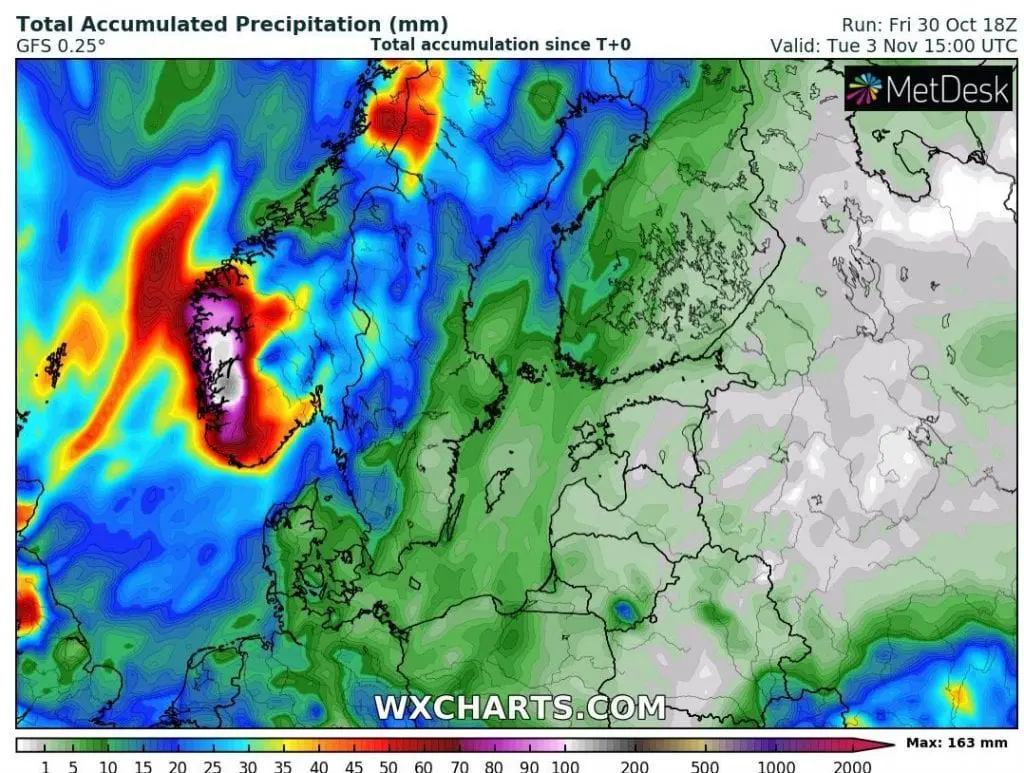
Estimated trajectory of the strongest winds is crossing northern Ireland and Scotland and heavy rains are in all Ireland, Scotland and western half of the UK, expected. Severe winds hits the coast of continental Europe, too (northern France, the Netherlands, Belgium, northern Germany). Strong winds with heavy rains will shift over Scandinavia early next week, with severe wind gusts in Norway, Sweden, Finland and Denmark and heavy rains in Bergen region, Norway.
Mkweather will inform about measured maximum wind gusts (and heavy rainfall) during incoming hours (days).
Infographics: wxcharts.com (expected wind gusts and precipitation totals):