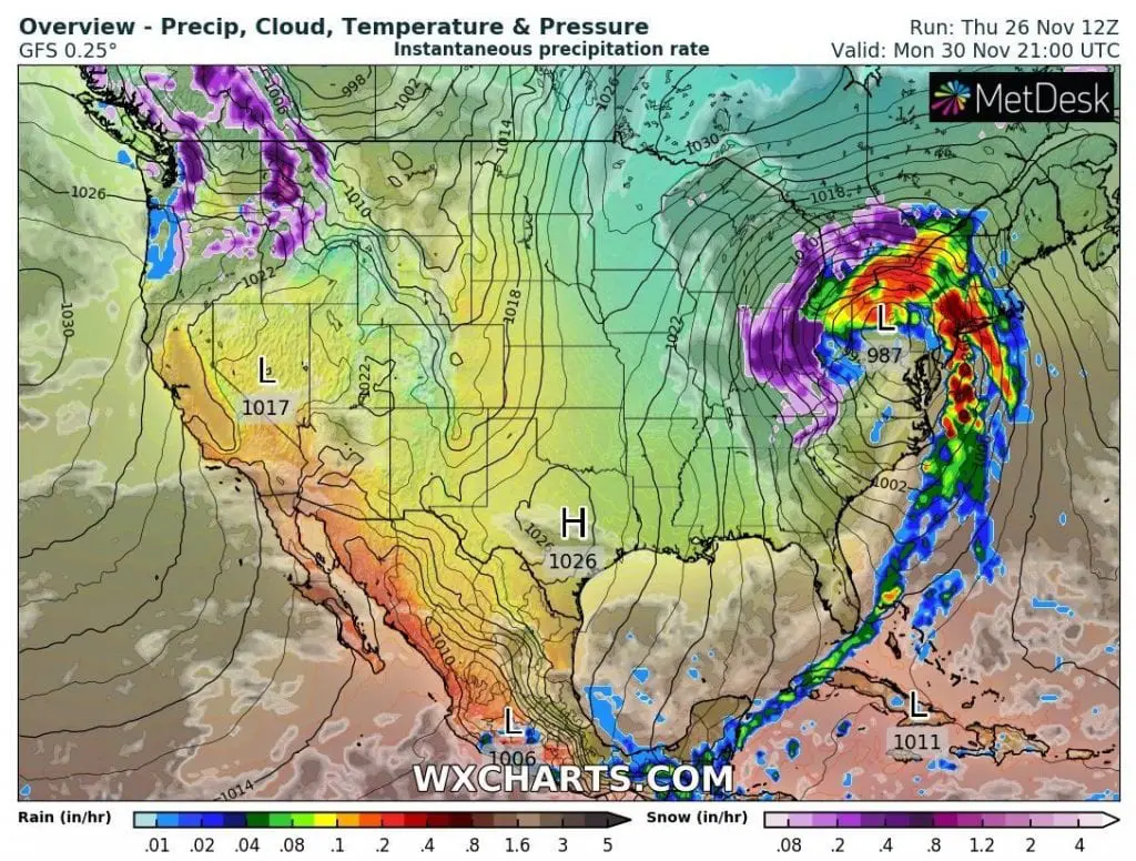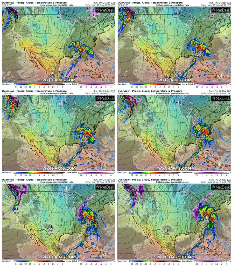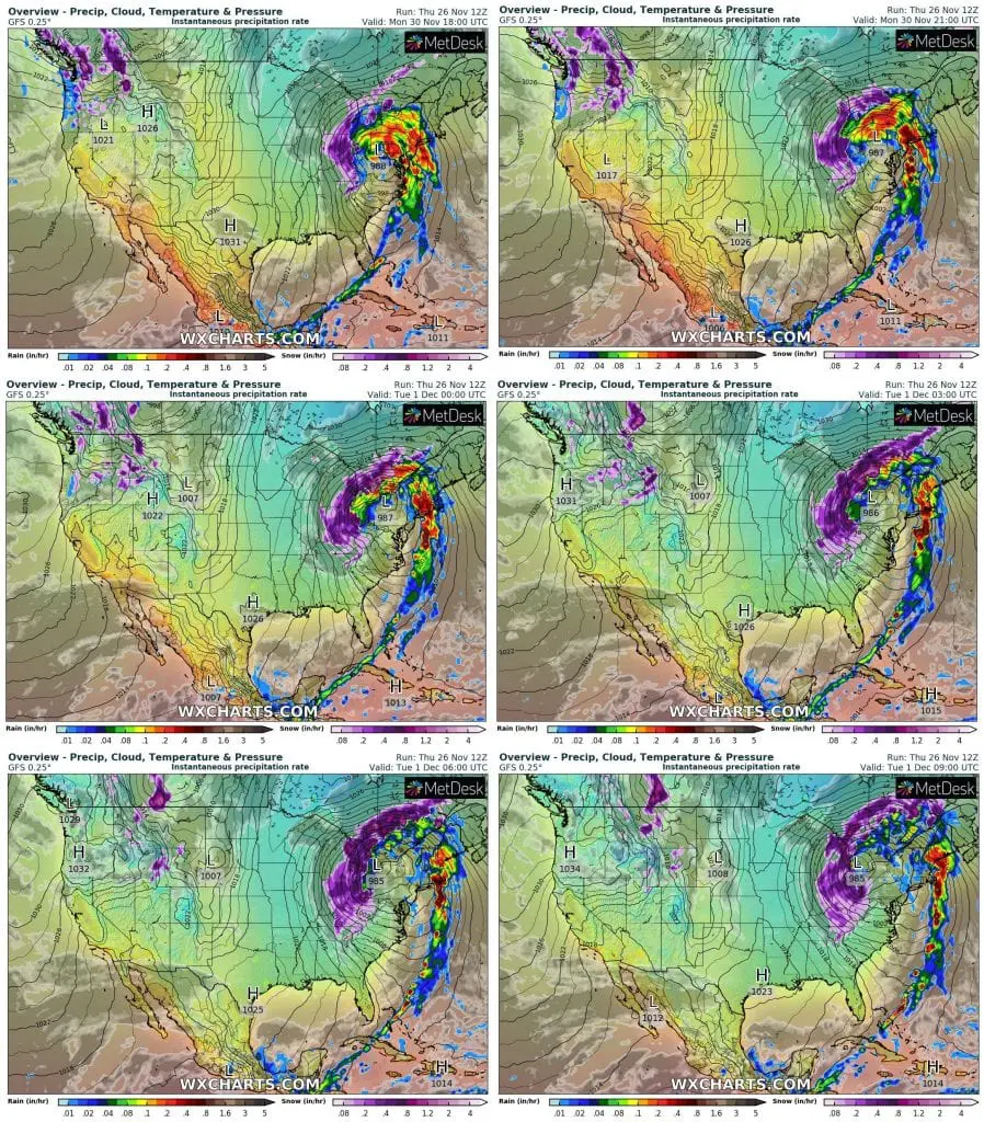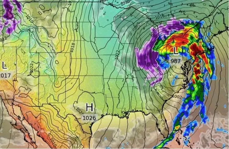
After Thanksgiving storms, even stronger storm, on its back side with blizzard conditions hits eastern USA – mainly Northeast and eastern Midwest, from 30. November to 1. December 2020.
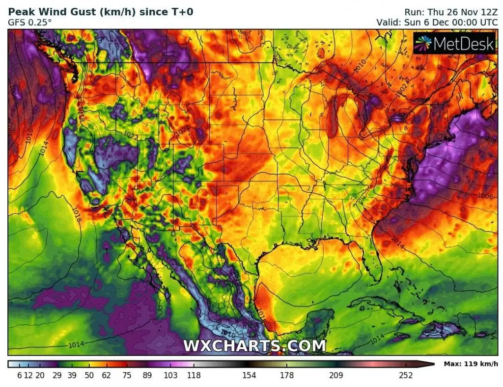
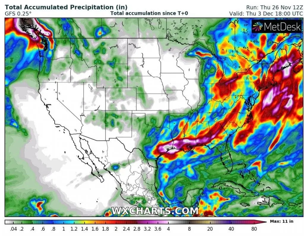
Forecast tools expect really heavy rainfall and snowfall near extreme strong winds, up to 120 km/h on the coast.
In some coastal states, up to 6 inches / 150 mm of rain should fall during the event and in Ohio region, up to 2 inches / 50 mm / 50 cm of snow is forecasted.
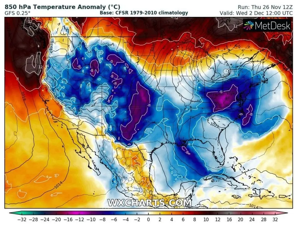
Winter therefore welcome many Americans, but too Canadians with extremely unfavorable weather and in neighboring parts Northeast with Midwest, with a blizzard conditions, too.
In New York, cooldown from maximum temperatures +15°C on Monday, 0. November to maximum temperatures only to +5°C on Wednesday is expected, in Chicago, maximum temperature reaches only +1°C on Monday and Tuesday and in Buffalo on Wednesday.
On the back side of a system, Arctic air masses floods almost all territory of the USA, but later, thanks to AO- phase, they will shift to the southern regions, while in the north (mainly Northern Plains) will be gradually warmer than usually.
Mkweather will be watching Monday´s storm – mainly wind gusts, rainfall and snowfall and brings fresh news about this event.
Infographics: wxcharts.com