Has been October really cold? Composites from NOAA (Europe, North America, Northern Hemisphere)
Early, maybe historic 200-year coldwaves, too, are not 100% warranty, that long climatic periods will be strongly below long-term temperature average.
Although, circulation is set to early powerful cold blasts in Northern Hemisphere, between these cold spells are occurring powerful warm periods and too, in regions where early coldwaves absent, blocking circulation patterns are bringing very warm weather.
Moreover, climate is significantly warmer than in 80s or 90s, from which data are computed climate normals.
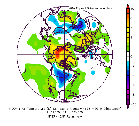
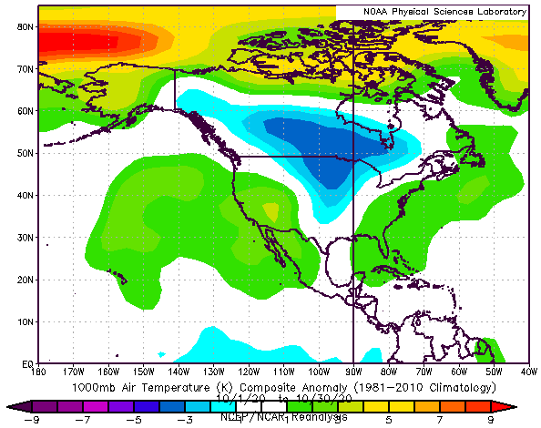
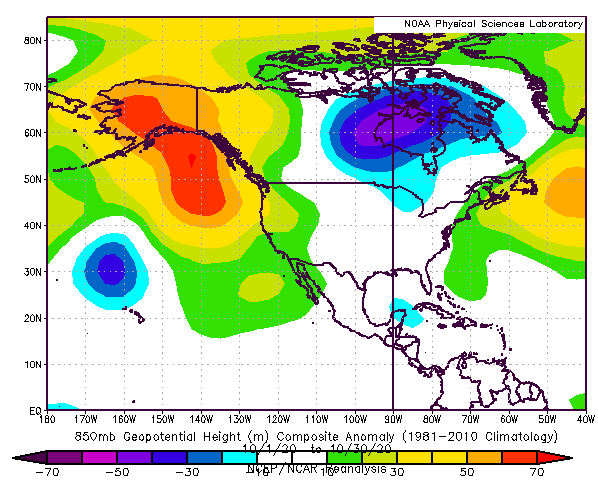
Nevertheless, extreme October coldwaves has produced negative temperature anomalies above Canada, central USA and western Europe in October 2020 and cold was in central Asia, southern parts of Siberia, Mongolia and parts of China, too.
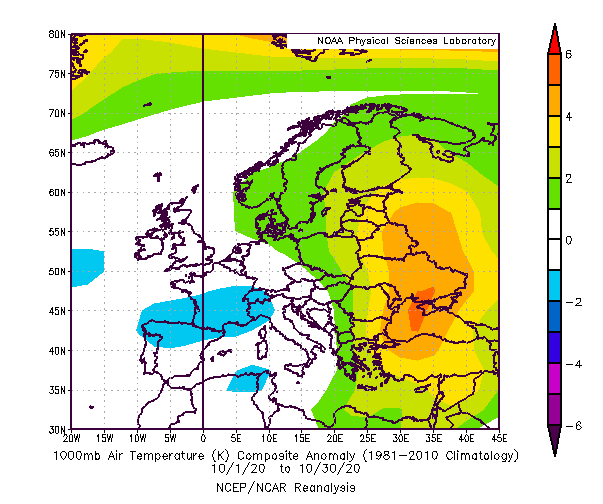
Robust blocking high still warmed up eastern Europe, eastern Mediterranean and Middle East (and in western USA too) and thanks to Arctic Amplification and AO- phase, extremely warm air has persist over the Arctic.
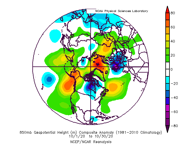
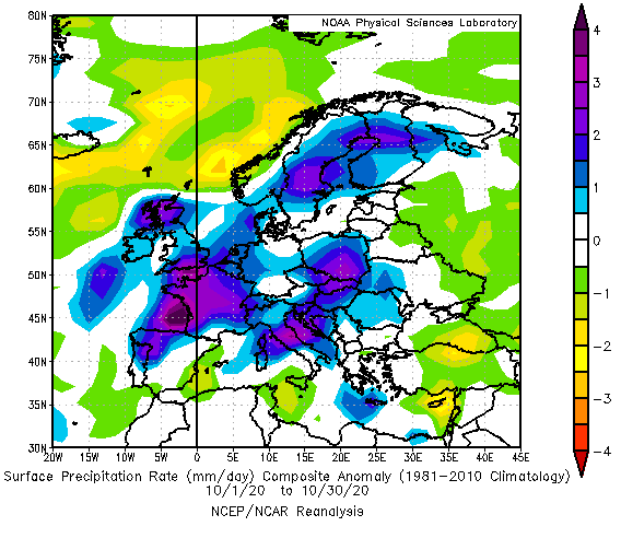
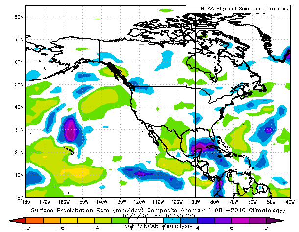
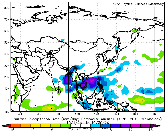
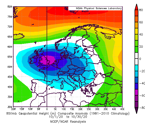
Extremely low geopotential (pressure) has been measured mainly above Europe, with above-average rainfall. Significant rainfall has been detected above Gulf Coast and Carribbean thanks to hurricane activity and in monsoon Asia thanks to La-nina.
Although temperature conditions appear such neutral in many populated parts of Northern Hemisphere, we can consider these conditions for colder variant, because if in October 2020 occurred AO+, temperature and geopotential anomalies should be extremely positive and precipitation anomalies negative in large parts of moderate climate zone.
Composites of Air temperature in 1000 hPa, Geopotential (pressure) in 850 hPa and Precipitation for 1.-30. October 2020 /https://psl.noaa.gov/data/composites/day/